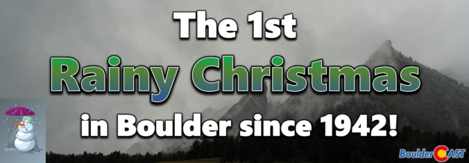
Yesterday on Christmas Day, a deluge of rain dumped on the western Denver Metro area during the afternoon and evening, but amazingly not a single snowflake fell across most of the lower elevations as temperatures remained several degrees too warm for frozen precipitation. This led to the first “Rainy Christmas” that most of us have ever experienced. As expected, a white Christmas was enjoyed by those in the higher terrain where temperatures were colder. We recap the holiday raindrops and snowflakes, including a look at just how rare Christmas rain really is and if it will be the new normal in a warming climate.
Daily Forecast Updates
Get our daily forecast discussion every morning delivered to your inbox.
All Our Model Data
Access to all our Colorado-centric high-resolution weather model graphics. Seriously — every one!
Ski & Hiking Forecasts
6-day forecasts for all the Colorado ski resorts, plus more than 120 hiking trails, including every 14er.
Smoke Forecasts
Wildfire smoke concentration predictions up to 72 hours into the future.
Exclusive Content
Weekend outlooks every Thursday, bonus storm updates, historical data and much more!
No Advertisements
Enjoy ad-free viewing on the entire site.
If you want to help support the passionate work we do here at BoulderCAST and/or wish to receive a morning weather update from us every single day for the next year, consider subscribing to BoulderCAST Premium; our 2024 holiday sale is ongoing through the end of the year.
T
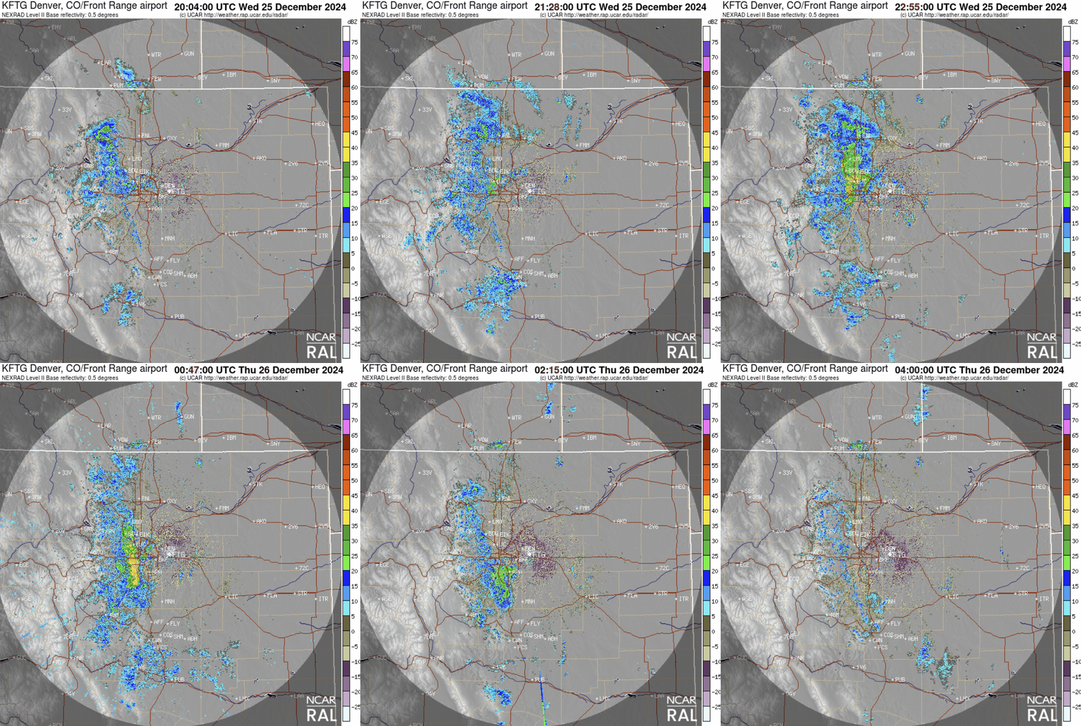
he radar animation below shows the development of the almost stationary showers Wednesday afternoon. The west and northwest Denver Metro area got the brunt of these showers, with only light and brief rainfall occurring east of Interstate 25.
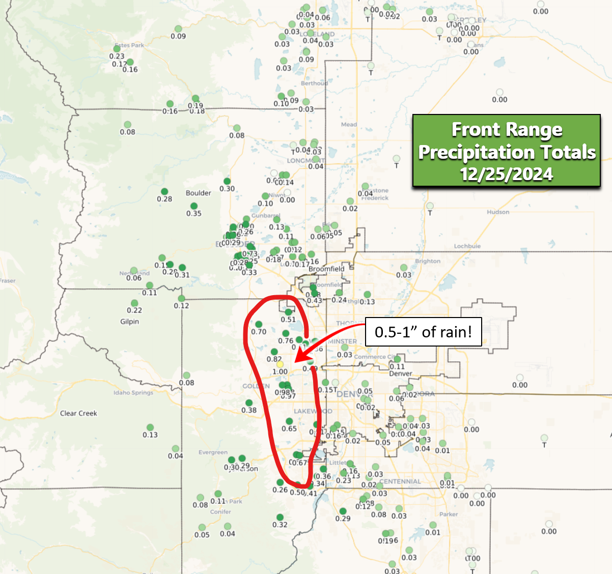
Rainfall totals were impressive in some spots, with upwards of 1″ falling in western Arvada and near Golden. We must point out that it is exceptionally rare to get this much rain from a single event in December, at least without a brief change-over to snow on the backend.
This resulted in many areas seeing their first rainy Christmas that anyone can remember. In fact, this was only the second recorded rainy Christmas in Boulder — that last was during World War II in 1942! Denver (DIA) actually didn’t report measurable rainfall on Wednesday, but Denver already had two rain-only Christmases on its rap sheet, both occurring more than a century ago.
We have received a lot of questions asking if rainy Christmases are here to stay in the Front Range given the warming climate. In short, no — this is not the new normal for us. We’re not doomed to brown, soggy yuletide celebrations forever — at least not yet. Climate change isn’t fully responsible for this specific weather event. Purely rain events from mid-November through late February are still exceptionally rare in the Denver area and that isn’t going to change anytime soon.
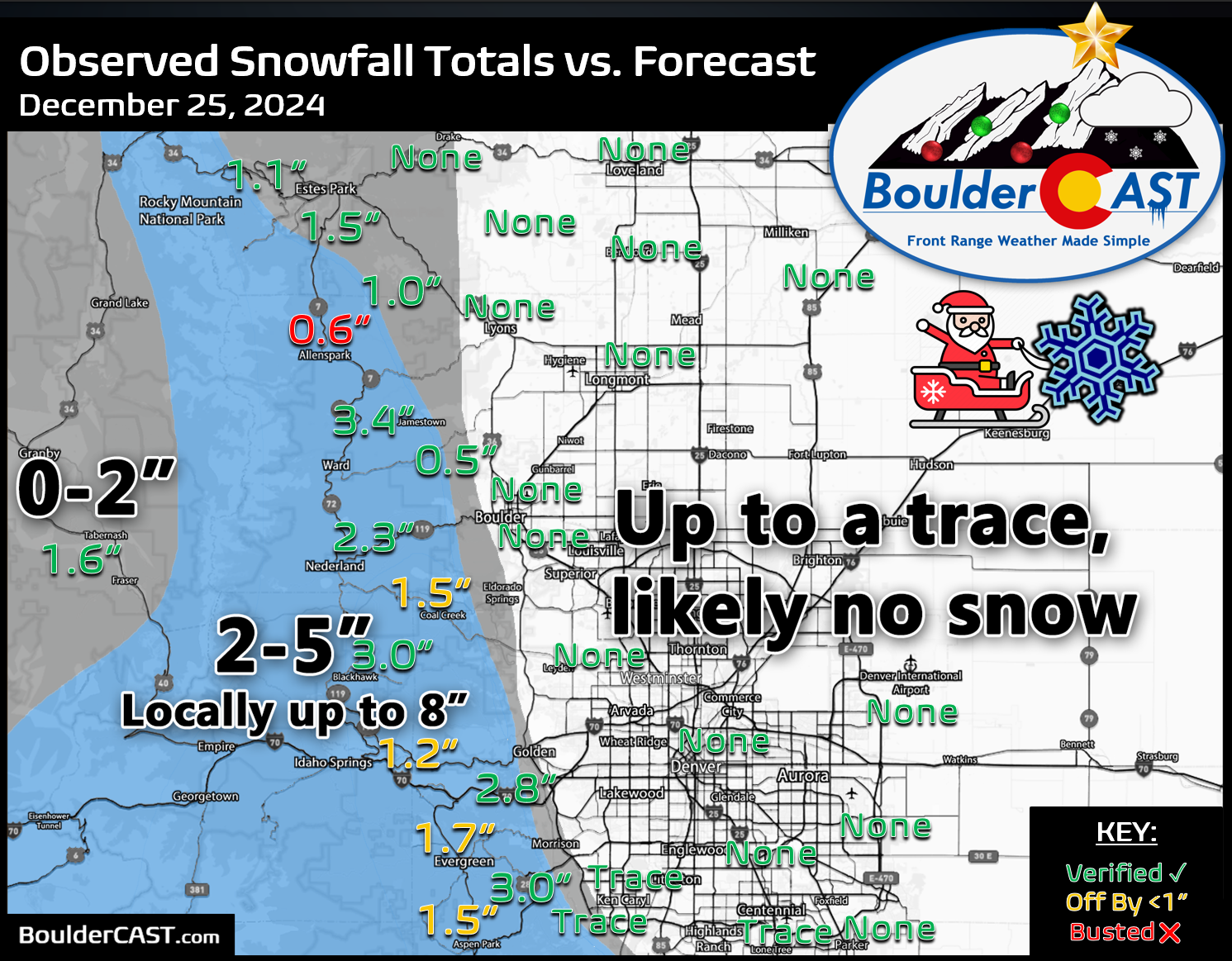
While rain and gloom were the only travel issues for the lower elevations on Christmas, just up the hill it was colder and snowing giving most mountain communities a white Christmas to remember. Snow was particularly heavy Wednesday afternoon just east of the Eisenhower Tunnel as convective snow showers spawned and lingered. At one point, Interstate 70 was closed in both directions due to the sheer number of traffic accidents! There’s not really any good snow reports from this area, but it certainly looked like 6″ or more fell based on traffic cams.
Our holiday snowfall forecast map issued Wednesday morning is shown below with storm totals overlaid. Green values indicate our forecast verified, Yellow values mean the observed total was just outside our forecast (within 1″), while Red was a busted forecast. Overall we had fairly decent forecast verification, but not perfect. Leading into the storm, models were insisting the slow-moving showers would be mostly up in the Foothills. In reality, these showers ended up about 10-20 miles further east across the western Metro area. This led to somewhat lower snowfall totals that expected in the higher terrain. If that booming bullseye of 1″ of precipitation had been over the colder Foothills, some spots could have seen over a foot of Christmas snow!
Officially, Boulder and Denver received no snow from this warm Christmas rainstorm and thus seasonal snowfall totals remain unchanged. Boulder recorded a total of 0.26″ of rain, while Denver saw only a trace. You can find a recap of all the winter storms so far in the 2024-2025 snow season HERE.
| Seasonal Snow Totals (Updated December 26 2024) |
|---|
| Boulder | Denver |
|---|---|
| 20.8" | 23.3" |
Looking ahead, the upcoming pattern this weekend of moist northwesterly flow will support intermittent light to moderate snowfall in the Mountains, but generally dry weather in the Boulder-Denver area though with some wind at times. Colder weather and our next chance of snow come during the early to middle part of next week as we close out 2024. Stay tuned and be sure to follow us on Twitter, Facebook, Bluesky and Threads for impromptu weather updates, or subscribe to get notified of our long-form updates like this one.
Get BoulderCAST updates delivered to your inbox:
Daily Forecast Updates
Get our daily forecast discussion every morning delivered to your inbox.
All Our Model Data
Access to all our Colorado-centric high-resolution weather model graphics. Seriously — every one!
Ski & Hiking Forecasts
6-day forecasts for all the Colorado ski resorts, plus more than 120 hiking trails, including every 14er.
Smoke Forecasts
Wildfire smoke concentration predictions up to 72 hours into the future.
Exclusive Content
Weekend outlooks every Thursday, bonus storm updates, historical data and much more!
No Advertisements
Enjoy ad-free viewing on the entire site.
Enjoy our content? Help us out and give it a share:


You must be logged in to post a comment.