The well-advertised late-week winter storm delivered widespread wet snow to the entire Denver Metro area and nearby Foothills Thursday into Saturday, with some rain mixing in at times across the warmer northern tier. We review the soupy snowfall totals from this final bout of winter weather that put a bow on the lengthy cold and snowy week in the Front Range. We also discuss the shift back to sunny and dry conditions for the upcoming week.
O
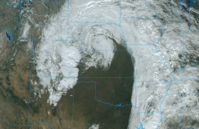
ur departing low pressure is really strutting its stuff Saturday morning, with GOES-East picking up its textbook comma cloud structure typical for a mature, mid-latitude cyclone. Look how much snow this monster storm is leaving behind in its wake across New Mexico and Colorado!
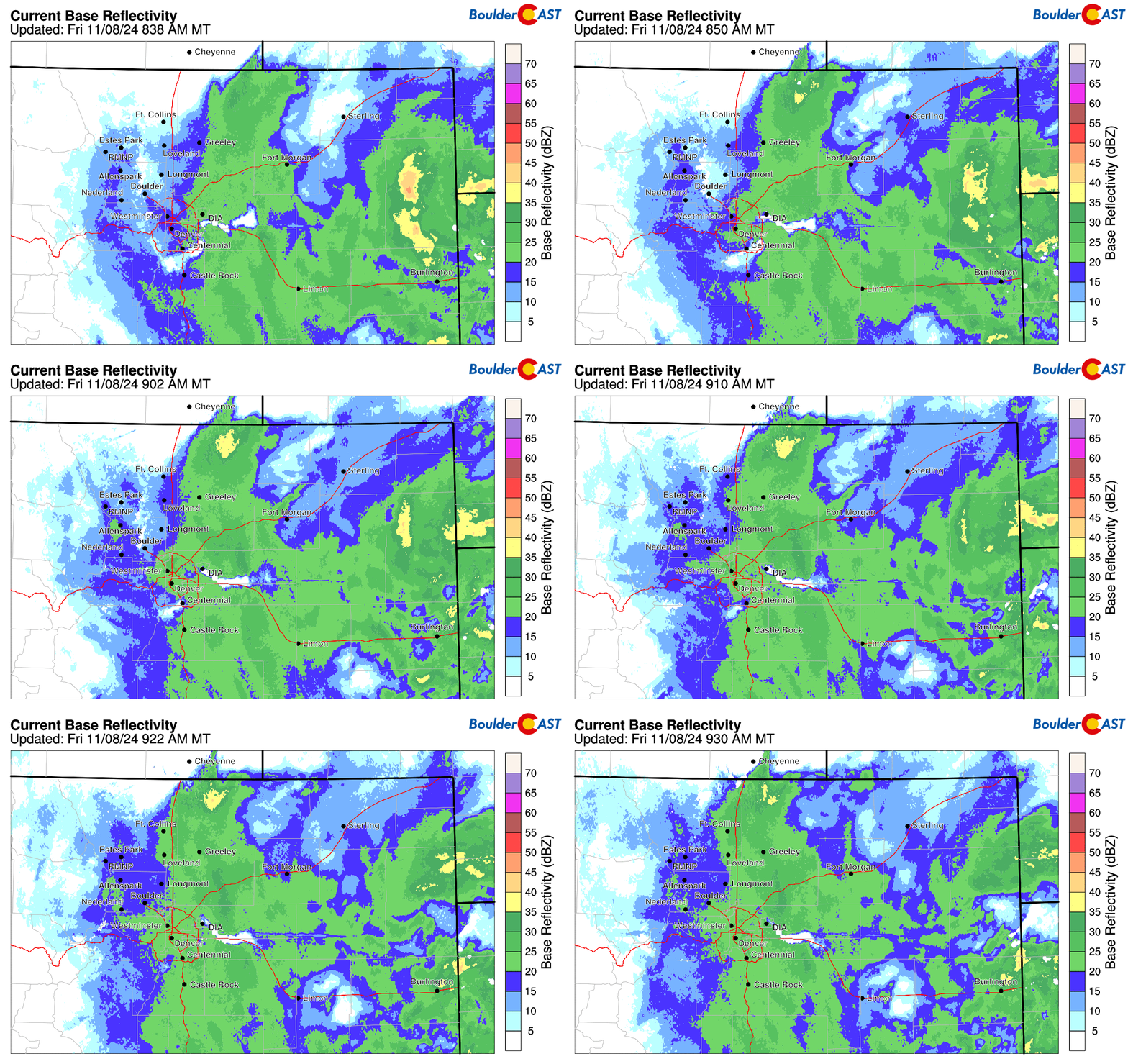
We didn’t know or expect it at the time, but the bands of snow that moved in Friday morning ended being the heaviest snowfall we would see from the entire event with rates of 1-2″ per hour but only lasting about 90 minutes. The radar animation below is from around 9AM Friday as the first wave of intense snow spread into the area from the southeast. This band caused slick roads for the Friday morning commute, but this generally melted off quickly.
There was a lull in the action Friday afternoon as a dry slot briefly penetrated northward into the Denver area. Some places saw the snow cease, but most just shifted to very light snow. This break was short-lived, with widespread light to moderate snow returning by late afternoon and early evening as the storm system moved into position across southeast Colorado.
Friday 2:30PM Update: The dreaded dry slot brought a lull in the snow to most of the area this afternoon. This has now pushed off to the west. The best upslope flow, Gulf moisture, & lift will be present across the area over the next 12 hours. Expect widespread moderate to heavy… pic.twitter.com/UlXLRFmboG
— BoulderCAST Weather 🏔️❄️ (@BoulderCAST) November 8, 2024
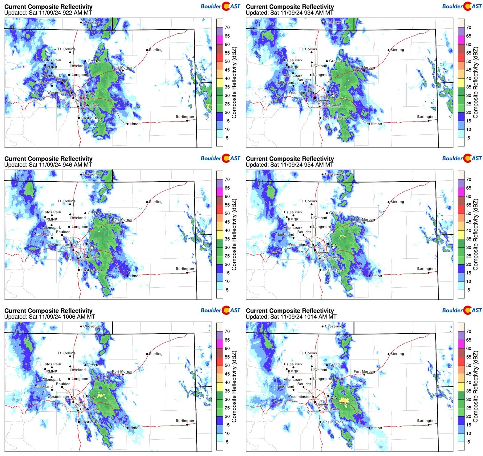
As expected, the heaviest snow remained across the eastern and southern parts of the Metro area, especially the snow that fell Friday evening into Saturday morning — that mainly resided along and east of I-25. In fact, even as of writing on Saturday, it is still snowing heavily on the eastern fringes of the Metro area, just east of DIA.
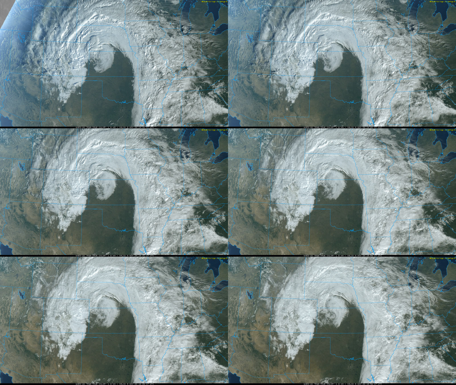
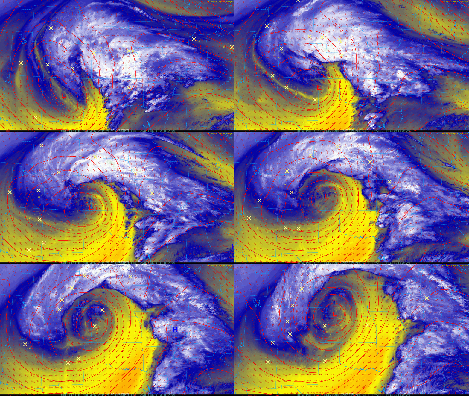
Ultimately the forecast came in on the lower end due to the final track of the low pressure system being slightly further east. The satellite animation below shows the evolution of the storm Friday into early Saturday. Notice how the center of the low moved northward while tracing the border between Kansas and Colorado.
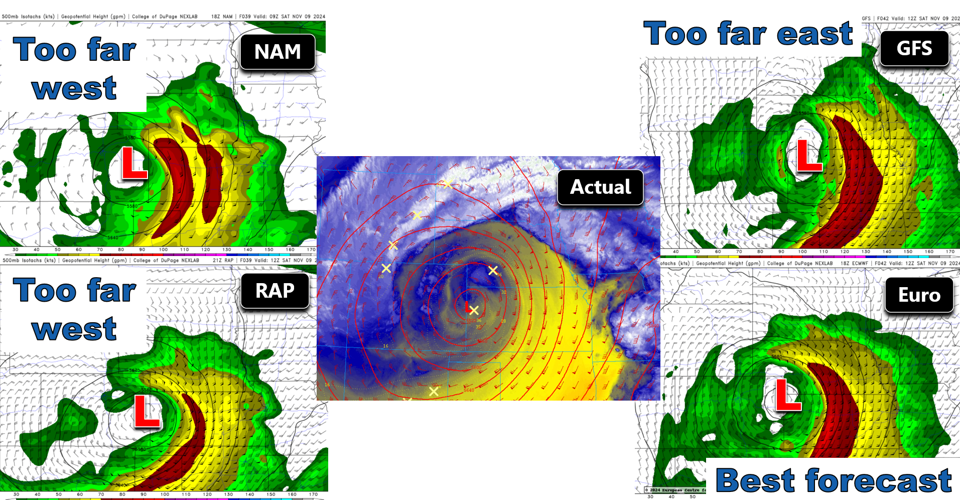
If the low had been slightly further west by ~75 miles, we would have had much better upslope into the Front Range (as the two left side models were projecting below). Look at all the northeast flow in the two left panels below blasting into Denver. The GFS forecast (top right below) predicted a track too far east, and thus underestimated impacts here. The Euro model ended up with the best forecast for this storm in our opinion, nailing the track of the storm about perfectly. We discussed the various model solutions early Friday in our Premium update, and at that time adjusted our snowfall projections downward a tad.
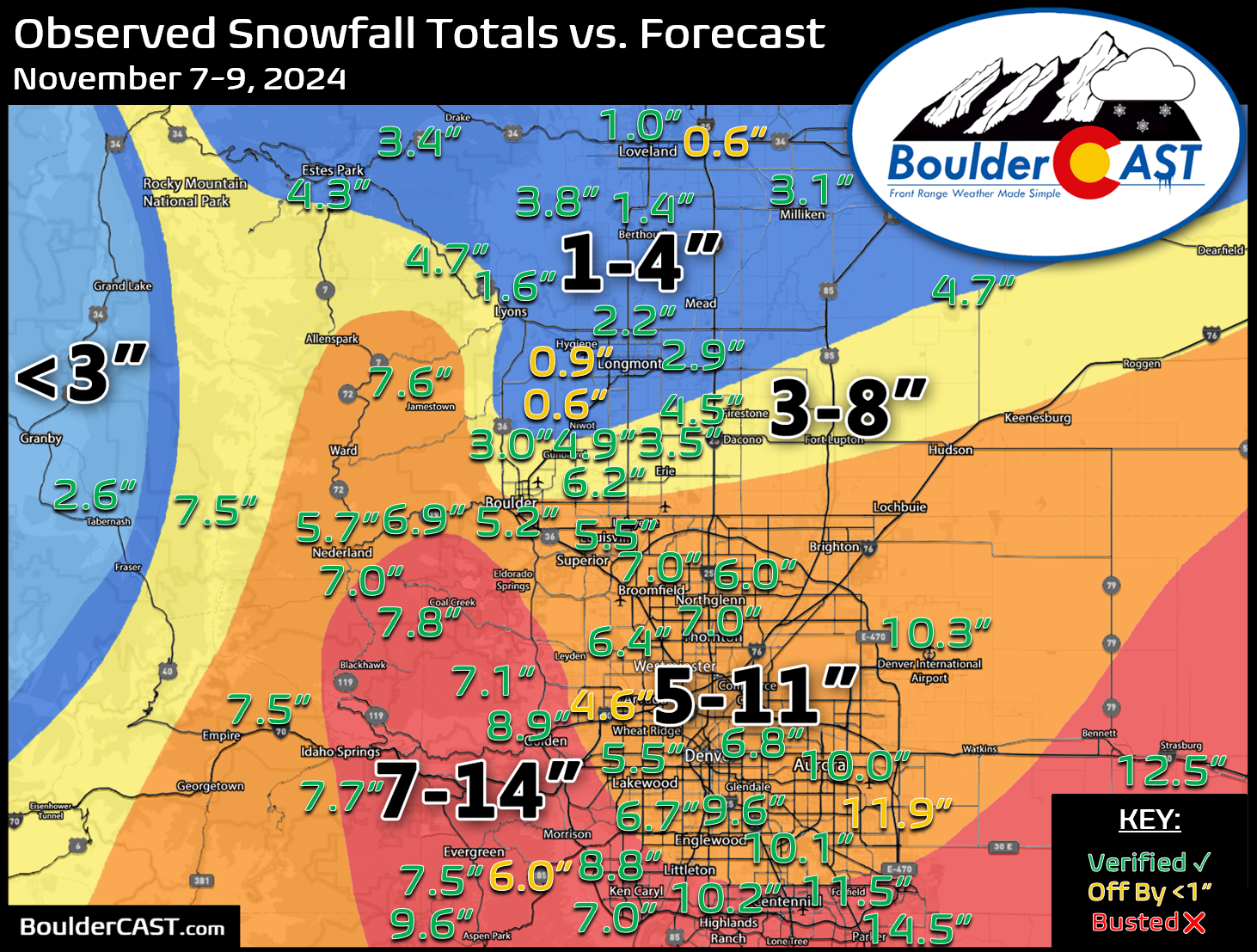
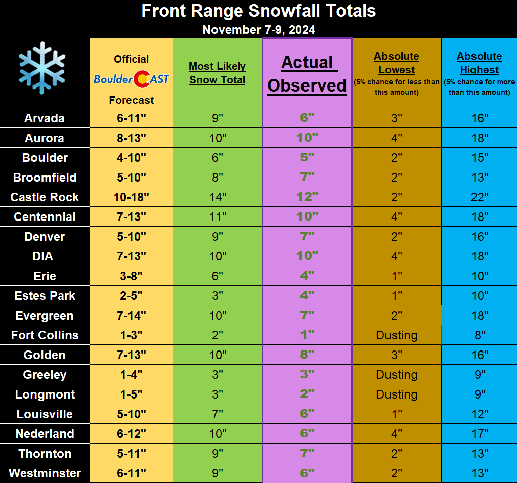
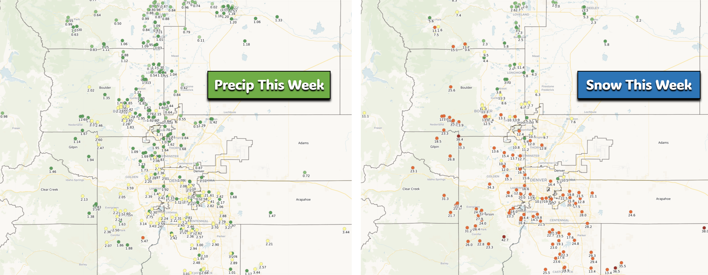
Our snowfall forecast map is shown below with storm totals overlaid. Green values indicate our forecast verified, Yellow values mean the observed total was just outside our forecast (within 1″), while Red was a busted forecast (there are no red this time). Overall we had fairly decent forecast verification, but not perfect. Up to a foot of snow dumped on the southeast side of Denver (these totals may go up a tad more from today’s lingering snow), with amounts going as low as less than an inch in parts of Longmont and Loveland.
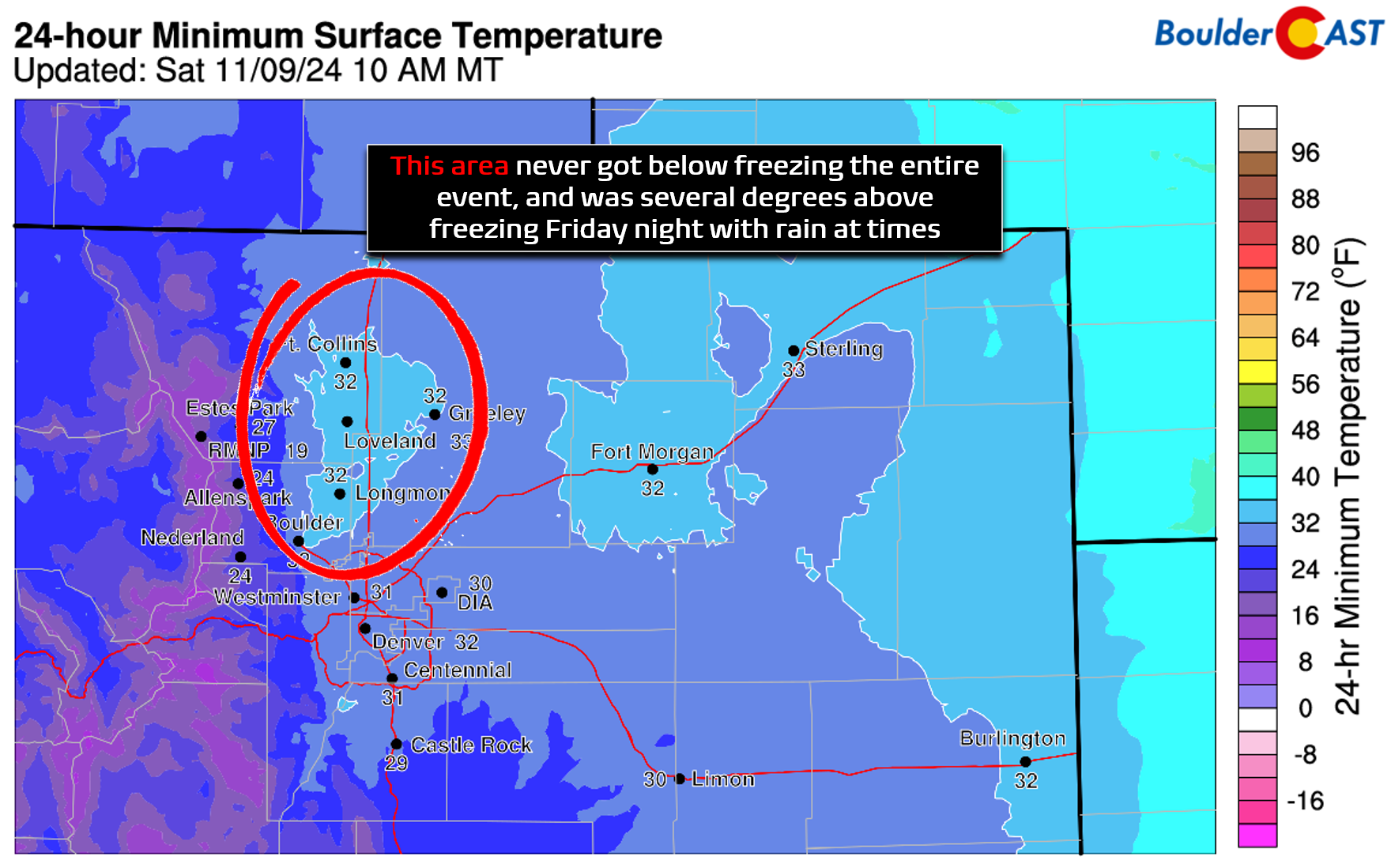
The northwest part of the Front Range struggled with warmer temperatures which caused a lot of melting throughout this long-duration event. This warm patch was expected and was the main reason for our forecast totals being so low there. Places like Boulder, Longmont and Fort Collins never dropped below freezing during the entire storm — meaning whatever snow that fell was melting the entire time.
In fact, it got so warm in Boulder Friday night that precipitation turned over to drizzle after midnight. That definitely didn’t help snow totals at all…
In the end, most cities ended up with their projected snow amounts, though some just squeaked into the lower bounds of our forecast.
Officially, Boulder received 5.2″ of new snow from this event, while Denver (DIA) recorded 10.3″ (and still climbing!). The snow season got off to a slow start, but we’ve made big strides this week! Denver has pulled ahead to a rare lead over Boulder. That won’t last forever, though! These last few storms have definitely been more productive for Denver rather than favoring the west side, as is more typical. You can find a recap of all the winter storms so far in the 2024-2025 snow season HERE.
| Seasonal Snow Totals (Updated November 9 2024) |
|---|
| Boulder | Denver |
|---|---|
| 13.0" | 19.2" |
The last five days have been the soggiest for the Front Range since April, with everyone picking up 1 to 3″ of liquid precipitation (rain + melted snow) since Sunday afternoon! Week-long snow totals were even more impressive, with up to 42″ being reported in the higher terrain southwest of Denver, with widespread 18 to 30″ totals elsewhere in the Foothills. Heck, even lower elevation places such as Parker and Highlands Ranch recorded close to 2 feet!
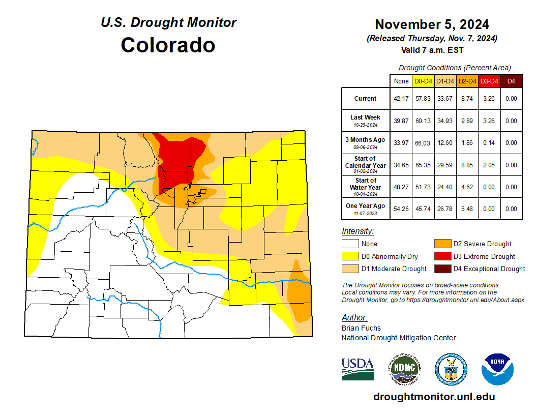
It will certainly be interesting to see how the drought map changes next week in response to our recent soggy and slushy weather. We should expect to see significant improvement across much of eastern Colorado.
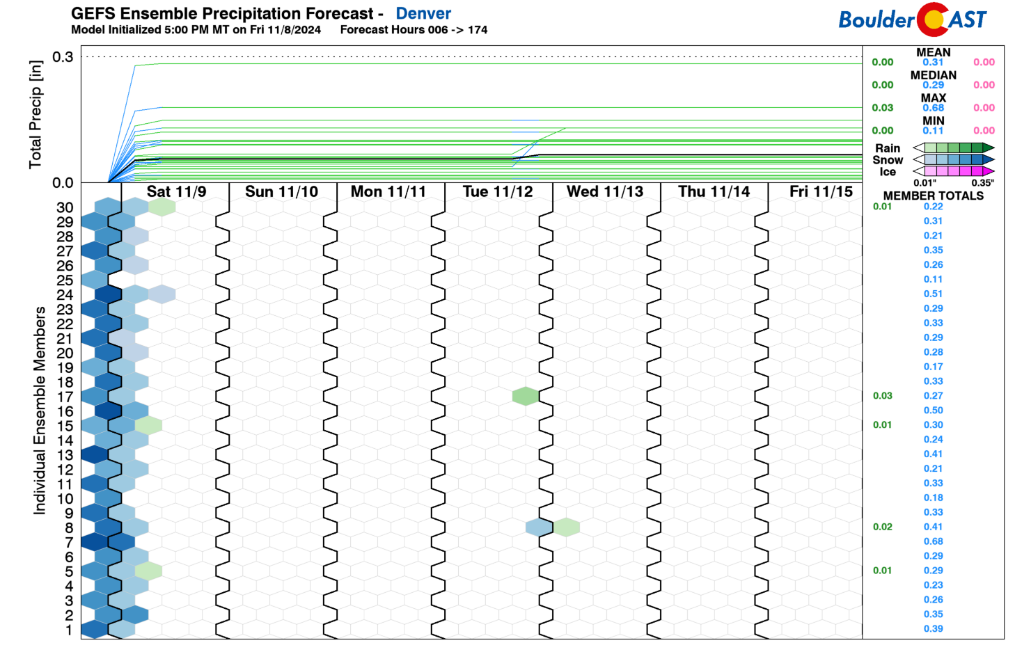
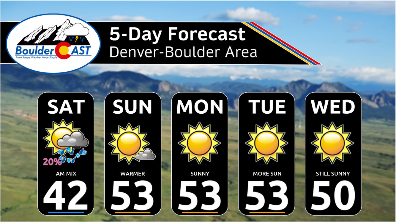
Looking ahead, our weather will turn quiet and seasonal for the foreseeable future with basically no chance of precipitation through the upcoming week. The sun should come out Saturday afternoon and it will remain mostly sunny for at least the next six days.
It’s been a crazy week in Colorado weather and we’re ready for a break. We’ll be back with our usual weekly outlook post Monday morning. Have a great rest of the weekend!
Get BoulderCAST updates delivered to your inbox:
DISCLAIMER: This weekly outlook forecast is created Monday morning and covers the entire upcoming week. Accuracy will decrease as the week progresses as this post is NOT updated. To receive daily updated forecasts from our team, among many other perks, subscribe to BoulderCAST Premium.
Daily Forecast Updates
Get our daily forecast discussion every morning delivered to your inbox.
All Our Model Data
Access to all our Colorado-centric high-resolution weather model graphics. Seriously — every one!
Ski & Hiking Forecasts
6-day forecasts for all the Colorado ski resorts, plus more than 120 hiking trails, including every 14er.
Smoke Forecasts
Wildfire smoke concentration predictions up to 72 hours into the future.
Exclusive Content
Weekend outlooks every Thursday, bonus storm updates, historical data and much more!
No Advertisements
Enjoy ad-free viewing on the entire site.
Enjoy our content? Help us out and give it a share:




You must be logged in to post a comment.