
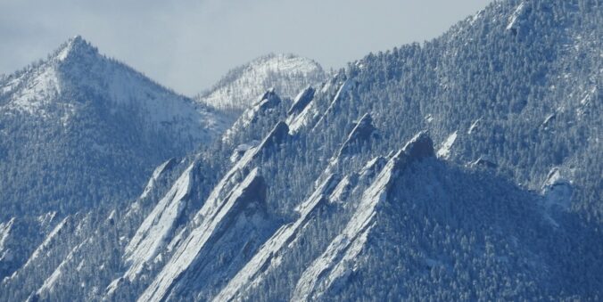
It’s been another day stuck in the Arctic airmass, but at least we’ve got a little sun this afternoon. The slow-moving storm responsible for this extreme cold and snow will finally begin to push eastward tonight through Thursday. This will dump another round of light snow upon us before things dry out and temperatures start to climb back towards normal in the coming days. We discuss how much snow has fallen so far and what is still to come this evening. Plus a look at when we will get back above freezing
At a Glance:
- The Arctic airmass is starting to loosen it’s grasp, but not just yet!
- Another round of light snow Wednesday evening into early Thursday will unfold across the area
- Generally 1-4″ of additional snow expected, highest northwest and lowest southeast
- Another chance of snow late in the day Friday, but that should be even lighter
- A slow warming trend will ensue heading into a beautiful and sunny weekend ahead
We discuss Boulder and Denver weather every single day on BoulderCAST Premium. Sign up today to get access to our daily forecast discussions every morning, complete six-day skiing and hiking forecasts powered by machine learning, access to all our Front Range specific weather models, additional storm updates and much more!

T
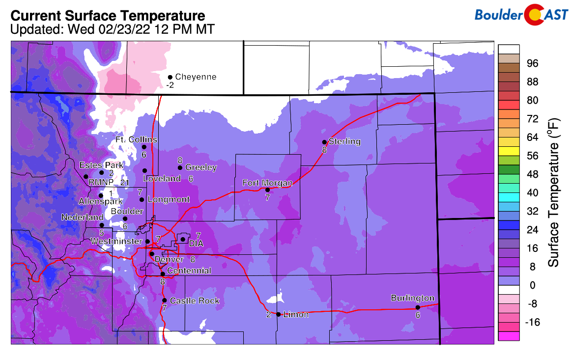
he sun may be out, but it’s still darn cold out there as the Arctic blast continues across the Front Range. As of the noon hour, temperatures were still in the single digits across the entire Denver Metro area, with some negative values holding strong in the Foothills.
It seems like we’ve taken an extended polar plunge, but we’re just now passed 48 straight hours of below freezing temperatures since the Arctic cold front blew through around midday Monday. If you can believe it, we still have at least 48 hours of this to go (if Friday can somehow squeak above freezing), but more likely the real number is closer to 72 hours as most models show high temperatures finally getting well into the 30’s on Saturday. Heat wave!
Snowfall totals thus far have been underwhelming in many areas, though they haven’t been too far from our expectations. Arctic air is by its very nature extremely devoid of moisture. It’s difficult to get much snow to fall out, especially in the absence of any significant mid- and upper-level forcings as has been the situation most of this week. Upslope can only get us so far! Even still, we’ve done okay for ourselves across the Front Range. Below is a look at the 48-hour snowfall totals ending around 8AM Wednesday. Broadly speaking, 1 to 3″ has fallen across most of the Denver Metro area so far, with 3 to 5″ in the Boulder sector, and 2 to 7″ in the Foothills (highest near Estes Park).
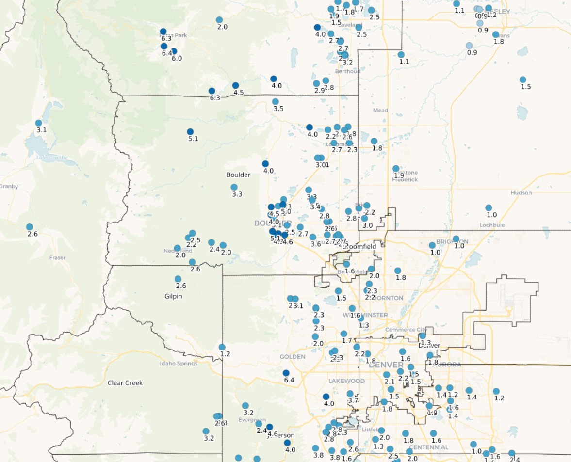
48-hour snowfall totals across the Denver Metro area ending at ~8:00AM Wednesday
In terms of moisture, there hasn’t been a lot to go around. Generally 0.15″ or less of liquid equivalent (melted snow) has occurred east of Interstate 25, with lucky spots like Boulder seeing 0.3″ or more in some cases.
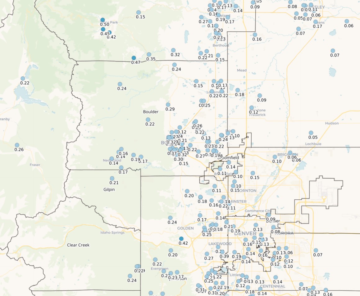
48-hour precipitation totals across the Denver Metro area ending at ~8:00AM Wednesday.
The bitter cold temperatures have forced somewhat lower snow-to-liquid ratios (SLRs) upon us. A few back of the envelope calculations from the observations indicates observed SLRs ranging from 13:1 to 15:1 — still not bad, but not as high as we’ve seen in recent weeks. We often talk about very fluffy (high ratio) snow when temperatures plummet, but the reality is that it can become too cold for fluffy snow, as has been the case this week. The graphic below shows that the ideal temperature range for fluffy snowflakes (dendrites) is between -18°C and -12°C (0°F and +10°F). We’ve had temperatures colder than this at the surface, but it’s been even colder aloft in the clouds much of the last two days. Thus, we’ve started to trend too far to the right on the graphic below into plate, needle and column-type snowflake territory. These accumulate in a denser fashion with comparatively lower SLRs.
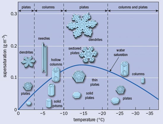
You can read our more in-depth discussion on snow ratios and how it varies spatially and with temperature HERE.
Looking ahead, there is still another wave of snow to come Wednesday evening and night before things start to really warm up and dry out heading into the weekend. On paper, this final wave of snow has the potential to produce the most for us. However, models have really struggled to resolve the pattern and upslope, and thus the snowfall all week long. The parent storm system causing the deep freeze across the area is still located all the way back west across central Nevada this afternoon (see the beautiful visible satellite animation below, compliments of GOES-East). The low pressure and trough have been slowly pushing south and east the last few days. Out ahead of everything, we’ve seen numerous disturbances track from southwest to northeast across Colorado aiding in snowfall production at times. The models have just not dealt with these all that well leading to generally low confidence in how the final wave of snow will transpire late Wednesday into Thursday morning.
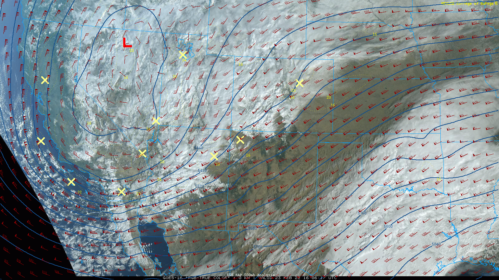
GOES-East visible satellite animation from late Wednesday morning
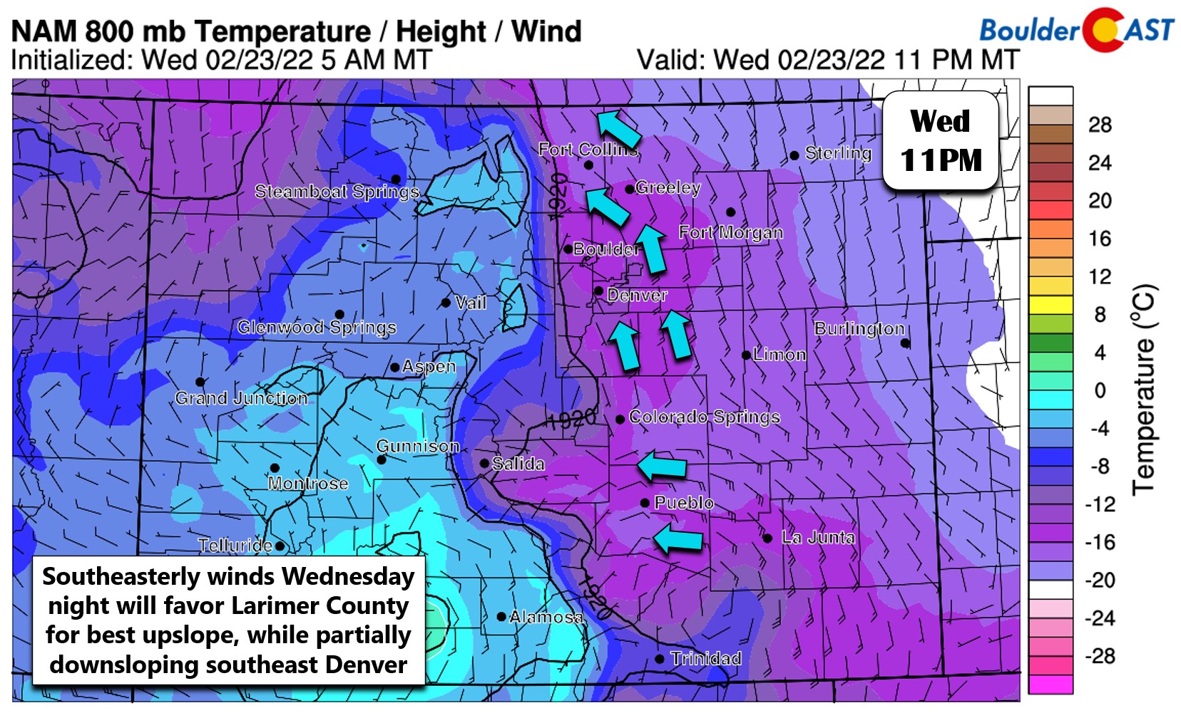
This last hurrah will basically be the core of the storm itself, so it still seems likely this could produce the most snow out of any of the waves for many Front Range locations, especially those that have seen meager snow totals so far. The storm is weakening and speeding up, but it should still offer a roughly 12 to 18 hour window for additional intermittent light snow here. One thing to watch will be the southeasterly wind direction Wednesday evening and night. This will favor Larimer County for the best upslope, while at the same time downsloping southeast Denver off the Palmer Divide. Thus, we should see some northward bias in the radar returns this evening.
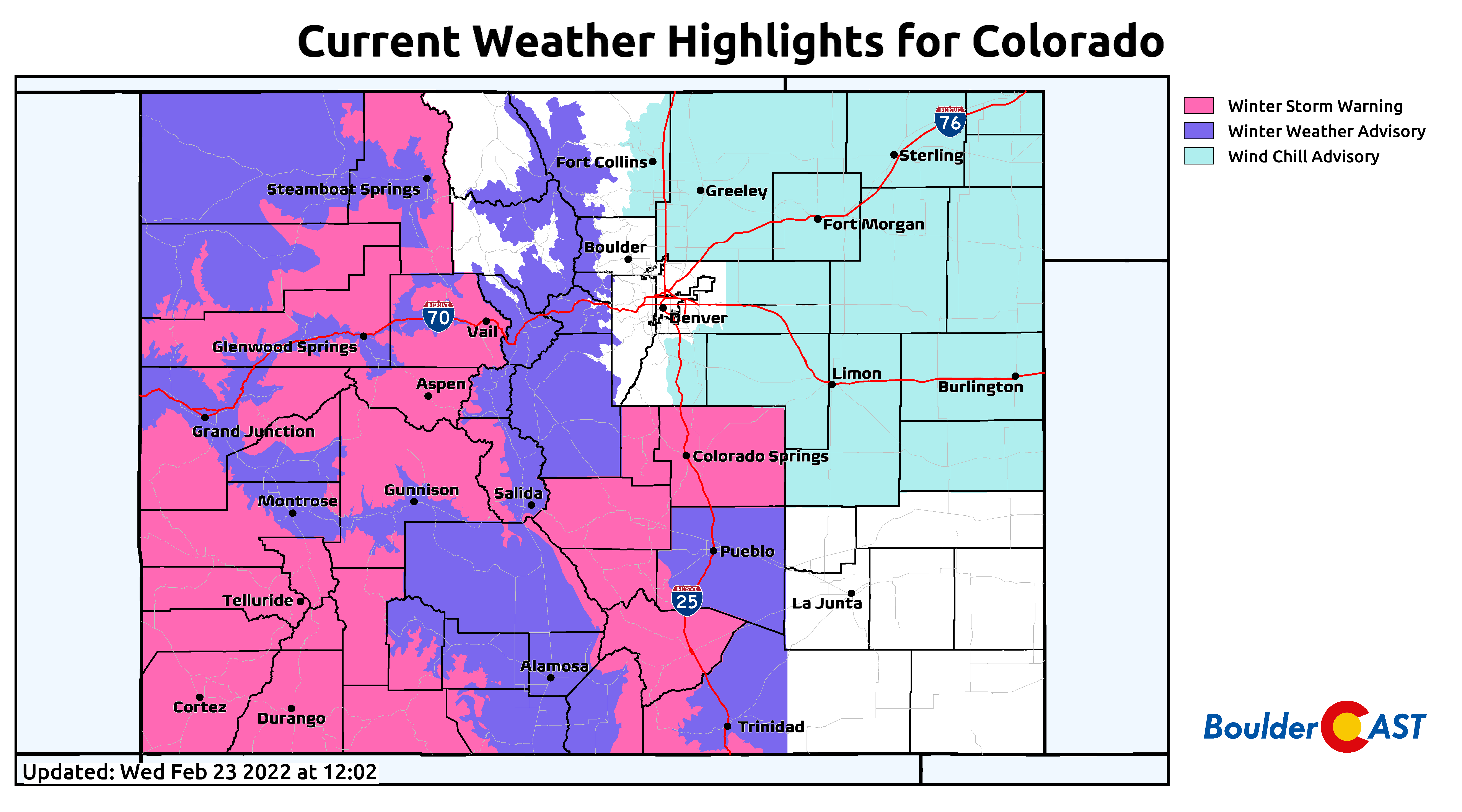
Also of note, the far better upslope setup for snow tonight will be across the southern part of the state from Colorado Springs to Pueblo where stronger due easterly winds will exist around a developing surface low pressure. Winter Weather Advisories and Storm Warnings are in effect for those areas — stellar news considering they have largely missed out on the plethora of snow in 2022 that the Front Range has benefited from.
The HRRR model simulated radar animation for this afternoon into Thursday morning is shown below. This gives an idea how the snow bands may setup across the area this evening, but it isn’t 100% accurate of course. Overall, we’re mainly looking for widespread light snow to develop over the region, but there could be pockets of more moderate snowfall rates mixed in at times Wednesday evening. Snow should begin by early evening and conclude Thursday morning sometime.
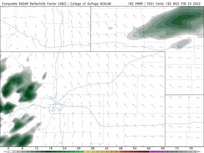
HRRR model-simulated radar animation from Wednesday afternoon into Thursday morning
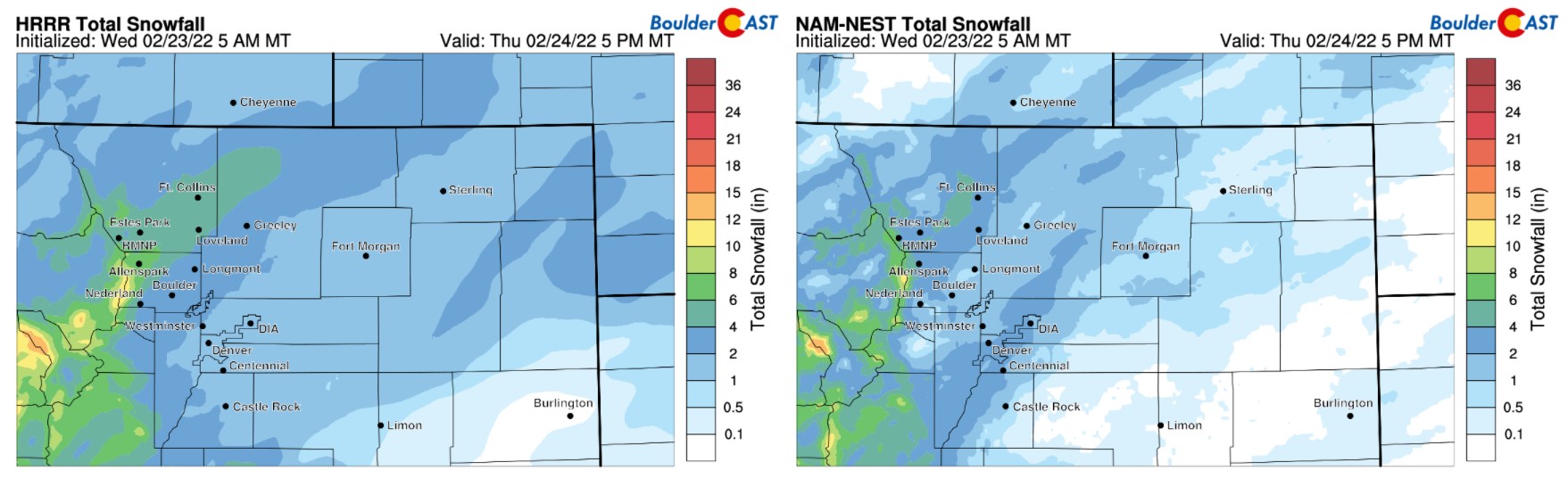
The HRRR model (left) and NAM-NEST (right) derived snowfall totals through Thursday are shown below. Both models have 1-4″ across the Denver Metro area, with perhaps a chance at more in parts of Larimer County thanks to the southeasterly upslope flow.
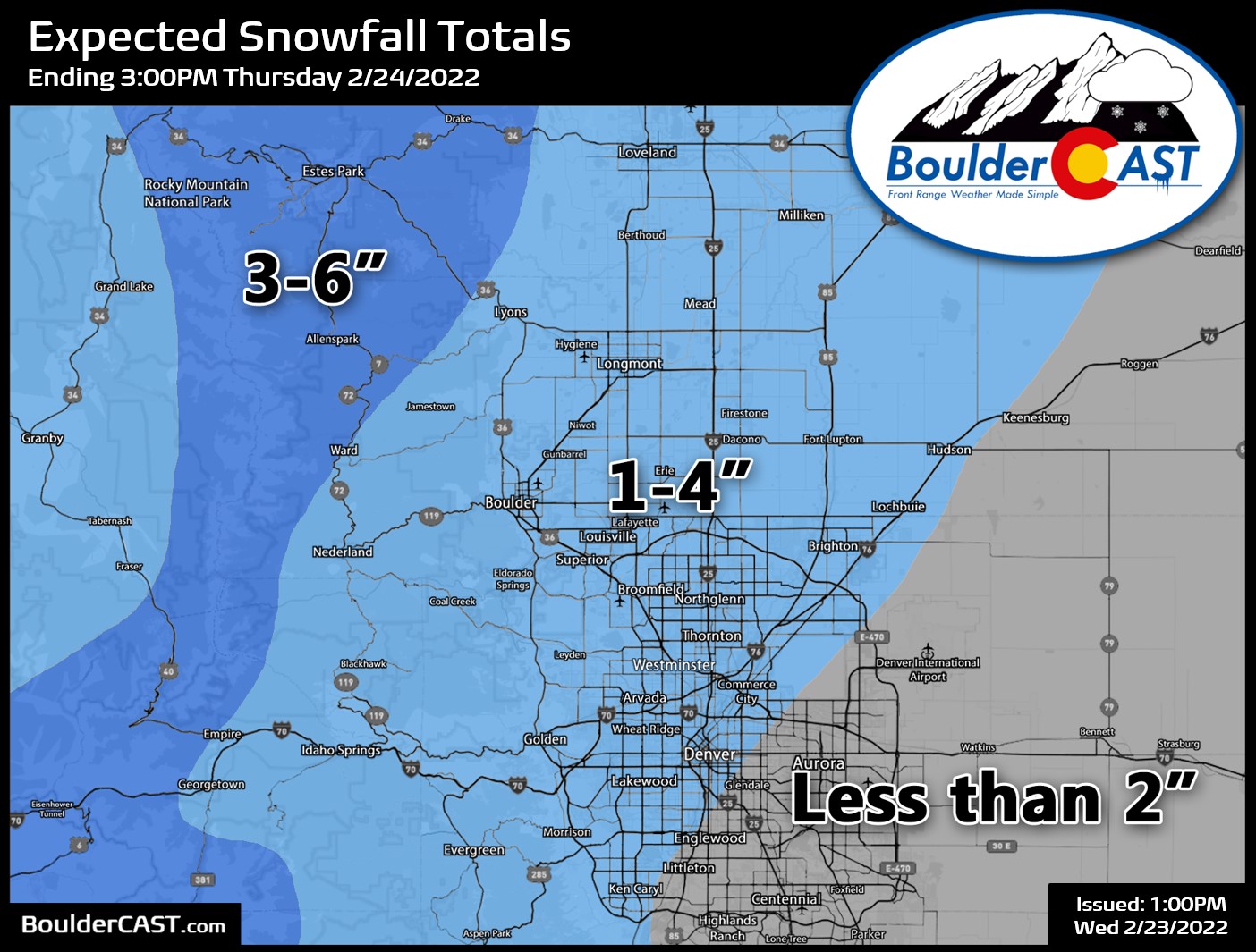
Our snowfall forecast map for this final wave of snow is shown below. This covers all snow falling Wednesday into Thursday.
While temperatures will remain starkly below normal, the edge will be taken off the bitter cold in the coming days with a beautiful weekend shaping up — the light at the end of the Polar Express tunnel. At this moment, it doesn’t look like we’ll get above freezing on Friday, but it will be close. Saturday is almost a sure bet though to end our sub-freezing streak!
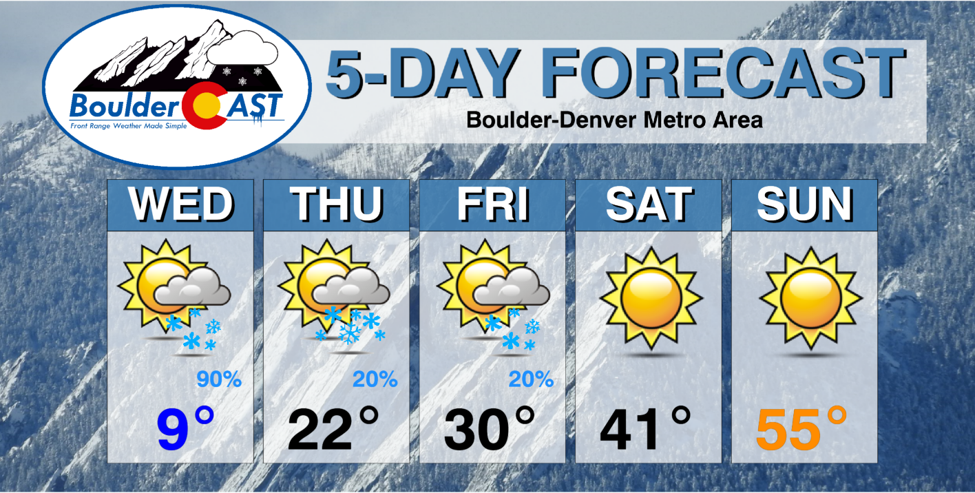
You may have noticed now that we lied to you earlier. Tonight’s snow isn’t actually the final bout for the week. There will be another chance of snow late in the day Friday as a secondary system slides through in the northwest flow. This looks minimal for now (i.e. a less than 1″ type of event), but there could be some jet-forcing in-play leading to banded snowfall. It’s something for us to watch for now, but nothing for you to worry about just yet. Stay warm!
It may have taken 123 years, but we’re (probably) doing it! 🥶
Boulder is likely to break both cold temperature records for February 23rd today. That is, the daily record low which is -5°F & the daily record low maximum which is 16°F — both set way back in 1899! #COwx #Boulder
— BoulderCAST Weather (@BoulderCAST) February 23, 2022
Get BoulderCAST updates delivered to your inbox:
Help support our team of Front Range weather bloggers by joining BoulderCAST Premium. We talk Boulder and Denver weather every single day. Sign up now to get access to our daily forecast discussions each morning, complete six-day skiing and hiking forecasts powered by machine learning, first-class access to all our Colorado-centric high-resolution weather graphics, bonus storm updates and much more! Or not, we just appreciate your readership!
Enjoy our content? Give it a share!


You must be logged in to post a comment.