After a quiet weekend in weather, the blocking pattern across the West wears down which leads to chances for rain and snow across Colorado. We also discuss Category 4 Hurricane Willa currently bearing down on Mexico.
Beautiful weekend weather carries into Monday
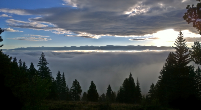
What gorgeous weather we had over the weekend! At BoulderCAST Station, we hit 69 degrees on Saturday and 73 degrees on Sunday with mostly sunny skies.
Despite a VERY active weather pattern configured across North America, Colorado has been quiet since our snowstorm last Sunday. The main reason for this calm stretch was stagnant and split-flow across the western United States, facilitated by a “rex block” pattern. A rex block is a split-flow atmospheric pattern which consists of a stalled high pressure north of a stalled low pressure (see below). This blocking pattern frequently occurs along the West Coast of the United States, leading to calm weather and seasonal temperatures for Colorado, which is exactly what happened late last week and over the weekend.
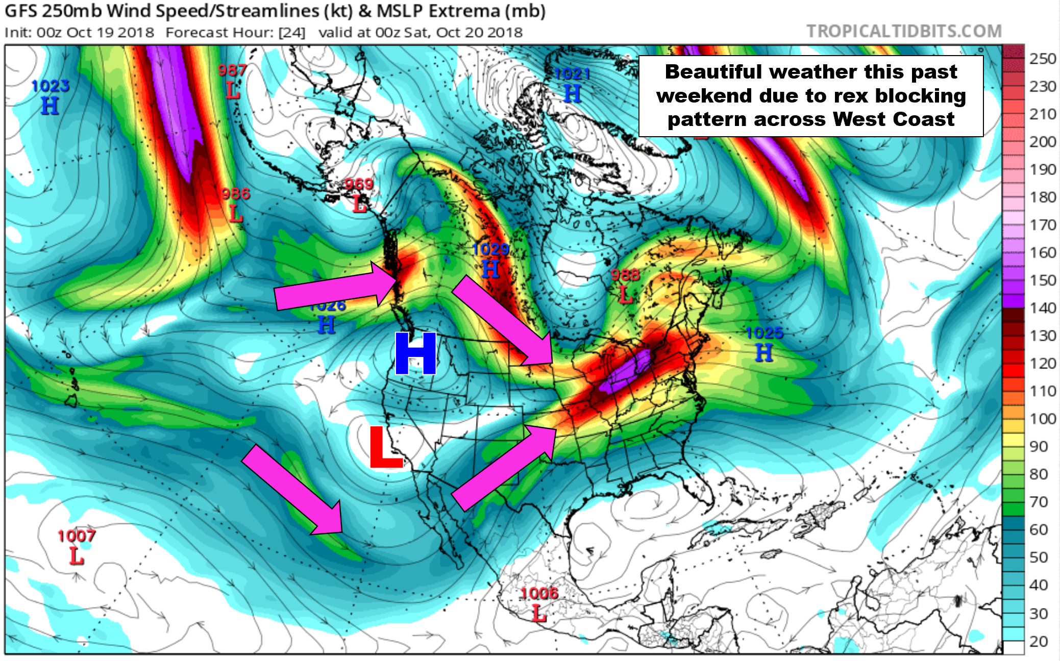
GFS 250 mb wind map for this weekend. A rex blocking pattern produced quiet conditions of late for Colorado
This pattern is breaking-down today, but we will manage to squeeze out one more glorious autumn day. Look for partly cloudy skies and temperatures in the upper 60’s today.
Slightly unsettled beginning Tuesday
By Tuesday, the low pressure trough that helped shape the southern tier of the rex block will begin to move eastward and gather a little energy. The GFS model shows as many as three weak trough axes embedded in the mean trough across the western United States (see below). The first wave will pass over our region Tuesday evening. The second (and probably strongest) one moves through Wednesday morning, with the final wave passing over sometime Thursday.
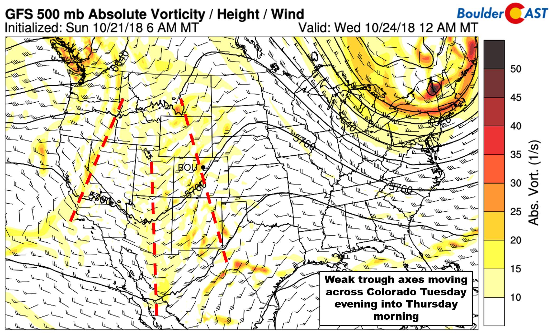
GFS 500 mb vorticity map for Tuesday night
There isn’t much moisture and energy to work with this week. Rain and snow showers will remain confined to the Mountains on Tuesday as the first wave passes. Still, cloud cover will be thickening across the Metro area.
As the secondary trough moves through late Tuesday night and early Wednesday, we believe there will be a slightly better chance for a few light rain showers across most of eastern Colorado. The timing of the rain will primarily be during the overnight hours Tuesday night, but a few rain showers could linger early into Wednesday morning. Without any real push of cold air or upslope in the lower levels of the atmosphere, rain amounts across the Front Range will be light from this event….generally less than 0.10″ in almost all cases. More widespread rain is anticipated east of the Metro area and across much of southern Colorado.
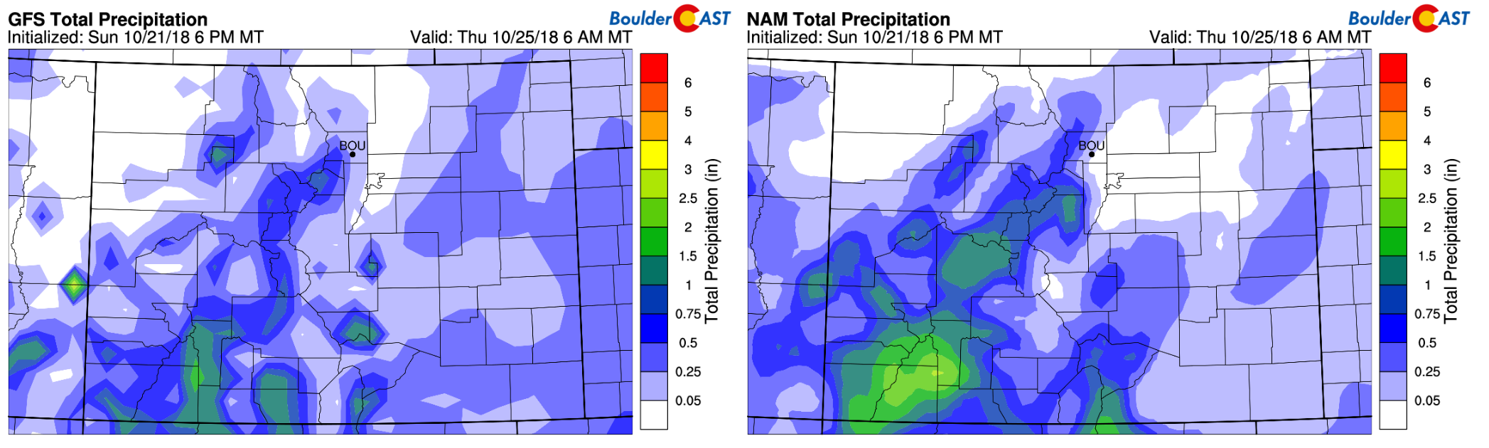
Total precipitation forecast through Thursday morning from the GFS (left) and NAM (right).
Clouds will stick around through most of Wednesday before finally eroding out in the evening. We may see a little clearing before sunset, but don’t count on it. Temperatures will be in the 50’s.
The third trough axis is expected to move across Colorado on Thursday. At this time, it looks like it will only produce a few patchy clouds and no precipitation at all for the state. Thus, expect mostly sunny skies with temperatures warming back-up towards 70 degrees.
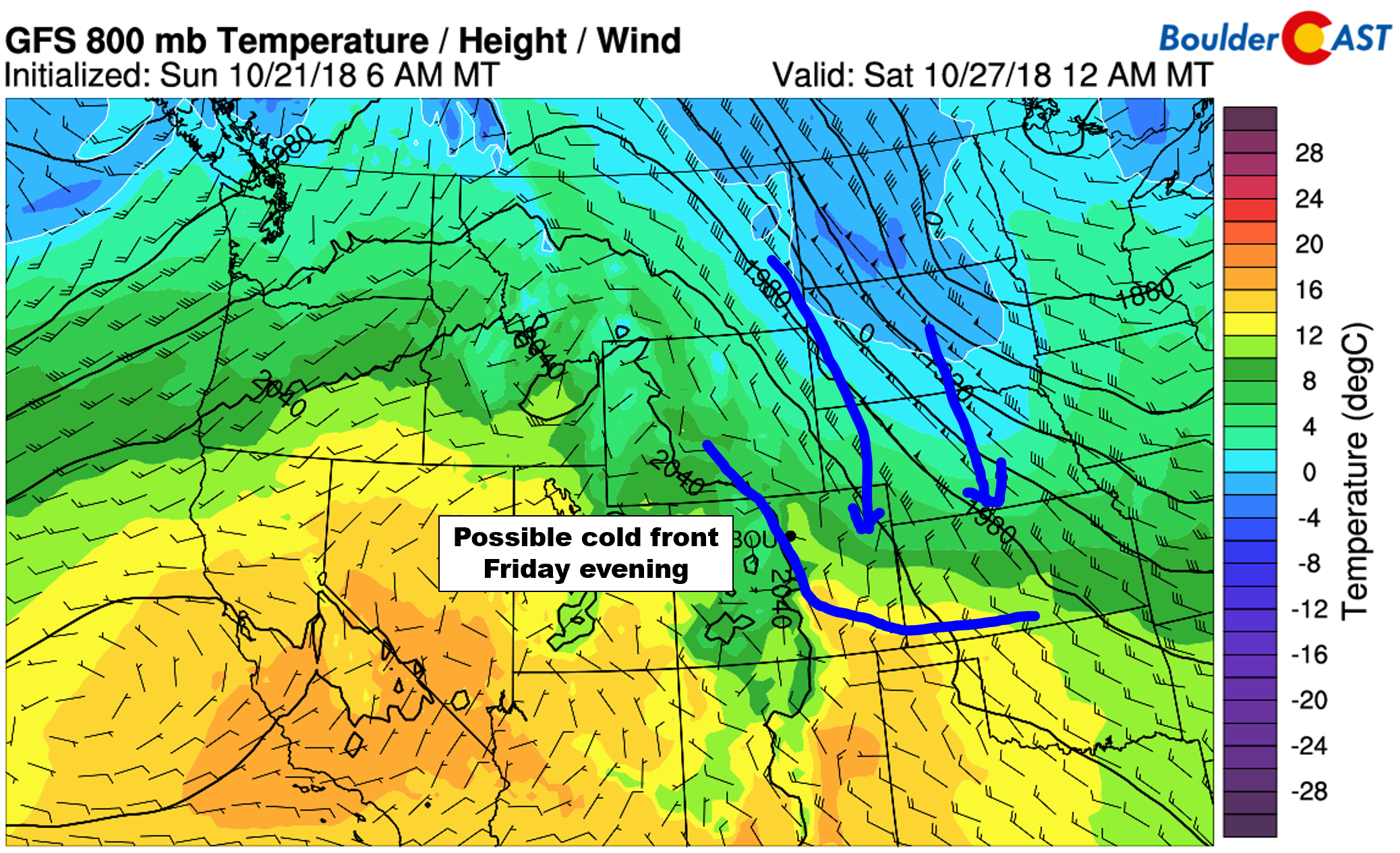
Friday will be similar to Thursday with a mix of clouds and sun and temperatures probably even a few degrees warmer. The models marginally agree on a cold front moving into eastern Colorado Friday night or sometime Saturday. No precipitation is expected with this passage, but it will be something to watch to potentially cool things off a little over the weekend (50’s maybe?).
Danger in Mexico
Yes, it’s almost November and we’re still talking about tropical cyclones. Hurricane Willa is currently a dangerous Category 4 major hurricane located in the eastern Pacific Ocean. Overnight it has strengthened to contain 155 mph sustained winds which is on the cusp of Category 5.
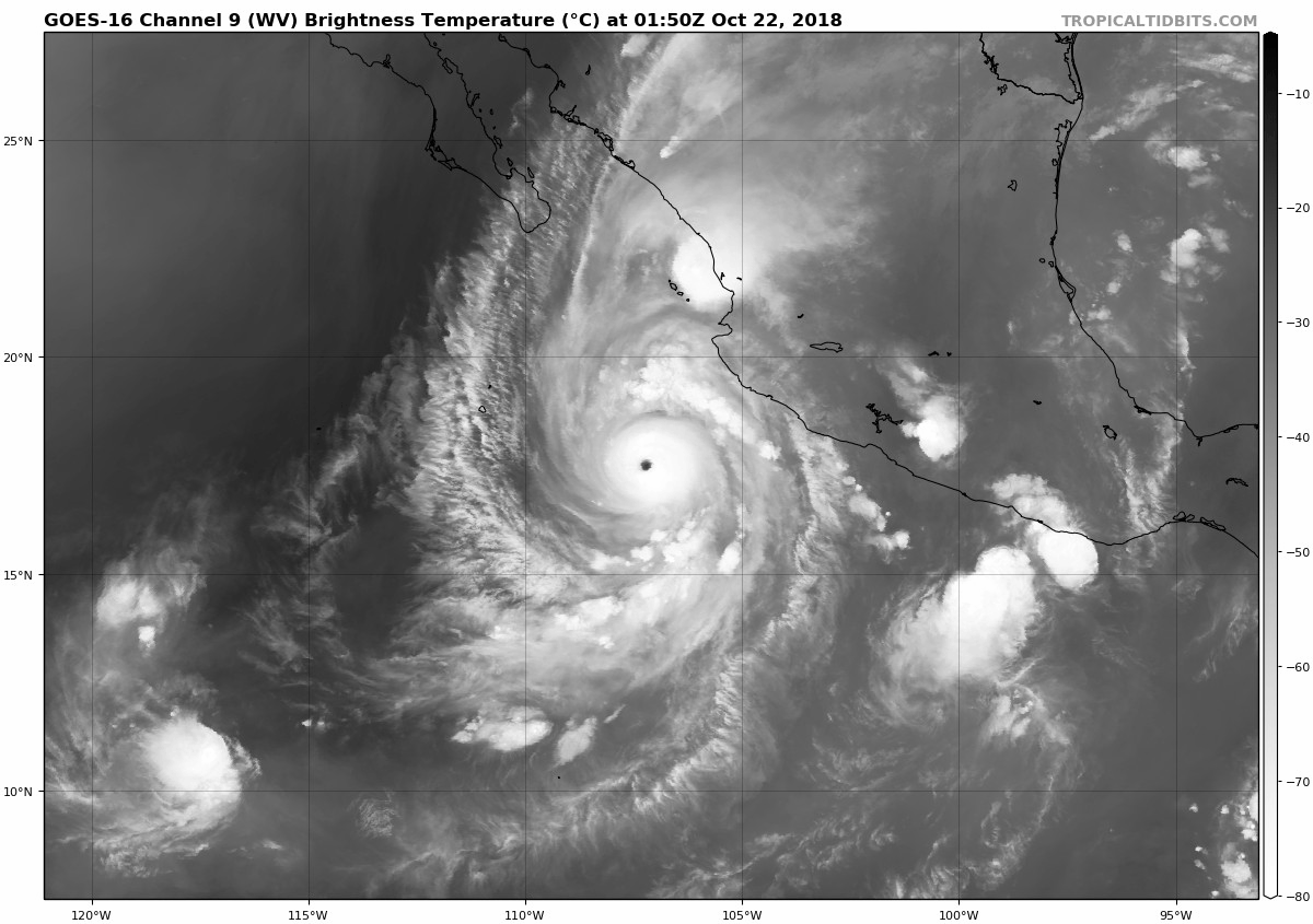
Unlike the last few major hurricanes in this region (Rosa and Sergio) which eventually made landfall in Mexico, Hurricane Willa will be coming ashore much further south with nothing but very warm waters in her path. As a result, the hurricane is NOT expected to weaken much between now and landfall on Tuesday. This is not good at all.
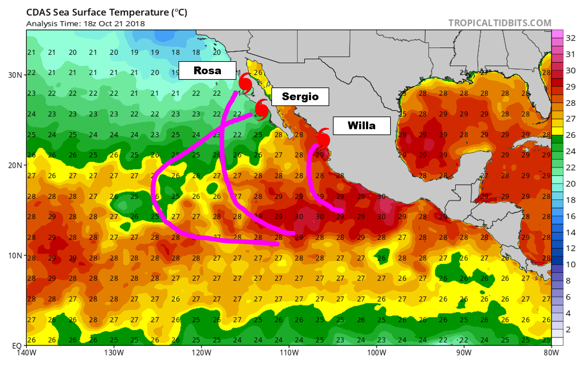
Current sea surface temperature analysis for the Eastern Pacific with the rough tracks of Hurricane Rosa, Sergio, and Willa annotated.
The situation is a dire one for the areas expected to take a direct hit. The National Hurricane Center forecast has Willa making landfall Tuesday afternoon or evening somewhere between the tourist destinations of Puerta Vallarta and Mazatlán. Life threatening catastrophic wind and storm surge damage is expected. We can only hope the region is preparing as well as Florida did for Category 4 Hurricane Michael’s landfall two weeks ago. Please keep the Mexican people in Willa’s path in your thoughts this week.
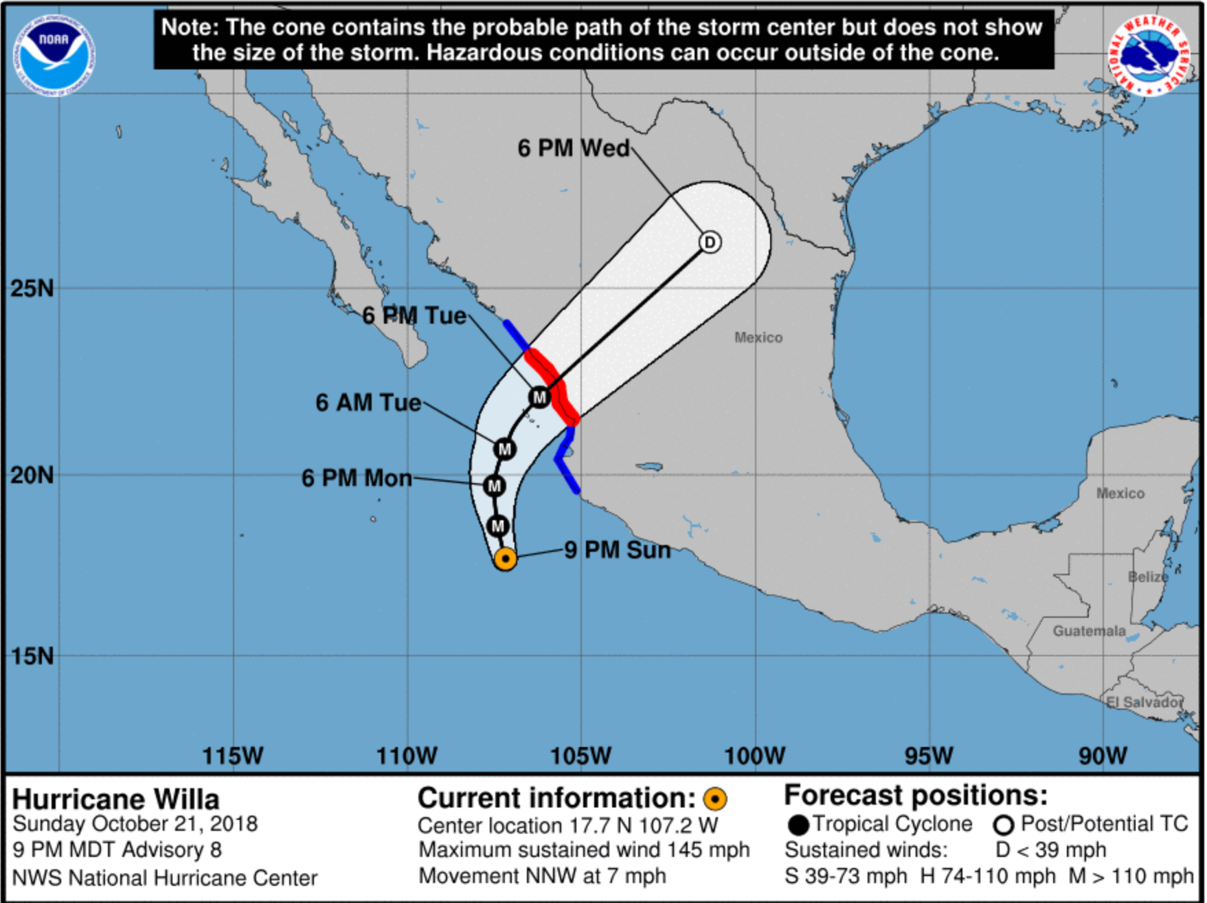
National Hurricane Center track forecast for Hurricane Willa
The remnants of Hurricane Willa will be skirting across the Gulf Coast later this week bringing widespread moderate to heavy rainfall (see below).
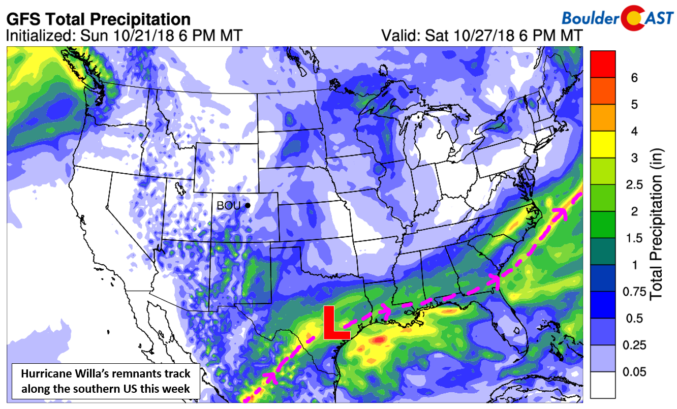
GFS total precipitation forecast through Saturday for the United States.
Forecast Specifics:
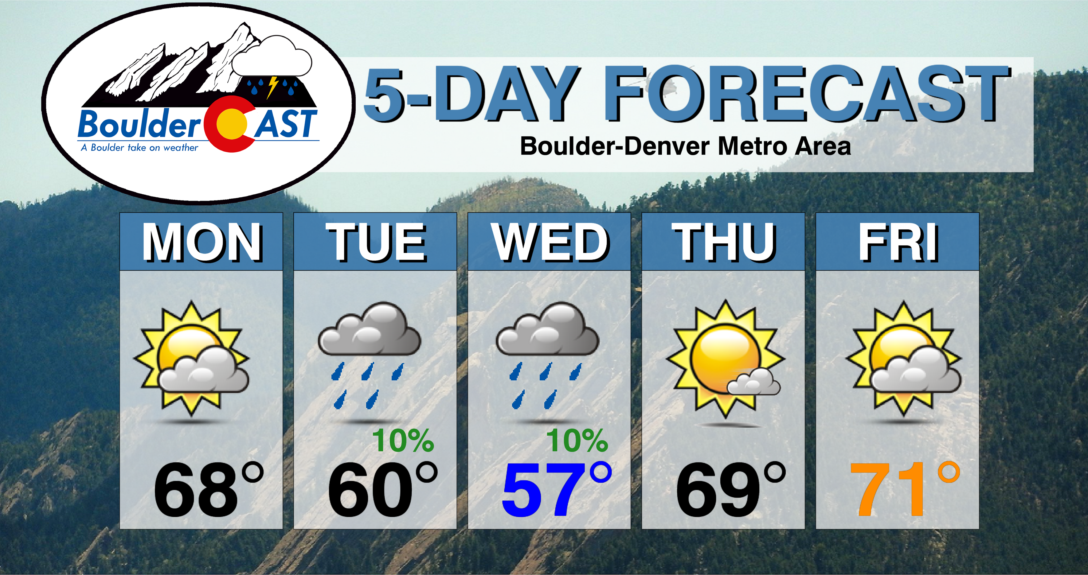
Monday: Partly cloudy, mild and dry. Highs in the middle to upper 60’s on the Plains and in the middle 50’s in the Foothills.
Tuesday: Mostly cloudy and cooler but mainly dry with highs near 60 on the Plains and upper 40’s in the Foothills. There is an isolated chance of rain showers during the day, especially across the Foothills. A slightly better chance of rain arrives Tuesday night into early Wednesday.
Wednesday: Gloomy with isolated rain showers in the early morning hours, then overcast with partial clearing possible around sunset. Highs in the middle 50’s across the Plains and in the middle 40’s in the Foothills.
Thursday: Mostly sunny with highs near 70 on the Plains and upper 50’s in the Foothills.
Friday: Partly cloudy and seasonal. High temperatures in the lower 70’s for the Plains and lower 60’s in the Foothills.
Weekend: A weak cold front is expected to move into Colorado from the north over the weekend. The timing is not clear right now, but it could make for a cooler day either Saturday or Sunday. Regardless, both days will be mostly sunny and not chance of precipitation.
High Country: Monday and Tuesday will be soggy or snowy in the Mountains depending on the elevation. Snow levels will be around 10,000 or 11,000 feet both days. Several inches of new accumulation will be possible, especially across the San Juans. Embedded thunder will be likely, especially on Tuesday afternoon. Things quiet down Wednesday through Friday with sunshine and warmer temperatures returning. Check out our SummitCAST page for 6-day forecasts for more than 120 Colorado mountain destinations!
DISCLAIMER: This weekly outlook forecast was created Monday morning and covers the entire upcoming week. Accuracy will decrease as the week progresses as this post is NOT updated. To receive daily updated forecasts, subscribe to BoulderCAST Premium.

.
Share our forecast!


You must be logged in to post a comment.