
The Mountains are finally beginning to actually accumulate snow! With an active weather pattern on tap for the week ahead, we’ll see this trend continue. For the lower elevations, we’re expecting downslope to greatly limit any chances of precipitation this week, but several surges of cold air will keep our temperatures quite chilly. Finally, we’re tracking a weak system for Friday that could bring some light snow to the lower elevations as well. Read on for our complete outlook of the upcoming week.
Mountain snow update
With the persistent warmth and ridging of the last few months, our Mountain snowpack is sitting well below normal. The time series below of snow water equivalent shows that the South Platte River Basin has just 40% of its normal amount of snowpack for late November.
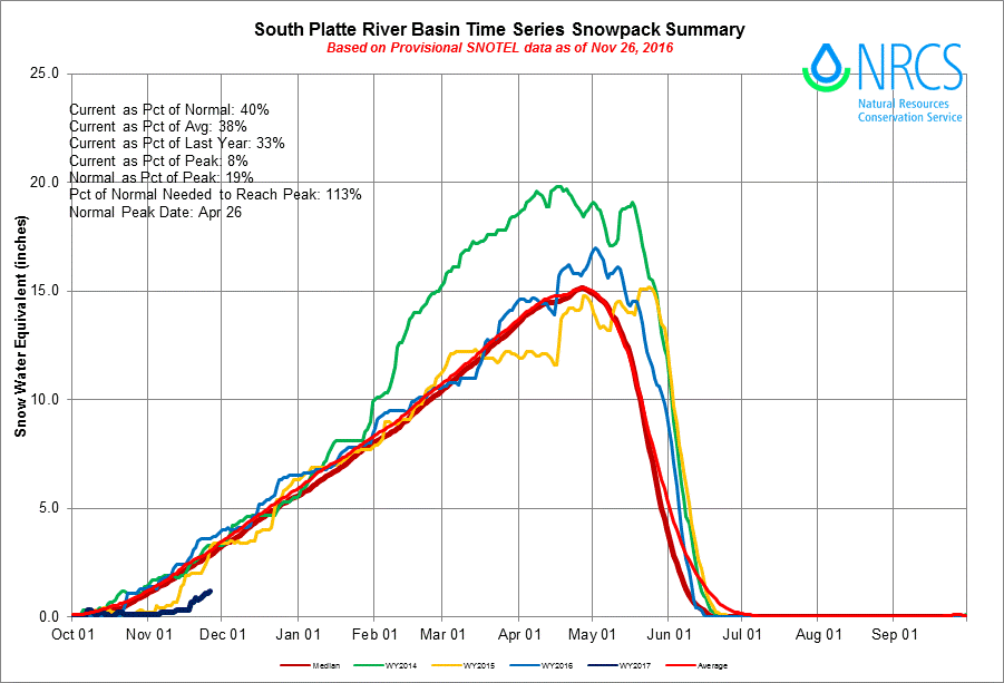
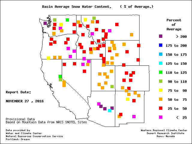
The South Platte, and even Colorado as a whole, are not alone in this reality. Nearly every single water basin in the western United States is running below normal in the snow department…
Not only has there been a lack of snow, but historic warmth between the snows we did get has contributed to increased melting. Both of these factors have added up to a significant, but not insurmountable, deficit. Though, most years when there is a slow start to snowpack, Mother Nature has trouble fully making a recovery through the rest of winter. Of course, two winters ago had a similar slow start, but a very snowy late April and May more than made up for it (see the yellow line on the top graph).
More snow dumps on the Mountains
Last week accumulated numerous inches of snow in the Mountains, and as we mentioned, that trend continues this week with even more white stuff for the higher elevations! This is all compliments to an active weather pattern, with trough after trough sliding across the state throughout the week. The 500mb height and anomaly animation below shows this nicely. Focus on Colorado and note how many passing waves there are. You will notice two stronger troughs on Monday and Tuesday, a week trough on Wednesday, and finally a slow-moving cut-off system for Friday.
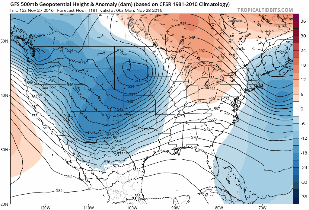
GFS 500 mb height and anomaly loop through Friday. Notice how active and “blue” the pattern is across Colorado.
All of this action is embedded in a general northwest flow. With this, we would expect good snows for the Mountains (especially in northwest Colorado), but limited activity for the Plains with downslope generally dominating. Nonetheless, temperatures will likely remain largely below normal through the week for everyone under this flow pattern.
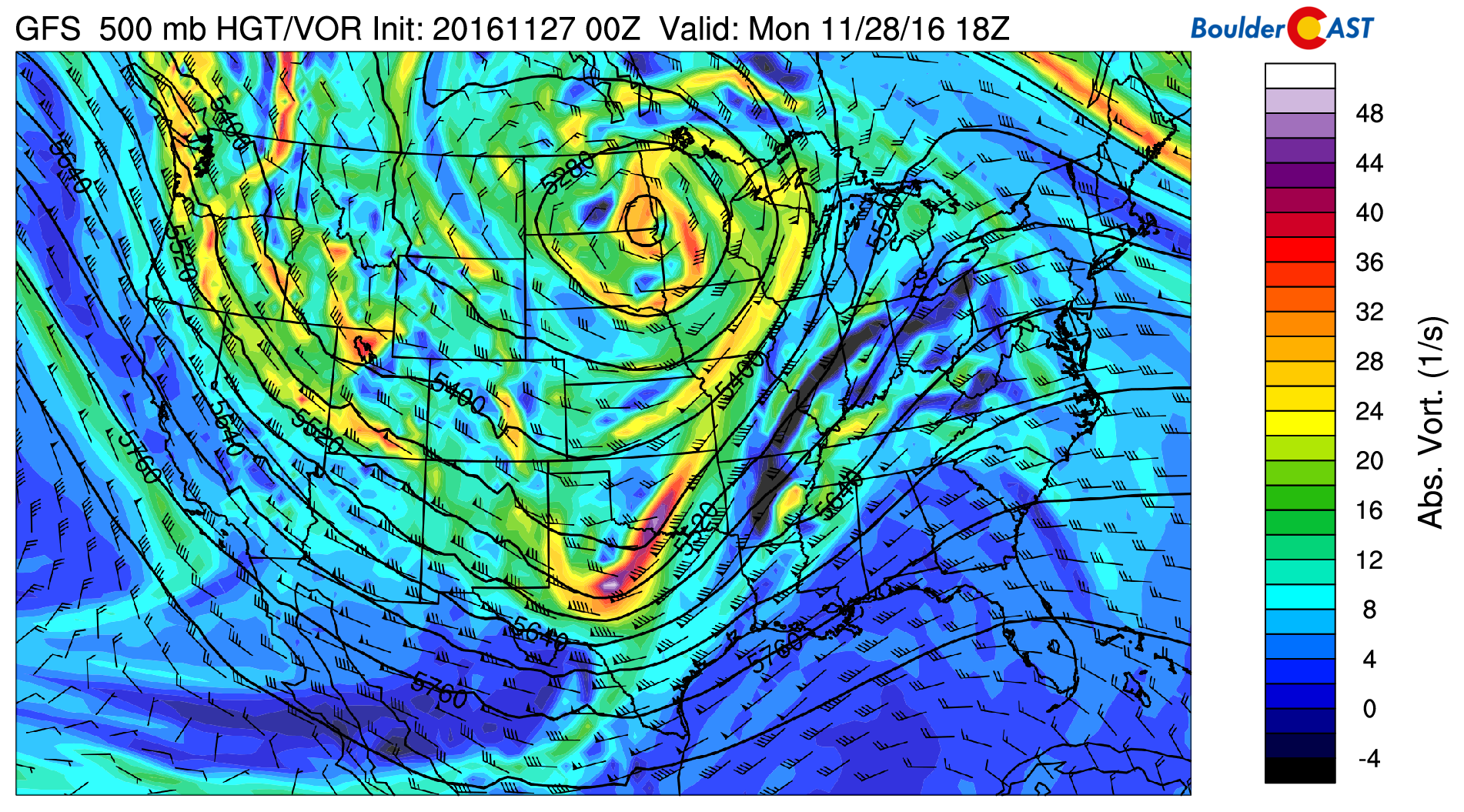
GFS model 500 mb vorticity map for Monday afternoon. A wave lies along the Colorado-Kansas border, and also in northern Utah.
Monday and Tuesday will see snow, heavy at times, continuing to pile up for the Mountains, especially in northwest Colorado. A combination of added lift from a few troughs and moisture-laden northwest flow (see above) will allow for 3 to 8″ of additional snow in the Front Range mountains above 10,000 feet with some western exposure. Both Monday and Tuesday will be decent powder days for all Colorado ski resorts that are open! Some light spill-over from the Divide into the higher Foothills is possible Monday afternoon. Up to 2″ of accumulation is possible above 9,000 feet, particularly along Peak to Peak Highway.

GFS model snowfall forecast for Monday and Tuesday. Another 4 to 8″ is possible for most of the resorts
Down on the Plains, with the troughs nearby, skies will remain partly to mostly cloudy Monday and Tuesday. Cool northwest flow will keep temperatures near normal on Monday in the upper 40’s. Tuesday morning should see a weak reinforcing shot of cold air. Thus, high temperatures then will be about ten degrees cooler than Monday.
Snow in the Mountains will decrease Tuesday afternoon and evening, mostly coming to an end Tuesday night.
Calmer on Wednesday & Thursday
Wednesday will be the quietest day for our state. We’ll be between systems on the fringe of a weak ridge, and the flow aloft turns more northerly (see below). While this is not a favorable direction for orographic snow, it is for chilly conditions to persist, even with sunshine returning.
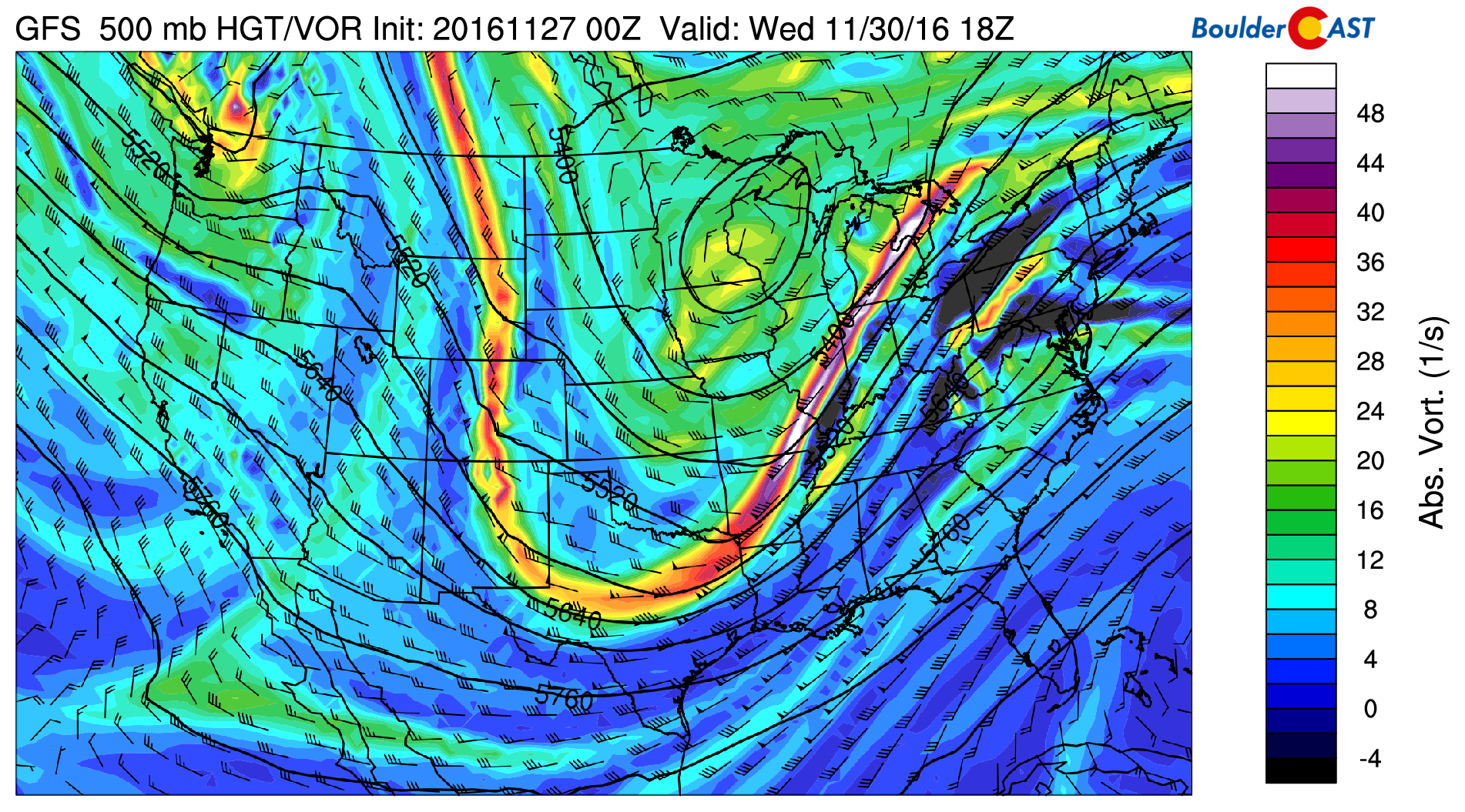
GFS model 500 mb vorticity map for Wednesday afternoon. A tiny wave is moving across Denver.
Highs will again be near 40 degrees Wednesday and Thursday with partly to mostly sunny skies.
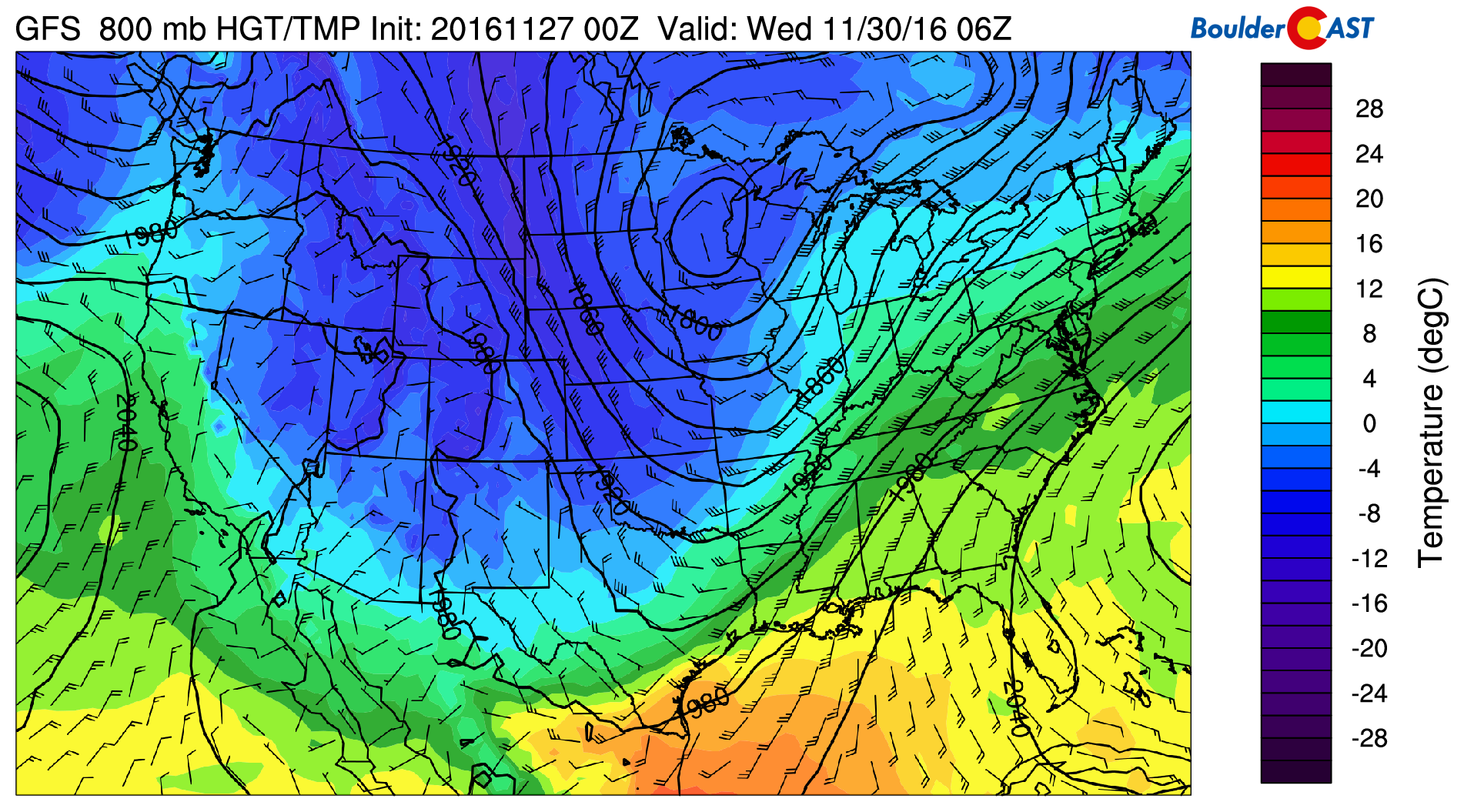
GFS model 800 mb temperature and wind map for Wednesday showing cold NNW-erly flow across Colorado.
Cut-off uncertainty to end the week!
By late-day Thursday, another system will be approaching Colorado from the northwest. Unlike the disturbances early in the week, models slow this final system down and look to eject it from the jet stream. Still five days out, you can imagine the uncertainty is quite high. The latest GFS model run for Friday afternoon is shown below, cutting the system off into Arizona and eventually Mexico.
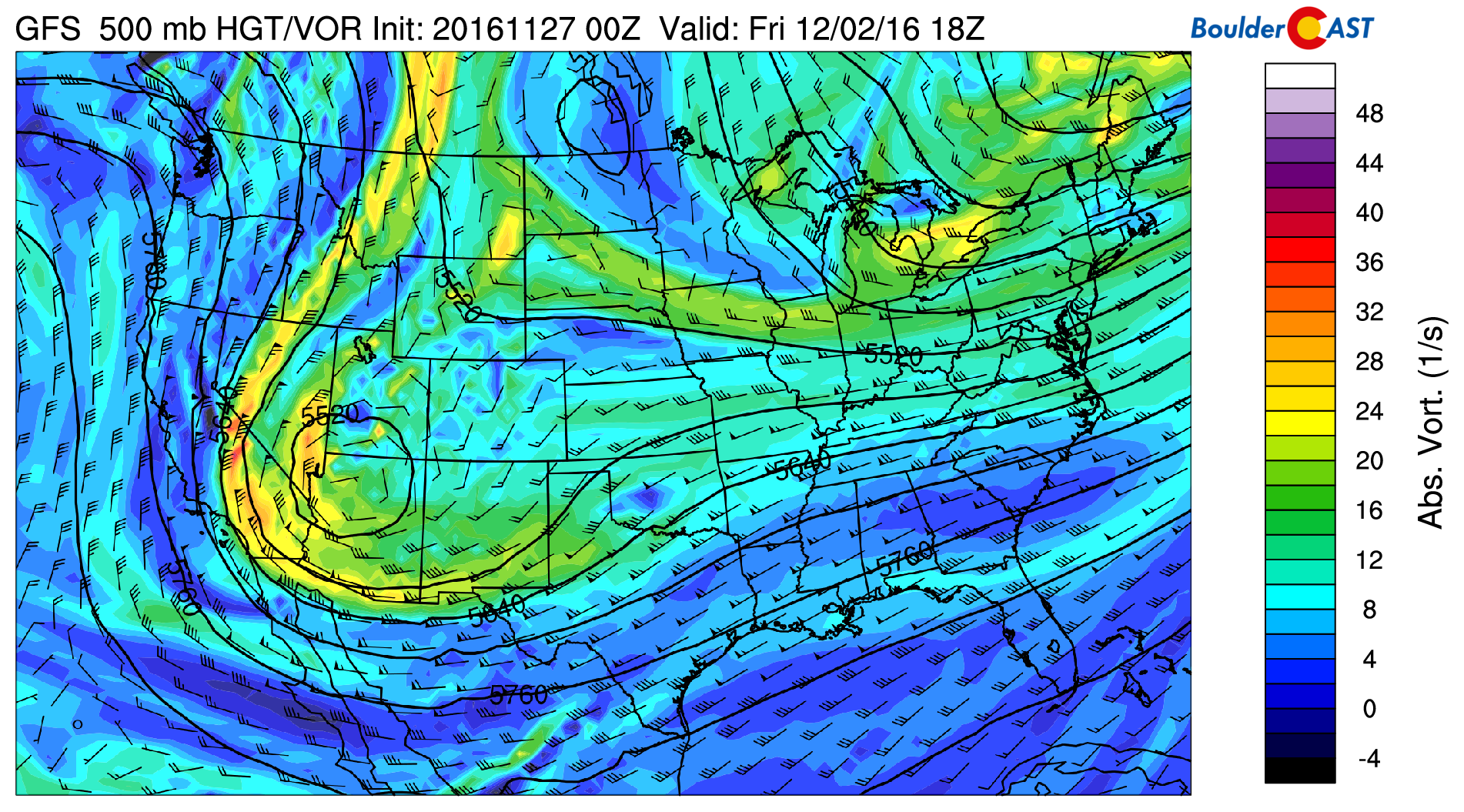
GFS 500 mb vorticity map for Friday, showing a system cutting off to our west and south
This pushes the jet stream very far south around the base of this system (see below). This would open the door for a weak cold front to enter northeast Colorado…
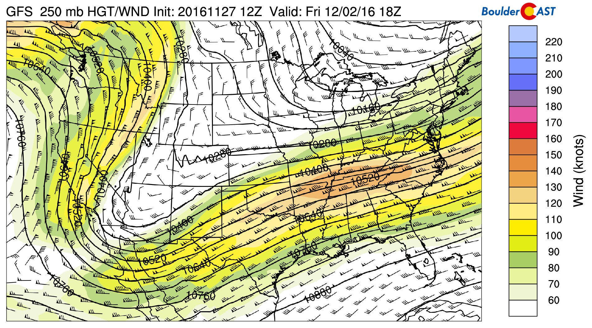
GFS 250 mb wind forecast for Friday afternoon, showing the jet stream taking a significant dip into Mexico
However, this set up would largely spare Colorado from much impact. Some runs and models have this system tracking further eastward and remaining an open wave, which to us seems unlikely. With that said, we expect this system to remain to our west and south. This will allow for just a few spotty higher elevation snow showers and some colder air to filter into the state from the north. If we can get a little upslope going, which is plausible alongside the front, light snow may be on the table for the Metro Area Thursday night into Friday.
Temperatures on Friday will likely be the coldest of the week. Depending on how things evolve with trough, upper 20’s to mid 30’s would be possible for the Plains. Brr!
Enjoy the last few days of November and the beginning of meteorological winter on Thursday! We’ll keep you updated on the (small) chance of snow for Friday, if necessary. Stay tuned.
Forecast Specifics:
Monday: Partly to mostly cloudy. Breezy at times with gusts up to 35 mph on the Plains, and 45 mph in the Foothills. The higher Foothills could see spotty light snow showers spilling over from the Divide, especially along Peak to Peak Highway, with 2″ or less of accumulation. Highs in the upper 40’s on the Plains, with mid 30’s in the Foothills.
Tuesday: Mostly cloudy, dry, and breezy with winds gusting up to 35 mph. High temperatures near 40 for the Plains, and in the upper 20’s in the Foothills.
Wednesday: Mostly sunny and quiet. High temperatures in the upper 30’s across the Plains, and in the mid to upper 20’s in the Foothills.
Thursday: Sun early with increasing clouds through the day. Look for highs in the upper 30’s for the Plains, with mid to upper 20’s in the Foothills.
Friday: Partly cloudy and colder with temperatures in the low 30’s on the Plains and low 20’s in the Foothills. Uncertainty in the track of a cut-off system leaves the potential from some light snow for everyone centered around early Friday. Accumulations, if this does happen, should be small.
High Country: Snow will be the story this week for the higher elevations. Moderate snow will continue through Monday into Tuesday afternoon, dropping another 4 to 8 inches, including most major ski resorts. Strong winds will also be present on Monday and Monday night. After a quiet Wednesday and first half of Thursday, light snow returns Thursday evening lingering into Friday. A few additional inches of accumulation will be possible.
Extended: The upcoming weekend should be relatively quiet and sunny for the Front Range. Temperatures will be slowly warming up from Friday’s chill, into the 40’s Saturday and maybe 50’s by Sunday. We’re seeing good indication of more troughs in the pipeline for next week. This should keep the threat of snow in the forecast for the Mountains, with at least a possibility of something mildly interesting happening for the lower elevations.
Mon
Tue
Wed
Thu
Fri


Temperature
47
41
40
39
32


Precip Chc (Plains)
0%
0%
0%
0%
10%


You must be logged in to post a comment.