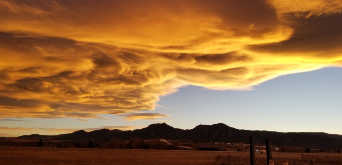
Dry and unseasonably warm conditions will continue across eastern Colorado for much of the week ahead. We discuss this along with an uncertain but interesting weather system for the upcoming weekend.
It’s been very dry across Colorado of late…
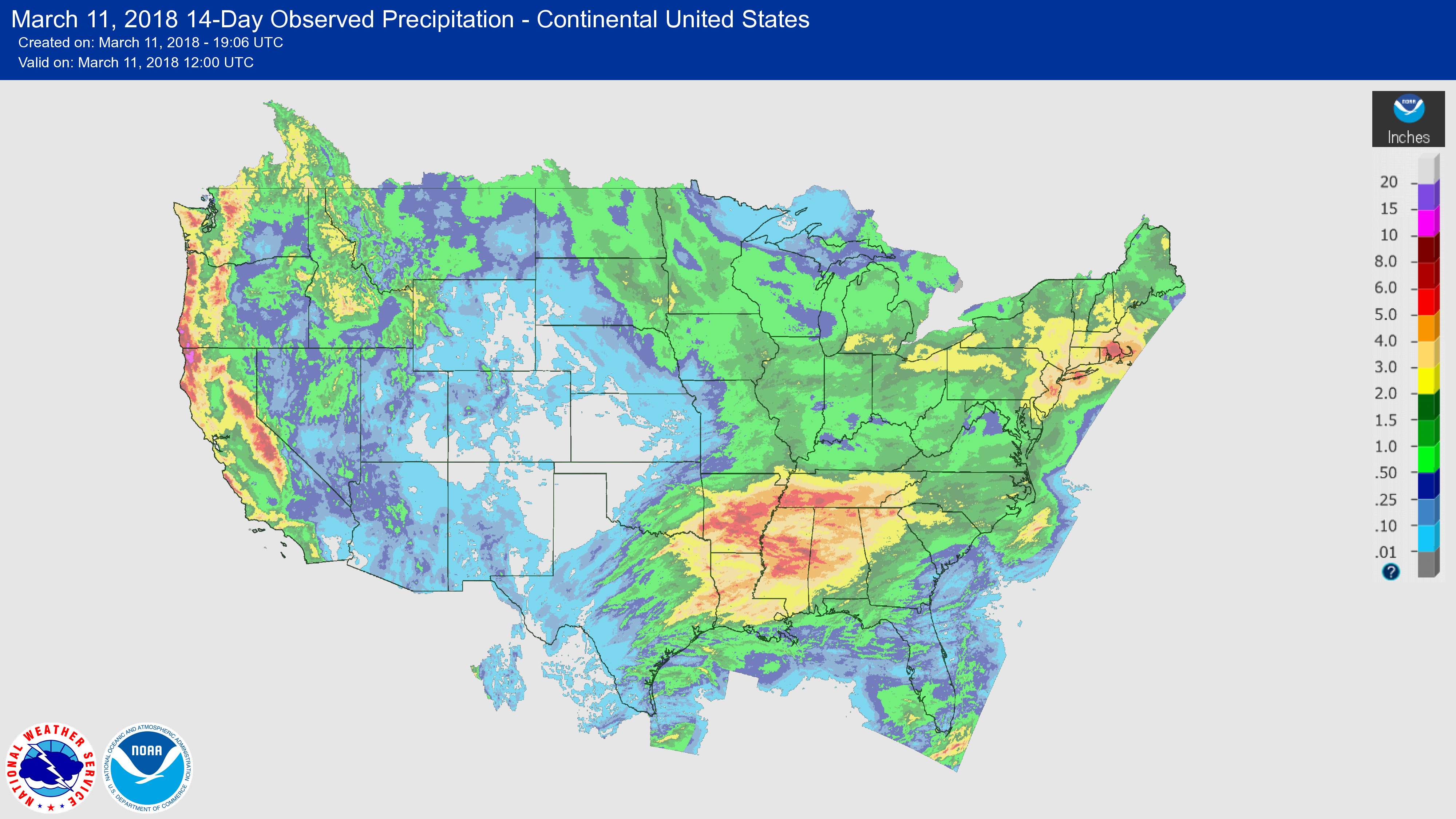
We have to go back more than two weeks to February 23rd to find Boulder and Denver’s last measurable precipitation. The storm track hasn’t been overly unfavorable for us. However, the main issue has been getting moisture to coincide with the passing atmospheric waves. Much of the moisture has been wrung out across California, the Pacific Northwest, and the northern Rockies, not propagating into Colorado at all. The 14-day precipitation analysis map below shows the “doughnut hole” of precipitation across our region.
Recent oceanic observations in the Pacific show that La Niña is in her dying stages right now. Near-surface temperature cold anomalies have decreased in coverage and intensity over the last two months. As of February 22nd, a warm anomaly is starting to develop along the South American coastline near the ocean surface. This is seen in top right corner of the very bottom panel below.
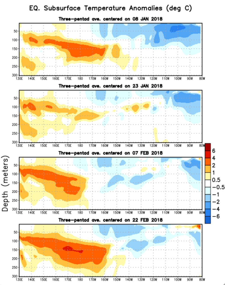
Oceanic sub-surface heat anomalies from January 8th to February 22 (top to bottom). The cold anomaly is dissipating, indicating a weakening La Nina.
La Niña dissipating is a development that could end up being important for our region. The probability of bigger snow storms increases significantly for ENSO-Neutral conditions relative to La Niña. With time quickly running out on our snow season, one or two big snows might be the only thing that can salvage the winter for Colorado.
Unfortunately the trend won’t be changing much for the upcoming week. Chances for rain and snow will be minimal with a large-scale ridge dominating much of western North America. We can see in the 250 mb wind map below that the polar jet stream is highly amplified, digging very far south off the California coast, then pushing far northward into the Arctic Circle in western Canada. This amplification will provide heavy snow to California, and warmth to Colorado by midweek. Also note that the base of the deep trough offshore is merging with the moist subtropical jet. This could eventually be a factor in delivering moisture to Colorado over the weekend.

GFS 250 mb wind map for Monday afternoon. A highly amplified polar jet is visible across western North America, with the sub-tropical jet tracing the southern United States’ border.
Pleasant start to the work-week
One of the few meager chances of precipitation for the week will occur Monday afternoon as a feeble pulse of energy moves across Wyoming. This can be seen in the 500 mb map below for Monday afternoon.
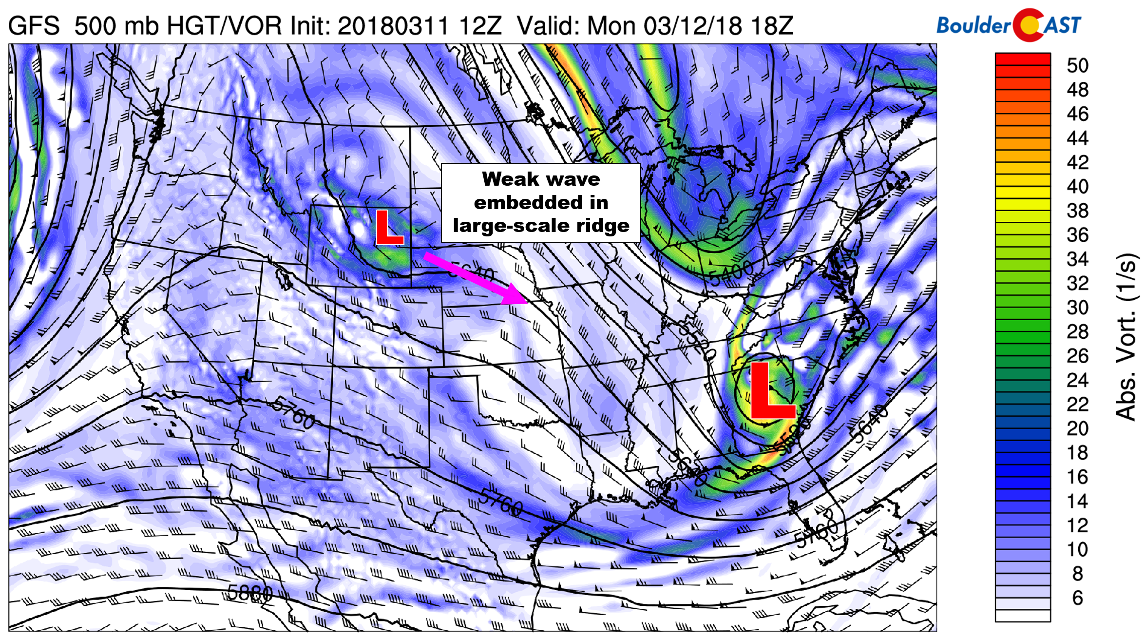
GFS 500 mb map for Monday afternoon. A weak disturbance in Wyoming will bring a few clouds and a tiny chance of rain the second half of Monday.
This wave is quick-moving and moisture-starved. The main impact to northern Colorado will be some clouds Monday afternoon. We can’t rule out a few isolated rain drops for the Metro area during the afternoon and evening, but most locations will be dry. We think only about a 5 to 10% chance of rain. Temperatures will be in the mid 50’s today.
Tuesday will be quiet, sunny and mild….temperatures will be in the middle 50’s again.
The “heat wave” begins Wednesday
By mid-week, the highly-amplified ridge axis will be passing over eastern Colorado (see map below). This will shift our winds from northwesterly to southwesterly, allowing warm air advection to take over through the depth of the atmosphere. Highs Wednesday will be near 70 degrees with a mix of clouds and sun. Thursday will be similar, but slightly cooler resulting from some cloud cover. Highs will be in the upper 60’s.
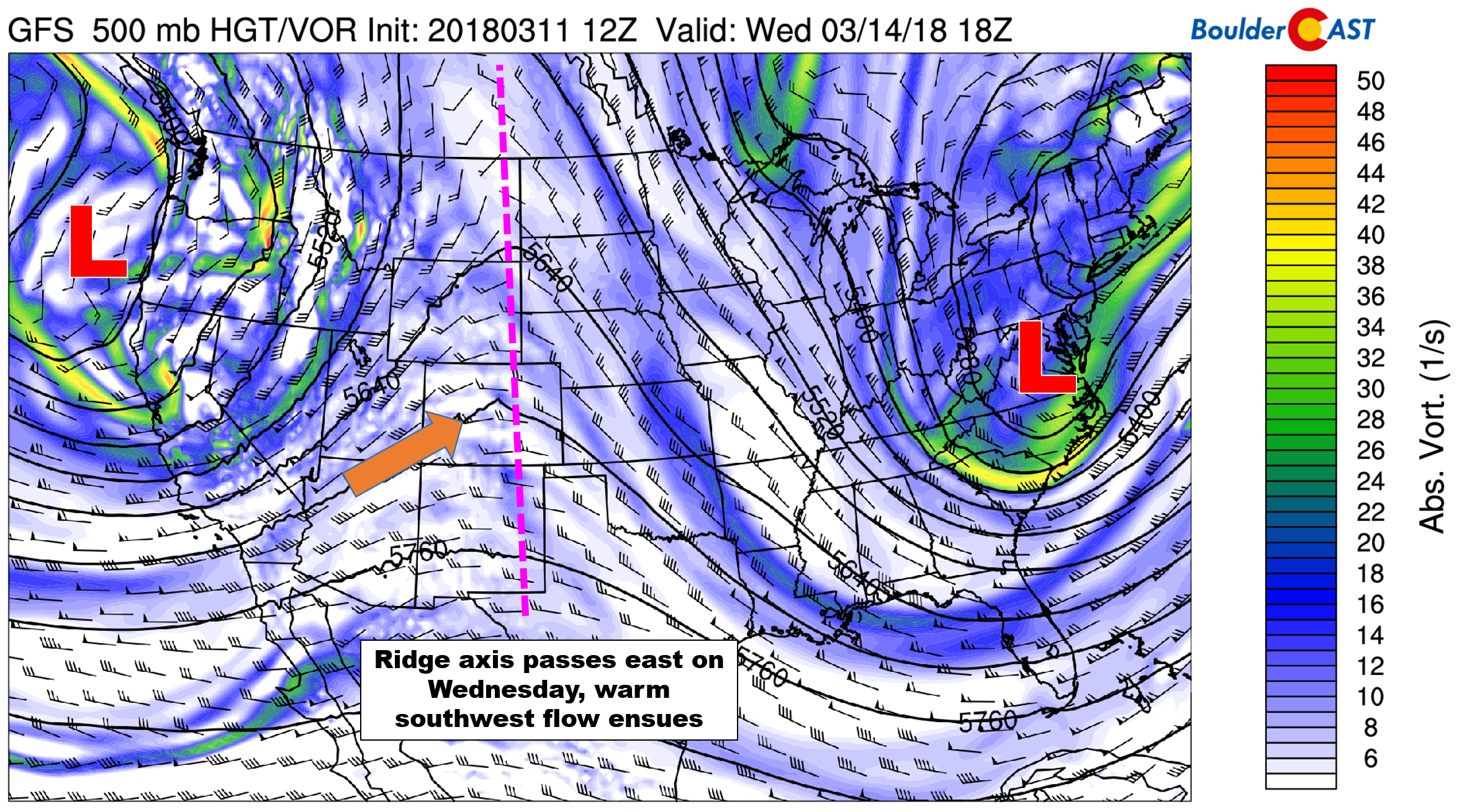
500 mb vorticity map for Wednesday. The ridge axis passes “turning on the heater” to Colorado
In the map above, also notice the large trough across the Pacific Northwest. It will be circulating several storm systems into California, Oregon, and Washington. Big snows are once again expected in the Sierras and Oregon Cascades, on the order of two to four feet through the week. It sure would be nice to get something like that in Colorado, wouldn’t it?
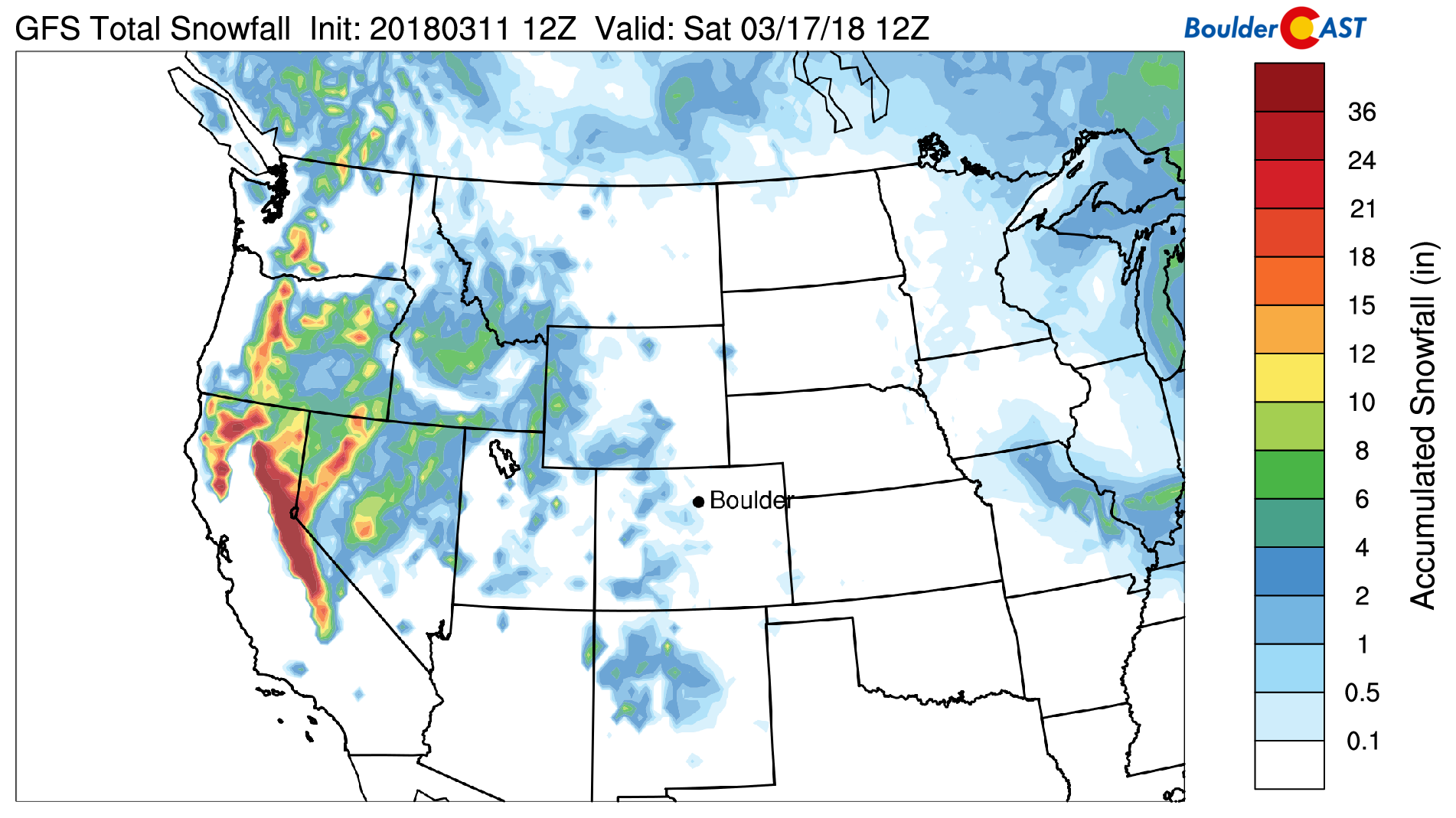
GFS model-derived total snowfall forecast through Saturday morning. Heavy snow is expected in the Sierras with little in Colorado.
Nonetheless, by late Wednesday, the outer edge of that trough will start to impact Colorado in the form of weak disturbances embedded in the southwest flow. Model uncertainty with these features is high right now as they will largely be dependent on small-scale jet streaks. It’s unclear when, if, and to what degree these may impact our region.
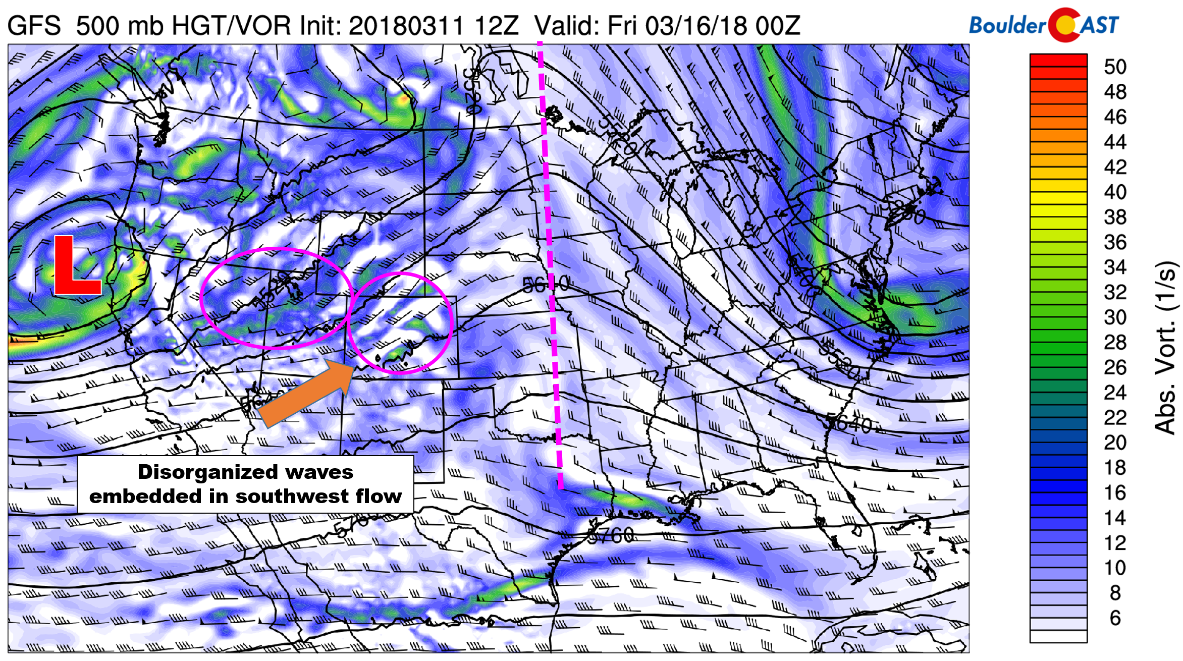
GFS 500 mb vorticity map for Thursday. A few weak waves could impact our region late in the week. However, specifics are unknown, outside that impacts should be minimal.
You can just tell from the disorganized, yet potent nature of the trough that this forecast is anyone’s guess right now, especially heading into the weekend. Anything that does materialize towards the end of the week should be classified as “minor” and will also be contending with unseasonably warm temperatures. Snow levels thus will be quite high statewide. Our snow level forecast map for Thursday evening is shown below. Even the high valleys would be looking at mostly rain. The higher Mountains could see a few inches of light snow during the Wednesday/Thursday time-frame, but we can’t say for sure right now or pinpoint the exact locations.

GFS model-derived snow level forecast for Wednesday evening. Warm temperatures will translate into elevated snow levels.
For the Metro area, forecast confidence is low as well. Models seem to somewhat agree on a pulse of energy Thursday afternoon into the night. Given the warm conditions and downslope flow, we expect that any precipitation that does fall would be all rain and very spotty east of the Divide. We’re also seeing a small amount of CAPE present late in the day Thursday. This could produce a few rumbles of thunder with any showers that do materialize.
Friday looks totally dry with partly cloudy skies and highs in the low to middle 60’s.
Looking to the weekend, that trough across the west is going to have to go somewhere. The GFS ensemble kicks it eastward into Wyoming on Sunday. This brings mountain snow to Colorado, maybe some rain to the Metro area, and a blizzard to eastern Wyoming. The Euro is more-or-less showing this as well. We’ll be watching this through the week for sure. It may be another swing and a miss for northeast Colorado, though…
Stay tuned!
Forecast Specifics:
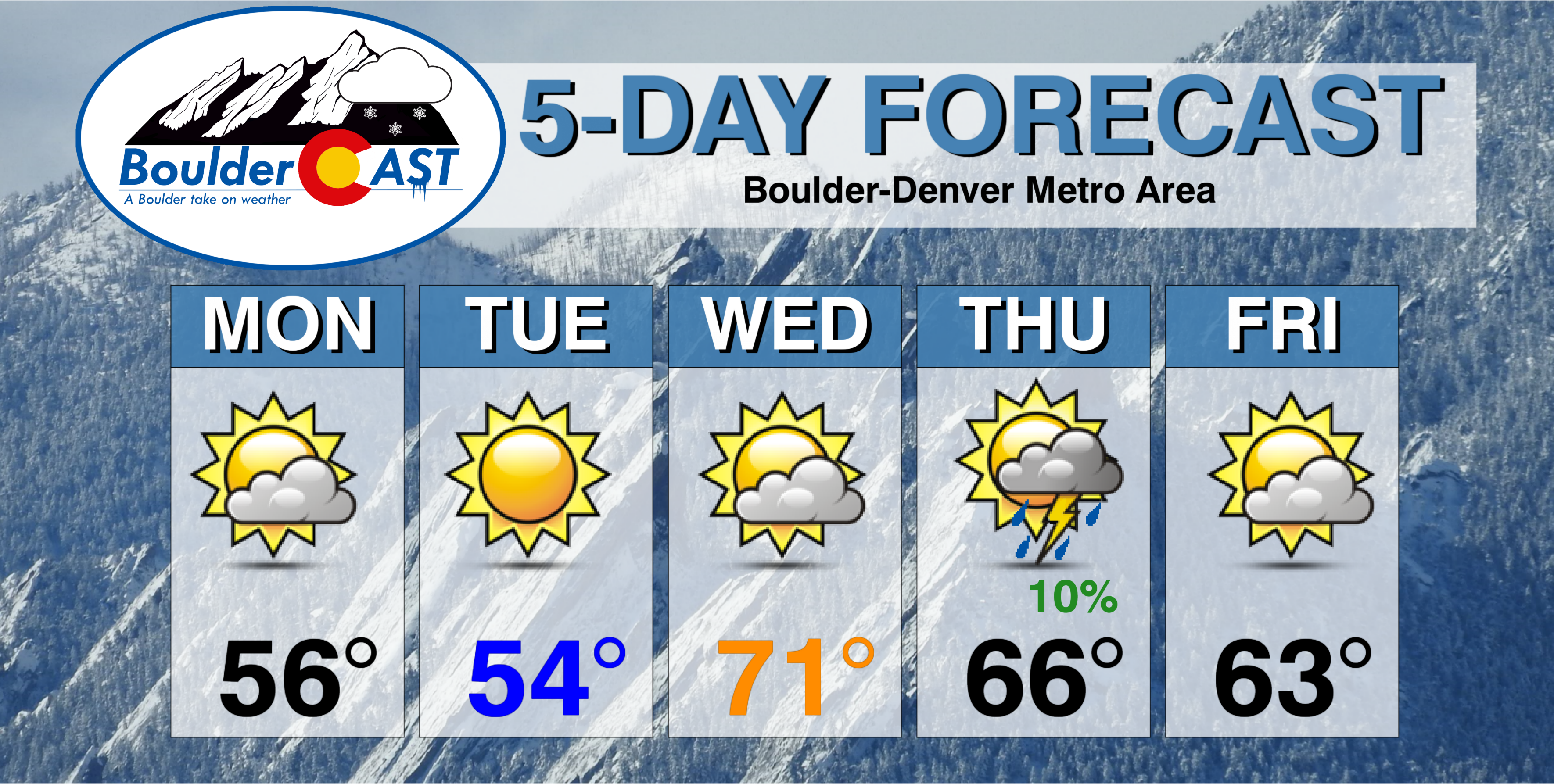
Monday: Morning sunshine with partly cloudy skies in the afternoon. A few extremely isolated rain showers will be around during the afternoon and evening. Most areas will be dry. Look for highs in the middle 50’s on the Plains with middle 40’s in the Foothills.
Tuesday: Sunny skies with temperatures in the middle 50’s for the Plains with low 40’s in the Foothills.
Wednesday: A mix of clouds and sun with warm temperatures near 70 for the Plains and in the upper 50’s in the Foothills.
Thursday: Mostly cloudy and warm. There may be a slight chance of isolated rain showers and a few rumbles of thunder Thursday evening and night. Expect high temperatures in the mid to upper 60’s for the Plains and in the middle 50’s in the Foothills.
Friday: Partly to mostly cloudy and slightly cooler, but still mild. Highs in the low to middle 60’s across the Plains, with low 50’s in the Foothills.
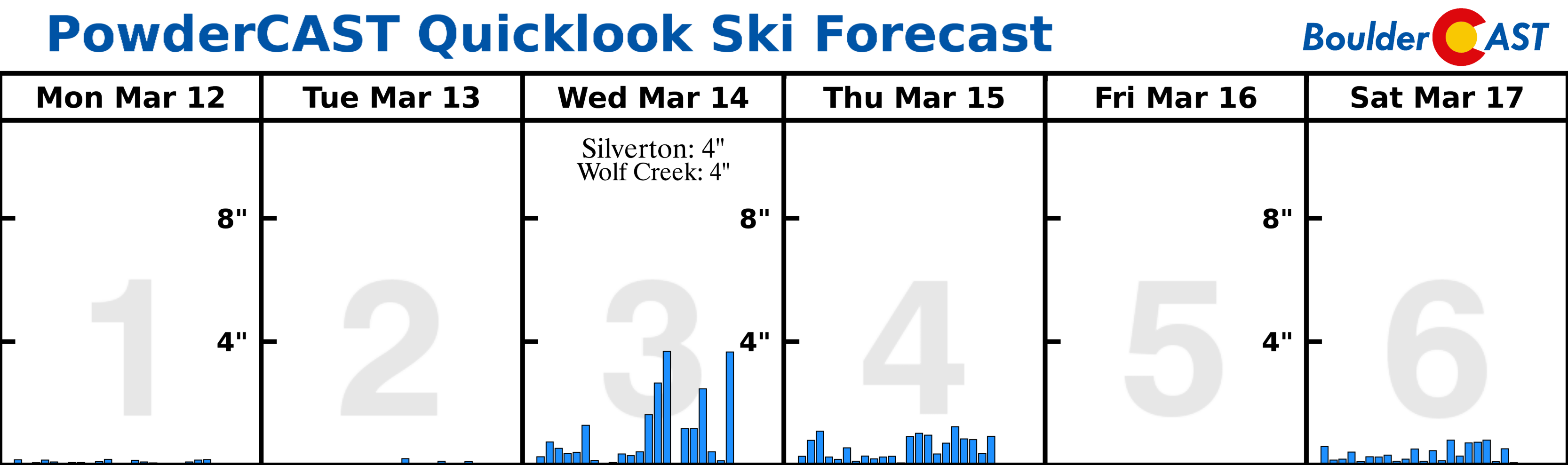
High Country: Another disappointing weather week for the Mountains is expected. Ridging and generally dry air across the state will lead to little in the way of snowfall. A few light snow showers are expected Monday afternoon, with almost no accumulation. The best chance of Mountain snow comes Wednesday into Thursday. Uncertainty is high, but some resorts could see a few inches of snow. Find the latest forecast for all your favorite Colorado ski resorts on our PowderCAST page.
DISCLAIMER: This weekly outlook forecast was created Monday morning and covers the entire upcoming week. Accuracy will decrease as the week progresses as this post is NOT updated. To receive daily updated forecasts, subscribe to BoulderCAST Premium.

.
Share our forecast!


You must be logged in to post a comment.