
A cool and dreary Monday will give way to a generally pleasant rest of the week with warming temperatures. We also discuss the slim chance of seeing additional snowfall this season.
O
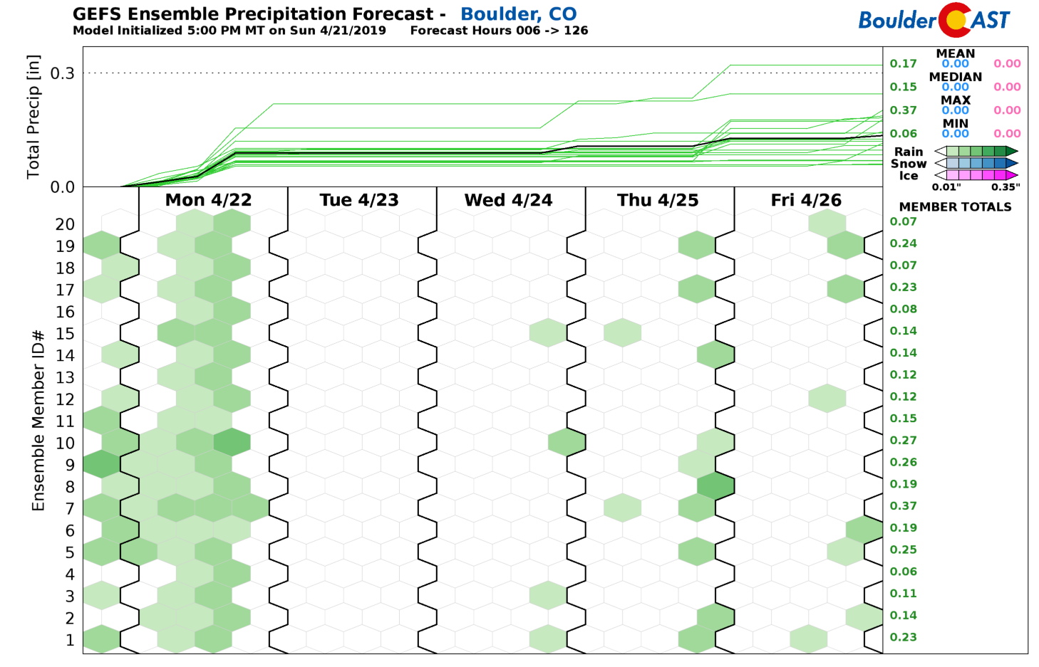
ur best chance of precipitation for the week is already upon us as of Monday morning! The same storm system that brought widespread rainfall to the area during the day yesterday has dropped southward into extreme southwestern Arizona. Most of the storm’s energy is there too right now.
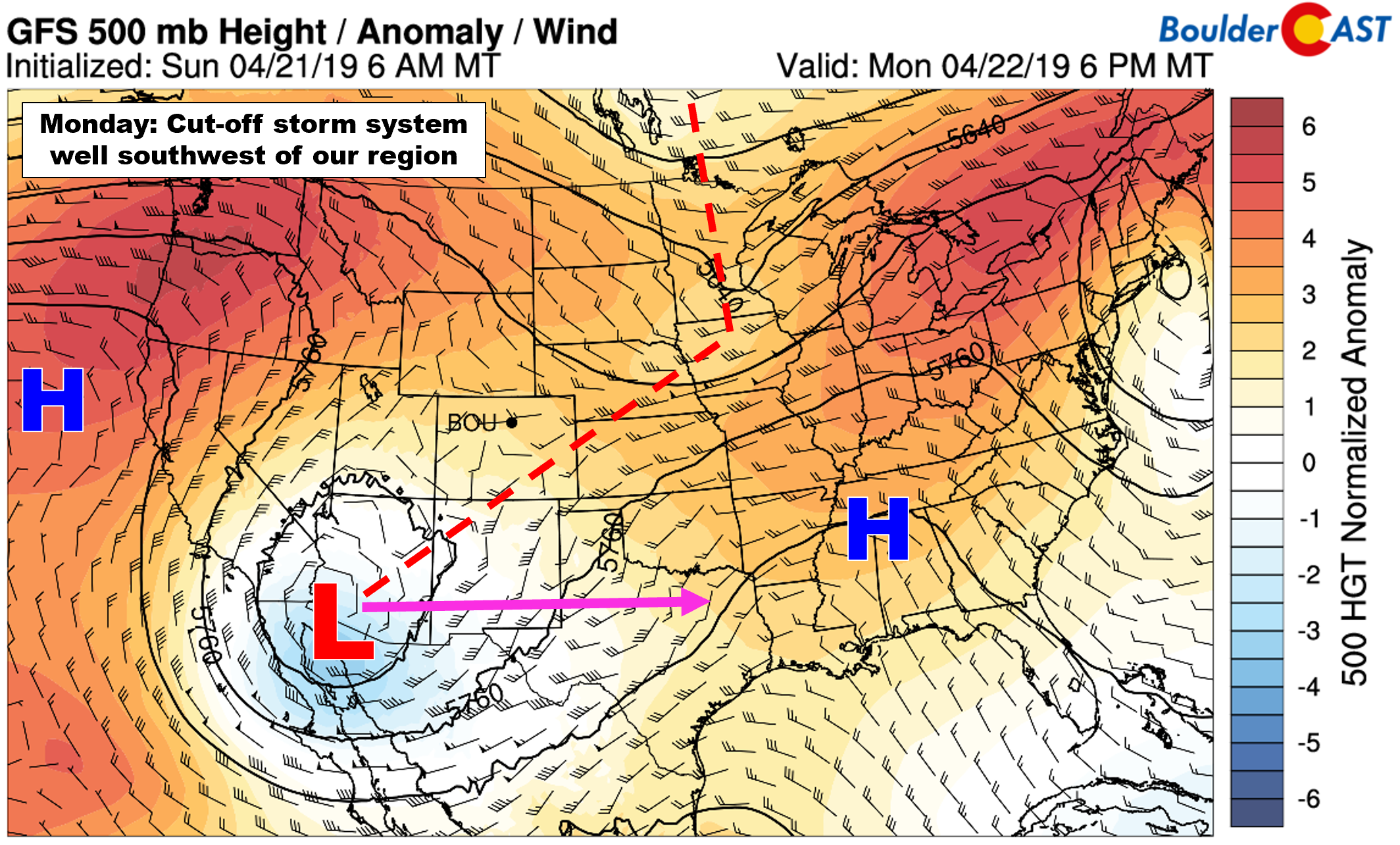
GFS 500 mb height anomaly forecast for Monday
However, the large-scale set-up has brought a cold front and widespread upslope and shallow moisture into the Denver Metro area overnight and this will continue through much of Monday. This northeasterly flow is reinforced by an approaching high in Montana and a departing low in South Dakota (see below).
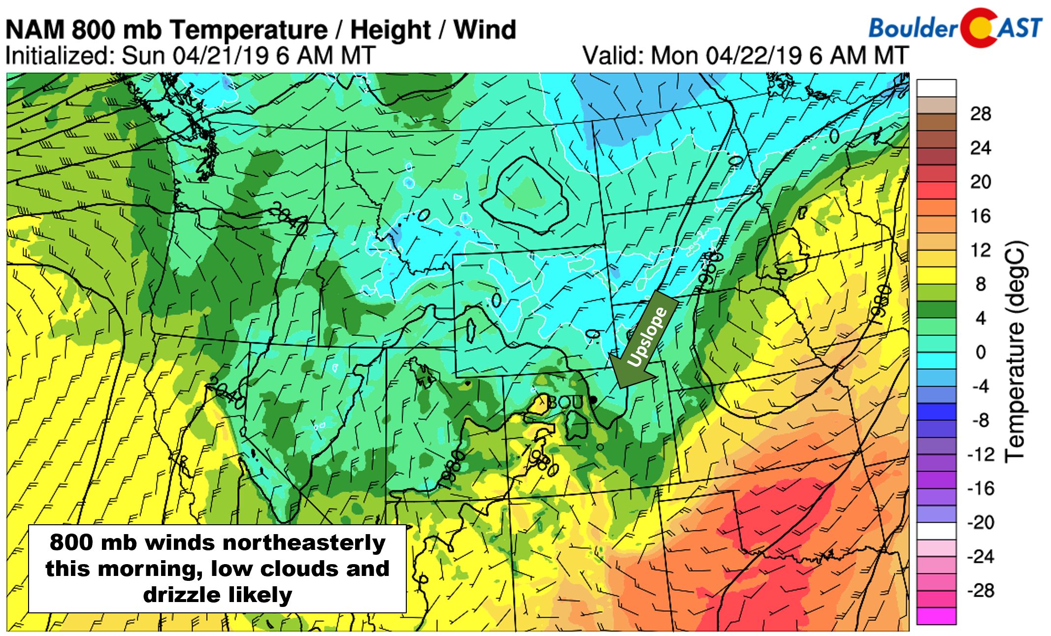
NAM 800 mb temperature and wind forecast for Monday morning showing the upslope into northeast Colorado and cool airmass.
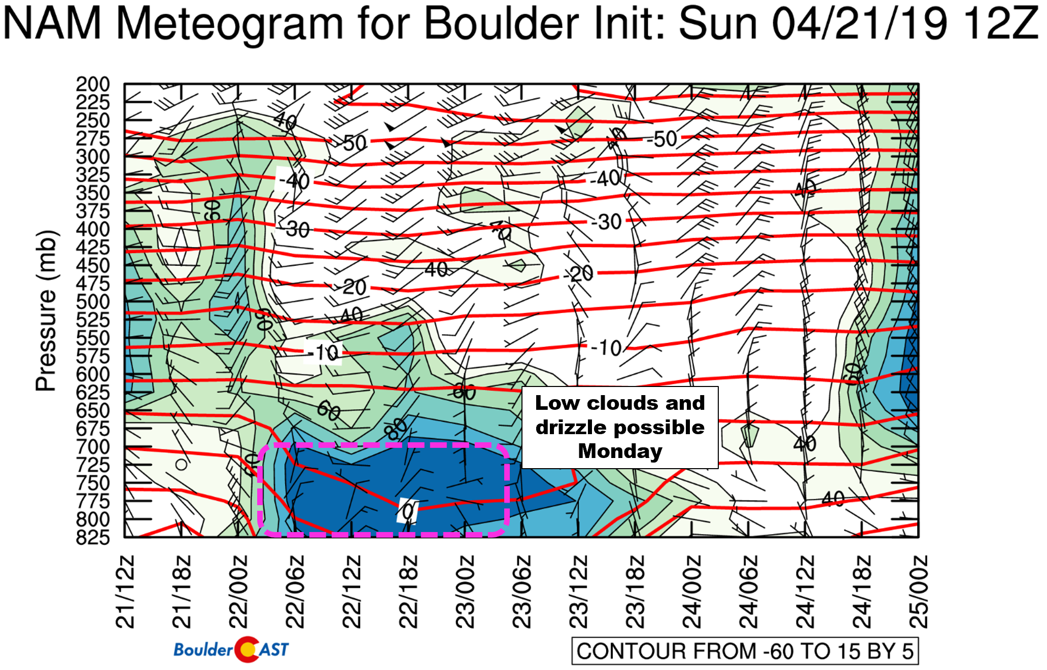
The result of this upslope and moisture will be low clouds, fog, and drizzle across the area much of the day Monday, especially in locations near the base of the Foothills (Boulder, Golden, Lyons). The time-height model plot below shows the shallow upslope and high relatively humidities hugging the surface in Boulder, indicative of fog and drizzle.
As such, Monday will be a cool and dreary day overall with highs only in the lower 50’s across the Plains and in the 30’s in the higher elevations. Expect fog and drizzle to be focused primary in and near the Foothills, with snow above 7500 feet elevation. Up to 1″ of accumulation is possible there.
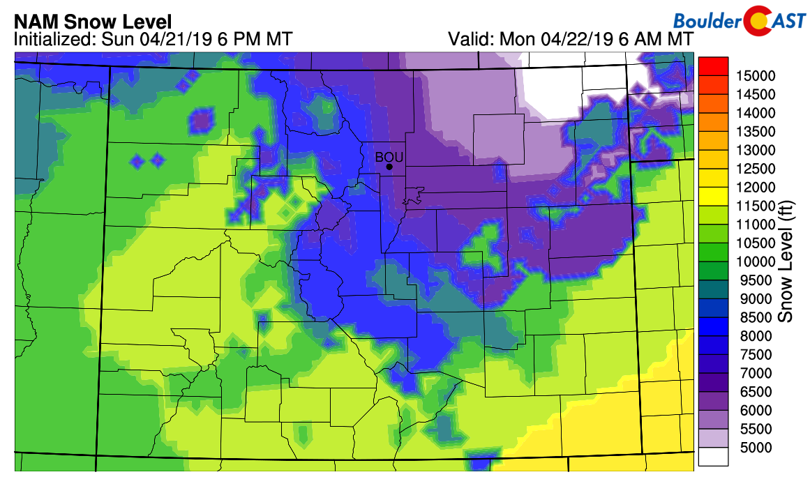
NAM model-derived snow level forecast for Monday morning. Some snow is possible above 7500 feet
Scattered late day thunderstorms will form across the higher elevations on Monday. These have very low odds of moving eastward onto the Plains given the weak steering flow aloft.

HRRR model radar simulation for Monday at 6PM. Late-day storm activity should remain across the higher elevations.
For the rest of the week, models are in agreement that the upslope will begin to relax Monday evening which will pave the way for a warming trend the rest of the week as a flattened ridge takes a commanding hold across the western United States. In general, we can expect mainly dry weather and temperatures feeling very spring-like through Friday and into the weekend.
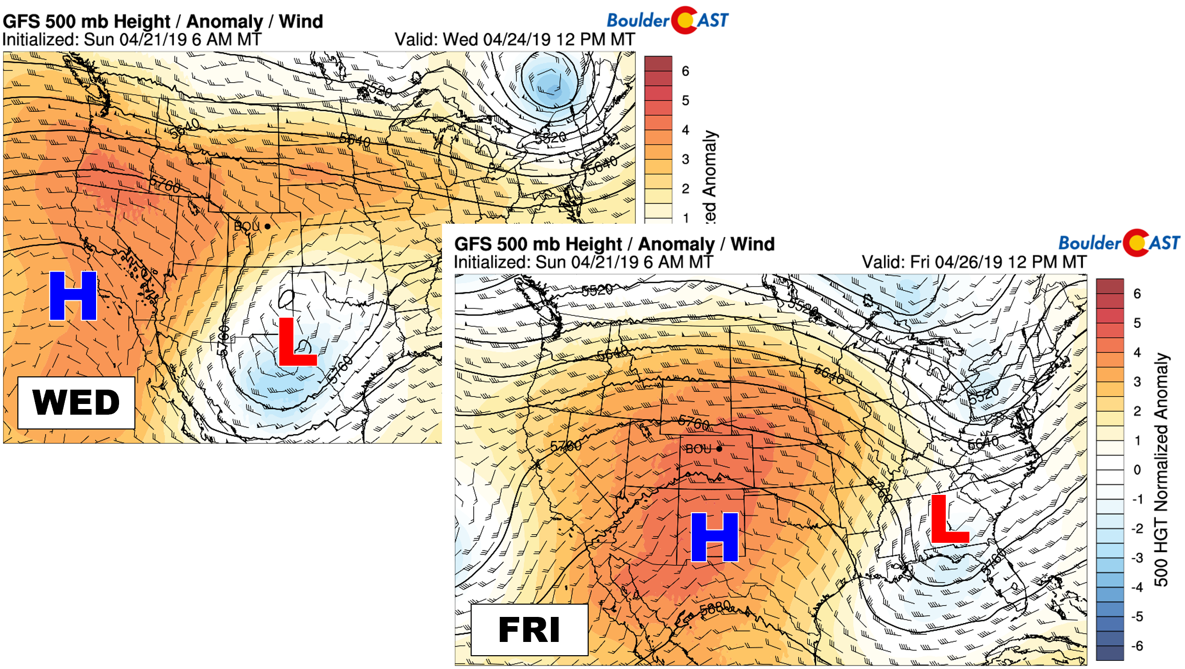
GFS 500 mb height anomaly forecasts for Wednesday (left) and Friday (right). A ridge will be building into the Rockies.
It won’t take much to initiate isolated afternoon and evening showers and storms across the Mountains this week with just a bit of lingering moisture present across the state beneath the ridge. Models are also hinting that some of these storms could move eastward into the Denver Metro area, especially Thursday and Friday. At this time, we don’t expect much activity and most areas could end the week without seeing any rain at all given just how dry the lower levels will be through the week. We put the chance of seeing a brief shower or storm at only 10% Thursday and Friday for the Metro area.
Finally, we did want to mention that we are not seeing any indication whatsoever in the extended outlook from any models for snowfall across the Denver Metro area. April 26th (Friday) is the climatological median date of Boulder’s last accumulating snow of the year, so that window is closing rapidly for our region. This late in the year, there are a very specific set of circumstances that lead to snow for us, none of which are in the pipeline through the first week of May. At this point, it’s looking fairly unlikely that we’ll see snow again, but as 2017 boldly reminded us, never say never!
Forecast Specifics:
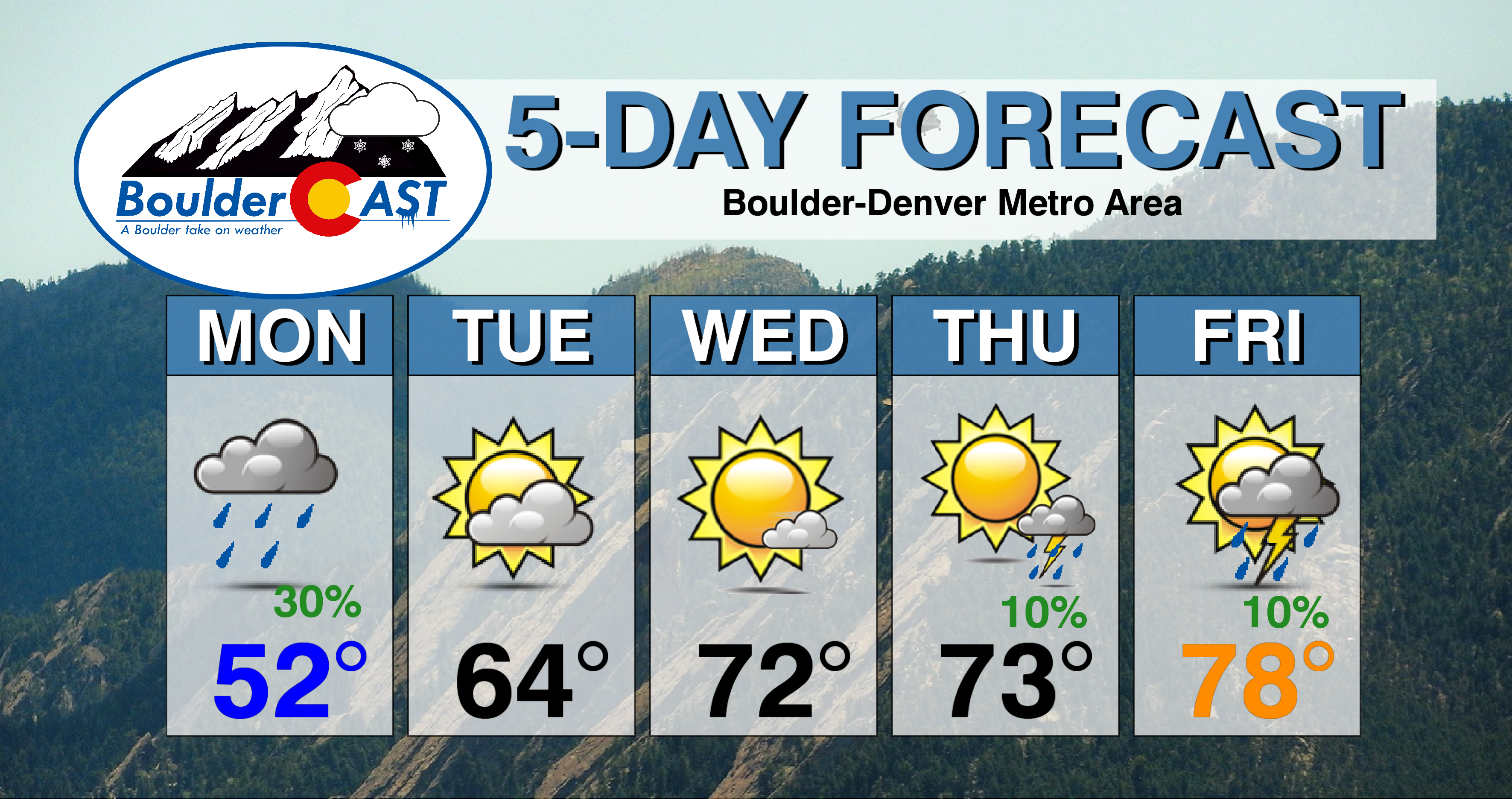
Monday: Cool and dreary with overcast skies and drizzle possible through the morning, primarily near the base of the Foothills. Light snow is expected above 7500 feet elevation, with up to 1″ of accumulation possible. Scattered showers develop through the afternoon and evening across the Foothills, but likely don’t make an eastward push onto the Plains. Highs in the lower 50’s for the Plains with middle to upper 30’s in the Foothills.
Tuesday: Mostly cloudy in the morning, then partly cloudy in the afternoon. Dry with high temperatures in the middle 60’s for the Plains and in the low 50’s in the Foothills.
Wednesday: Mostly sunny and warmer with highs in the lower 70’s across the Plains and in the upper 50’s in the Foothills.
Thursday: Morning sunshine with partly cloudy skies in the afternoon. Isolated thunderstorms develop late in the day. Expect highs in the low 70’s across the Plains with upper 50’s in the Foothills.
Friday: Very warm with a mix of clouds and sun. Isolated thunderstorms are again possible. Highs near 80 degrees for the Plains with middle 60’s in the Foothills.
High Country: Monday and Tuesday will be fairly wet and snowy across the Mountains, especially in southern Colorado. Amounts should generally be less than 6″ for most areas above 10,000 feet, though locally higher totals are possible given the convective nature of the shower activity. Wednesday through Friday will be warmer with snow levels much higher and primary isolated to widely scattered afternoon and evening thunderstorms expected each day. Check PowderCAST for updated forecasts for all the Colorado ski resorts.
DISCLAIMER: This weekly outlook forecast was created Monday morning and covers the entire upcoming week. Accuracy will decrease as the week progresses as this post is NOT updated. To receive daily updated forecasts from our team, subscribe to BoulderCAST Premium.

.
Share our forecast!


You must be logged in to post a comment.