The first full week of autumn will be rather tame across the Front Range. A ridge of high pressure will provide warm and mostly dry conditions through Thursday for the area, but a storm system is eyeing the region Friday into Saturday with rain and some Mountain snow on the way. Read on for all the details.
This week’s highlights include:
- Another week, another ridge across the West — it will stick around through early Thursday
- Warm and mostly dry conditions through Thursday with temperatures in the upper 70s to lower 80s
- Watching the tropics: Powerful Hurricane Ian will make an impactful landfall along the Gulf Coast (likely in Florida) around Thursday
- The ridge finally breaks down late-week with a good chance of rain Friday into Saturday for the Front Range and cooler temperatures
- Another ridge is expected to develop by early next week with persistent warm and dry conditions returning to Colorado
- Make sure to submit your entry to our 8th Annual First Snowfall Contest ASAP!
DISCLAIMER: This weekly outlook forecast is created Monday morning and covers the entire upcoming week. Accuracy will decrease as the week progresses as this post is NOT updated. To receive daily updated forecasts from our team, among many other perks, subscribe to BoulderCAST Premium.

The first week of autumn is largely warm & dry
This past weekend was absolutely gorgeous across the Front Range with warm temperatures and sunshine abound. Personally, I dont think I’ve seen a cloud since Thursday evening! This blue sky photo below was taken Saturday afternoon from Standley Lake in Westminster! Our weather this week will commence on a very similar same note…
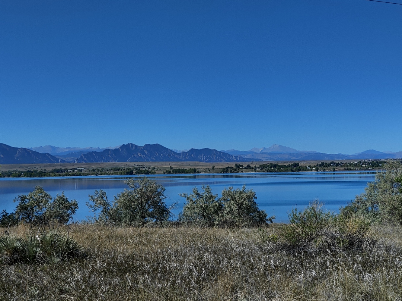
Front Range Mountain view from Standley Lake | 9/24/2022
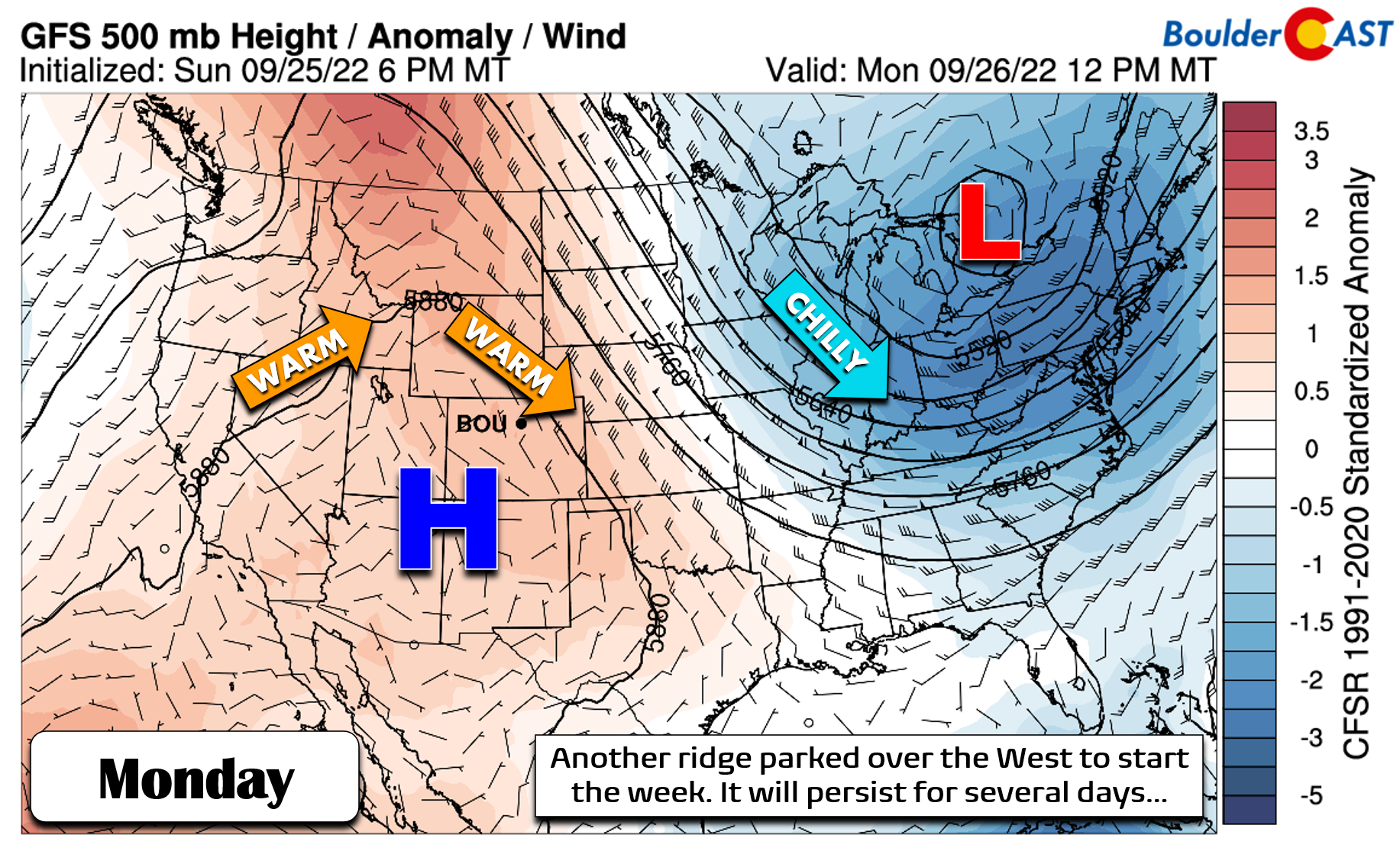
The week begins with a familiar weather pattern across the western United States — a slow-moving ridge of high pressure — go figure! This is the same ridge that brought us dry, warm and sunny conditions throughout this past weekend. The large-scale atmospheric pattern for Monday is shown below. High pressure is centered over the Four Corners region, with warmth stretching northward across Colorado and into western Canada. Low pressure and unseasonably cool weather encompasses much of the eastern United States. In between, the Front Range starts the week within a northwest flow regime — one capable of producing warm temperatures but nothing too hot.
This ridge will be the main weather feature in Colorado throughout the week until Thursday with little in the way of moisture or lift to speak of until then. The European ensemble forecast for 500mb height anomalies below shows the ridge sticking around through early Thursday. It’s not until late in the week that a system finally comes ashore in the Pacific Northwest. This storm will move across the northern Rockies over the weekend bringing some changes to our weather. More on this in a moment…
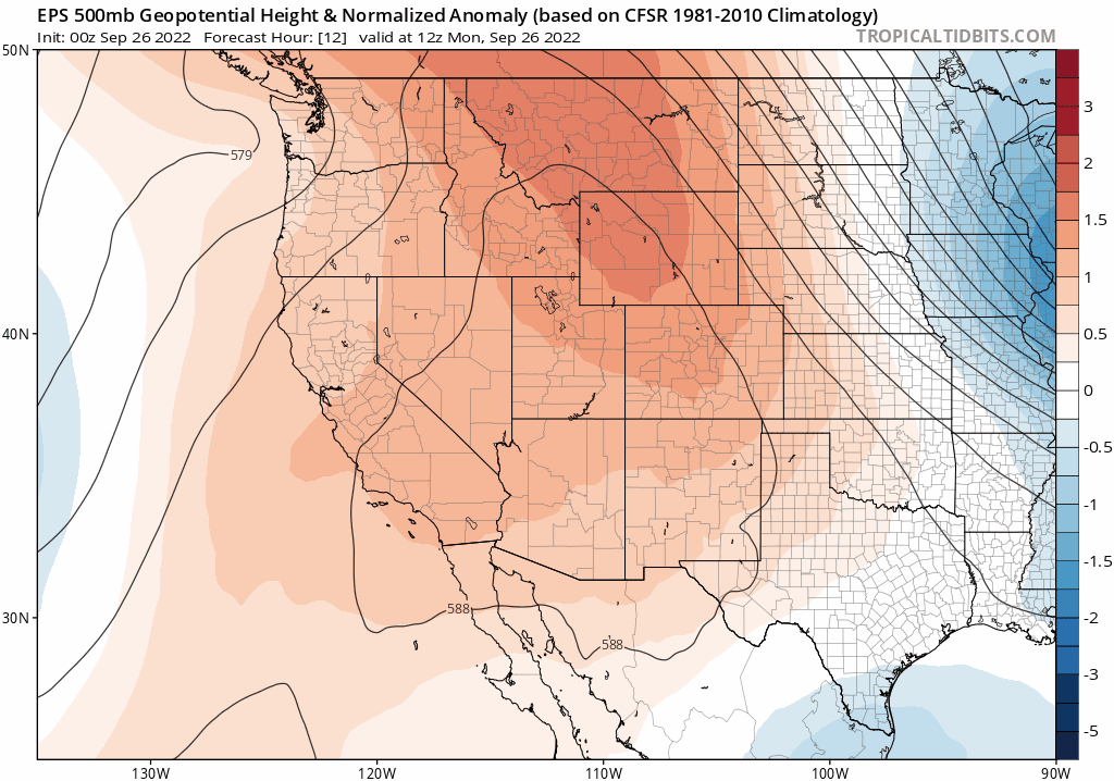
European ensemble mean 500mb height anomaly forecast animation spanning Monday through Thursday across the West. A ridge remains over the Four Corners and slowly drifts southeastward.
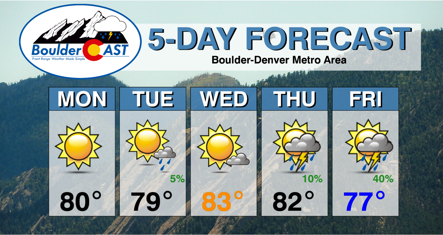
Sunday turned out a little bit cooler following the passage of a dry cold front tied to the trough in the eastern United States. That cooler airmass will erode quickly on Monday with highs returning to the lower 80s across the Front Range under continued sunny skies.
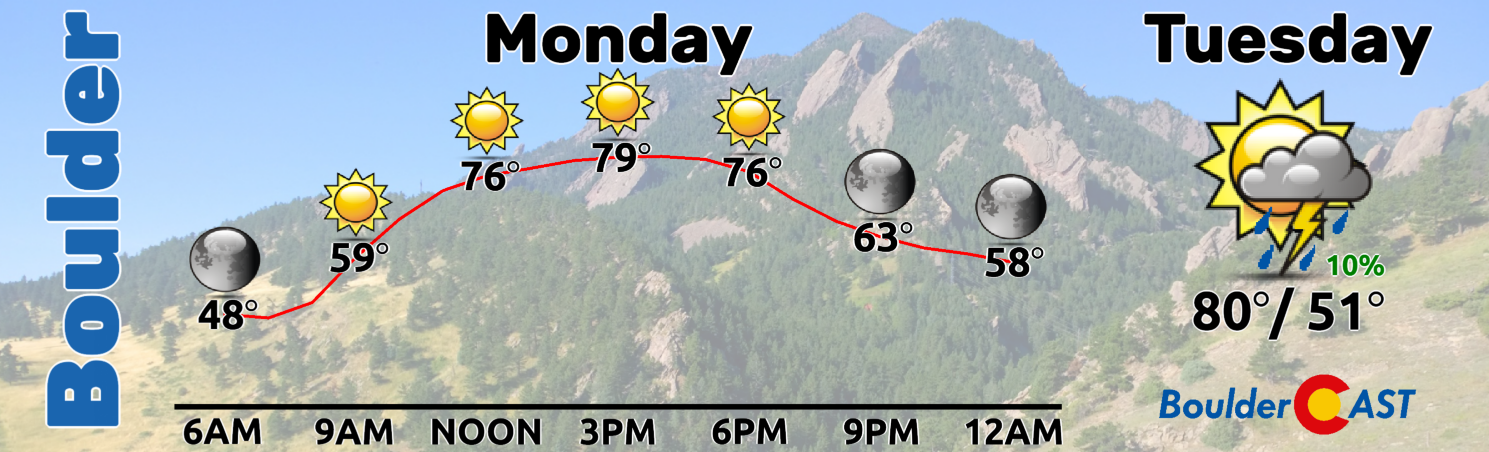
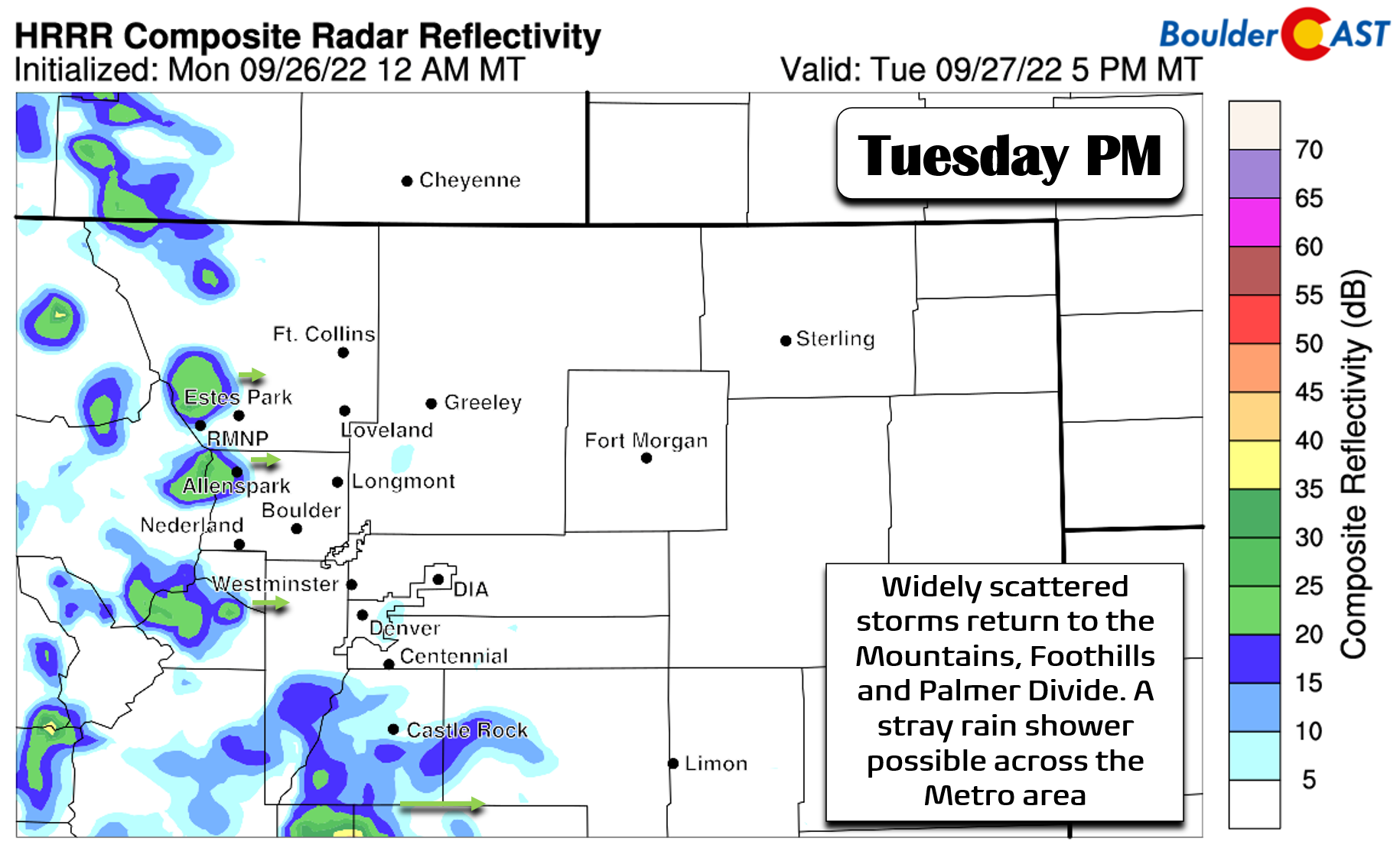
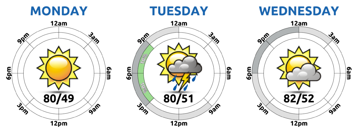
Tuesday will see a slight uptick in moisture arriving to the area from the southwest as the ridge axis meanderers ever-so-slightly eastward. This will allow for precipitable water values to creep up towards 0.40″ over the area — not a lot of moisture but certainly higher than the prior several days. Widely scattered storms will develop across the Mountains, Foothills, and Palmer Divide Tuesday afternoon and evening as a result. Conditions across the lower elevations will be less favorable with only a stray shower or two pushing out into the Boulder/Denver area. Highs will rise into the upper 70s Tuesday with increasing clouds.
Wednesday we will dry out again with temperatures in the lower 80s and partly sunny skies.
Turning cooler and wetter towards the weekend
By Thursday the ridge of high pressure will begin to break down, shifting southeastward into Texas and weakening considerably. At the same time that aforementioned Pacific trough will be approaching the northern Rockies leading to an uptick in southwest flow into Colorado and increasing moisture aloft. This will spell out a return of rain chances to northern Colorado, mainly across the higher terrain again though. The Denver Metro area will see just isolated showers and storms on Thursday with temperatures remaining above seasonal normals in the lower to perhaps middle 80s.
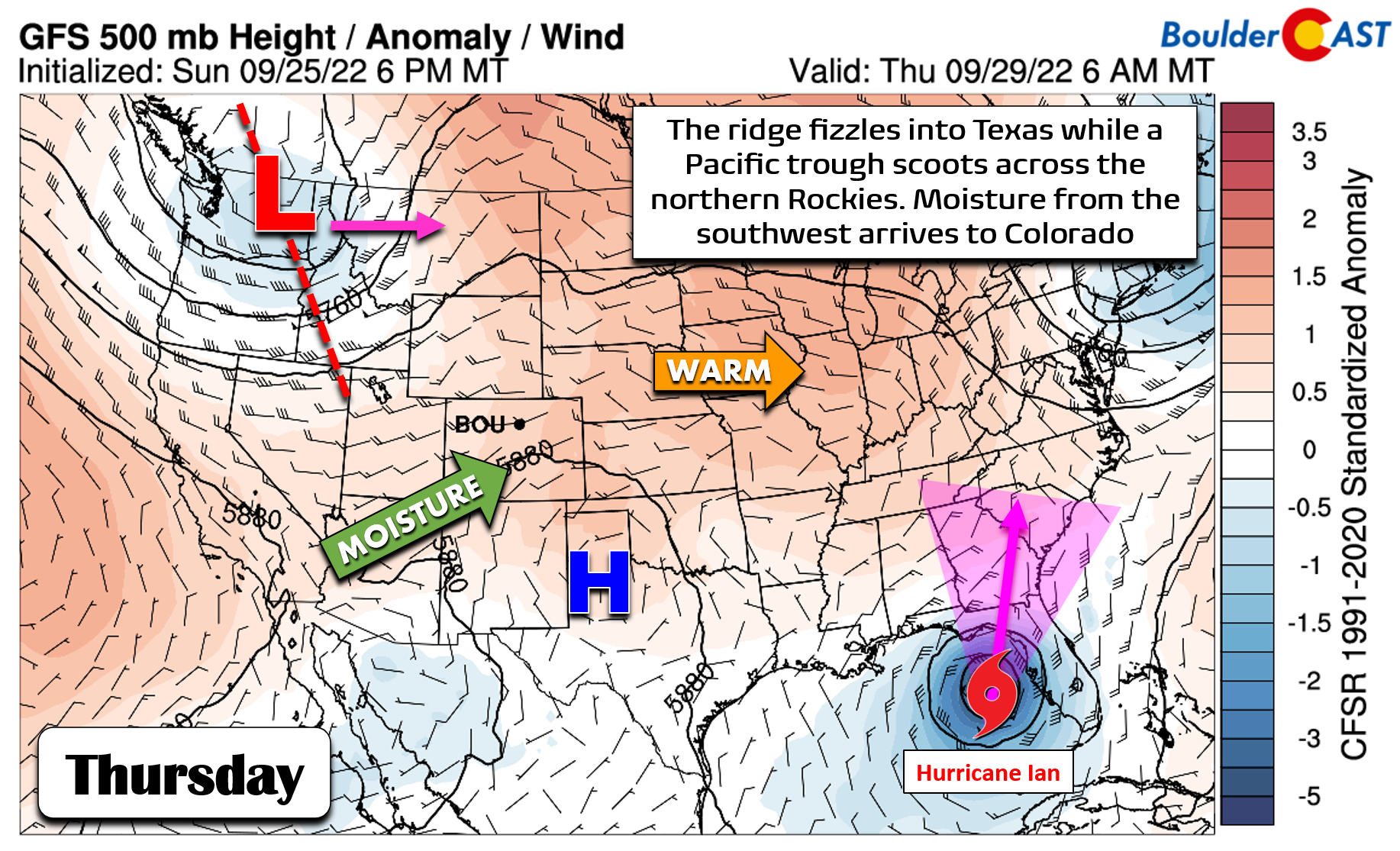
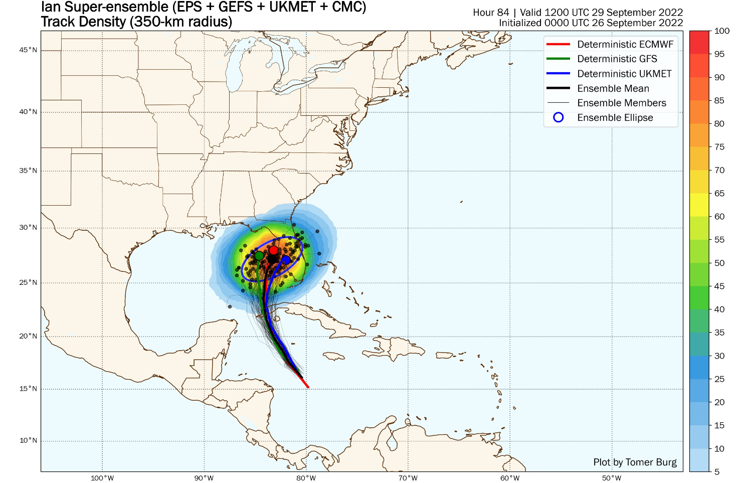
Thursday will also be the day to watch for the landfall of powerful Hurricane Ian somewhere in the eastern Gulf of Mexico. Ian is expected to intensify to Category 4 status as early as Monday night. Forecast confidence is growing for an impactful landfall somewhere on the Gulf-facing coastline of Florida!
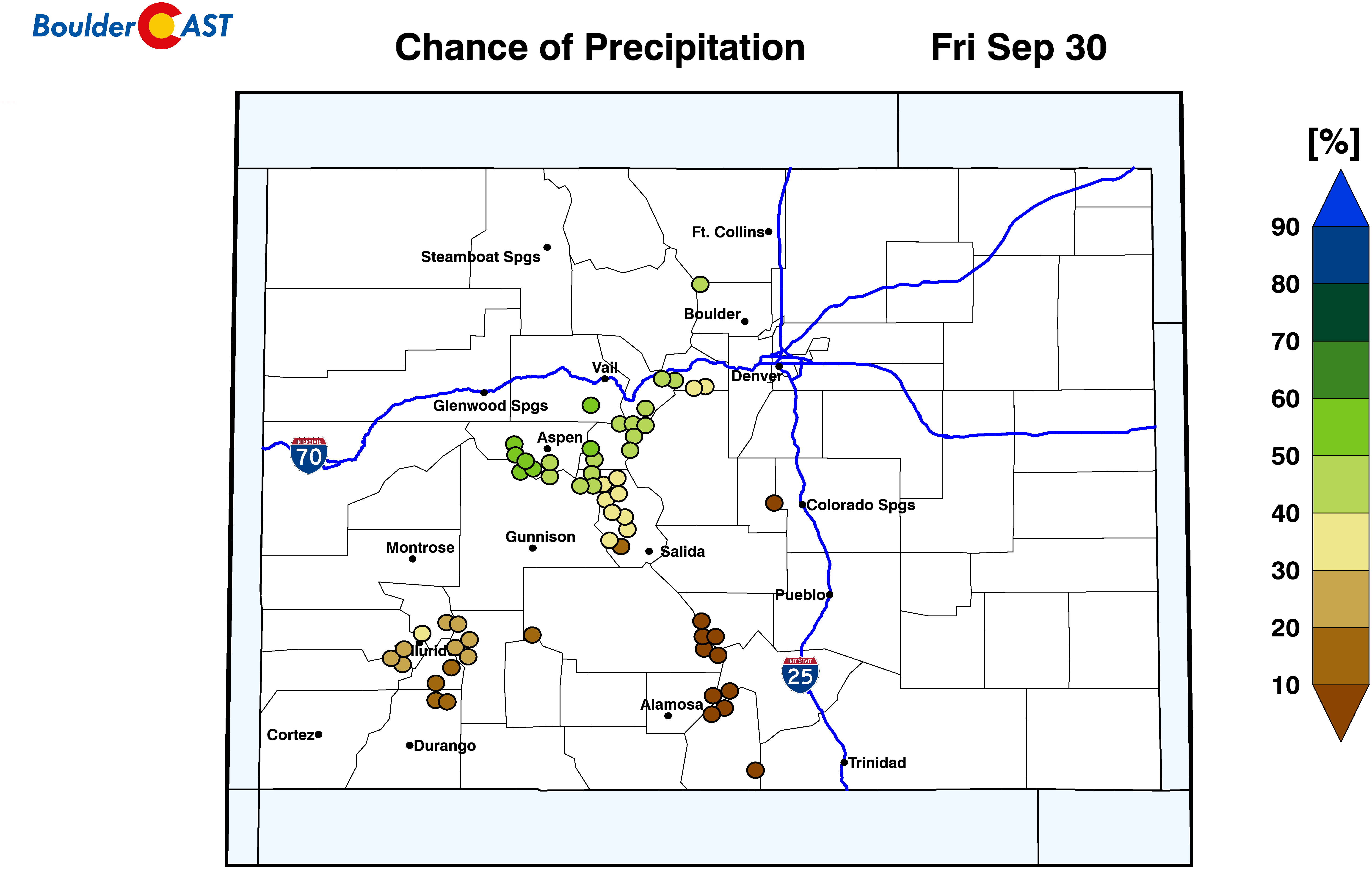
We end the week with our best chance of rain on Friday as southwest flow maximizes and pulls a narrow plume of subtropical moisture into the area. Scattered showers and storms will be possible from afternoon into the overnight. Temperatures are still likely to be fairly mild on Friday with highs in the upper 70s to near 80 degrees.
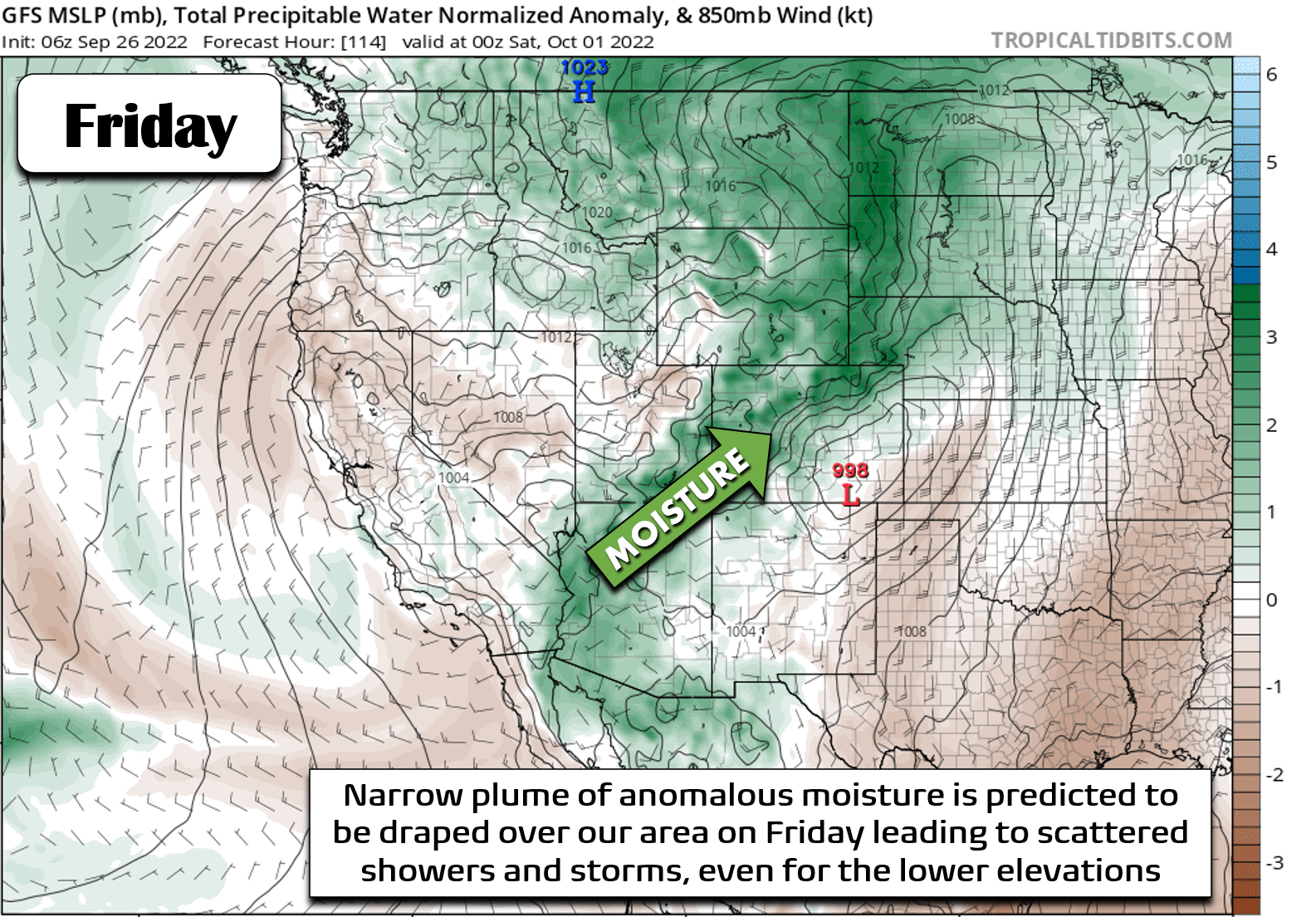
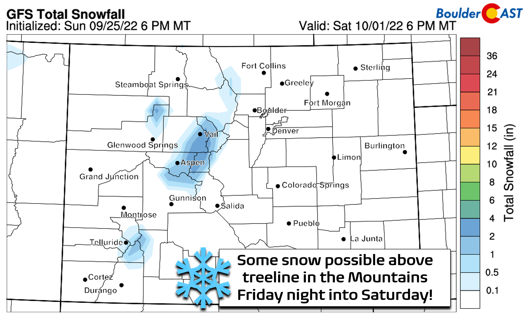
Ensemble guidance is zeroing in on an unsettled period from Friday afternoon into Saturday for the Denver Metro area. Initially this will be supported by the moist southwest flow Friday afternoon. Late on Friday, though, a cold front should arrive bringing cooler temperatures and the potential for post-frontal upslope rainfall. The GFS forecast (shown below) is currently wetter than the European model forecast, so uncertainty is still high. However, substantial rainfall — more than say 0.25″ or so — is looking unlikely with this system. With the cooler, cloudy and unsettled setup on Saturday, temperatures will be cooler in the 60s to lower 70s at best. Things should dry out on Sunday, but not completely.
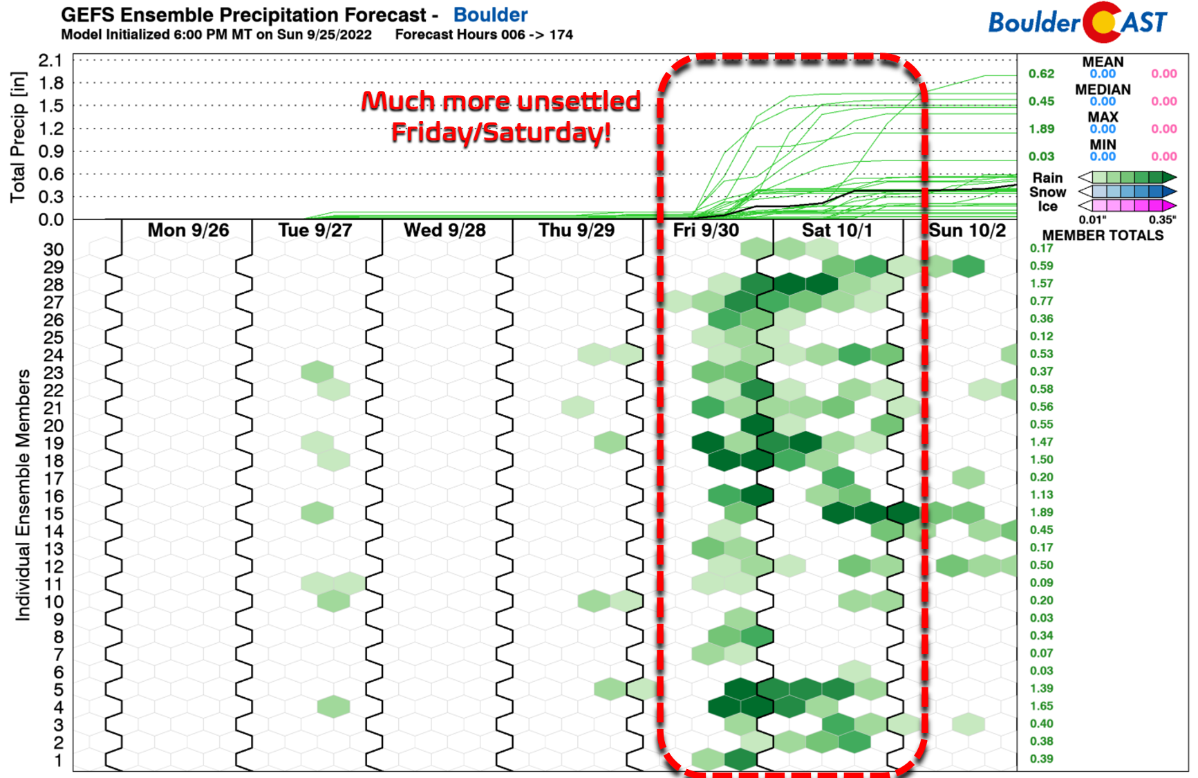
Finally, with the change in seasons, each passing storm this time of year is more likely to produce snowflakes in the Mountains. The late-week system will be no exception with up to a couple inches of accumulation possible in the Mountains as snow levels drop to around 10,000 feet Friday night into Saturday. Accumulation would be most likely above treeline in central and northwest portions of Colorado.
The cooler and wetter weather will be short-lived as model ensemble guidance is in good agreement that yet another long-lasting ridge of high pressure will develop over the West come next week. This should produce many days of above normal temperatures throughout the entire West.
Finally, be sure to enter your prediction ASAP for Boulder’s first snowfall of the season in our 8th Annual First Snowfall Contest. Have a good week!
Forecast Specifics:
Monday: Sunny and warm with highs in the lower 80s across the Plains with upper 60s in the Foothills.
Tuesday: Partly cloudy with a slight chance of showers and storms, mainly across the higher elevations. A stray shower could reach the Metro area with just light rain and gusty winds. Temperatures reach the upper 70s on the Plains with middle 60s on the Foothills.
Wednesday: Drier and partly cloudy with highs in the lower 80s on the Plains and upper 60s in the Foothills. A stray showers/storm possible in the higher elevations.
Thursday: Increasing clouds with isolated late-day showers and storms possible. Staying warm with temperatures reaching the lower 80s on the Plains and upper 60s in the Foothills.
Friday: Morning sunshine, then scattered afternoon, evening and overnight showers and storms. Temperatures turn slightly cooler topping out in the 70s on the Plains and in the lower to middle 60s in the Foothills.
High Country: Rain chances will largely stay across southern Colorado Monday and Wednesday, with an isolated chances stretching northward into the Front Range Mountains on Tuesday as well. Thursday and Friday turn more active, with even some accumulating snow possible Friday into Saturday as a cool Pacific trough reaches the region.
Help support our team of Front Range weather bloggers by joining BoulderCAST Premium. We talk Boulder and Denver weather every single day. Sign up now to get access to our daily forecast discussions each morning, complete six-day skiing and hiking forecasts powered by machine learning, first-class access to all our Colorado-centric high-resolution weather graphics, bonus storm updates and much more! Or not, we just appreciate your readership!
Spread the word, share the BoulderCAST forecast!


You must be logged in to post a comment.