September kicks off with a mellow vibe across the Front Range — warm days and mostly dry skies are expected. But don’t let the quiet start fool you. Between drifting wildfire smoke, sneaky cold fronts, and a potential tropical system by the weekend, there’s more nuance in our forecast this week than meets the eye. Read on as we break down what to expect day by day, plus what might shake things up by the weekend.
This week’s highlights include:
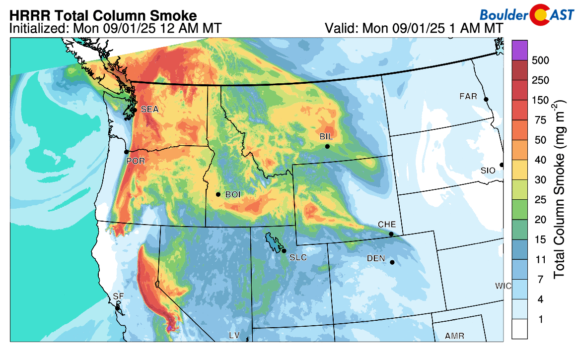
- Mellow Start, Smoky Skies: High pressure dominates early week with seasonal temps in the low to mid 80s. Wildfire smoke from the Pacific Northwest and western Canada may drift into the Denver Metro by Tuesday.
- Low Rain Chances: GEFS hints at isolated showers Tuesday, Wednesday, and Friday, but confidence is low. Most areas stay dry, with any convection likely confined to higher terrain.
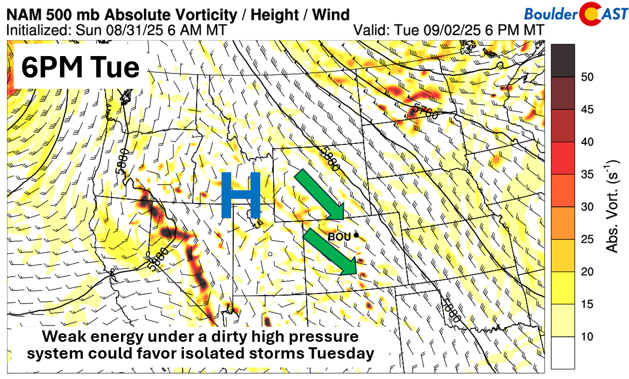
- Midweek Trough & Cold Front: A glancing trough brushes eastern Colorado Wednesday, nudging a weak cold front through Boulder-Denver. Slight cooling and a bump in storm chances possible, but impacts look minimal.
- Late-Week Pattern Shift: A second trough arrives Thursday night or Friday, with perhaps a slightly further westward push into our area. This may cool temperatures for Friday with increased rain chances.
- Weekend Moisture Potential: Guidance suggests a West Coast trough could bring increased moisture and warmer air by Saturday. Rain chances hinge on timing and a tropical influence—still uncertain but worth watching.
- Tropical Wildcard: A Baja California tropical cyclone may influence Colorado’s setup late weekend or early next week. Model spread is wide, but if tropical remnants reach the Desert Southwest, a moisture boost is possible for our area.
DISCLAIMER: This weekly outlook forecast is created Monday morning and covers the entire upcoming week. Accuracy will decrease as the week progresses as this post is NOT updated. To receive daily updated forecasts from our team, among many other perks, subscribe to BoulderCAST Premium.

Go Premium, get all the perks.
Daily Forecast Updates
Get our daily forecast discussion every morning delivered to your inbox.
All Our Model Data
Access to all our Colorado-centric high-resolution weather model graphics. Seriously — every one!
Ski & Hiking Forecasts
6-day forecasts for all the Colorado ski resorts, plus more than 120 hiking trails, including every 14er.
Smoke Forecasts
Wildfire smoke concentration predictions up to 72 hours into the future.
Exclusive Content
Weekend outlooks every Thursday, bonus storm updates, historical data and much more!
No Advertisements
Enjoy ad-free viewing on the entire site.
A warm & large dry week, but watching wildfire smoke
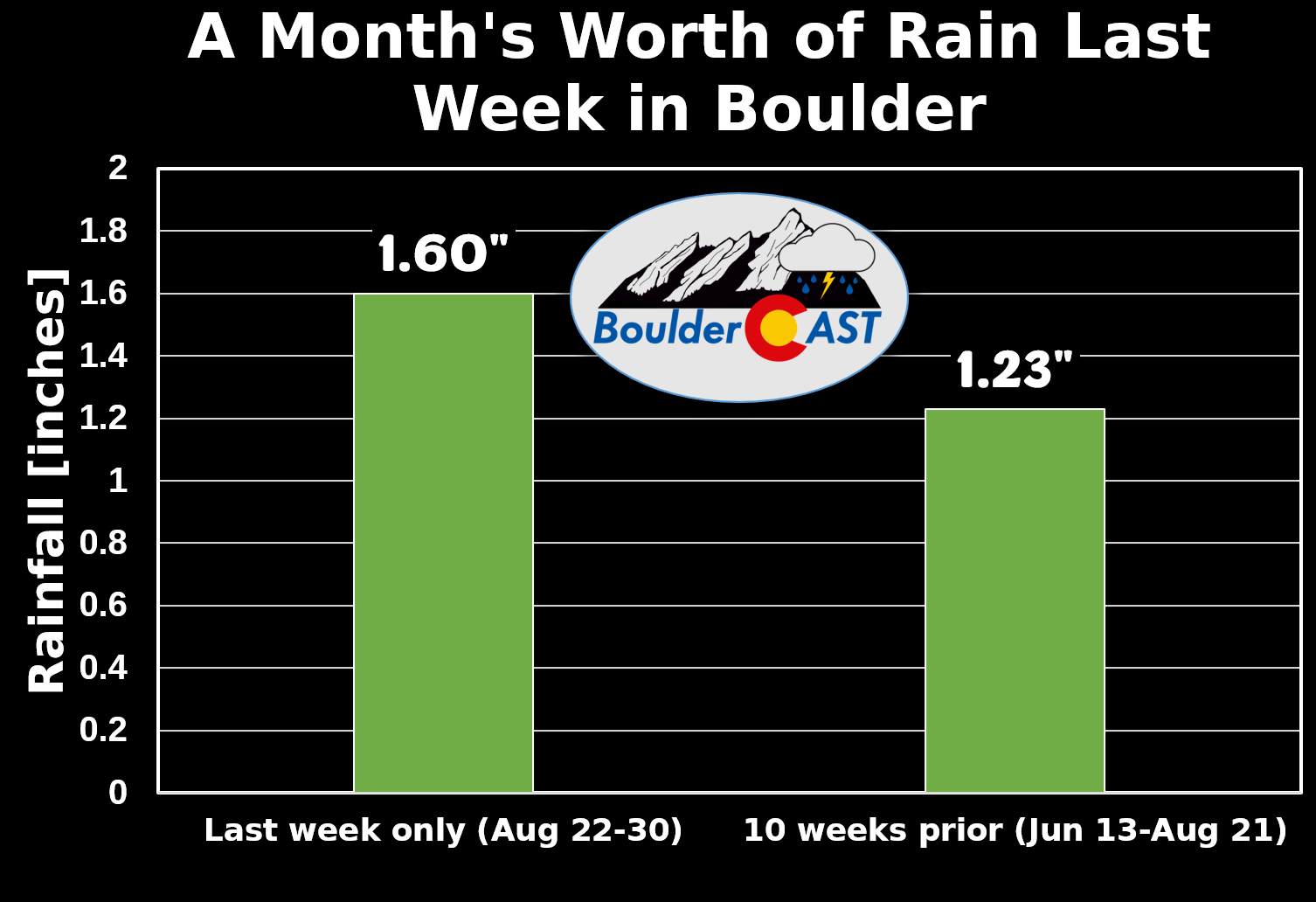
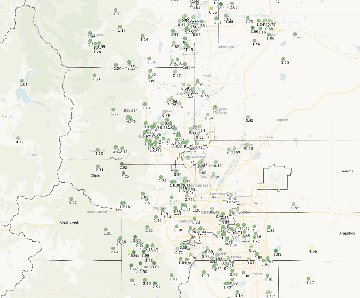
We don’t yet have the official rainfall totals from Boulder last week owing to a few days of missing data, but around 1.60″ accumulated in the city between August 22nd and 30th. This is the amount of rain we typically receive throughout the full month of August, so the week-long stretch of rain and gloom was definitely abnormal for this time of year.
The soggy end to August will not roll into September. Overall, it’s going to be a pretty mellow start to the month for Colorado and the Front Range. We’re tracking a couple of cold fronts and some splotchy rain chances, but nothing too dramatic is on the horizon. The most notable feature might actually be wildfire smoke drifting in from the Pacific Northwest and western Canada. By Tuesday and into midweek, upper-level winds will steer that haze into the Denver Metro area . After that, things get a bit murky — literally and figuratively — as smoke coverage becomes harder to pin down but it does seem likely there will be several smoky days this week.
It’s shaping up to be mainly a dry week. The GEFS ensemble shows a few members hinting at measurable precipitation for Boulder on multiple days, but confidence is low. If we do see anything, Tuesday, Wednesday, and Friday are the likeliest candidates for a stray shower or isolated storm. The weekend might actually trend more favorable for moisture — we’ll revisit that proposition towards the end of this week’s post.

High pressure kicks off the week. A ridge centered over Utah will dominate through Tuesday, though guidance suggests some weak mid-level energy sneaking southeast Tuesday afternoon and evening. Moisture is limited, so any convection should stay confined to the higher terrain. Still, we wouldn’t rule out a rogue shower or storm near the Foothills.
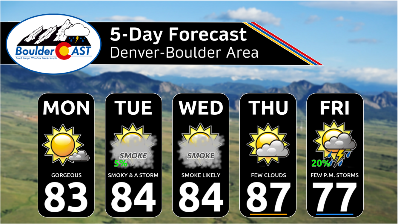
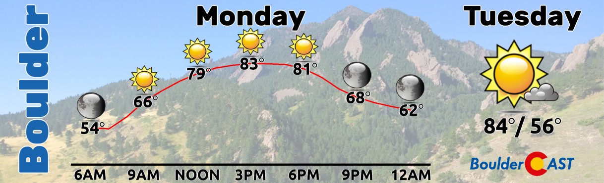
Expect highs in the low to middle 80s early in the week— more-or-less seasonal for early September in Boulder.
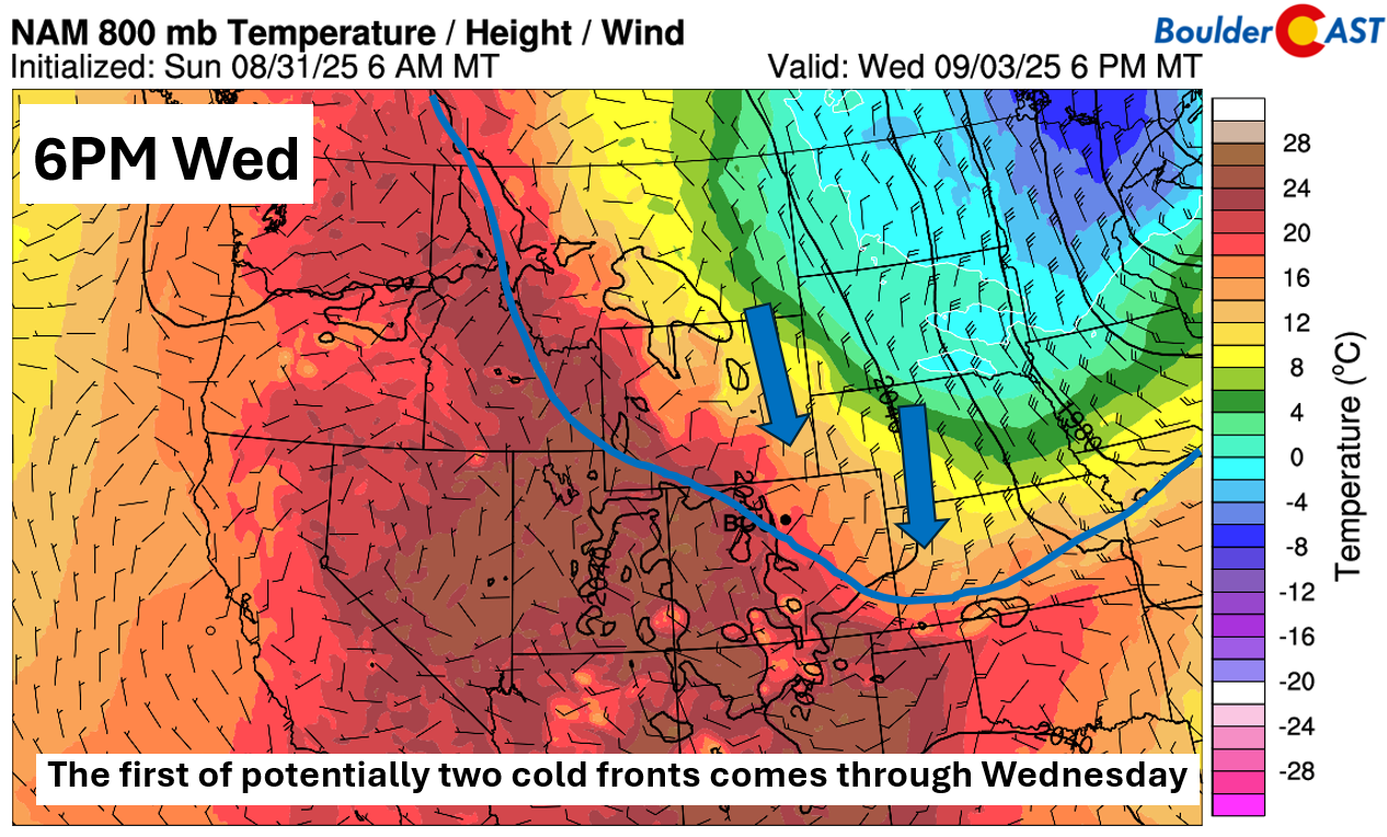
Deep troughing will start to play a role by mid to late week. The first in a series of troughs drops into the Midwest and Great Lakes by Wednesday, with its western edge brushing eastern Colorado.
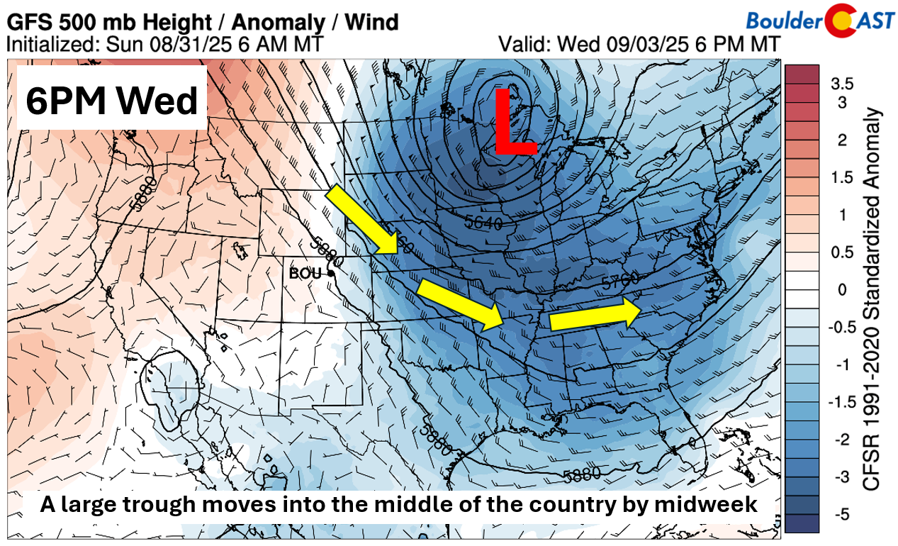
The glancing trough will be enough to push a weak cold front through the Boulder-Denver area sometime Wednesday evening. Ahead of it, we’ll likely stay in the middle 80s, but if the front speeds up, upper 70s are on the table. It could also bump up storm chances slightly late Wednesday, though we’re not expecting much at all.
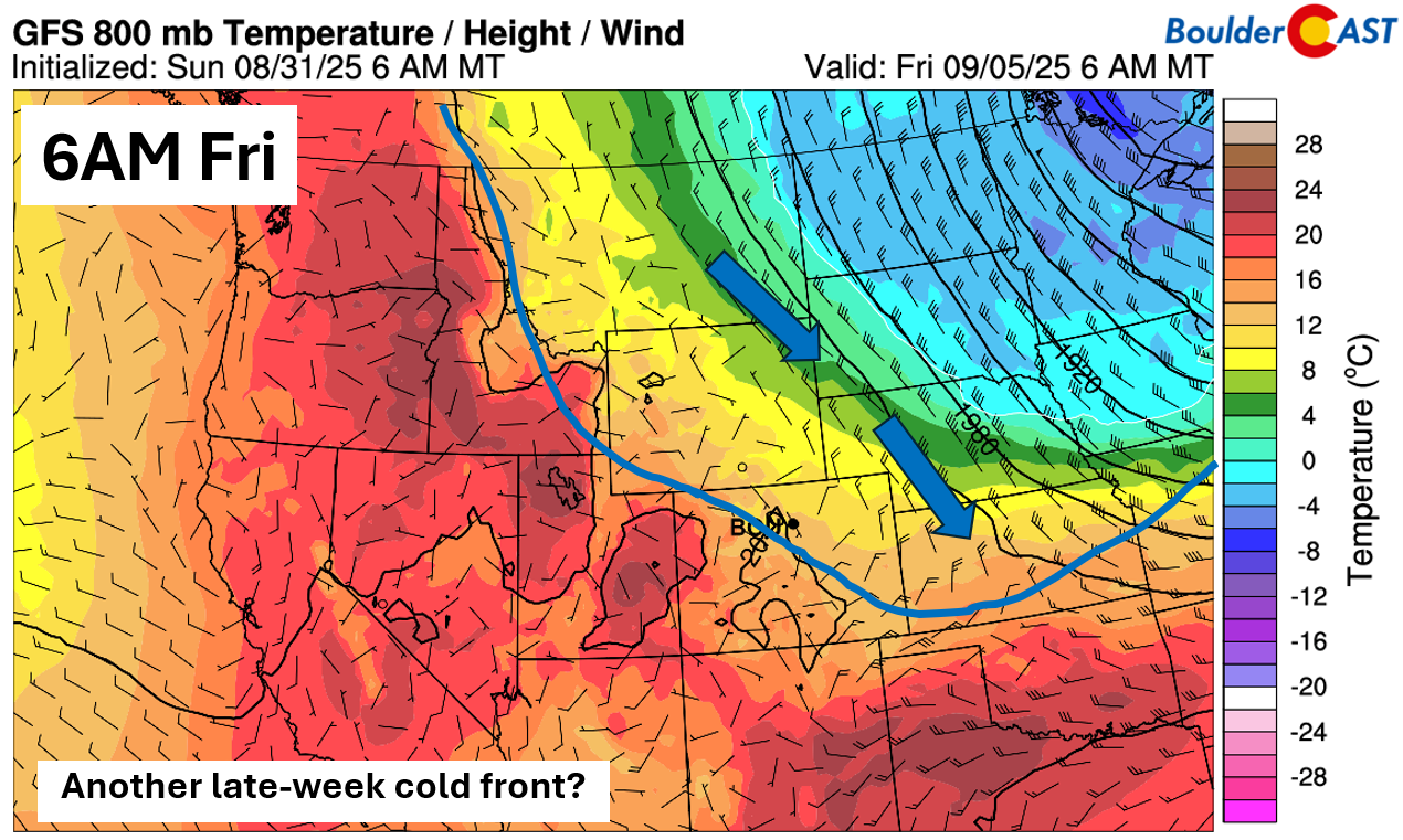
Another trough rolls in late week, and this one’s a bit trickier. Models disagree on how far west it’ll dig — if it shifts westward, we could cool into the low to mid 70s. If it stays east, we’ll hold onto warmer highs. For now, we’re splitting the difference, but it’s worth noting that September fronts tend to pack a bit more punch as we start the transition into autumn and away from summer. Thus, we wouldn’t be surprised if the cooler scenario wins out.
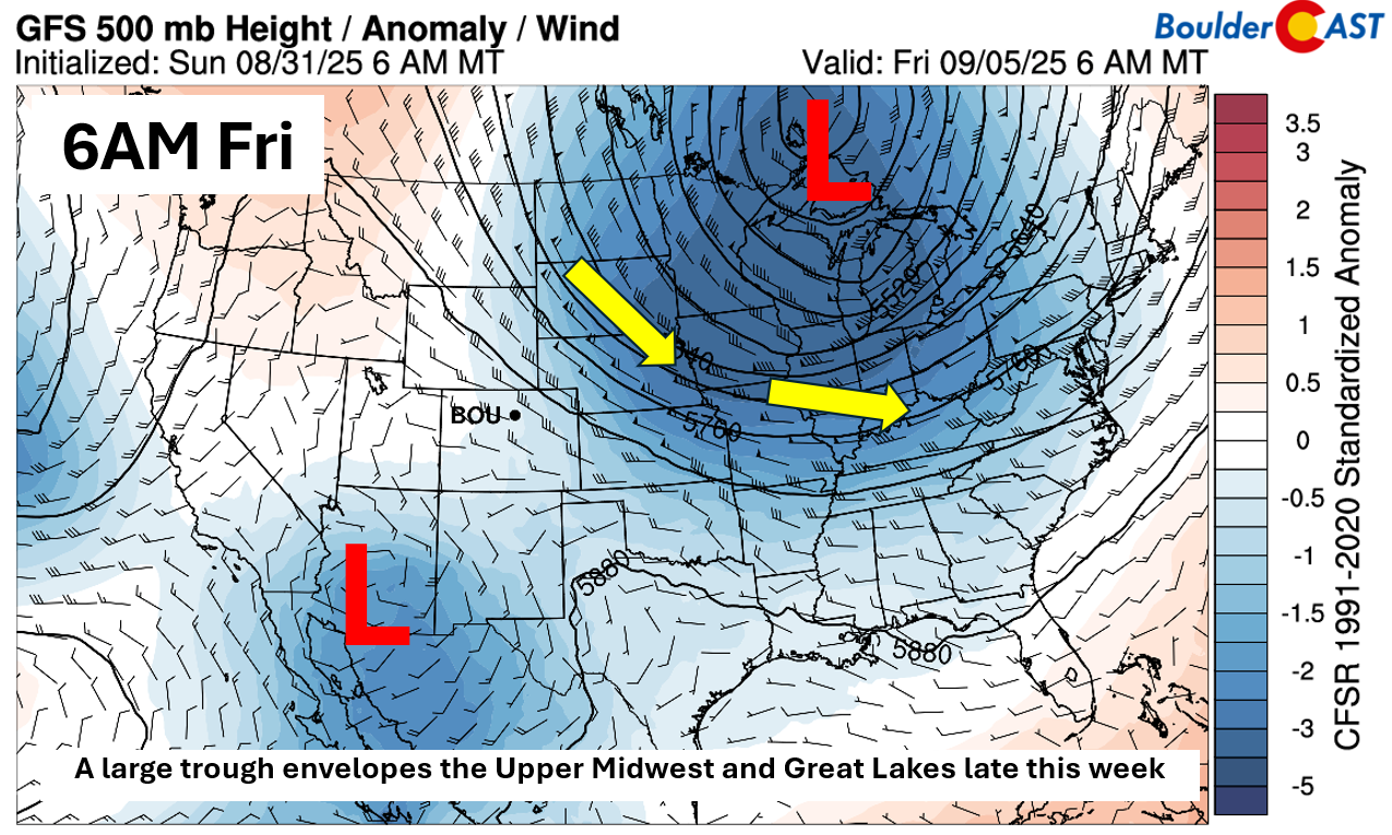
That late-week front could arrive Thursday night or early Friday, depending on which model you trust. It’ll be providing near-freezing overnight lows in the upper Midwest, but nothing nearly that cold here. If moisture can sneak in from a trough near the West Coast, we might see our rain chances increase — not a high-confidence setup, but it’s in the mix.
For now it looks like we’ll stay mostly in the 80s this week with largely dry conditions and pulses of smoke at times. The second trough late in the week is currently the most likely to bring cooler weather here (and some rain), but it’s also still rather uncertain. Stay tuned!
A wetter weekend ahead?
Looking ahead to Saturday, the pattern starts to shift. Most ensemble guidance suggests the eastern trough will slowly slide away, opening the door for a West Coast trough to nudge moisture and warmer air back into Colorado. The big questions: How soon does that happen? And how much rain do we actually get out of it? There’s even a hint of possible tropical influence, but it’s too early to say how that might play out. What we do expect is a bump in moisture sometime over the weekend, with highs generally landing in the low to mid 80s.
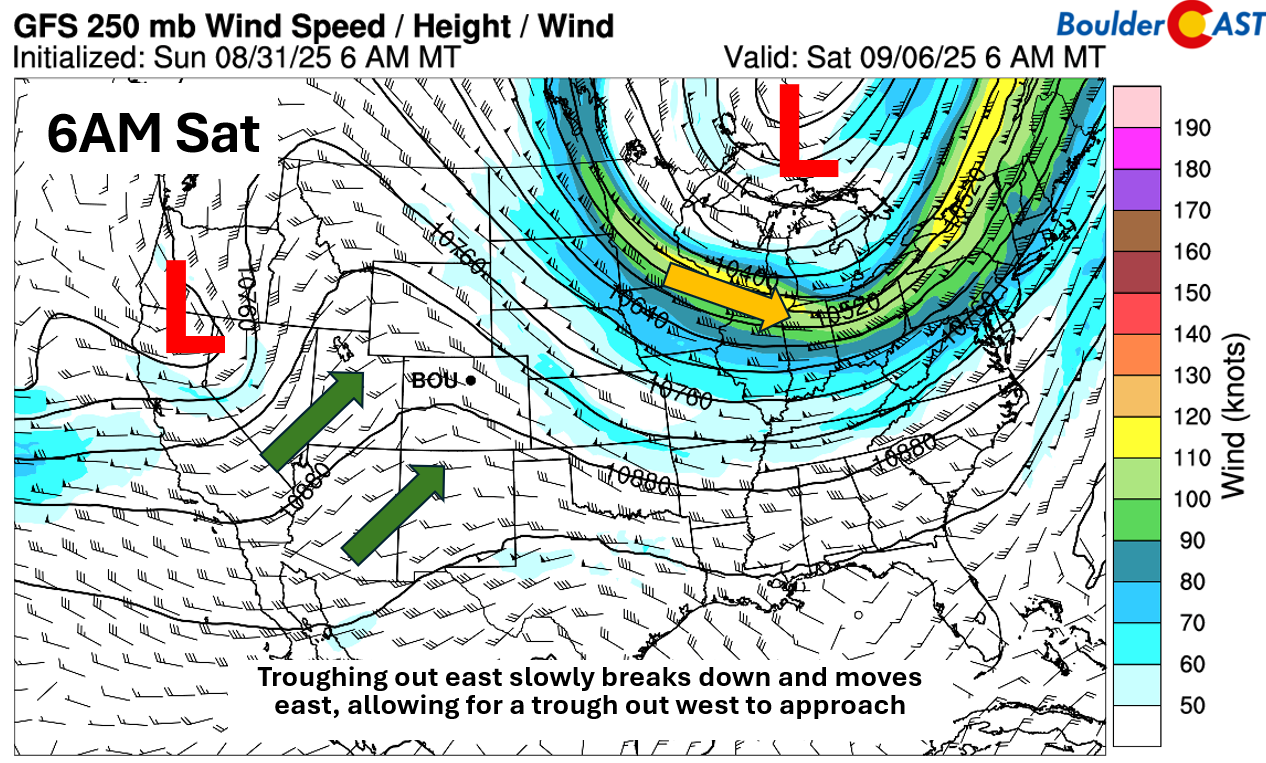
Friday’s setup is a bit of a hinge point. The front looks to drape right along the Front Range, with a pocket of anomalous moisture just to our west. If that moisture surges eastward faster — as the GFS is currently hinting — we could see better rain chances Friday than we’re projecting right now. Either way, moisture should be on the upswing by the weekend if the current pattern holds.
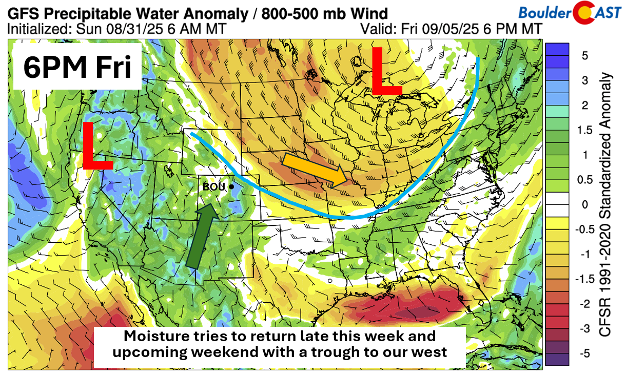
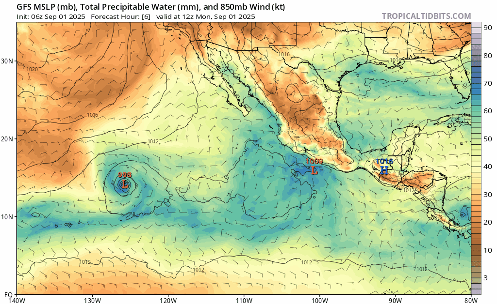
Tropical moisture is on the radar by the weekend, but confidence is low. There’s some credence for a tropical system near the Baja potentially influencing our setup late this weekend or early next week, shown as the red “X” below:
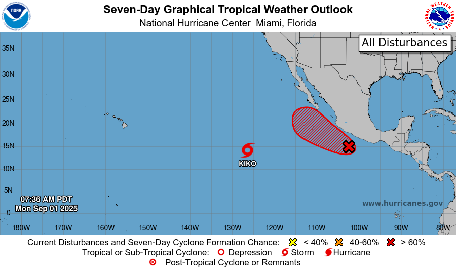
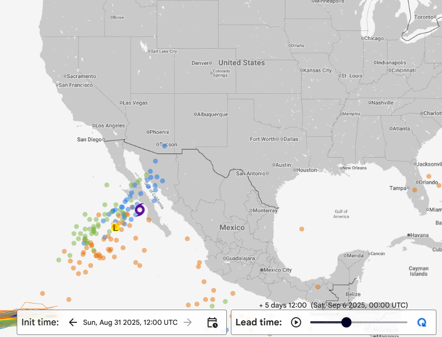
The latest GFS model forecast shows would-be Hurricane Lorena making landfall in the Baja on Friday with the remnants heading towards Colorado over the weekend.
However, this track is far from certain five days out. Google’s experimental AI model, paired with ECMWF ensemble data, allows us to explore possible tracks — notice that the spread is rather wide, ranging from landfall in Mexico to the storm fizzling out well offshore.
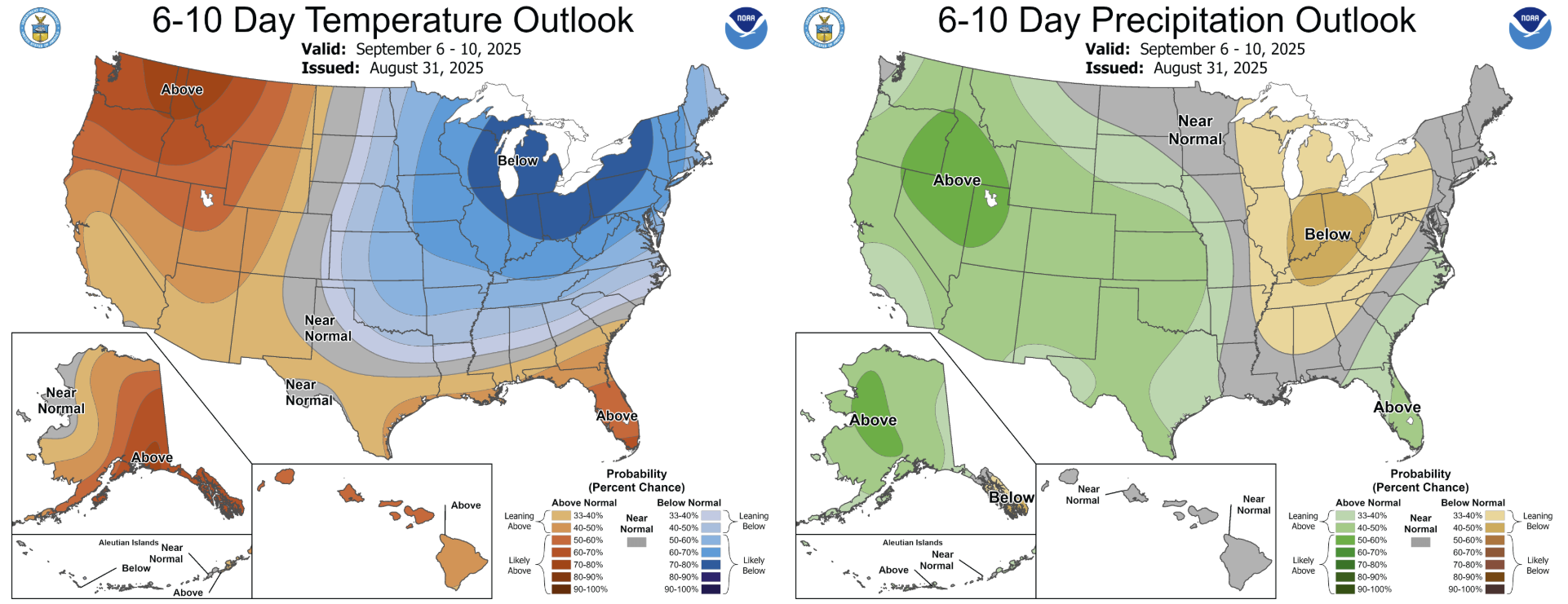
If remnants do reach the Desert Southwest, we could see a moisture boost for the weekend, but for now it’s only speculative. The Climate Prediction Center is leaning wetter than normal in Colorado this weekend and early next week, for what its worth.
Happy Labor Day and have a great week!
Forecast Specifics:
Monday: Mostly sunny with some possible haze with highs in the lower 80s on the Plains and low 70s in the Foothills.
Tuesday: Partly cloudy with wildfire smoke and a tiny chance of an isolated shower or weak storm. Highs in the middle 80s on the Plains and lower 70s over the Foothills.
Wednesday: Increasing clouds with a slight chance of a storm over the higher terrain. Some smoky haze is also favored with highs in the low to middle 80s on the Plains and lower 70s in the Foothills.
Thursday: Partly cloudy with highs well into the 80s on the Plains and in the 70s in the Foothills.
Friday: Increasing clouds with a chance of late-day showers or storms. Highs in the middle to upper 70s on the Plains and middle 60s in the Foothills.
Weekend: Better chances of afternoon and evening storms and warmer with highs on the Plains in the in the upper 70s to middle 80s. Exact rain potential will hinge on the uncertain tropical remnants coming up from the Baja.
DISCLAIMER: This weekly outlook forecast is created Monday morning and covers the entire upcoming week. Accuracy will decrease as the week progresses as this post is NOT updated. To receive daily updated forecasts from our team, among many other perks, subscribe to BoulderCAST Premium.
Go Premium, get all the perks.
Daily Forecast Updates
Get our daily forecast discussion every morning delivered to your inbox.
All Our Model Data
Access to all our Colorado-centric high-resolution weather model graphics. Seriously — every one!
Ski & Hiking Forecasts
6-day forecasts for all the Colorado ski resorts, plus more than 120 hiking trails, including every 14er.
Smoke Forecasts
Wildfire smoke concentration predictions up to 72 hours into the future.
Exclusive Content
Weekend outlooks every Thursday, bonus storm updates, historical data and much more!
No Advertisements
Enjoy ad-free viewing on the entire site.
Enjoy our content? Give it a share!


You must be logged in to post a comment.