As we transition deeper into autumn season, Colorado weather continues to keep us all on our toes. This past weekend, a slow-moving storm system that was expected to bring widespread light precipitation to the Denver Metro area ended up being a tad underwhelming, with the bulk of the moisture staying to our south. While Boulder and Denver received only minimal rainfall, areas of southern Colorado and New Mexico experienced heavy rainfall which led to deadly flash flooding. Looking ahead, this week promises relatively quiet weather for the Front Range, with just a brief cool down scheduled for late week. We’re also tracking an interesting storm in the pipeline for next week which could bring sub-freezing temperatures and potentially some snow to the area just in time for Halloween.
This week’s highlights include:
- Storm Recap: The anticipated storm over the weekend mostly missed the Denver Metro area, with only light rain/snow across the area. Arizona, New Mexico, and southern Colorado experienced heavy rain, severe thunderstorms, and mountain snow. Roswell (NM) saw historic and deadly flooding.
- Major Storm System Departs Monday: Our storm system is still close on Monday with a few lingering impacts expected Monday including Mountain snow, a couple raindrops on the Plains, and gusty winds
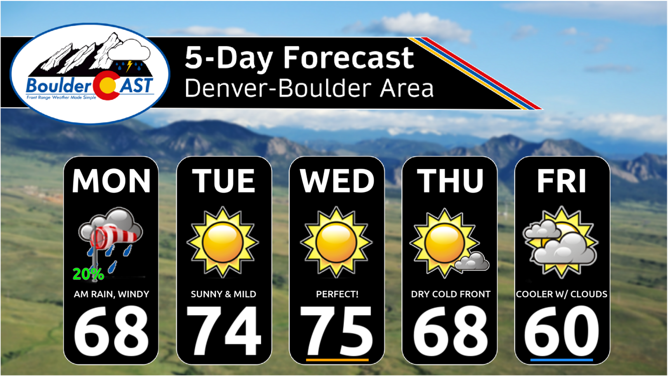
- Another Warm/Dry Week & Weekend Ahead: The rest of the week will be mostly dry and warm, with a slight chance of rain early Monday morning and a dry cold front passing on Thursday.
- Watching Early Next Week: Though still a week away, model support is growing for a strong trough to reach Colorado early next week with much colder weather and possibly some light snow in the cards.
DISCLAIMER: This weekly outlook forecast is created Monday morning and covers the entire upcoming week. Accuracy will decrease as the week progresses as this post is NOT updated. To receive daily updated forecasts from our team, among many other perks, subscribe to BoulderCAST Premium.
Daily Forecast Updates
Get our daily forecast discussion every morning delivered to your inbox.
All Our Model Data
Access to all our Colorado-centric high-resolution weather model graphics. Seriously — every one!
Ski & Hiking Forecasts
6-day forecasts for all the Colorado ski resorts, plus more than 120 hiking trails, including every 14er.
Smoke Forecasts
Wildfire smoke concentration predictions up to 72 hours into the future.
Exclusive Content
Weekend outlooks every Thursday, bonus storm updates, historical data and much more!
No Advertisements
Enjoy ad-free viewing on the entire site.
Storm Recap: Weekend storm was mostly a miss
The anticipated storm system this past weekend ended up being a near-complete miss for the Denver Metro area. While our team called for the track of the low pressure to be too far southwest to bring big impacts to our region, there was still a dabble of rain and plenty of gloom in the forecast. Ultimately the storm ended up tracking about 125 miles further south than expected as it dove into far southern Arizona over the weekend. The full water vapor satellite animation loop from Friday through Monday morning is shown below. Notice how the low pressure hangs out in Arizona almost the entire weekend. Only late on Sunday did it start to make progress eastward. In fact, as of writing Monday morning, the mid-level low is almost directly over Denver.
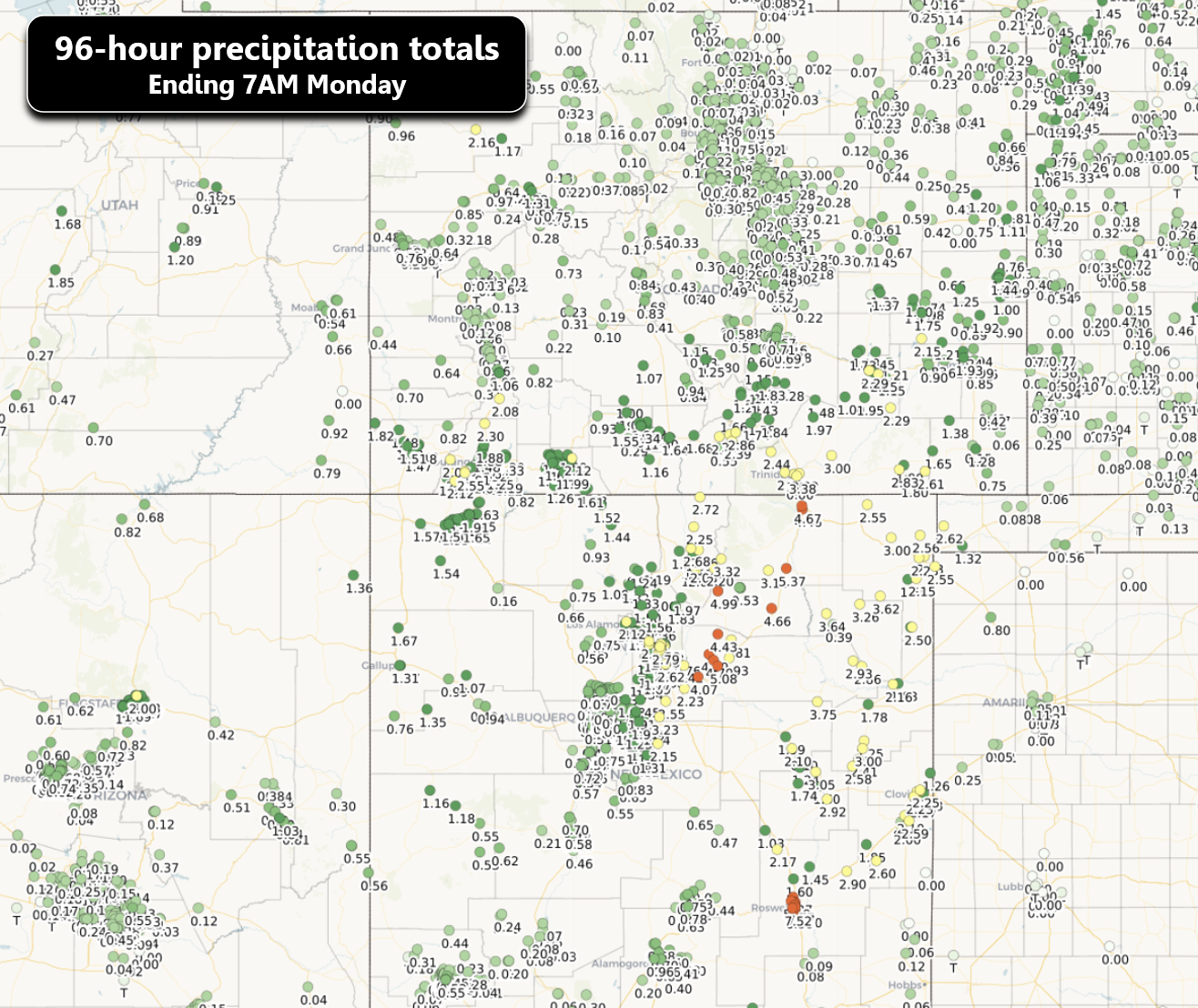
Arizona, New Mexico and southern portions of Colorado got slammed by this stationary storm with heavy rain, severe thunderstorms, and high mountain snow as deep Gulf of Mexico moisture got pulled into the Southwest. Roswell New Mexico, normally famous for aliens and UFOs, got hit particularly hard when localized stationary torrential thunderstorms produced up to 8″ of rain in just a few hours leading to historic flooding in what is normally a flat, arid city. Hundreds of residents had to be rescued and there were sadly a few fatalities.
Rivers in the streets at the flash flood emergency in Roswell! pic.twitter.com/GDUcRXymNA
— Reed Timmer, PhD (@ReedTimmerUSA) October 20, 2024
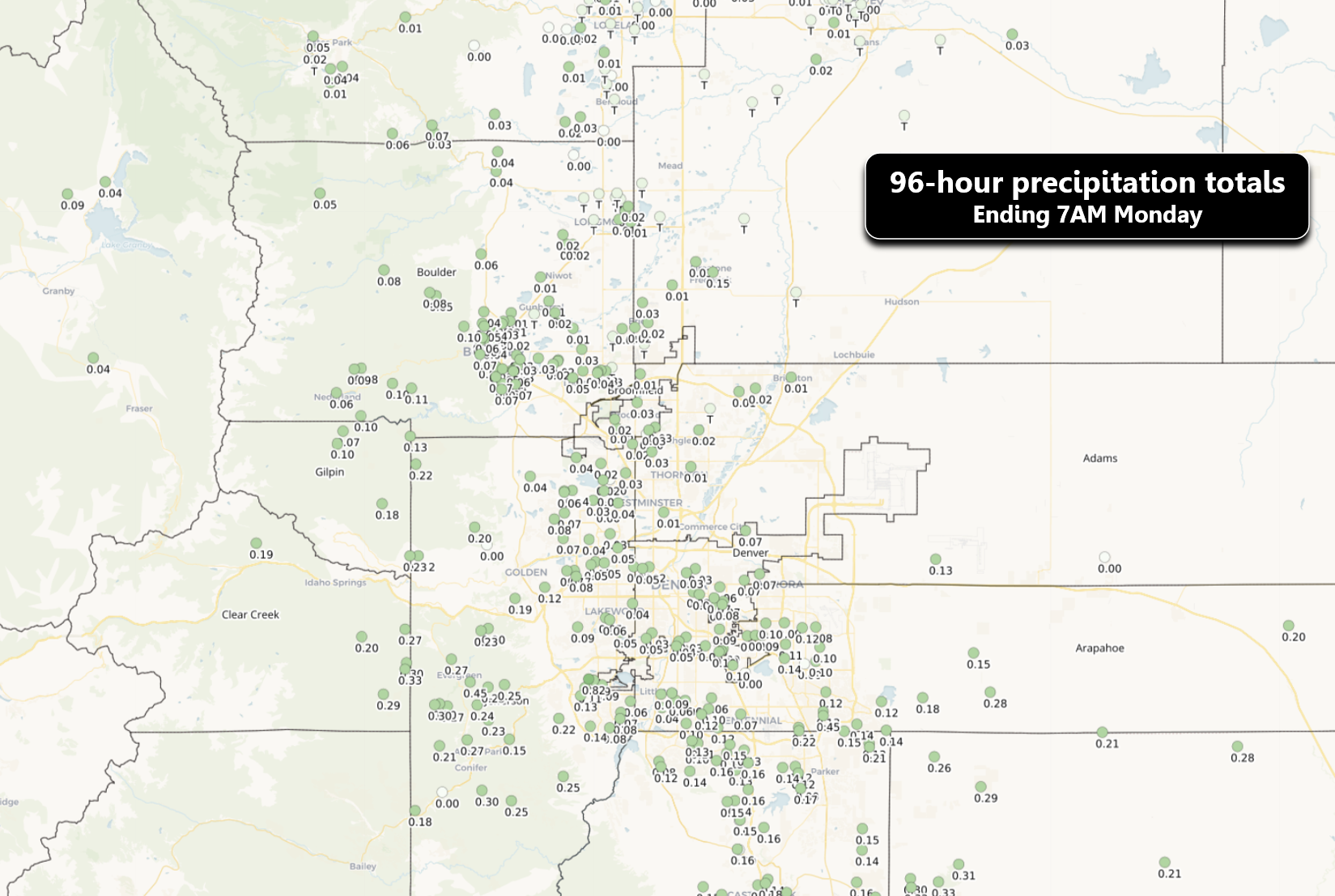
The map below shows 96-hour precipitation amounts ending Monday morning. Huge 1-5″ totals were reported across much of eastern New Mexico and southeast Colorado. The unfortunate winner was Roswell with over 7″!
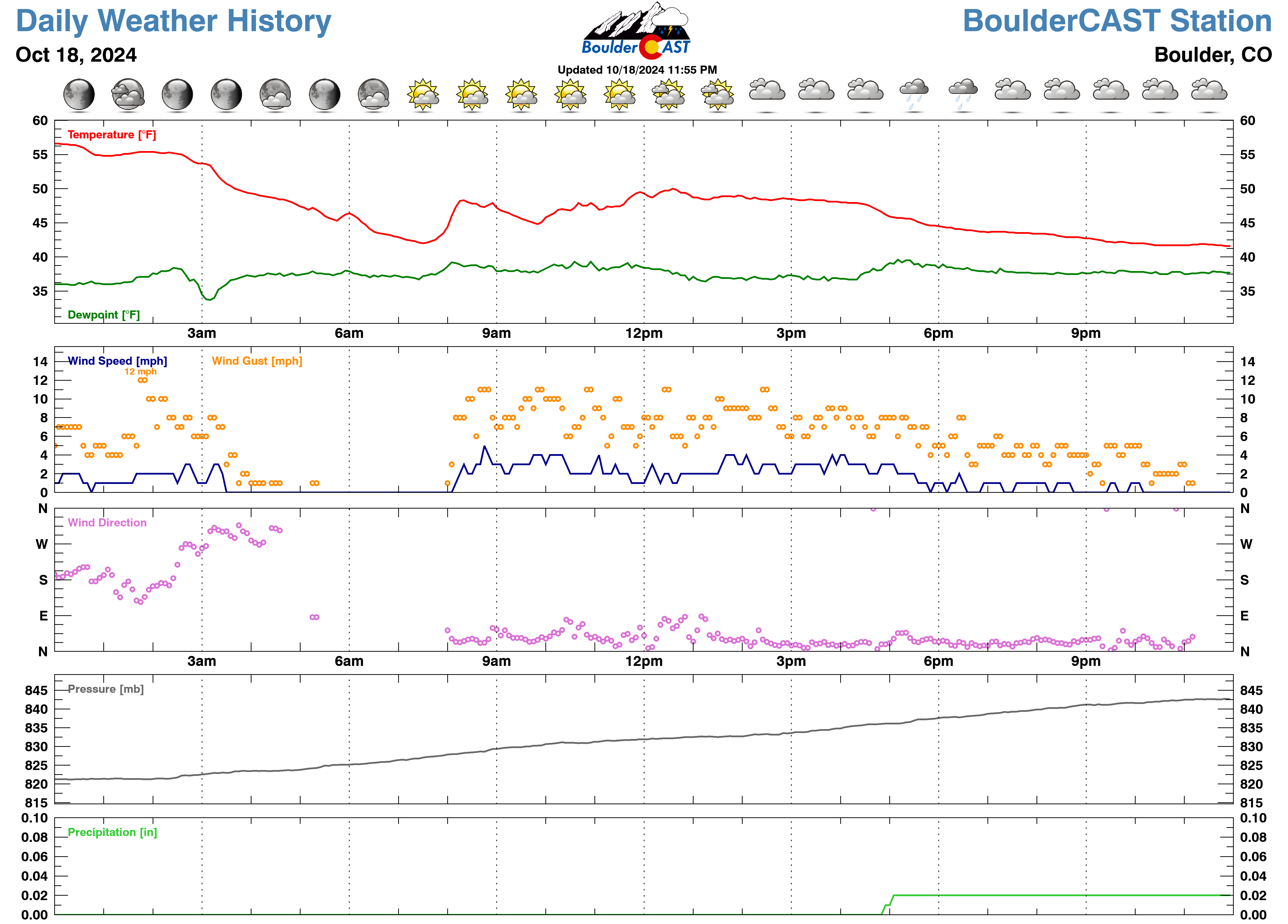
A closer look at the Front Range shows some truly pathetic precipitation totals, generally less than 0.25″ in most spots. Officially, Boulder and Denver received 0.04″ and 0.09″ of rain, respectively — far from what we need, but sadly it was still our most substantial precipitation event in about four weeks.
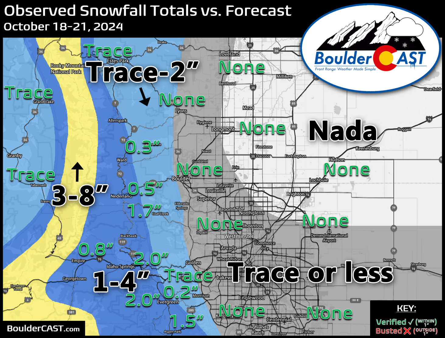
Given the lack of precipitation over the weekend, it’s thus no surprise that snow totals also came in on the lower side. There was no snow observed across the lower elevations (which was always just an outside chance of a couple flakes), so we still await our elusive first snow of the season down here. The Foothills from Boulder County southward did receive a light dusting to 3″ of new snow over the weekend.
Overall, the weekend didn’t turn out too bad at all in the Front Range. It was definitely cooler and dished out some autumn feels, particularly on Friday when our daytime highs were only in the 40s!
The week ahead: Business as usual (dry & warm)
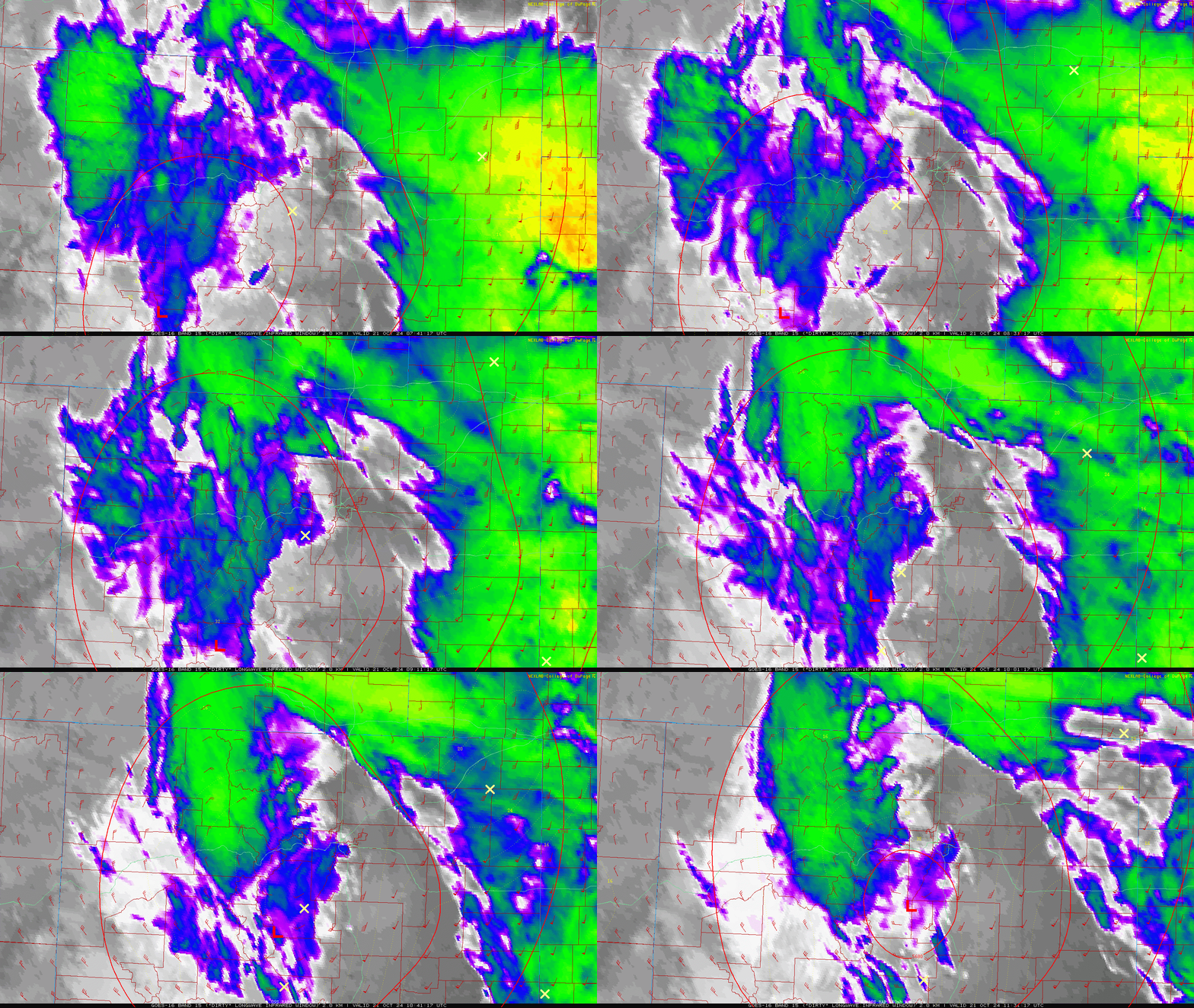
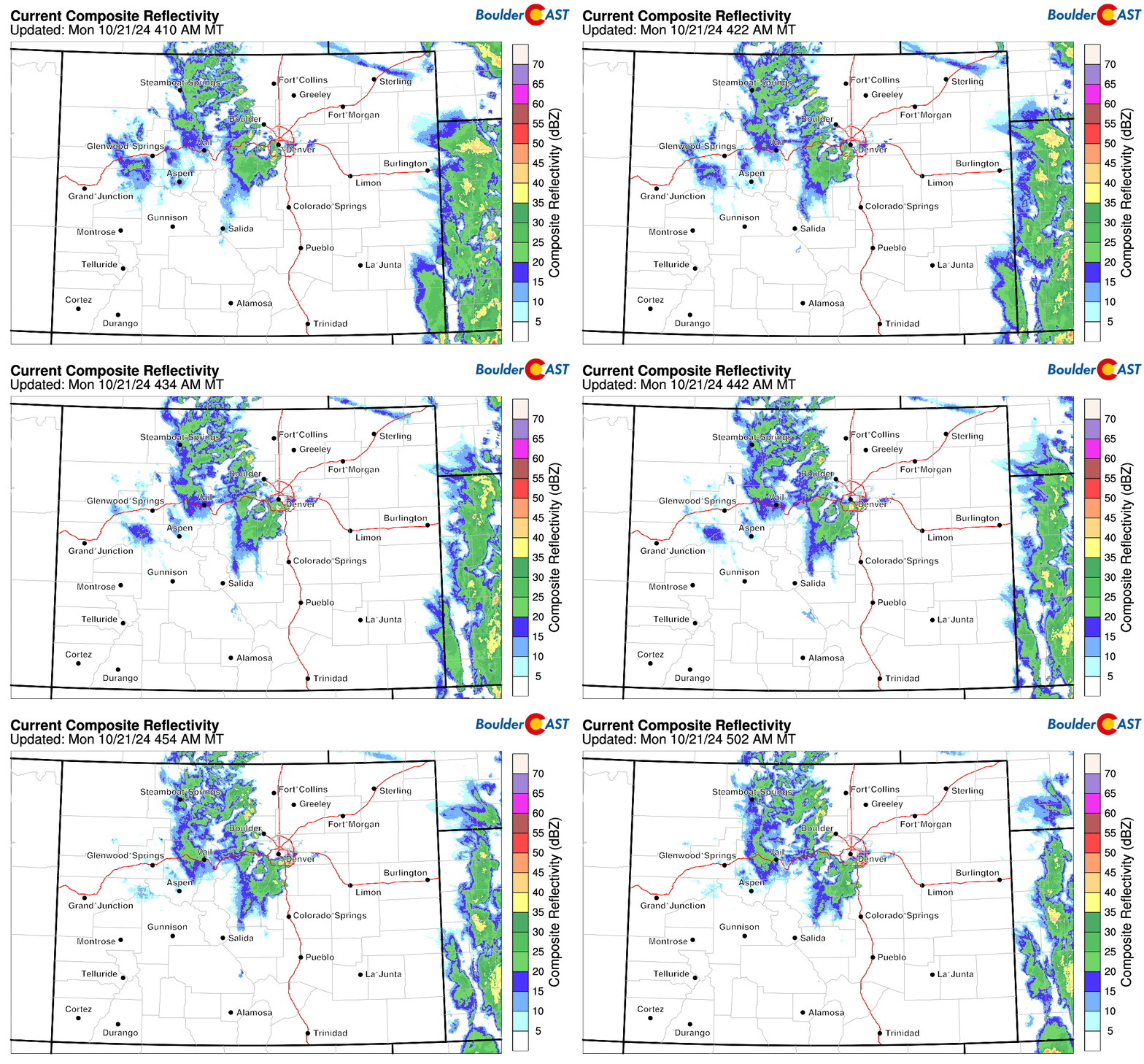
Our best chance of rain for the week actually comes very early Monday morning as the lingering low pressure system passes directly over Denver. Unfortunately, most of the widespread stratiform rain has already passed east of our area overnight, while the wrap-around moisture this morning is producing showers (with a nasty convective component) almost exclusively across the higher terrain, including heavy snow along the I-70 Corridor and in Rocky Mountain National Park.
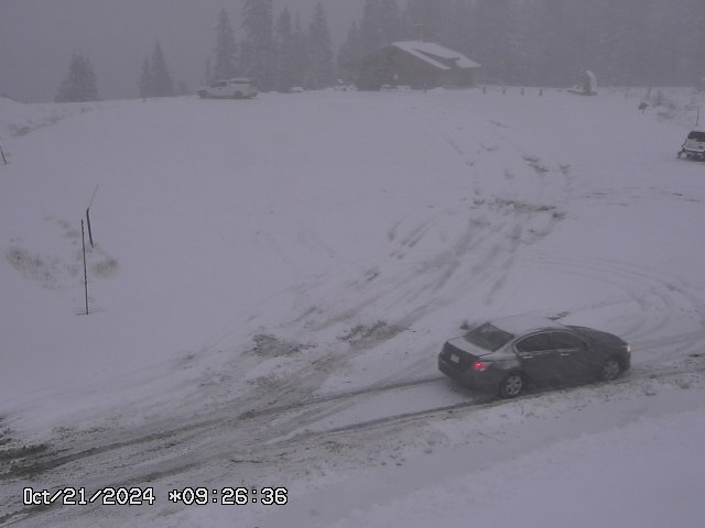
Expect treacherous travel Monday morning if you are heading over any Mountain passes from the snow and wind. Some of them are already closed due to safety concerns! The image below is from the 12,000 foot apex of Berthoud Pass as of Monday morning.
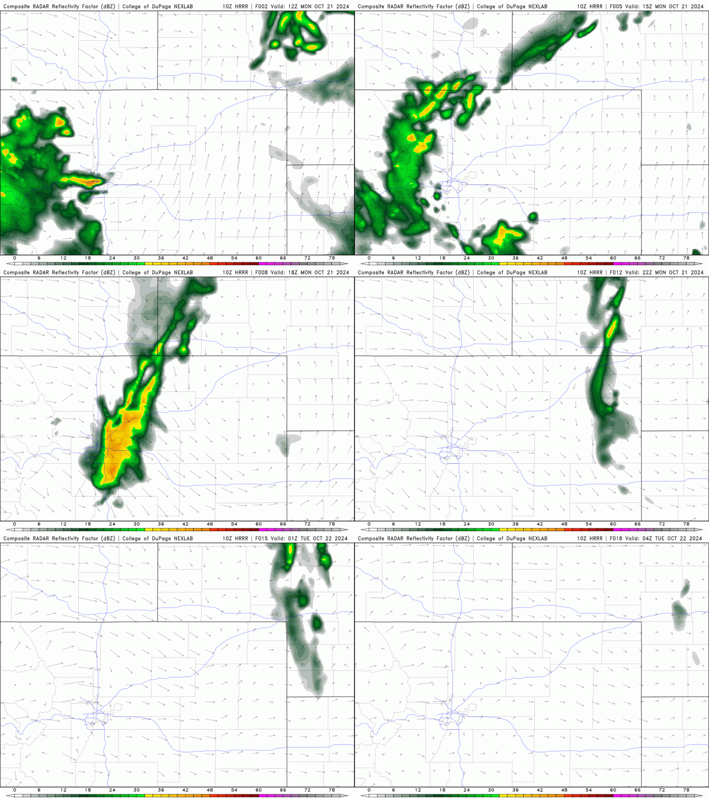
The Denver Metro area unfortunately sits in the big ol’ dry slot of the storm Monday morning — not what you want to see considering we already missed out on most of our precipitation from this event.
However, the wrap-around moisture and lift from the departing low pressure will clip our area this morning as it heads eastward. Look for a few spotty showers to be around through the morning hours, clearing out before lunchtime. Downslope may wipe most of the activity out as it passes through, with just light rain expected at best.
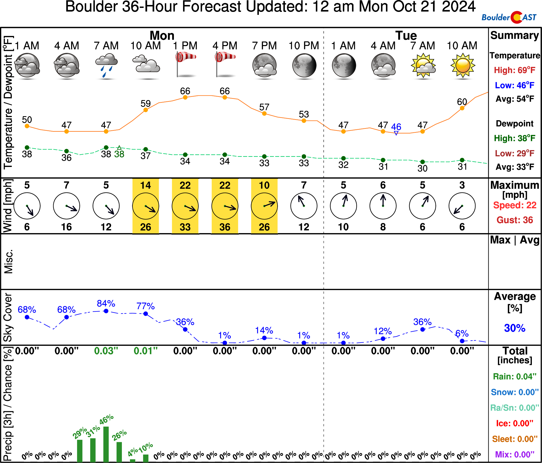
In the wake of the storm, the rest of our Monday will be sunny but quite breezy. Gusts of 15 to 35 MPH will be possible much of the day Monday with highs in the mid to upper 60s. Hold on to your hats!
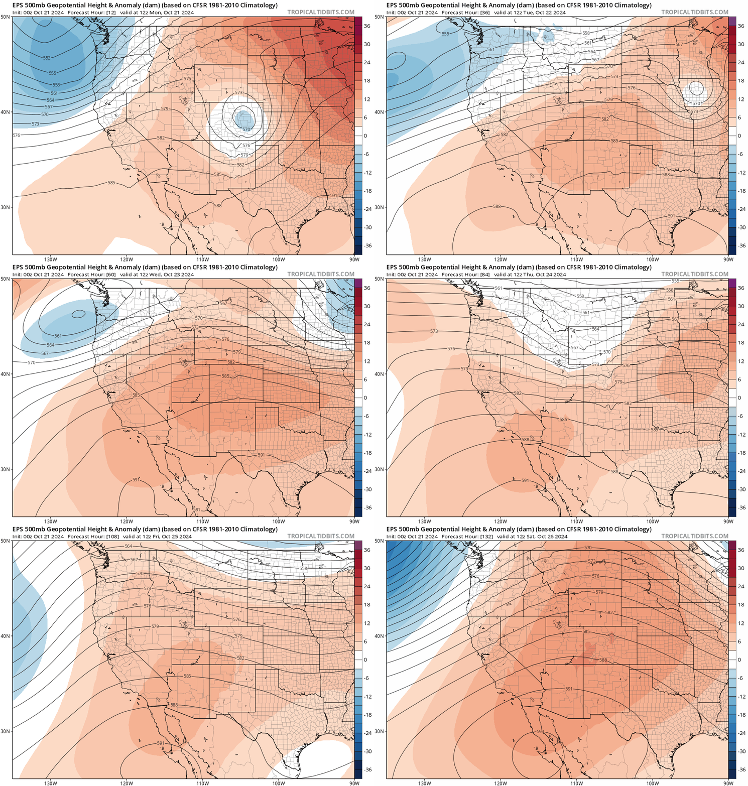
After the departure of the early-week low into the Great Plains, the rest of the week will see the development of a pesky of high pressure across the western United States, with Colorado squarely under its protective care. It won’t be quite as strong as the ridges we’ve seen the last several weeks, but it will lead to mostly dry and fairly warm weather throughout the extended for us.
Tuesday and Wednesday will be very pleasant with highs in the middle 70s and lots of sunshine.
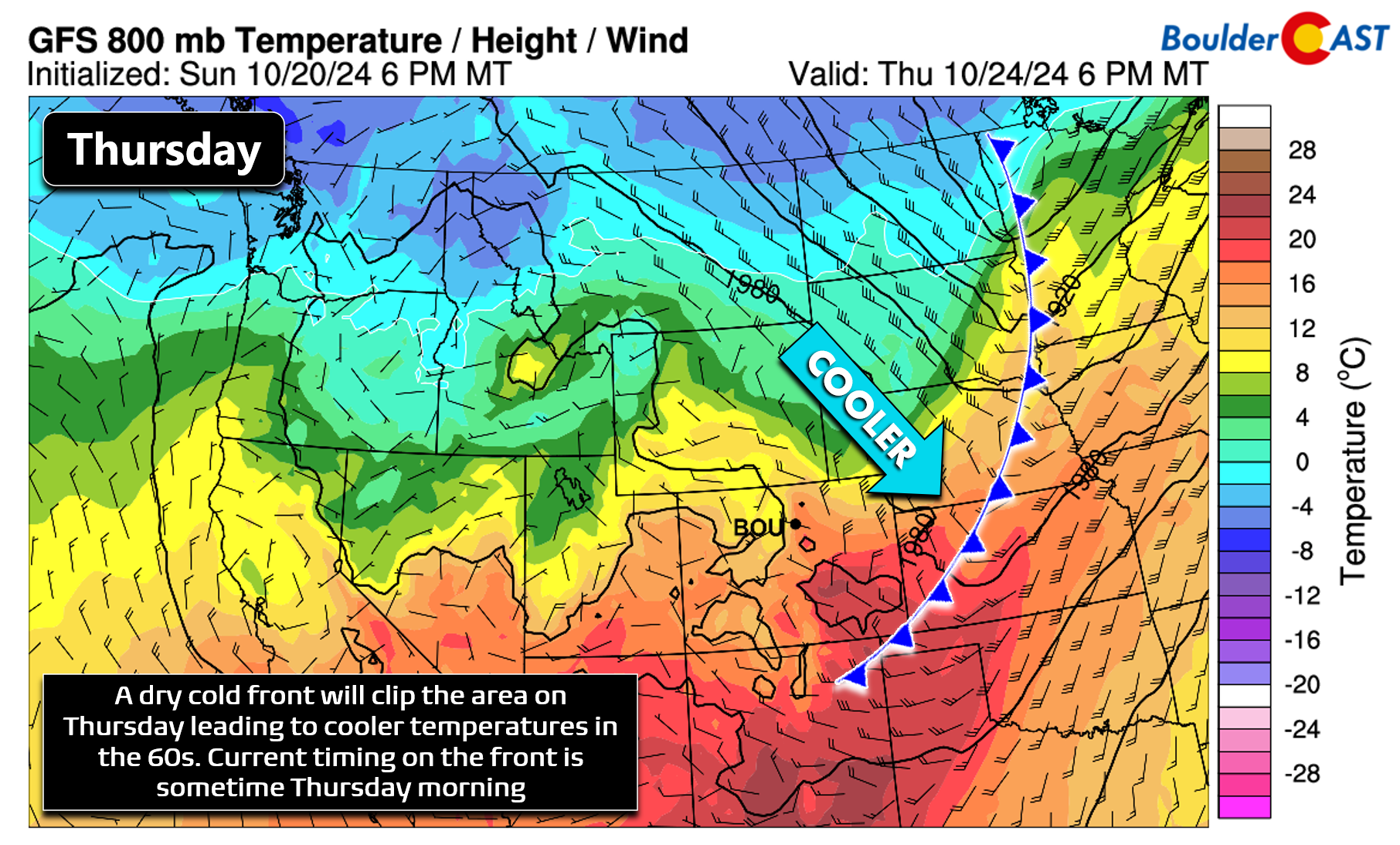
A weak Pacific storm system will pass across the northern Rockies on Thursday — did you catch it in the animation above? The only impact on Colorado will be, wait for it…. a dry cold front with marginally cooler air on the backside! The cold front is currently slated to move through the Front Range Thursday morning or early afternoon leading to a cooler day with temperatures in the 60s. Depending on the timing of the front, we could possibly get into the 70s again, but that is looking less likely based on the latest guidance. There could be a few snow showers with this wave in the Mountains, but the lower elevations around Boulder and Denver will be dry and downsloped.
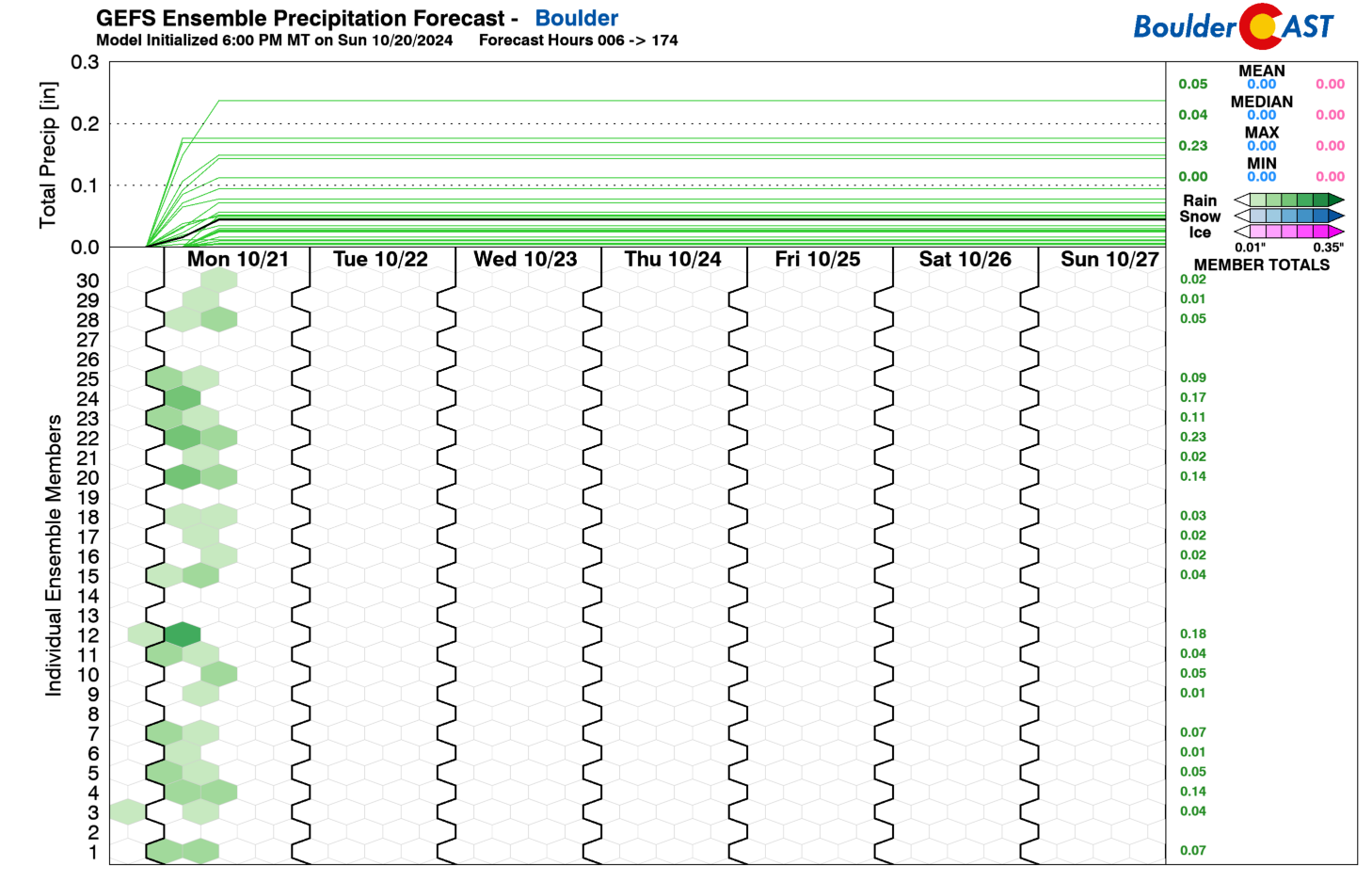
Friday will be a bit cloudier and chillier with highs only around 55 to 65 degrees in lieu of the front. Depending on the exact influx of cold air and how much cloud cover will be around, both Thursday night and Friday night are potential candidates for frost forming across the lower elevations. Frost is possible, but at this point we cannot consider it likely given the marginal temperatures and increased cloud cover late week. Here’s a look at the extended — depicting what will be yet another dry and fairly warm week in the Front Range.
With the exception of a few sprinkles Monday morning, the ensembles are bone dry the entire week and weekend ahead.
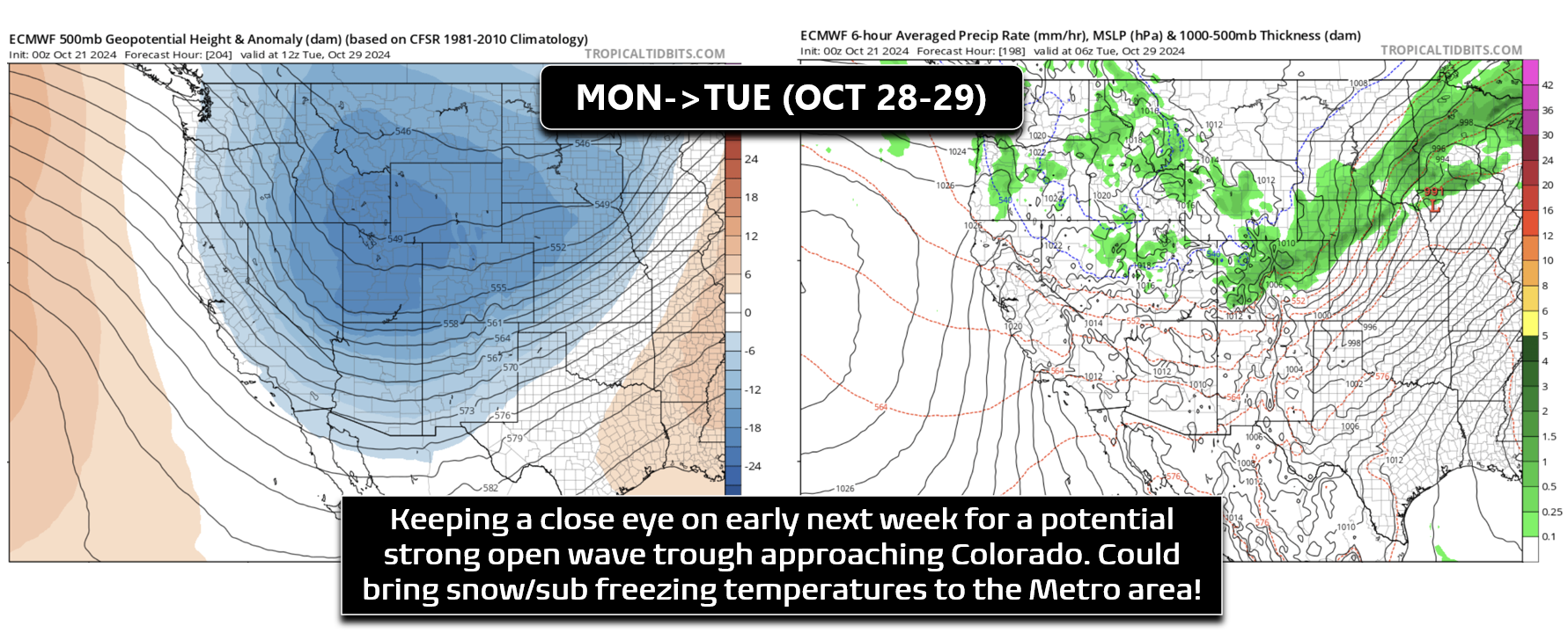
We are starting to see some mild long-range model agreement for a strong but progressive storm impacting Colorado early next week (late Monday or Tuesday timeframe). It’s still a long ways out, but this system will probably will bring our first frost or hard freeze of the year and potentially some snow as well. We don’t want to jinx it, but stay tuned and keep a close eye on early next week in the lead up to Halloween!
Forecast Specifics:
Monday: Cloudy with a few light rain showers possible in the morning, then mostly sunny and windy. Gusts of 20 to 30 MPH will be common during the day. Highs reach the mid to upper 60s on the Plains with middle 50s in the Foothills.
Tuesday: Sunny and warmer with highs in the middle 70s on the Plains and lower 60s in the Foothills.
Wednesday: Sunny and continued warm. High temperatures top out in the low to middle 70s again on the Plains with lower 60s in the Foothills.
Thursday: A dry cold front will move through during the morning to early afternoon hours with cooler temperatures as a result. Highs likely land between 65 and 75 on the Plains (depending on frontal timing) and near 60 in the Foothills.
Friday: Cooler and cloudier with highs in the lower 60s on the Plains and lower 50s in the Foothills. There is a slight risk of frost Friday morning.
Weekend: Sunny and dry with highs in the 70s both days. There is a slight risk of frost Saturday morning.
Get BoulderCAST updates delivered to your inbox:
DISCLAIMER: This weekly outlook forecast is created Monday morning and covers the entire upcoming week. Accuracy will decrease as the week progresses as this post is NOT updated. To receive daily updated forecasts from our team, among many other perks, subscribe to BoulderCAST Premium.
Daily Forecast Updates
Get our daily forecast discussion every morning delivered to your inbox.
All Our Model Data
Access to all our Colorado-centric high-resolution weather model graphics. Seriously — every one!
Ski & Hiking Forecasts
6-day forecasts for all the Colorado ski resorts, plus more than 120 hiking trails, including every 14er.
Smoke Forecasts
Wildfire smoke concentration predictions up to 72 hours into the future.
Exclusive Content
Weekend outlooks every Thursday, bonus storm updates, historical data and much more!
No Advertisements
Enjoy ad-free viewing on the entire site.
Enjoy our content? Give it a share!




You must be logged in to post a comment.