


After one final taste of summer warmth on Monday, the weather pattern across Colorado is about to undergo a dramatic shift. A much colder and wetter setup is taking aim at the Front Range this week, with rain returning to the forecast, accumulating snow in the Mountains, and perhaps our first real frost threat of the season by week’s end. While we’ve seen promising storm systems fizzle already this fall, the data continues to suggest this one has a better chance of delivering. We break down the timing of the cooldown, what the latest ensemble guidance says about rainfall totals, and why Friday and Saturday mornings will bear watching for frost.
This week’s highlights include:
- ☀️ One More Warm Day: Summer-like warmth hangs on today, but a major pattern change is already knocking on the door.
- 📉 Temperatures Take a Tumble: The week features a dramatic cooldown, with conditions feeling much more like mid-autumn by midweek.
- 🌧️ Rain Chances Return: After several near-misses this season, the atmosphere may finally be lining up for a more widespread precipitation event.
- 🏔️ Winter in the Mountains: Colder air arriving this week will bring the first meaningful taste of snow to much of the High Country.
- 💨 Another Front on Deck: The initial cooldown won’t be the end of the story, as a second push of colder air arrives later in the week.
- ❄️ Frost Watch Late Week: Some locations may be flirting with their first frost of the season, but there are still important forecast details to sort out.
DISCLAIMER: This weekly outlook forecast is created Monday morning and covers the entire upcoming week. Accuracy will decrease as the week progresses as this post is NOT updated. To receive daily updated forecasts from our team, among many other perks, subscribe to BoulderCAST Premium.

Go Premium, get all the perks.
Daily Forecast Updates
Get our daily forecast discussion every morning delivered to your inbox.
All Our Model Data
Access to all our Colorado-centric high-resolution weather model graphics. Seriously — every one!
Ski & Hiking Forecasts
6-day forecasts for all the Colorado ski resorts, plus more than 120 hiking trails, including every 14er.
Smoke Forecasts
Wildfire smoke concentration predictions up to 72 hours into the future.
Exclusive Content
Weekend outlooks every Thursday, bonus storm updates, historical data and much more!
No Advertisements
Enjoy ad-free viewing on the entire site.
One Last Taste of Summer Before Fall Reclaims the Front Range
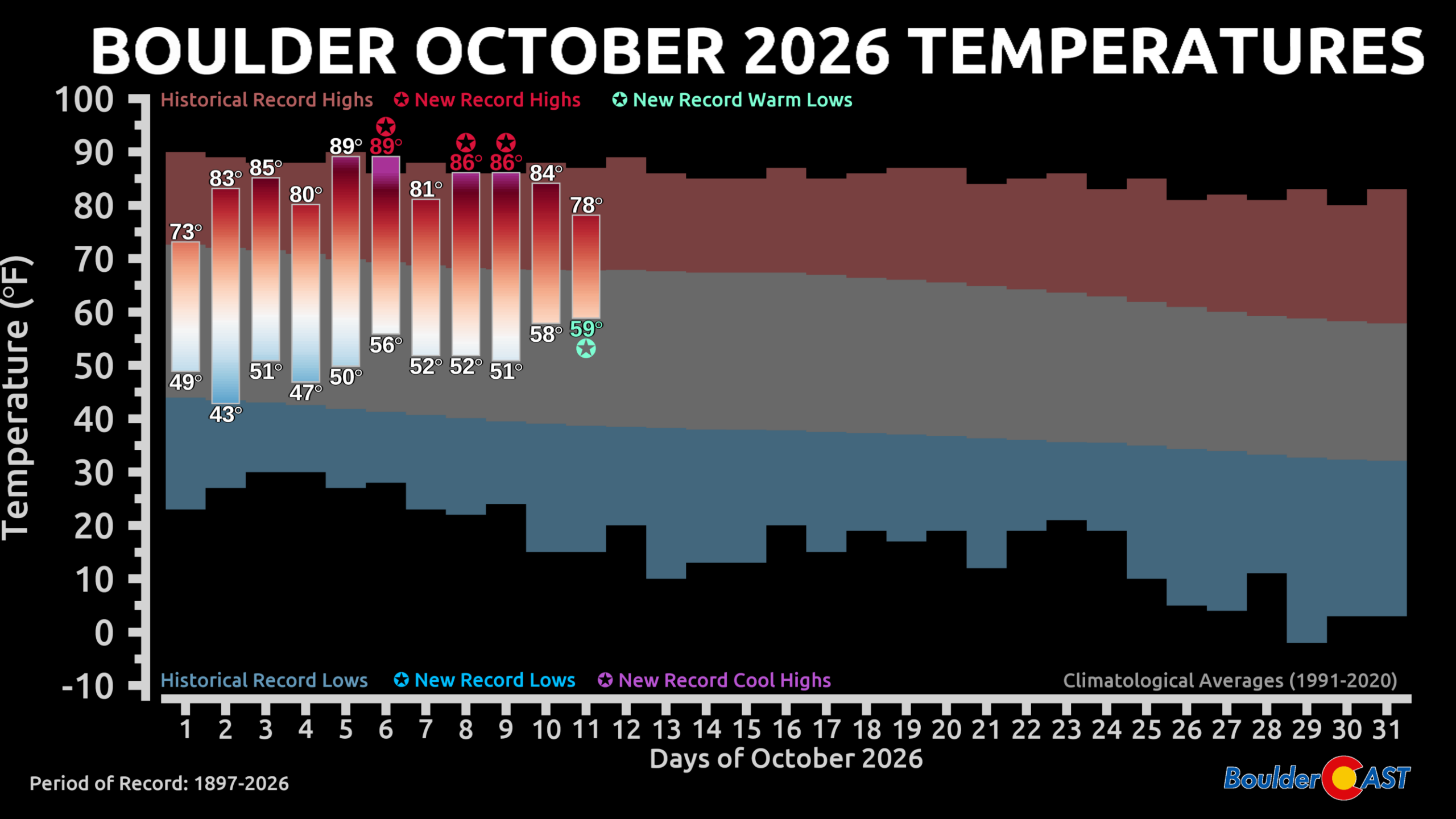
If you enjoyed October’s summer-like warmth so far, you will be able to soak up one more day of it in the Front Range. Temperatures surged well above seasonal norms over the last week, and Monday will feel much the same with highs climbing into the lower 80s. For perspective, average highs in mid-October in Denver are now down into the upper 60s, so we’re running roughly 10 to 15 degrees above normal.
That warmth, however, is living on borrowed time.
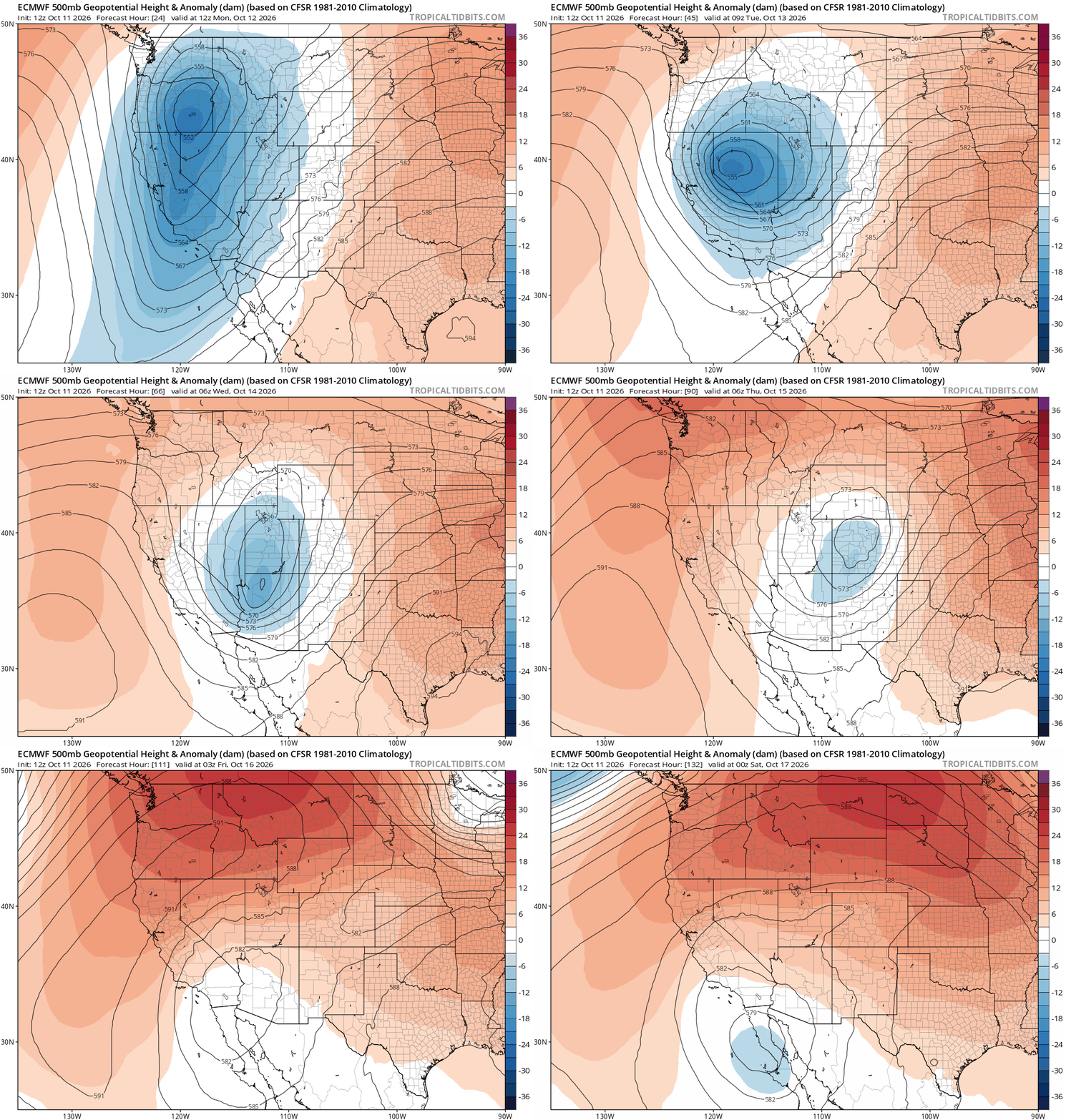
A much more autumn-like pattern is set to take hold as a potent mid-level trough digs eastward from the Great Basin and crosses Colorado from late Tuesday through Thursday. The setup has all the ingredients for a meaningful pattern change, including cooler temperatures, increasing moisture, periods of rain, mountain snow, and perhaps our first widespread frost concerns of the season by week’s end. We’ve been burned by promising storm systems before this fall, so a healthy dose of skepticism remains justified, but this one continues to look considerably more legitimate than many of its predecessors.
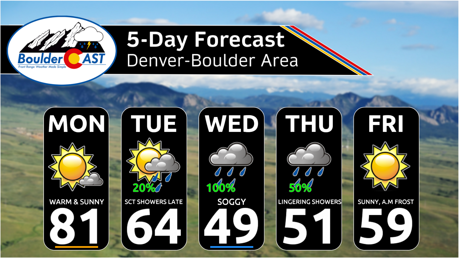
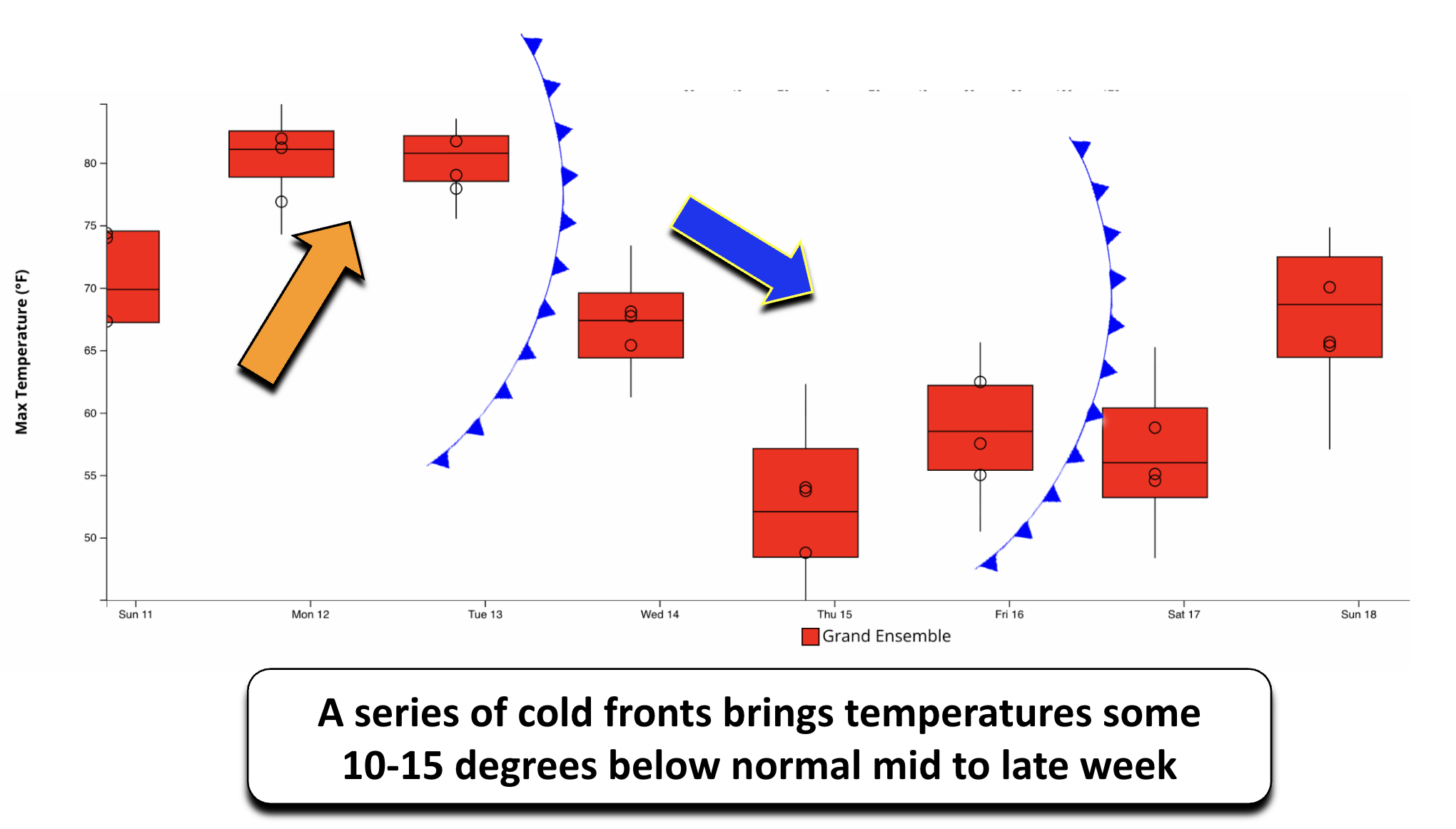
The transition begins Tuesday as the first of two cold fronts sweeps through during the morning hours. High temperatures will come down noticeably, settling back into the upper 60s and lower 70s, much closer to climatological averages.
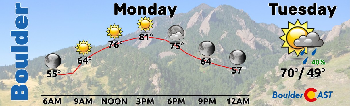
The bigger cooldown arrives midweek. From Wednesday through Friday, highs are expected to remain confined to the mid-40s to mid-50s, a sharp departure from the summer-like temperatures we’ve been perpetually enjoying. A modest warmup is then expected next weekend as temperatures recover toward seasonal norms.
Wet Midweek Pattern Takes Shape, with Snow Returning to the High Country
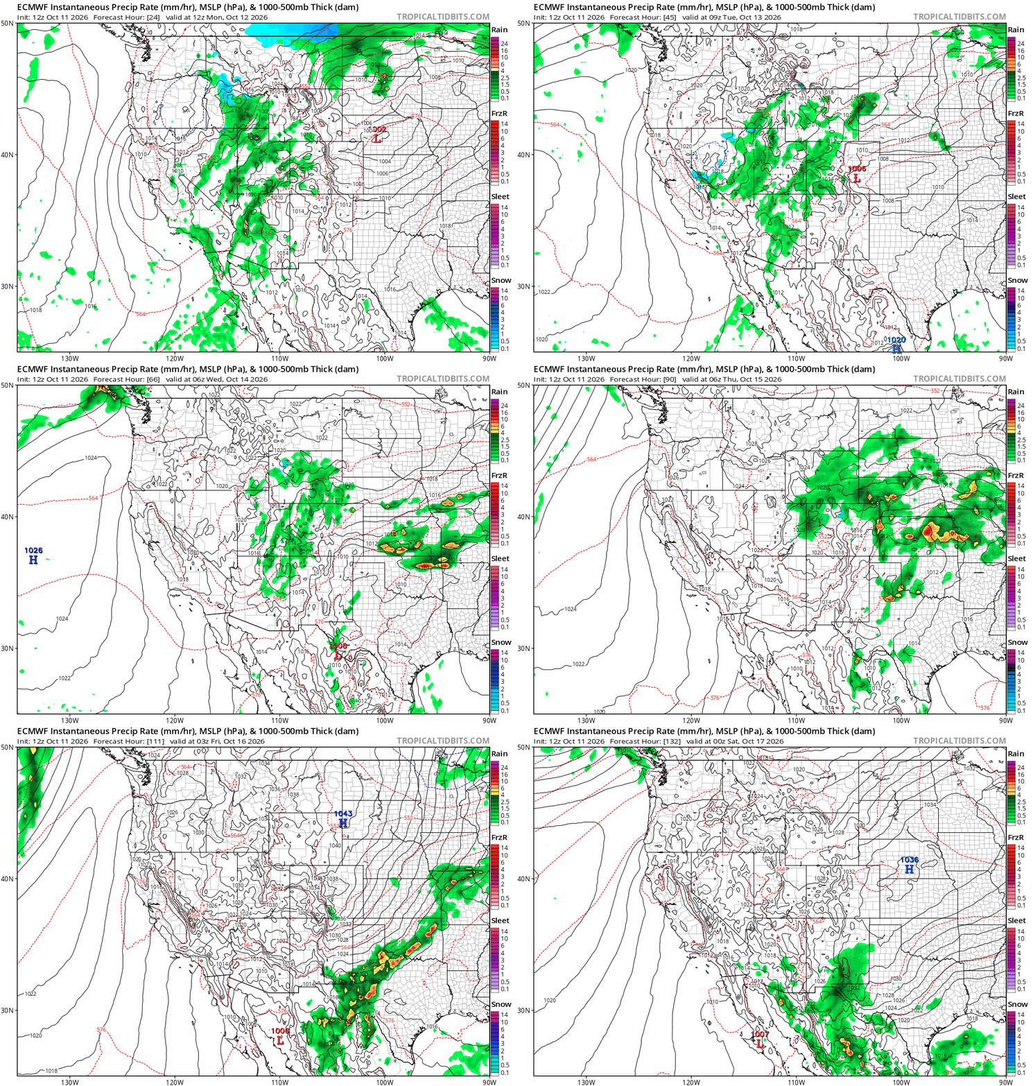
As the trough approaches Tuesday afternoon and evening, low-level upslope flow will begin developing along the Front Range. While a scattered spotty showers could emerge late Tuesday, most guidance delays the more organized precipitation until Wednesday, when moisture deepens and easterly flow strengthens considerably.
Expect cloud cover to steadily increase through Tuesday, with the most active portion of the storm centered on Wednesday and potentially lingering into Thursday. How long precipitation lasts will depend on the battle between lingering upslope flow and the return of drier downslope influences later in the week.
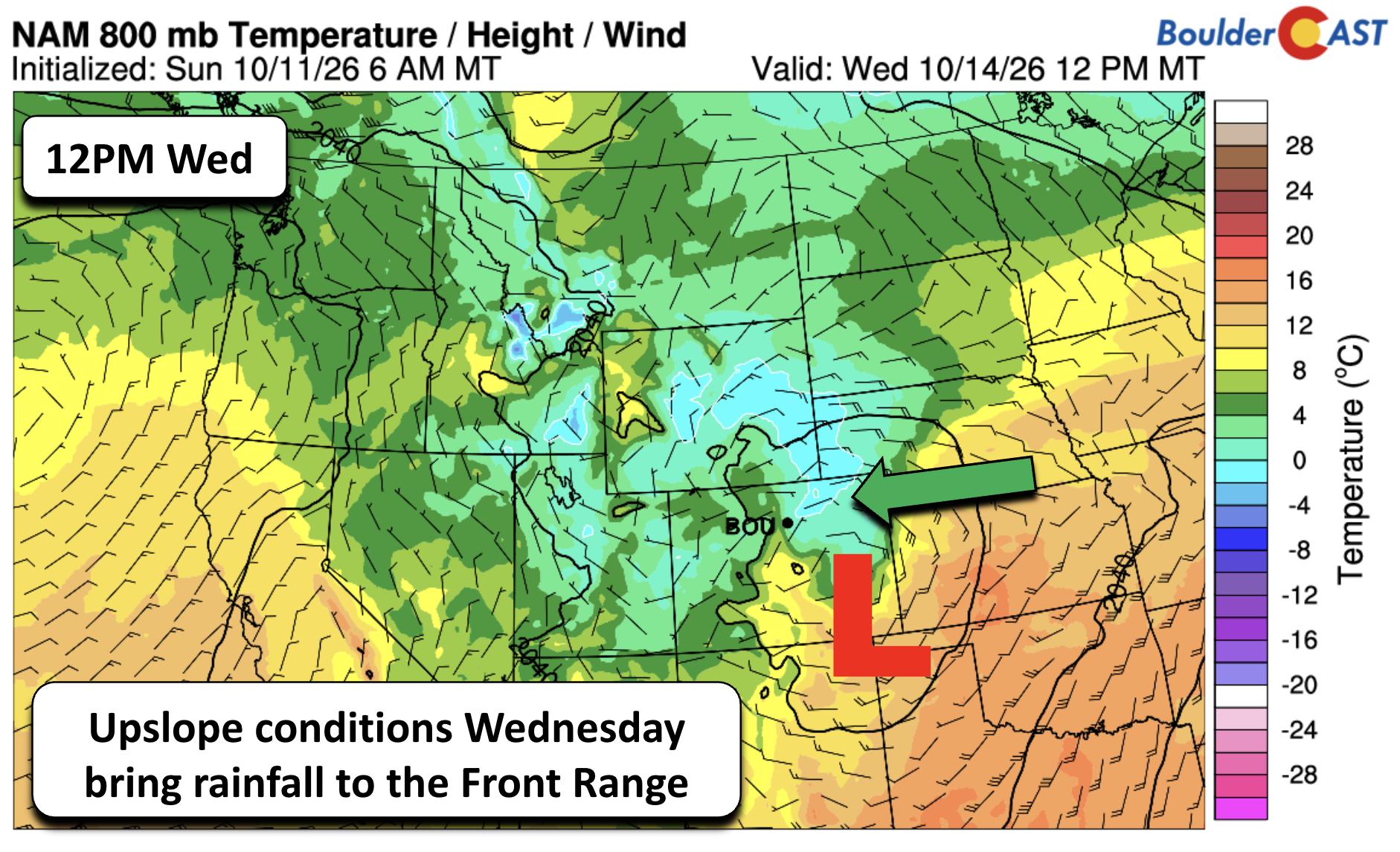
The upslope component remains one of the more encouraging signals in this forecast. Guidance continues to depict a period of persistent easterly flow Wednesday, helping squeeze available moisture out along in Boulder-Denver area and Foothills. Some model solutions, particularly the NAM shown below, remain notably colder than the consensus and bring temperatures uncomfortably close to freezing just above the surface. While that solution appears to be a colder outlier for now, it highlights the strength of the cold air that will accompany this system.
So, is this another storm that ultimately underperforms?
At this point, the data says probably not.
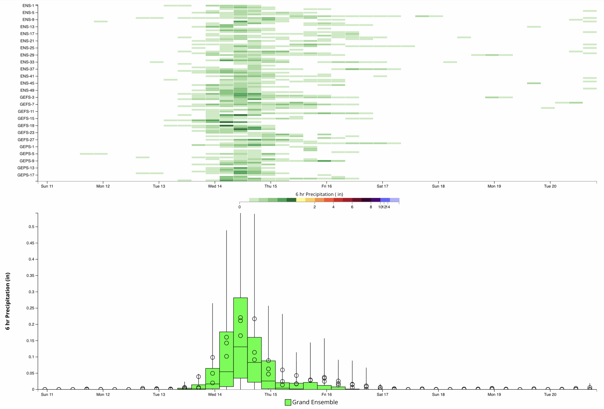
All 100 members from the combined ECMWF, GEFS, and GEPS ensemble suites produce measurable precipitation somewhere across the Front Range. The greatest concentration of rainfall still appears focused on Wednesday, with lingering scattered rain possible Thursday and perhaps even early Friday before drier air arrives.
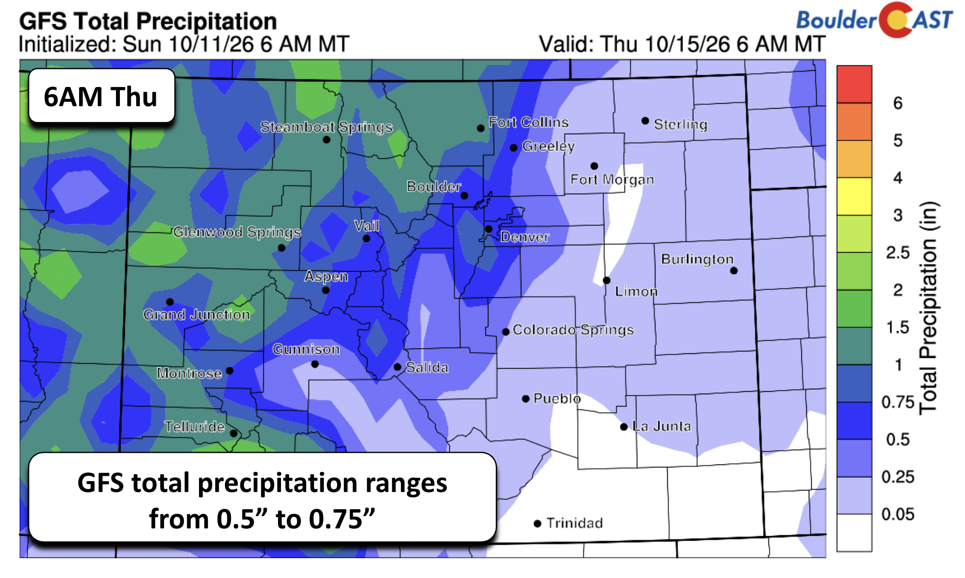
Deterministic guidance such as the GFS continues to advertise widespread totals in the one-half to three-quarter inch range.
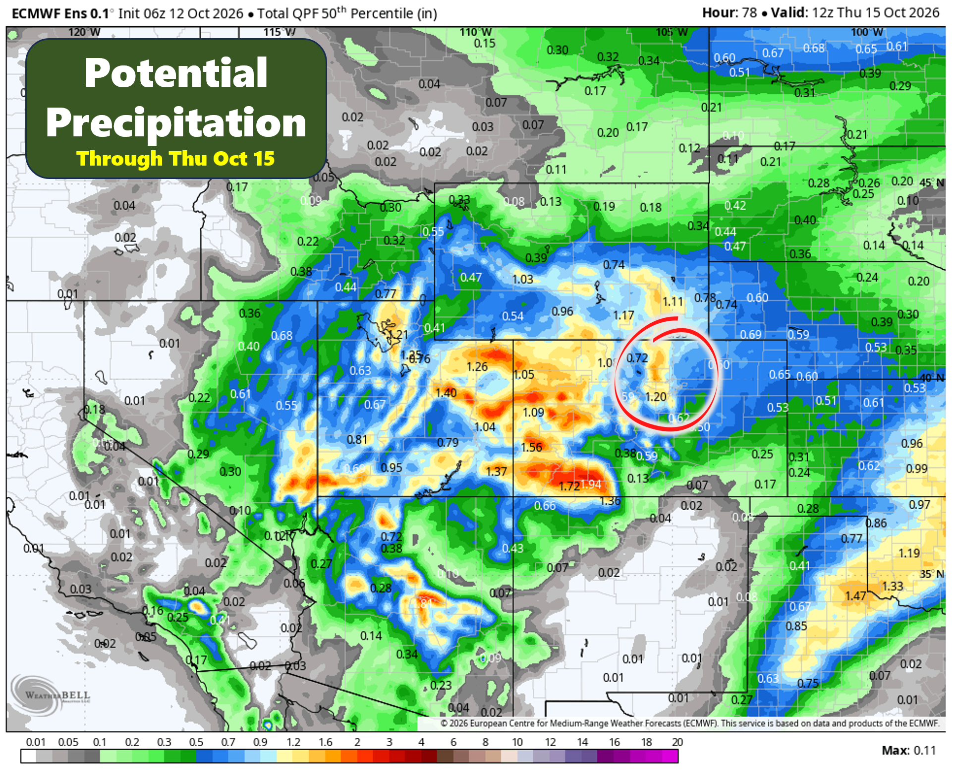
Looking beyond any single model run, the ensemble data tells a similar story. There’s still a healthy spread in potential outcomes, which is typical several days out, but the most likely rainfall totals for the Boulder-Denver area currently fall between 0.4 and 0.8 inches. Higher-end scenarios exceed an inch, while lower-end solutions generally still manage at least a tenth to two-tenths of an inch.
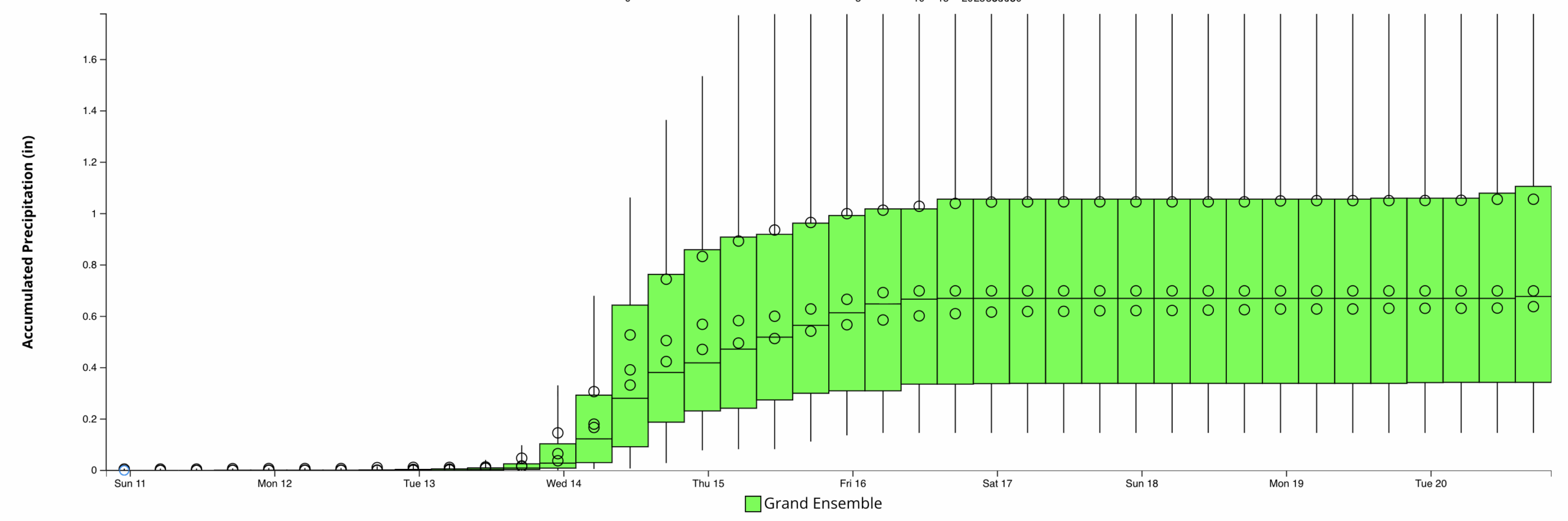
In other words, there remains uncertainty regarding exactly how much rain falls, but confidence is steadily increasing that most locations will receive at least some meaningful precipitation. Solutions featuring weak or ineffective upslope flow now appear to be in the minority rather than the rule.
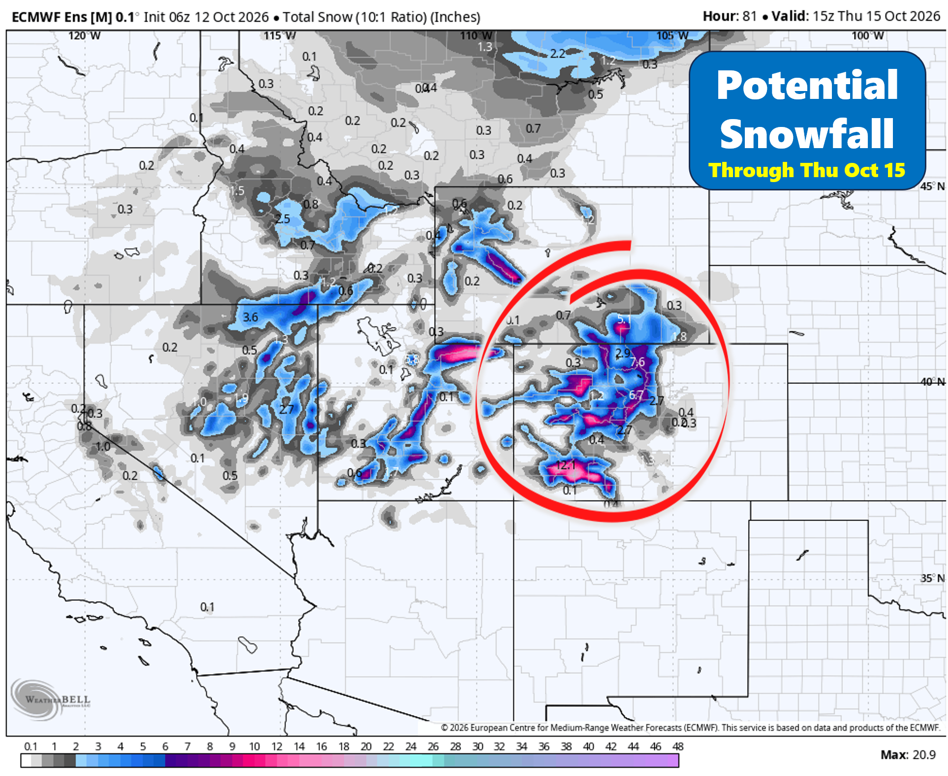
Meanwhile, colder air aloft should be sufficient to generate accumulating snow across portions of the High Country midweek. Snow levels will drop to the lowest levels we’ve seen so far this season. Areas above 9,000 feet could pick up several inches of accumulation. Current guidance supports a broad swath of 1 to 5 inches in these areas, with locally higher totals possible on the peaks, perhaps 5 to 10 inches along the Continental Divide. If you are traveling over any mountain passes, plan for winter driving conditions!
Frost Potential Emerging for Friday and Saturday Mornings
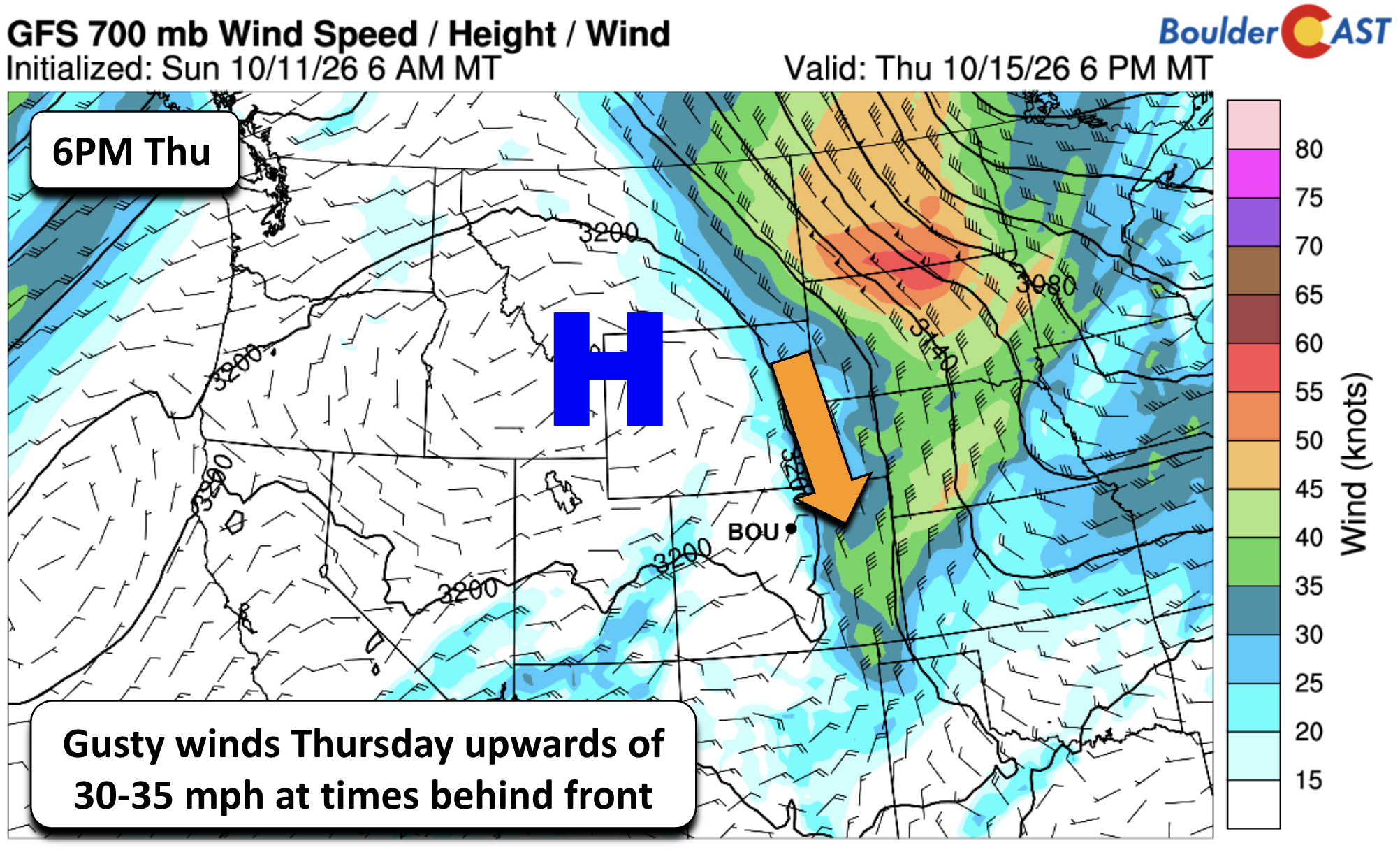
Attention then turns to a secondary surge of colder air expected late Thursday or Thursday night.
As this second cold front pushes through, gusty northwest winds may develop across portions of the Denver metro area and adjacent plains, with gusts potentially reaching 30 to 35 MPH at times. Forecast details will continue to evolve, particularly regarding how far west the coldest air ultimately settles.
Interestingly, guidance over the past several days has shifted the core of the Canadian air eastward compared to earlier projections. The coldest portion of the air mass is now expected to focus farther east across the Upper Midwest rather than directly over eastern Colorado. That trend matters because relatively small shifts in the strength of the western ridge can have meaningful impacts on overnight temperatures along the Front Range.
Even so, a substantially cooler air mass is expected to settle across the region by Friday as strong continental high pressure builds southward into the Rockies.
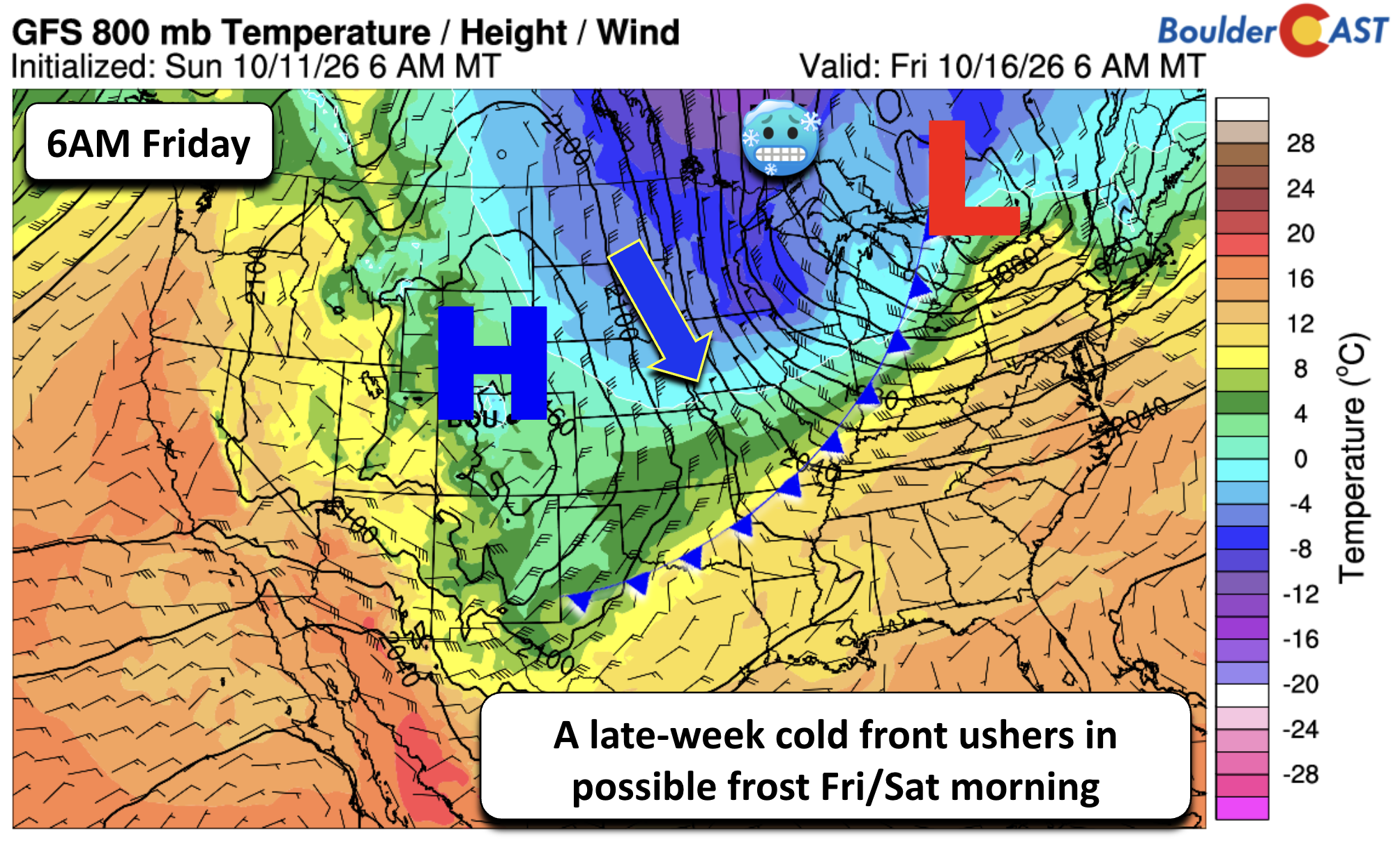
That brings our first credible frost threat of the season.
Ensemble guidance continues to show a fairly large spread in overnight temperatures Friday and Saturday mornings, with projected lows ranging from the lower 30s to the lower 40s depending on location and individual solutions. As a result, confidence in widespread frost remains only moderate at this time. However, colder pockets, sheltered neighborhoods, and outlying areas could easily flirt with frost, especially if skies clear and winds diminish overnight.
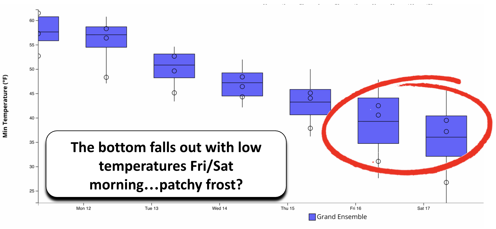
For now, consider frost potential something to watch closely rather than a lock. The signal is there, but we’ll need another day or two of model consistency before determining whether this becomes our first widespread frost event of the fall season.
Enjoy the cooler, wetter week ahead!
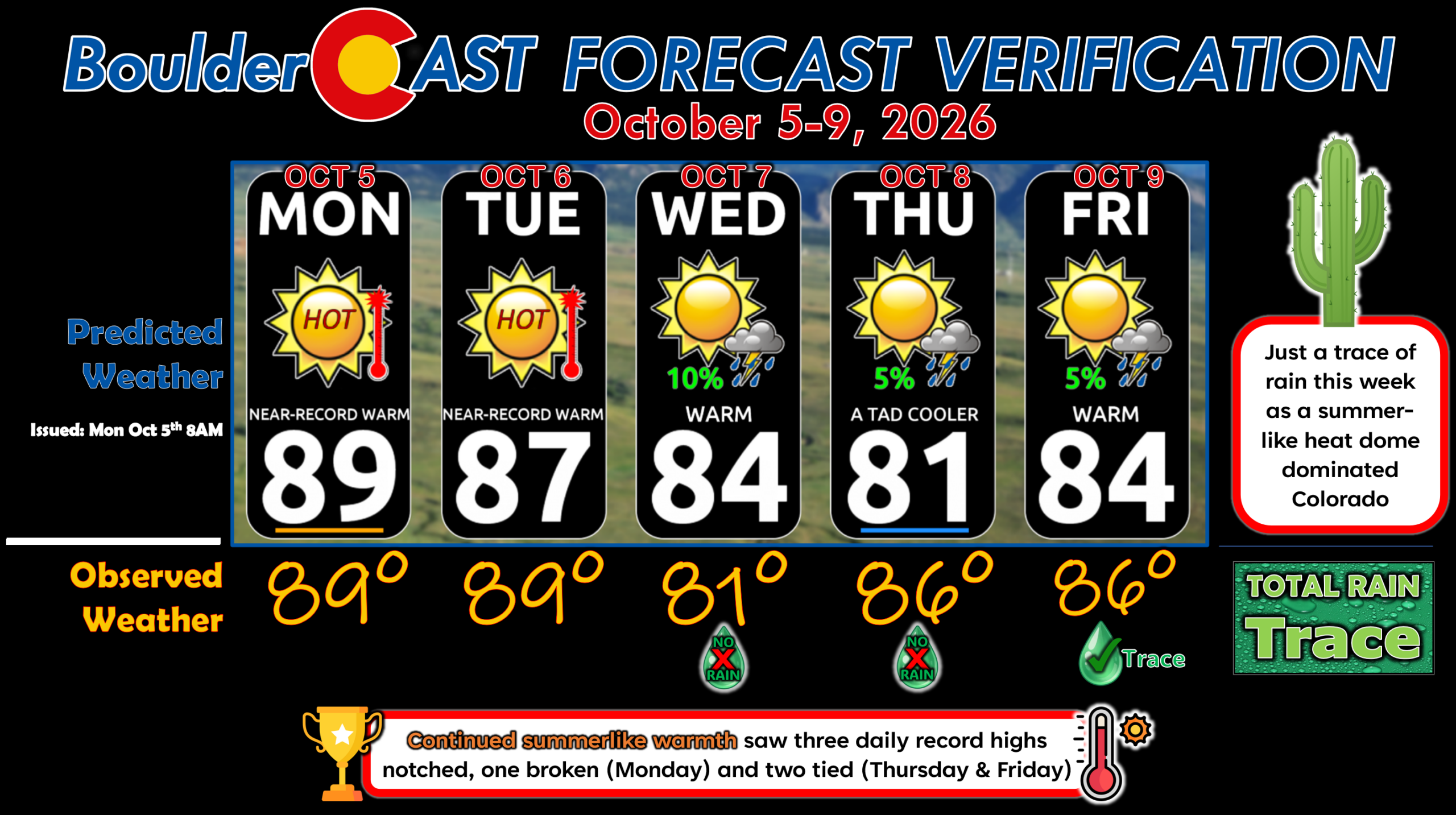
Forecast Verification: October 5-9, 2026 (Last Week)
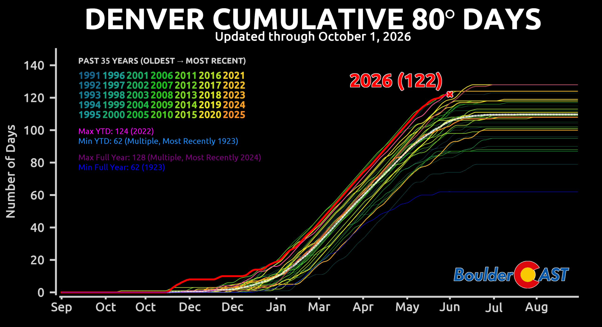
- Warm all week with every day reaching the 80s —- Boulder sits at a count of 138 for the year, an new all-time calendar year record.
- Largest temperature error was 5° on Thursday when the timing of a weak, backdoor cold front was misjudged and perhaps overestimated.
DISCLAIMER: This weekly outlook forecast is created Monday morning and covers the entire upcoming week. Accuracy will decrease as the week progresses as this post is NOT updated. To receive daily updated forecasts from our team, among many other perks, subscribe to BoulderCAST Premium.
Go Premium, get all the perks.
Daily Forecast Updates
Get our daily forecast discussion every morning delivered to your inbox.
All Our Model Data
Access to all our Colorado-centric high-resolution weather model graphics. Seriously — every one!
Ski & Hiking Forecasts
6-day forecasts for all the Colorado ski resorts, plus more than 120 hiking trails, including every 14er.
Smoke Forecasts
Wildfire smoke concentration predictions up to 84 hours into the future.
Exclusive Content
Weekend outlooks every Thursday, bonus storm updates, historical data and much more!
No Advertisements
Enjoy ad-free viewing on the entire site.
Enjoy our content? Give it a share!












Leave a Reply
You must be logged in to post a comment.