After a quick burst of weekend snow and our coldest temperatures since early December, the week ahead turns much quieter across Colorado. Temperatures will climb steadily as Boulder and Denver stay dry into the New Year, while the Mountains prepare for a well‑timed round of snow for the holiday weekend. We’ll walk you through the day‑to‑day weather this week, where the snow will fall, and check in on long‑range guidance which still isn’t advertising much in the way of winter for eastern Colorado.
This week’s highlights include:
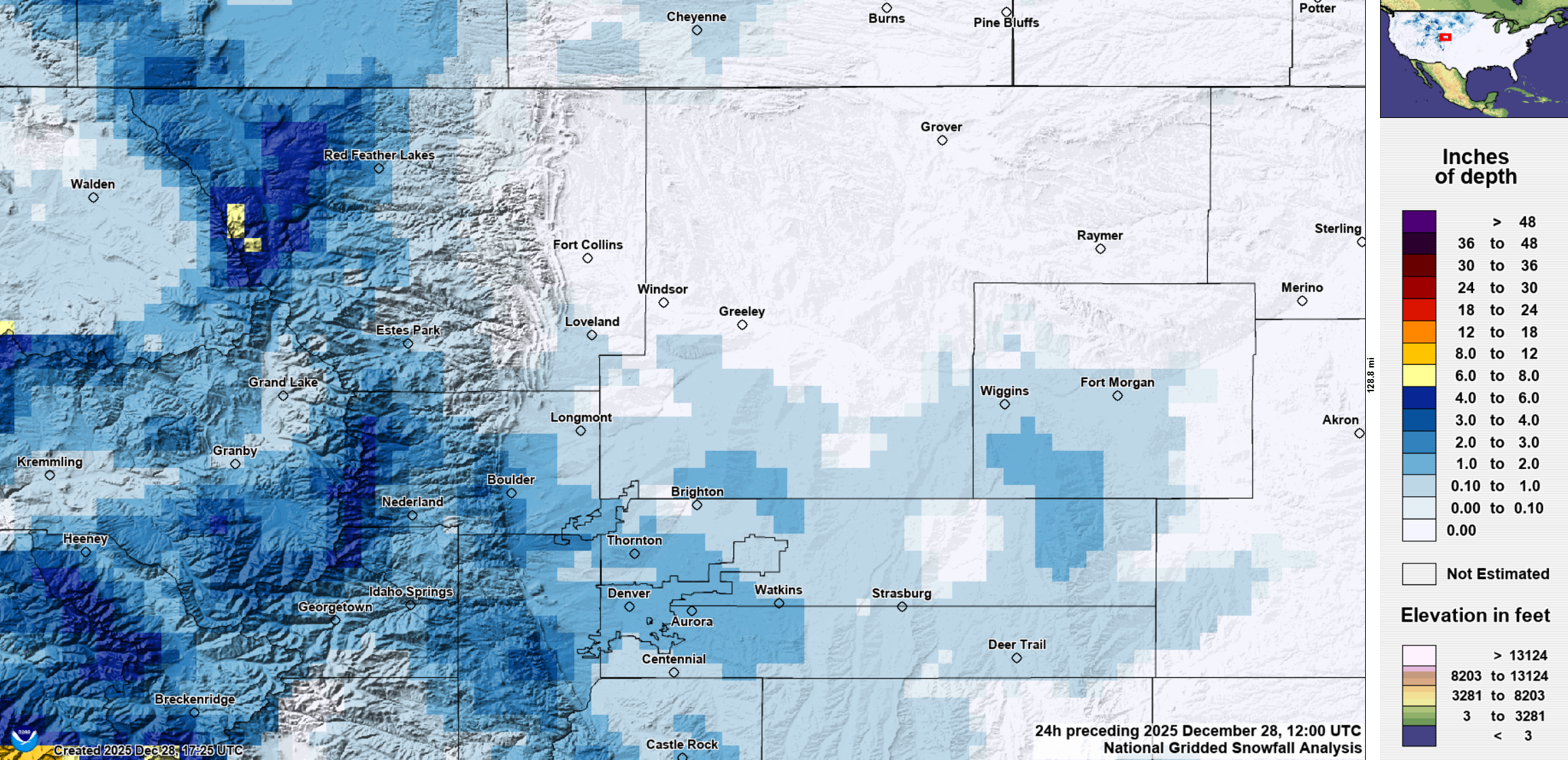
- ❄️ Hello Again Cold & Snow: Weekend snow brought up to 3″ locally, with Monday morning being the coldest since early December.
- 🌤️ Warm & Dry Week Ahead: Quiet, warming pattern this week as a West Coast ridge rebuilds over the region.
- 🌧️ More Heavy Rain/Snow in California: Atmospheric river slams California Thu–Sat; this same moisture reaches Colorado but gets blocked by the Divide.
- 🏔️ Mountain Snow Late-Week: The Mountains will pick up several inches of snow Thursday into Friday, while Boulder/Denver stay mild and dry.
- 🌡️ Temperature Trend Up: Temps climb from 40s today into the 50s Tuesday and near 60° by mid‑week.
- 🔥 Fire Danger on Temporary Pause: Fire danger stays low for now, but winds late weekend + ongoing drought will bring concerns back in time.
DISCLAIMER: This weekly outlook forecast is created Monday morning and covers the entire upcoming week. Accuracy will decrease as the week progresses as this post is NOT updated. To receive daily updated forecasts from our team, among many other perks, subscribe to BoulderCAST Premium.

Go Premium, get all the perks.
Daily Forecast Updates
Get our daily forecast discussion every morning delivered to your inbox.
All Our Model Data
Access to all our Colorado-centric high-resolution weather model graphics. Seriously — every one!
Ski & Hiking Forecasts
6-day forecasts for all the Colorado ski resorts, plus more than 120 hiking trails, including every 14er.
Smoke Forecasts
Wildfire smoke concentration predictions up to 72 hours into the future.
Exclusive Content
Weekend outlooks every Thursday, bonus storm updates, historical data and much more!
No Advertisements
Enjoy ad-free viewing on the entire site.
Another warm, mostly dry week
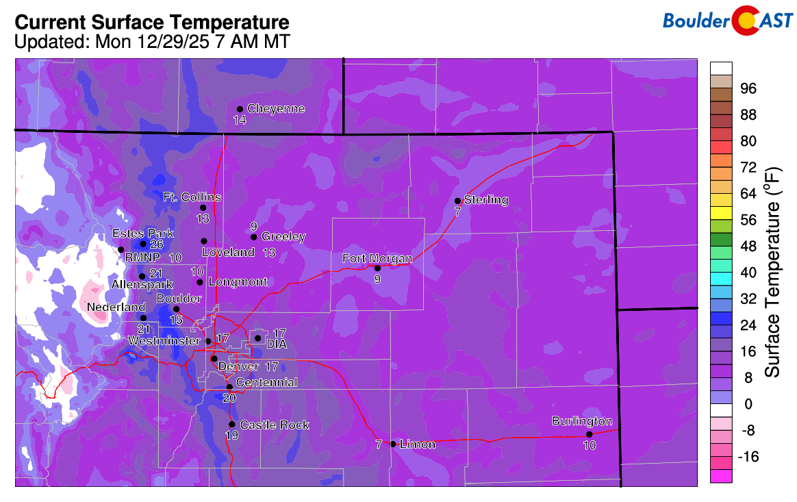
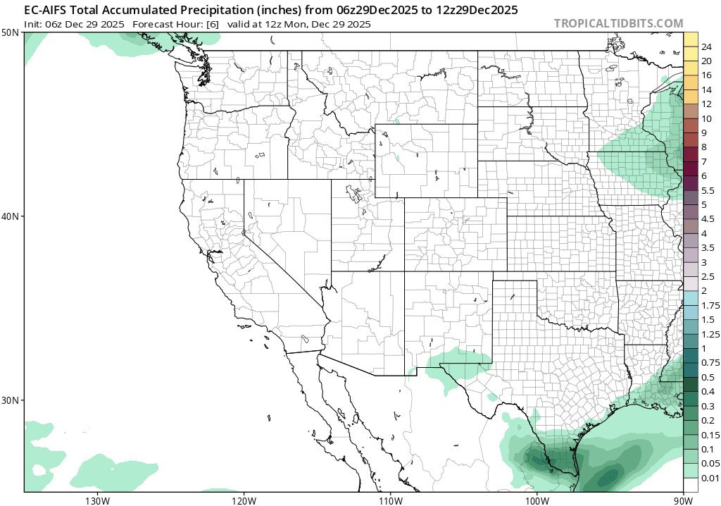
After our quick‑hitting weekend snow event—one which dropped up to 3 inches in parts of the Metro area—the holiday week ahead is looking much quieter across Colorado. Temperatures will climb a little each day, too. The snow didn’t bring the moisture we really need, but it did snap us back into winter mode after more than three weeks without meaningful cold or snow.
As of Monday morning, we’re starting off in the teens and single digits across northeast Colorado. It’s Boulder’s coldest morning since early December, and it’ll end up being the coldest day of the week.
The broader pattern this week features yet another anomalous ridge of high pressure anchoring itself along the West Coast. Colorado sits downstream of that ridge to start the week and eventually gets pulled directly underneath it—very similar to what we saw around Christmas. Not until late week does the ridge flatten enough to allow a few shortwaves to slip into the state.

Meanwhile, California is gearing up for another round of potentially dangerous heavy rain and mountain snow from Thursday into Saturday as deep tropical moisture surges into the Southwest.
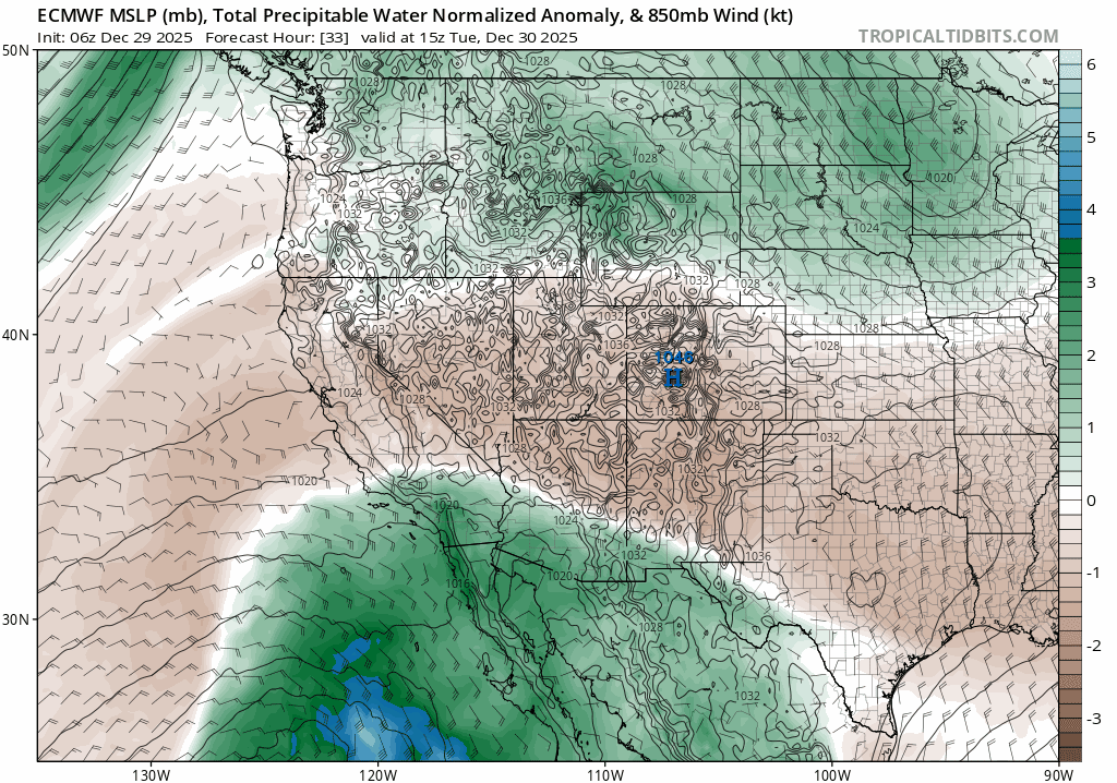
Some of that moisture will drift into Colorado Thursday and Friday, but models agree it won’t make it past the Continental Divide in any meaningful way.
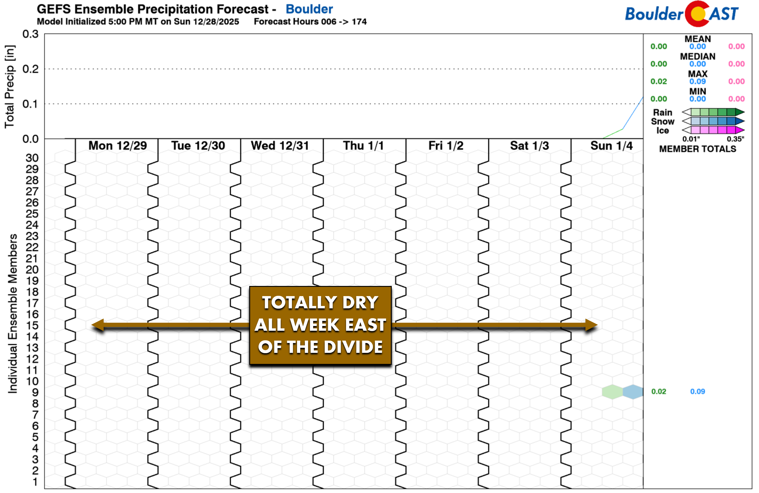
So for Boulder and Denver, it’s a mild, dry week ahead.
The Mountains, however, are in line for several inches of snow beginning Thursday and continuing into Friday—good timing for the long holiday weekend and any planned snow adventures. Totals don’t look huge right now, but some ranges could top 6 inches. The west‑southwest flow won’t favor the Front Range peaks, but other mountain zones should do reasonably well.

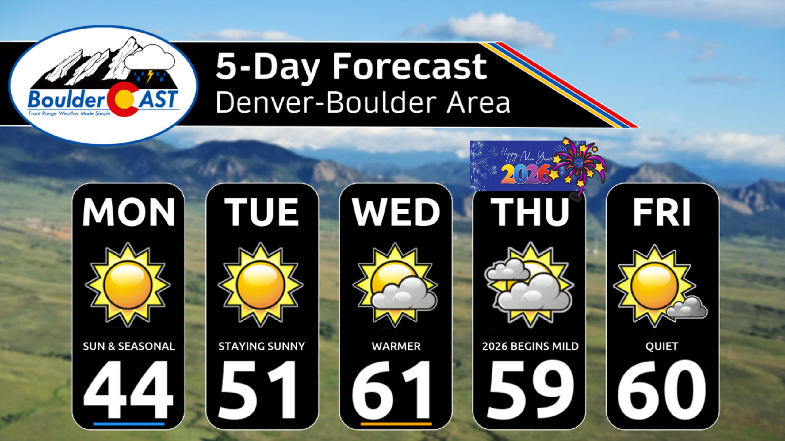
Monday will be the coldest day of the week, with highs near normal in the low to mid‑40s under full sunshine.
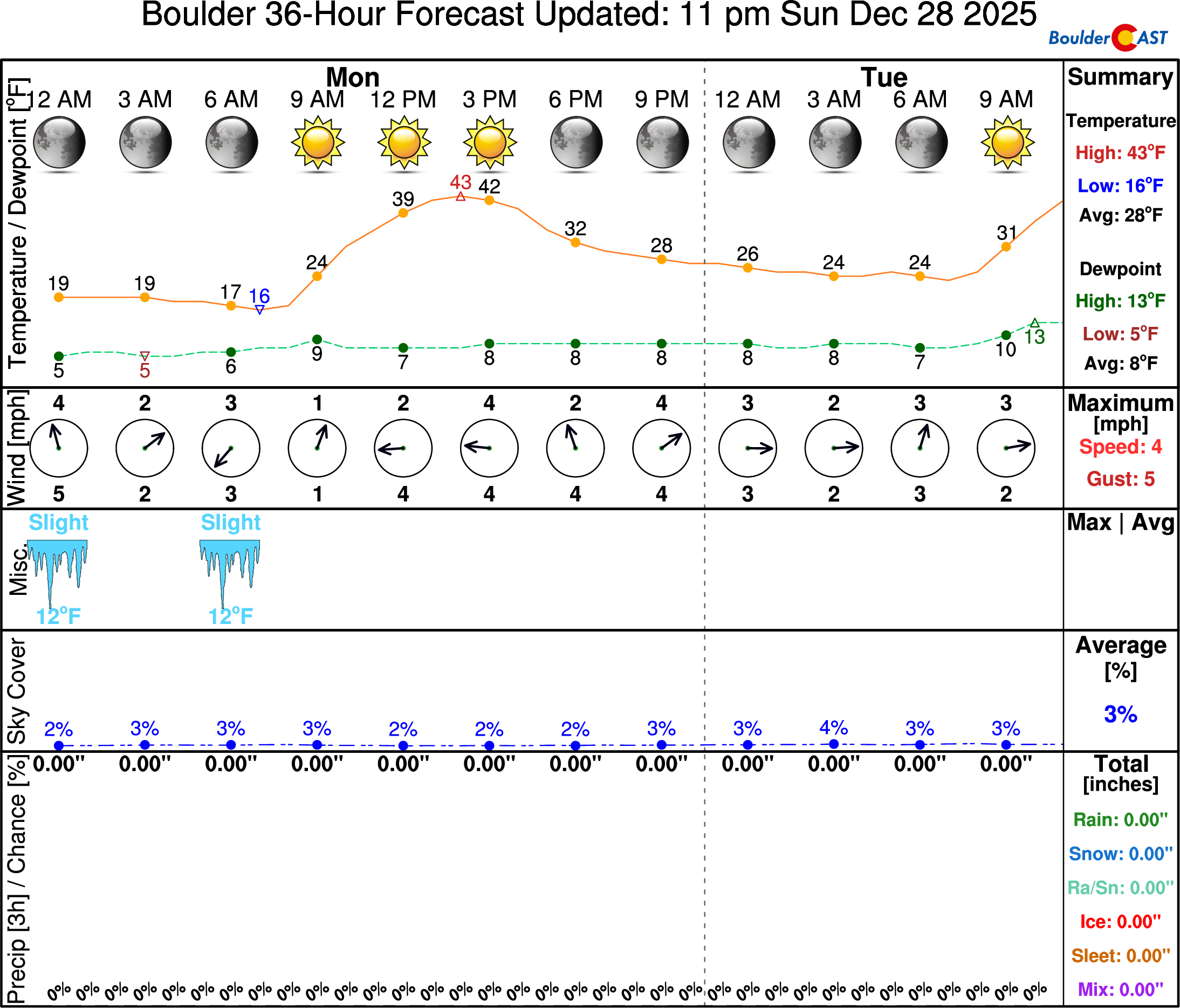
From there, temperatures steadily climb: lower 50s Tuesday, then pushing toward 60° by Wednesday and beyond. Holiday travelers around Boulder or Denver won’t run into any weather issues, though Mountain passes could see slick spots on New Year’s Day into Friday. Wednesday evening and night looks brisk (40s dropping into the 30s) but pleasant for outdoor plans or celebrations.
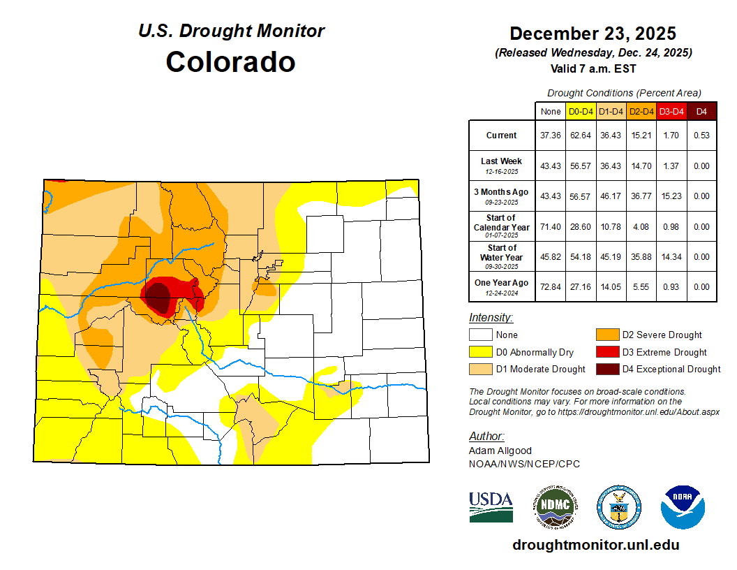
Recent snowfall and the lack of strong winds will keep fire danger in check for now, but drought remains firmly in place across the Front Range. Winds are expected to pick up late in the upcoming weekend, which could bring fire‑weather concerns back into the picture.
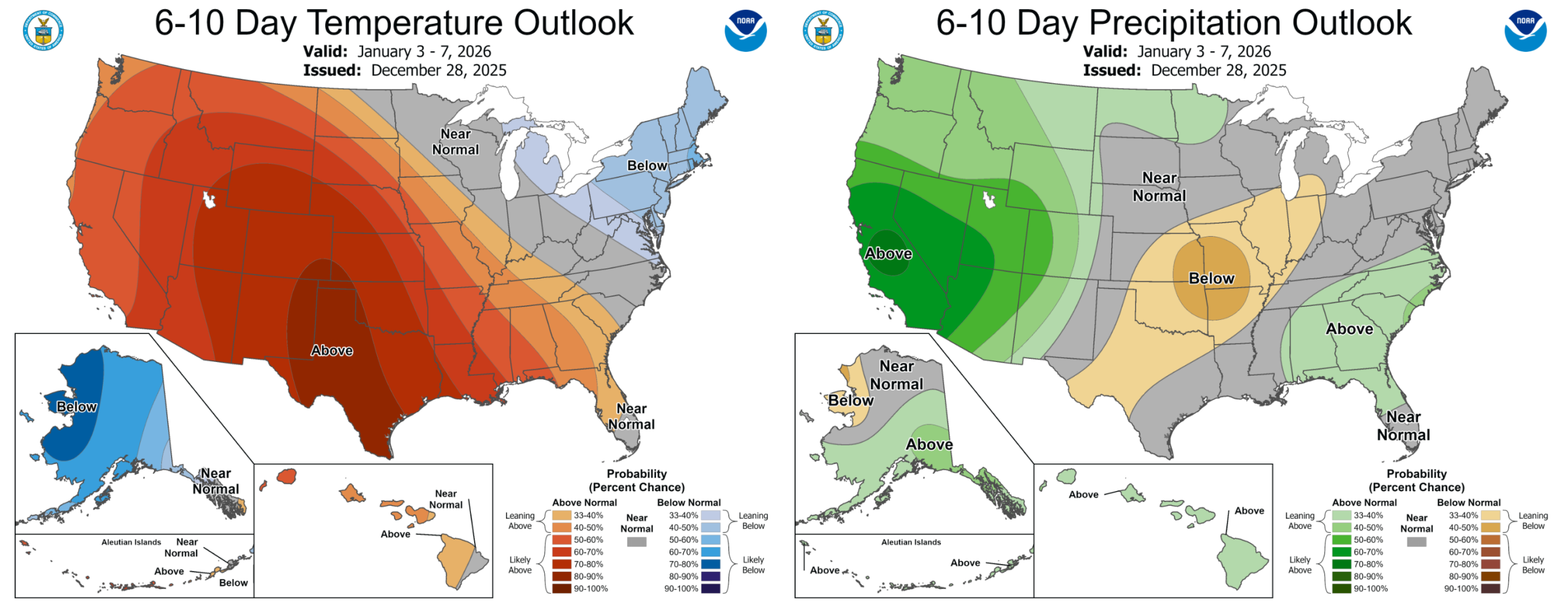
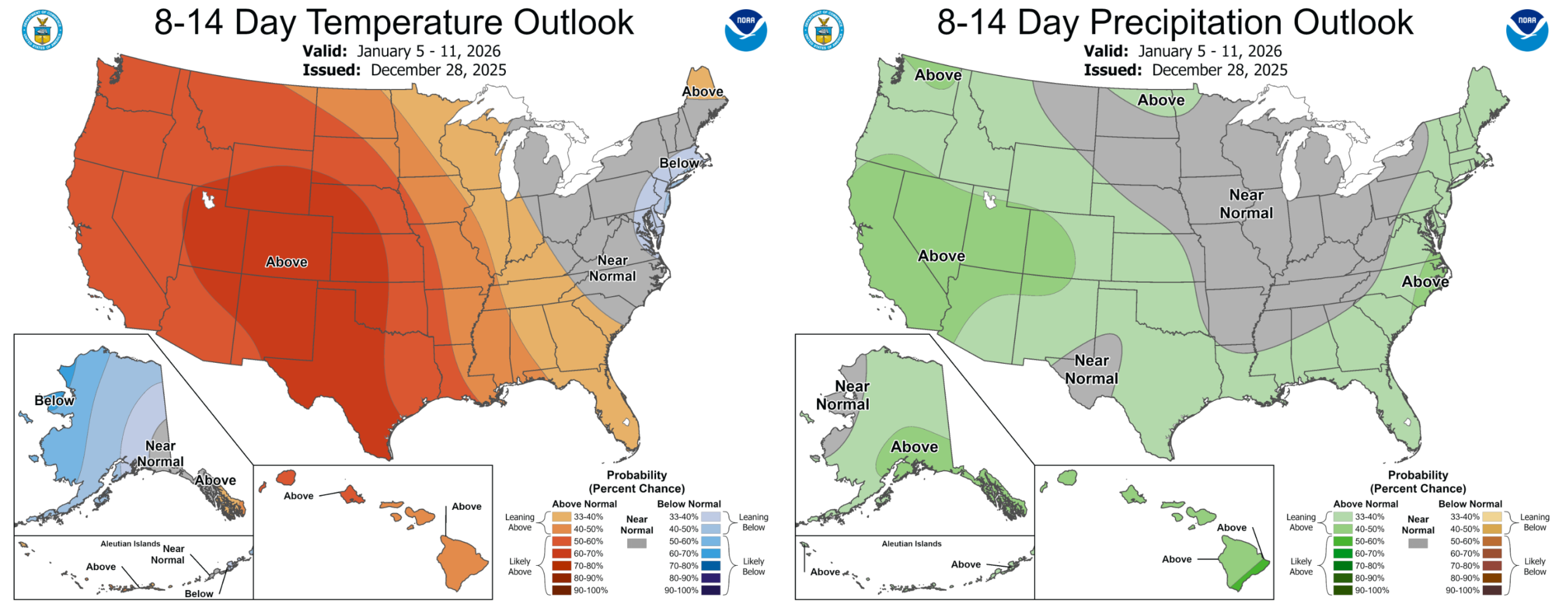
And looking farther out, long‑range guidance still isn’t showing any major pattern shift for early 2026. Eastern Colorado is likely to stay warmer and drier than normal for much of the next two weeks. The Mountains, at least, will continue to see periodic snow chances thanks to the active Southwest storm track.
Have a safe, healthy and wonderful transition to 2026, Happy New Year!
Forecast Specifics:
Monday: After a cold morning, sunny skies warm us nicely into the lower to middle 40s for highs on the Plains, with lower 30s in the Foothills.
Tuesday: Sunny skies and light winds. Highs reach the lower 50s on the Plains with upper 30s in the Foothills.
Wednesday: Warmer temperatures and more clouds around with highs topping out near 60 degrees on the Plains with upper 40s in the Foothills.
Thursday: Clouds will be more prevalent during the day with moisture streaming in aloft. Temperatures may drop a degree or two as a result, but we’re still expecting upper 50s on the Plains with upper 40s in the Foothills.
Friday: Quiet to end the week with partly to moistly sunny skies. Temperatures will reach around 60 degrees across the Plains with upper 40s in the Foothills.
Weekend: Continued calm and mild weather. No chance for precipitation and highs generally ranging from 55 to 65 degrees.
DISCLAIMER: This weekly outlook forecast is created Monday morning and covers the entire upcoming week. Accuracy will decrease as the week progresses as this post is NOT updated. To receive daily updated forecasts from our team, among many other perks, subscribe to BoulderCAST Premium.
Go Premium, get all the perks.
Daily Forecast Updates
Get our daily forecast discussion every morning delivered to your inbox.
All Our Model Data
Access to all our Colorado-centric high-resolution weather model graphics. Seriously — every one!
Ski & Hiking Forecasts
6-day forecasts for all the Colorado ski resorts, plus more than 120 hiking trails, including every 14er.
Smoke Forecasts
Wildfire smoke concentration predictions up to 72 hours into the future.
Exclusive Content
Weekend outlooks every Thursday, bonus storm updates, historical data and much more!
No Advertisements
Enjoy ad-free viewing on the entire site.
Enjoy our content? Give it a share!


If the high temperature on Wednesday exceeds 60, will that set a record for most 60° days in Boulder?
Yes, sir…we will take the record if we reach 60 degrees before 5PM on Wednesday! Good reminder.