The Christmas holiday week starts off on the cold to chilly side as an area of low pressure continues to impact us from the central United States. There will be another chance of snow late tonight on Christmas into Tuesday, but only light accumulations are expected south and southeast of Denver. However, blizzard conditions are set to unfold across far eastern Colorado with travel eastward becoming impossible at times Monday night into Wednesday. A trend towards drier and warmer weather is in-store for the latter part of the week and to close out 2023. Read on for the latest details.
This week’s highlights include:
- A blocking pattern across the nation traps a huge mid-level low pressure over the central US into midweek, keeping Colorado in a cold to chilly northerly flow
- An additional chance of snow Christmas night into Tuesday is possible with the system but only light amounts at best, mainly southeast of Denver
- Blizzard conditions are headed to far eastern Colorado Monday night into Wednesday — expect dangerous and even impossible travel at times
- Warmer and drier weather will unfold for us during the latter part of the week as ridging builds eastward — highs near 50°F with mild conditions to round out 2023
DISCLAIMER: This weekly outlook forecast is created Monday morning and covers the entire upcoming week. Accuracy will decrease as the week progresses as this post is NOT updated. To receive daily updated forecasts from our team, among many other perks, subscribe to BoulderCAST Premium.

Go Premium, get all the perks.
Daily Forecast Updates
Get our daily forecast discussion every morning delivered to your inbox.
All Our Model Data
Access to all our Colorado-centric high-resolution weather model graphics. Seriously — every one!
Ski & Hiking Forecasts
6-day forecasts for all the Colorado ski resorts, plus more than 120 hiking trails, including every 14er.
Smoke Forecasts
Wildfire smoke concentration predictions up to 72 hours into the future.
Exclusive Content
Weekend outlooks every Thursday, bonus storm updates, historical data and much more!
No Advertisements
Enjoy ad-free viewing on the entire site.
Christmas Eve snow totals
The highly-anticipated holiday rain to snow event came and went this weekend, with most areas ending up in the lower bounds of our forecast. The storm didn’t play out exactly as expected, they rarely do, but snow amounts did eventually land in the ballpark of expectations. It’s a bit disappointing considering what potentially could have unfolded from this storm in the Front Range had it gotten its act together a little earlier. More on that in a bit in the weekly outlook section to follow…
Shown below is our snowfall forecast map issued Saturday morning with actual storm totals overlaid. Green values indicate that our forecast verified to within one inch of the observed snowfall total. Red numbers did not. As you can see, we had minor snow amounts of 1-3″ across much of the Denver Metro area, with just a dusting or less in the northern parts. 4 to 11″ of snow fell throughout the Foothills solidifying a white Christmas for all above 6500 feet!
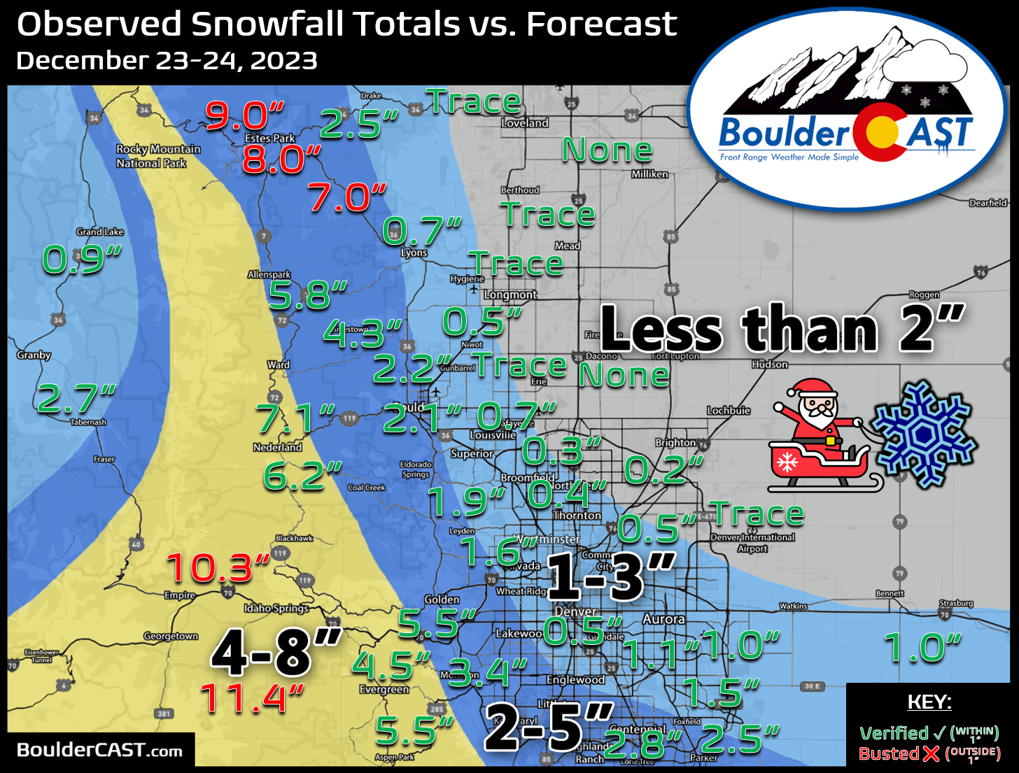
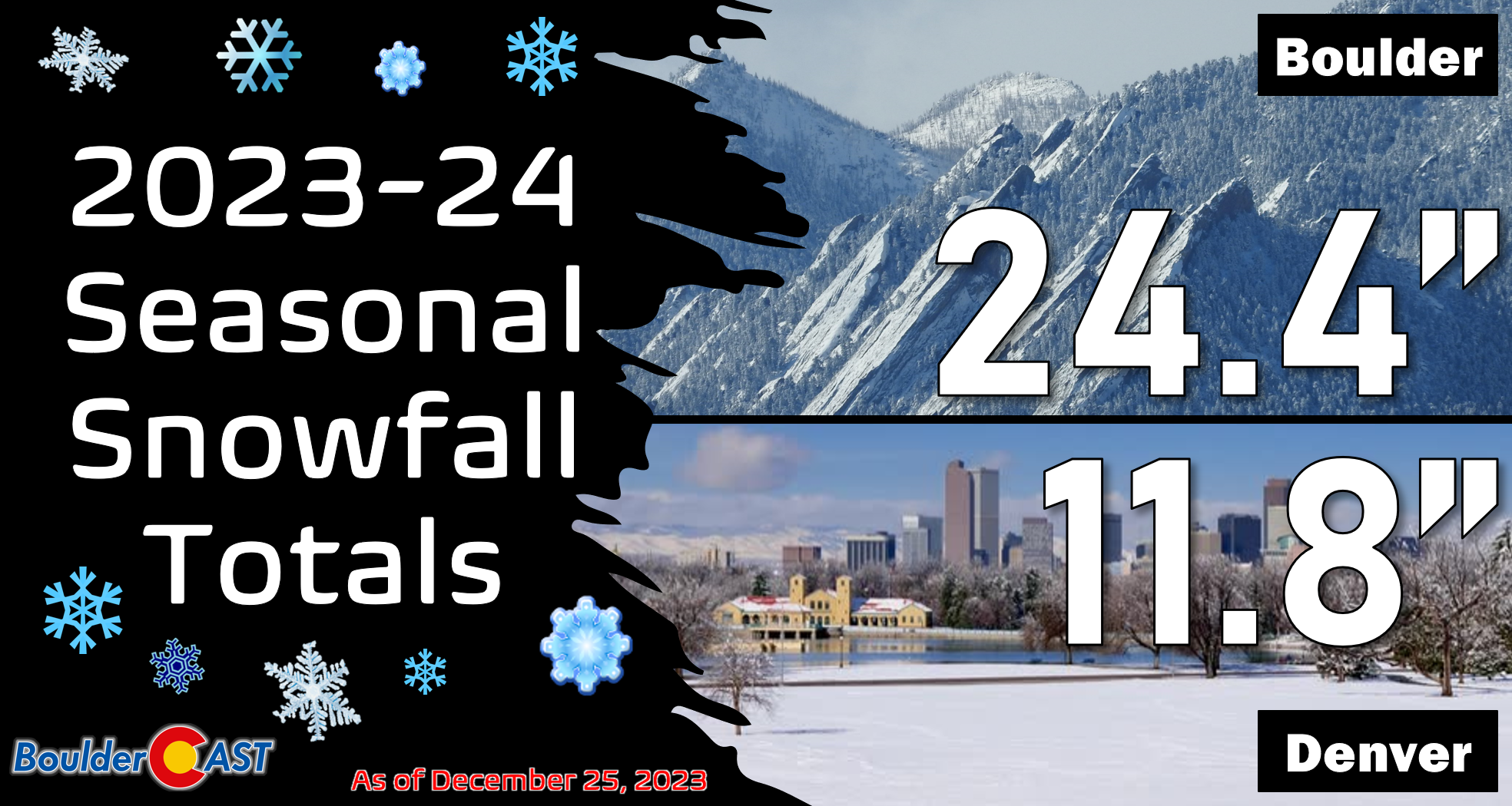
With this, Boulder has further expanded its seasonal lead over Denver, officially reporting 2.1″ of snow this weekend while Denver (DIA) recorded just a trace.
Cold to chilly with a chance of snow to start the week
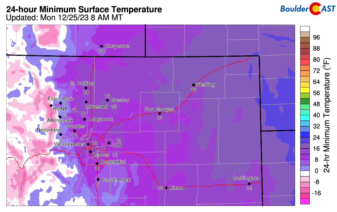
As of writing, Christmas morning has recorded the coldest temperature so far this season at our station (and many others around the Metro area), owing to the clear skies and fresh dusting of snow. At this point last year many areas had already dipped towards -20°F at least once or twice thanks to a couple significant Arctic outbreaks!
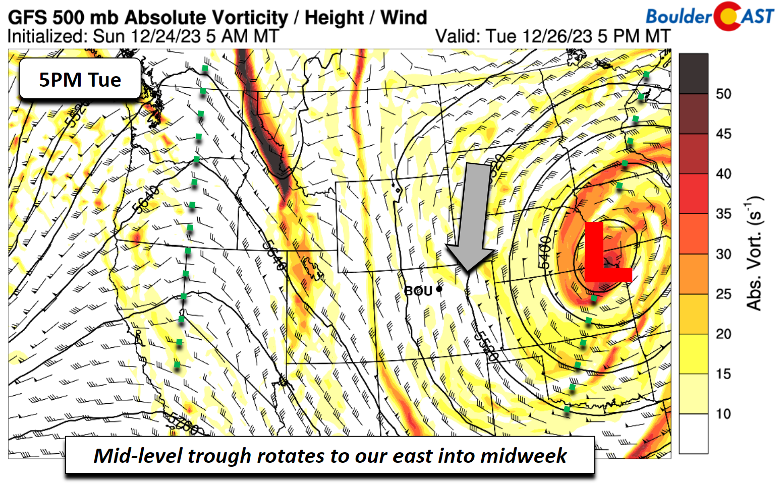
The trough at mid-levels which brought us snow late Saturday into Christmas Eve will further impact portions of eastern Colorado into midweek as the residual huge low pressure rotates counter-clockwise over the Great Plains region.
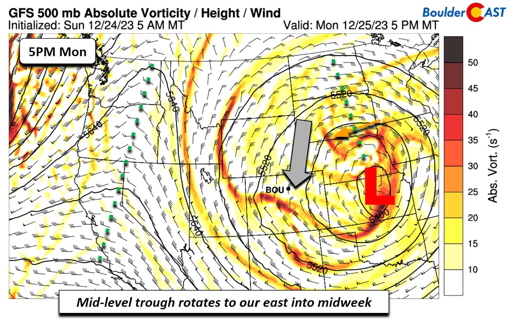
A blocking pattern with ridging over both coastlines of the United States will help the mid-level trough stay puts in the Great Plains and continue to promote strong, cold, northerly flow over Colorado into Wednesday.
Monday into Tuesday, the system will bring a wave of energy into the Front Range and northeast Colorado as a slight NNE flow develops over the Denver Metro. With plenty of cold air in place and highs in the low 30s Monday and upper 30s on Tuesday, the precipitation type would be all snow.
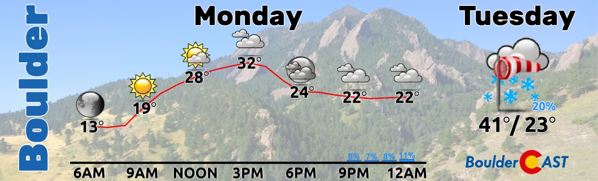
Gusty winds are favored today and tomorrow over portions of the Metro area, highest on Tuesday with gusts pushing into the 25 to 45 MPH range, especially east of Interstate 25.
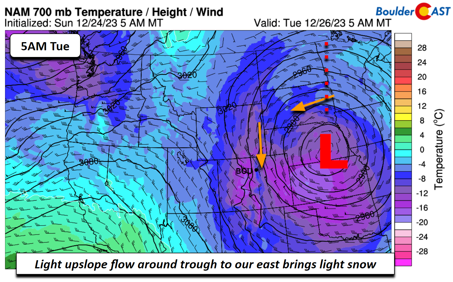
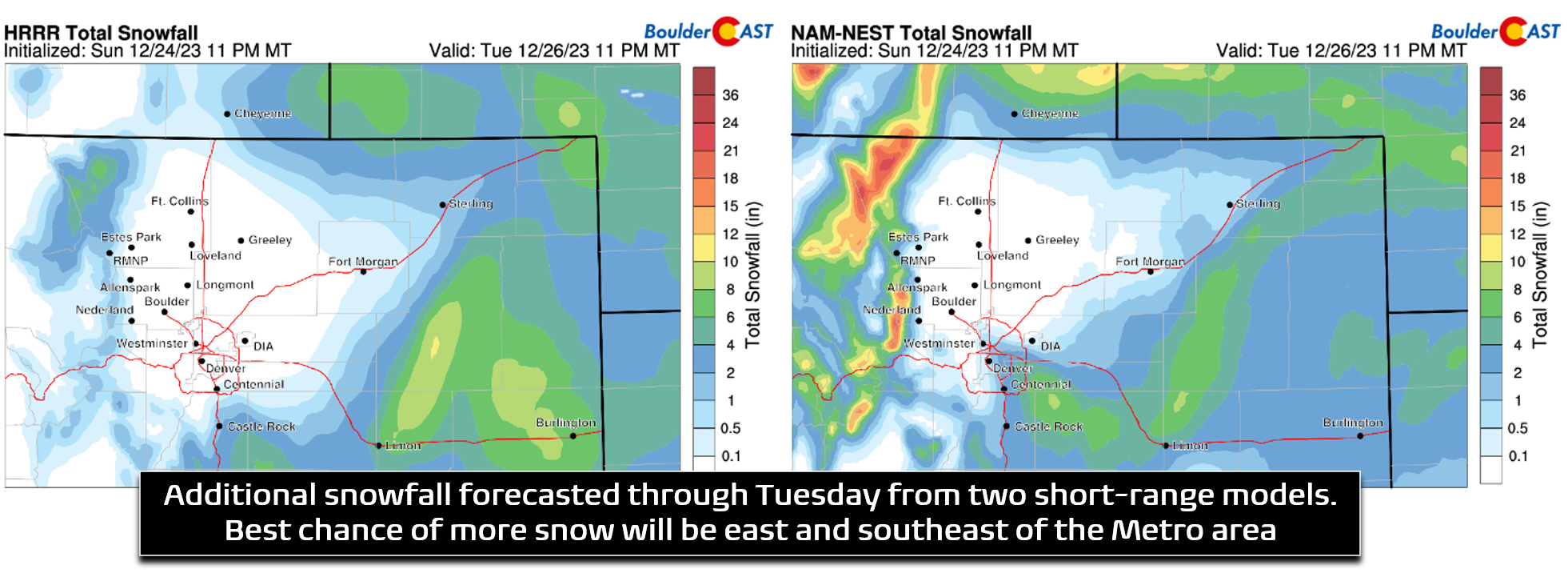
The GFS/ECMWF (GFS below) models both suggest a light band of snow oriented NW to SE over the Front Range and Foothills overnight tonight into midday Tuesday. However, amounts, if any, look to be on the light side.
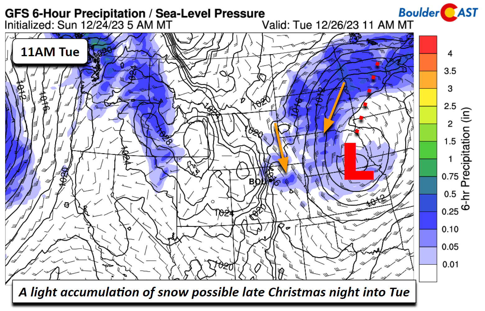
Short-range models suggest that the northern Metro area, including Boulder, will be at risk for some downslope during this period and likely will see little to no snowflakes, perhaps up to a light dusting at best. All in all, we don’t expect much accumulation from this system unfortunately, with 0 to 2 inches possible, highest in areas east and southeast of Denver. Our temperatures will warm Wednesday but likely remain near or slightly below normal in the low 40s with dry conditions.
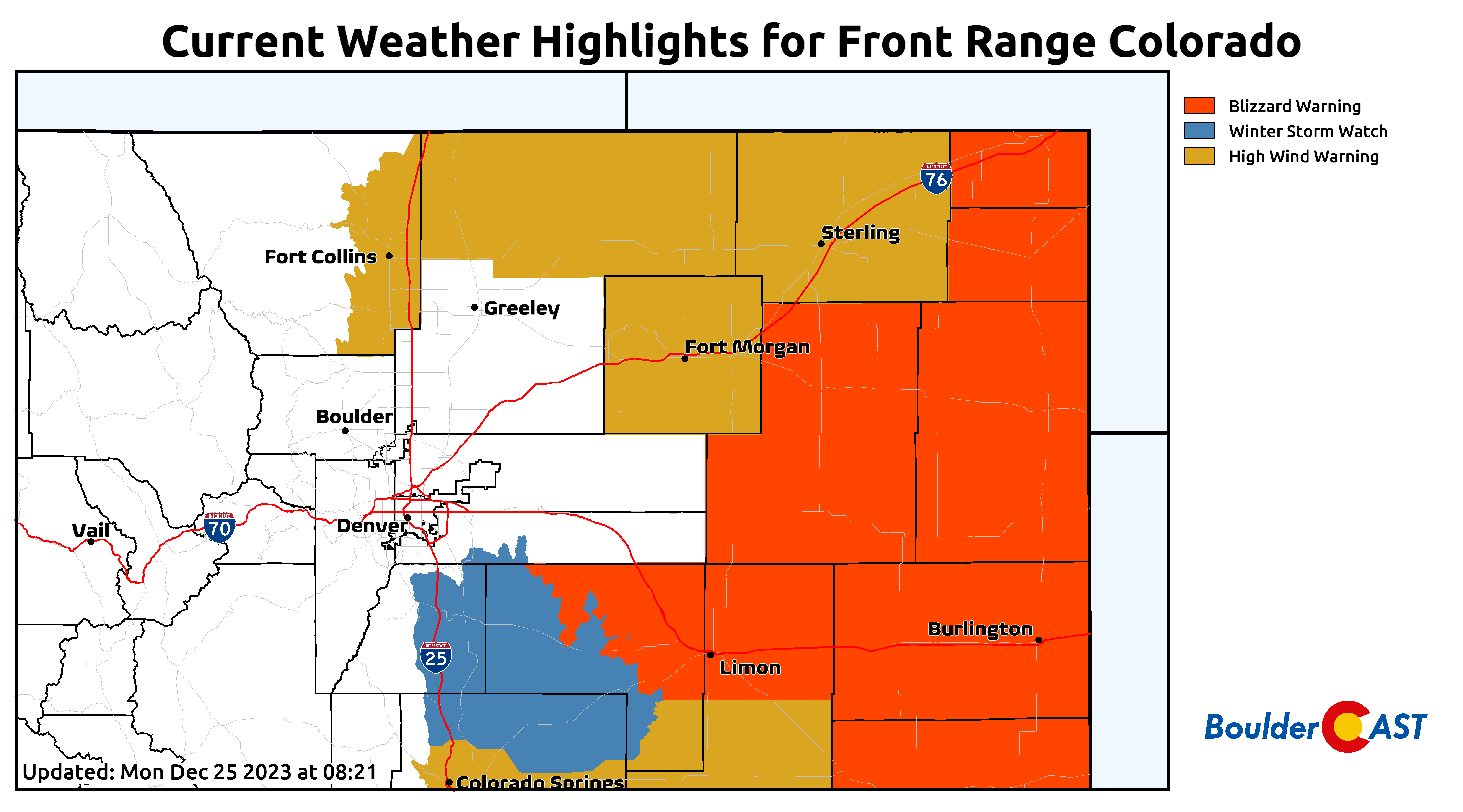
Further to the east in Colorado, all bets will be off with blizzard conditions expected late Monday into early Wednesday. A huge swath of Nebraska and South Dakota will see heavy snow and strong winds overlapping early in the week, with 10 to 20 inches of white stuff possible in some areas as the big storm stalls out and even wobbles back westward. These same areas could see 50 to 80 MPH wind gusts at the same time making travel impossible for a day or two! This is the exact situation that the initial outlier model solutions were showing for the Front Range last week. Fortunately (or unfortunately if you love crippling snowstorms), the ultimate evolution of the atmosphere spawned this monster storm well to our east!
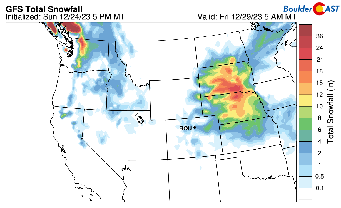
Blizzard Warnings are posted for a large area in anticipation of the heavy snow and strong winds with impossible travel likely in the coming days.
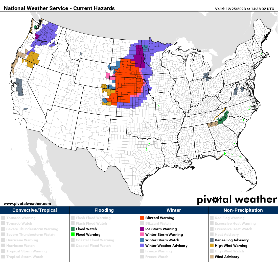
This does include portions of eastern Colorado which will be most at risk for whiteout (blizzard) conditions Monday night into Wednesday morning, even though only 3-6″ of snow are expected. Use extreme caution if travelling east during this timeframe as it is very likely we see full closures of Interstates 70, 76 and/or 80!
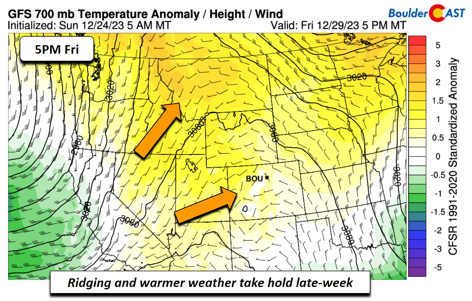
Ending the week on the dry & mild side
Most model guidance shows that the big ol’ trough will finally slide east Thursday and Friday as ridging builds into the area.
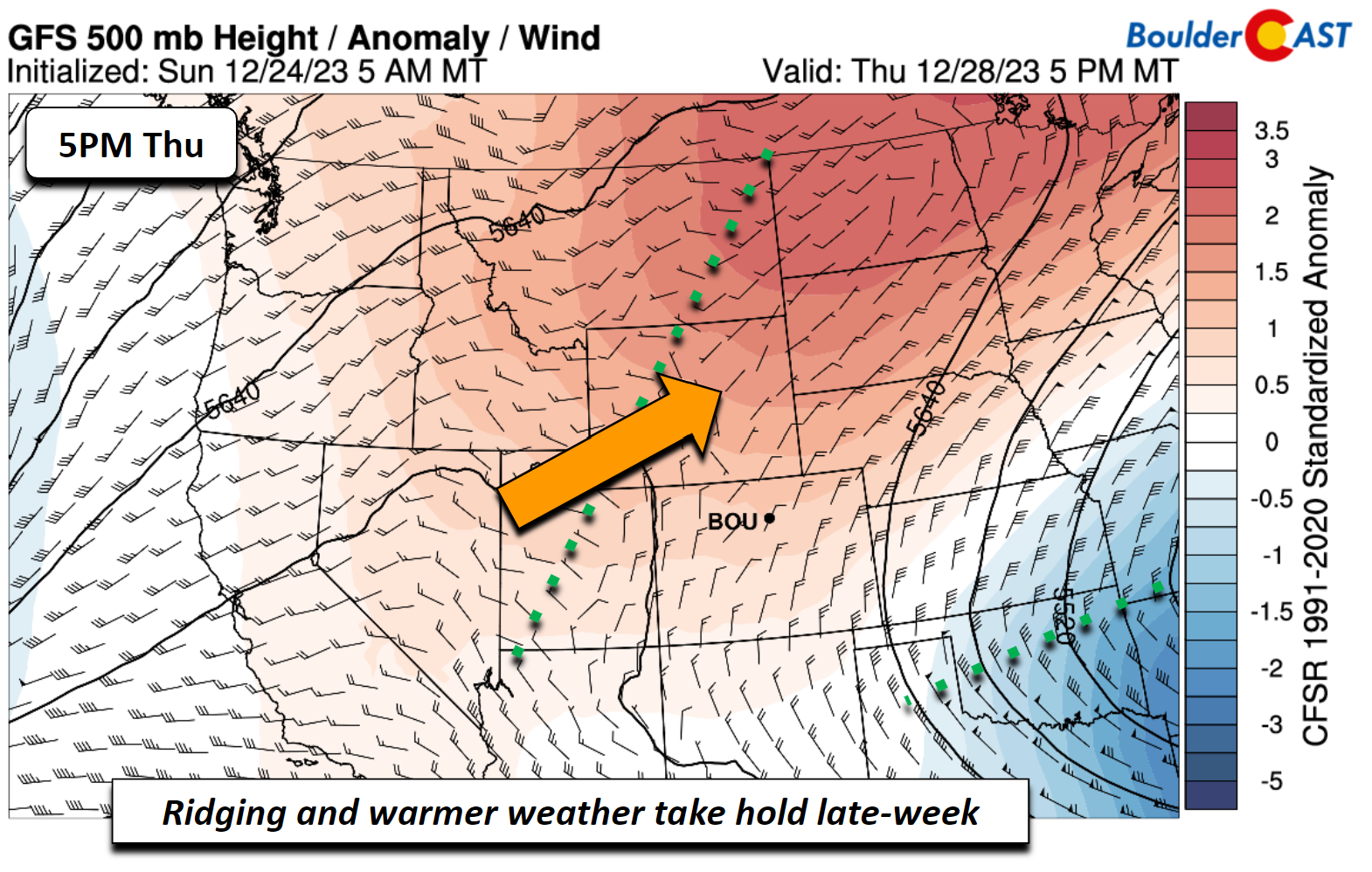
This should promote warm advection with our temperatures getting back into the upper 40s to low 50s by the end of the week.
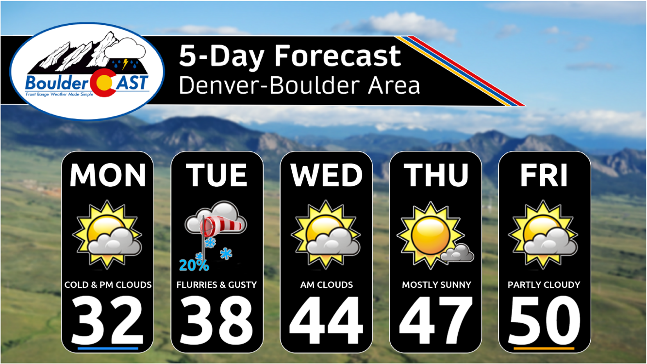
Here’s a look at the week — not too bad at all!
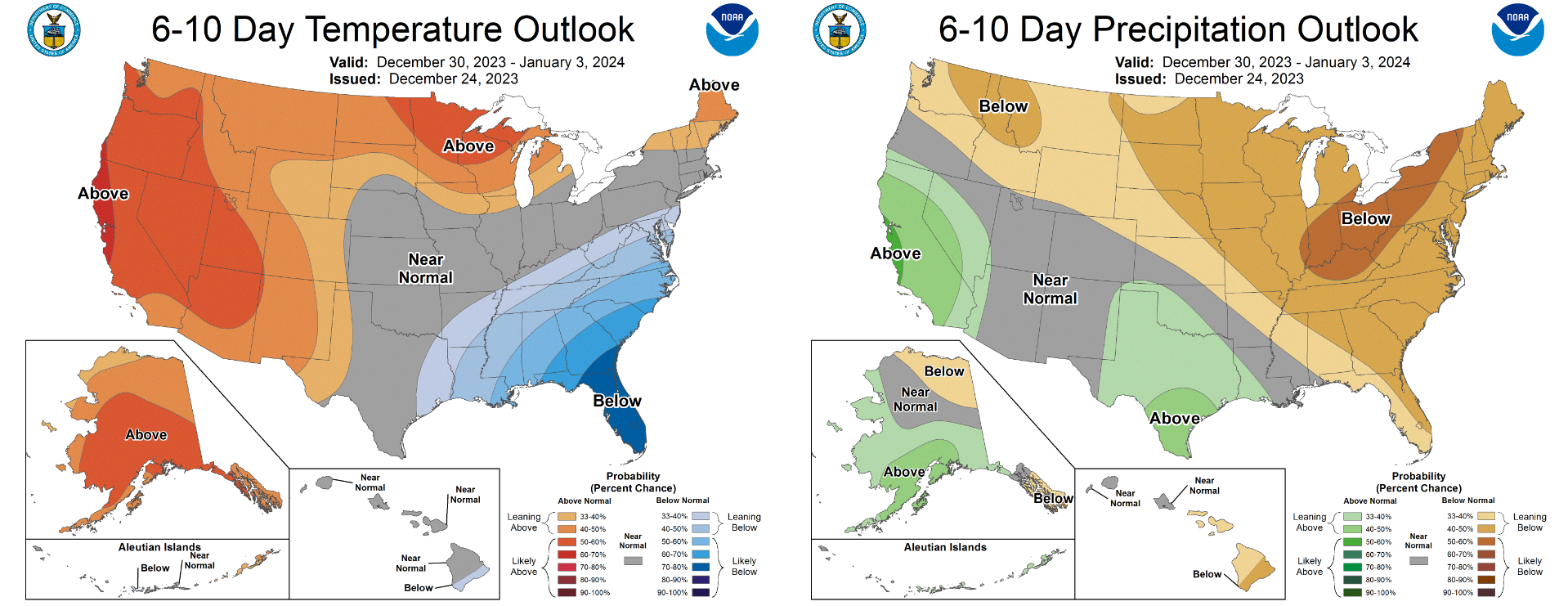
These dry and mild (but not terribly warm) temperatures are likely to persist through the rest of 2023, as shown by the 6-10 day outlooks from the Climate Prediction Center below.
That’s all we have for you this week. Be sure to follow us on Twitter, Facebook, and (finally now) on Threads for intermittent impromptu updates on Front Range weather.
From all of us at BoulderCAST,
we wish you a Happy Holidays!
![]()
If you want to help support the passionate work we do here at BoulderCAST and/or wish to receive a morning weather update from us every single day for the next year, consider subsubscring to BoulderCAST Premium; our 2023 holiday sale is ongoing through the end of the year.

Get BoulderCAST updates delivered to your inbox:
Forecast Specifics:
Monday: Morning sun but increasing clouds later in the day. Watch for light snow developing in the nighttime into early Tuesday, mainly east and southeast of Denver. Highs in the low 30s on the Plains and low 20s in the Foothills.
Tuesday: A few flurries possible, but most areas remain dry. Partly to mostly cloudy skies with gusty winds in some areas during the day up of 20 to 40 MPH, mainly east of Interstate 25. Highs in the upper 30s on the Plains and upper 20s in the Foothills.
Wednesday: Morning clouds but turning sunnier during the day. Staying chilly with highs in the low 40s on the Plains and low 30s in the Foothills.
Thursday and Friday: Partly to mostly sunny and mild. Highs top out in the upper 40s to low 50s for the Plains and around 40 degrees in the Foothills.
DISCLAIMER: This weekly outlook forecast is created Monday morning and covers the entire upcoming week. Accuracy will decrease as the week progresses as this post is NOT updated. To receive daily updated forecasts from our team, among many other perks, subscribe to BoulderCAST Premium.
Go Premium, get all the perks.
Daily Forecast Updates
Get our daily forecast discussion every morning delivered to your inbox.
All Our Model Data
Access to all our Colorado-centric high-resolution weather model graphics. Seriously — every one!
Ski & Hiking Forecasts
6-day forecasts for all the Colorado ski resorts, plus more than 120 hiking trails, including every 14er.
Smoke Forecasts
Wildfire smoke concentration predictions up to 72 hours into the future.
Exclusive Content
Weekend outlooks every Thursday, bonus storm updates, historical data and much more!
No Advertisements
Enjoy ad-free viewing on the entire site.
Enjoy our content? Give it a share!


You must be logged in to post a comment.