December has been anything but typical along the Front Range, with Boulder shattering warmth records and enduring weeks of bone‑dry weather that have fueled fire danger and stressed our local trees. As we head into Christmas, the holiday will feel more like patio season than sledding weather, with record highs likely and no snow available outside of the Mountains. But don’t pack away the winter gear just yet—a sharp cooldown and even a chance for light snow are on the horizon this weekend. We take a closer look this historically warm and dry December, the scorching Christmas forecast, and peek ahead to what’s next.

Go Premium, get all the perks.
Daily Forecast Updates
Get our daily forecast discussion every morning delivered to your inbox.
All Our Model Data
Access to all our Colorado-centric high-resolution weather model graphics. Seriously — every one!
Ski & Hiking Forecasts
6-day forecasts for all the Colorado ski resorts, plus more than 120 hiking trails, including every 14er.
Smoke Forecasts
Wildfire smoke concentration predictions up to 72 hours into the future.
Exclusive Content
Weekend outlooks every Thursday, bonus storm updates, historical data and much more!
No Advertisements
Enjoy ad-free viewing on the entire site.
What You Need to Know
🌡️ Historic December warmth: The Front Range is seeing one of its warmest Decembers ever, with multiple 70° days and record highs/lows shattered.
📊 Unusual streaks: 61% of December days have been in the 60s or 70s in Boulder; we barely avoided an unprecedented 16+ day run of extreme warmth.
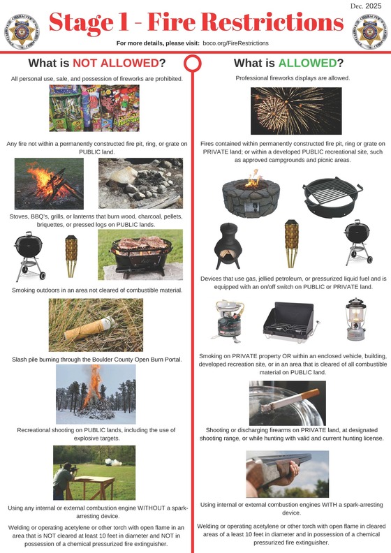
🔥 Extreme dryness & fire danger: Little to no snow has fallen in weeks with drought deepening statewide. A Stage 1 fire ban now in effect for Boulder County.
🌱 Tree care during these trying times— Trees and shrubs should be watered given the ongoing warm and dry spell, with little to no relief in sight.
🎄 Brown Christmas forecast — Near‑record warmth expected Christmas Eve/Day, with rain/snow showers in the Mountains
❄️ Weekend cooldown ahead — Strong cold front Saturday night will finally bring below‑normal temps to the Metro area and a light shot of snow.
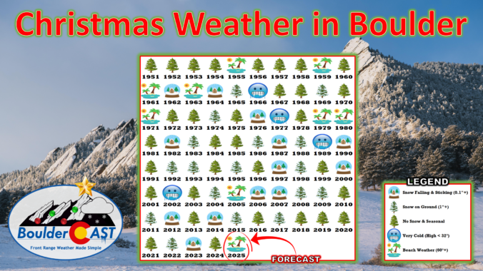
Warm & dry lead-up to Christmas 2025
The lead up an anticipation of a white Christmas in 2025 has been anticlimactic to say the least. We’ve known for a while now that that, pending an absolute miracle, this would be a very brown Christmas for the Denver-Boulder area, as the broader weather pattern has been stacked against us for weeks, keeping snow chances near zero.
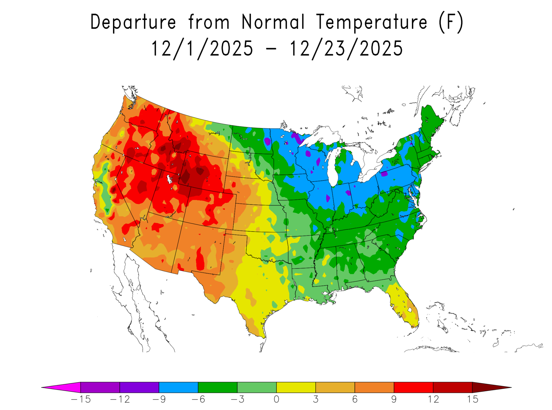
What’s caught us off guard is just how warm this December has been. This will be one of Boulder’s all-time warmest Decembers, something echoed across the entire West which has seen temperatures 5 to 15 degrees above normal so far.
For Boulder, month-to-date this December has been the warmest for overall average temperature, average high temperature and average low temperature since the current climate station near NIST in south Boulder was established in ~1990. When considering all data across multiple observation sites in the city dating back to the late 1800s, December 2025 so far ranks in the Top 7 for each category as well — it truly has been exceptional warmth on all fronts this month.
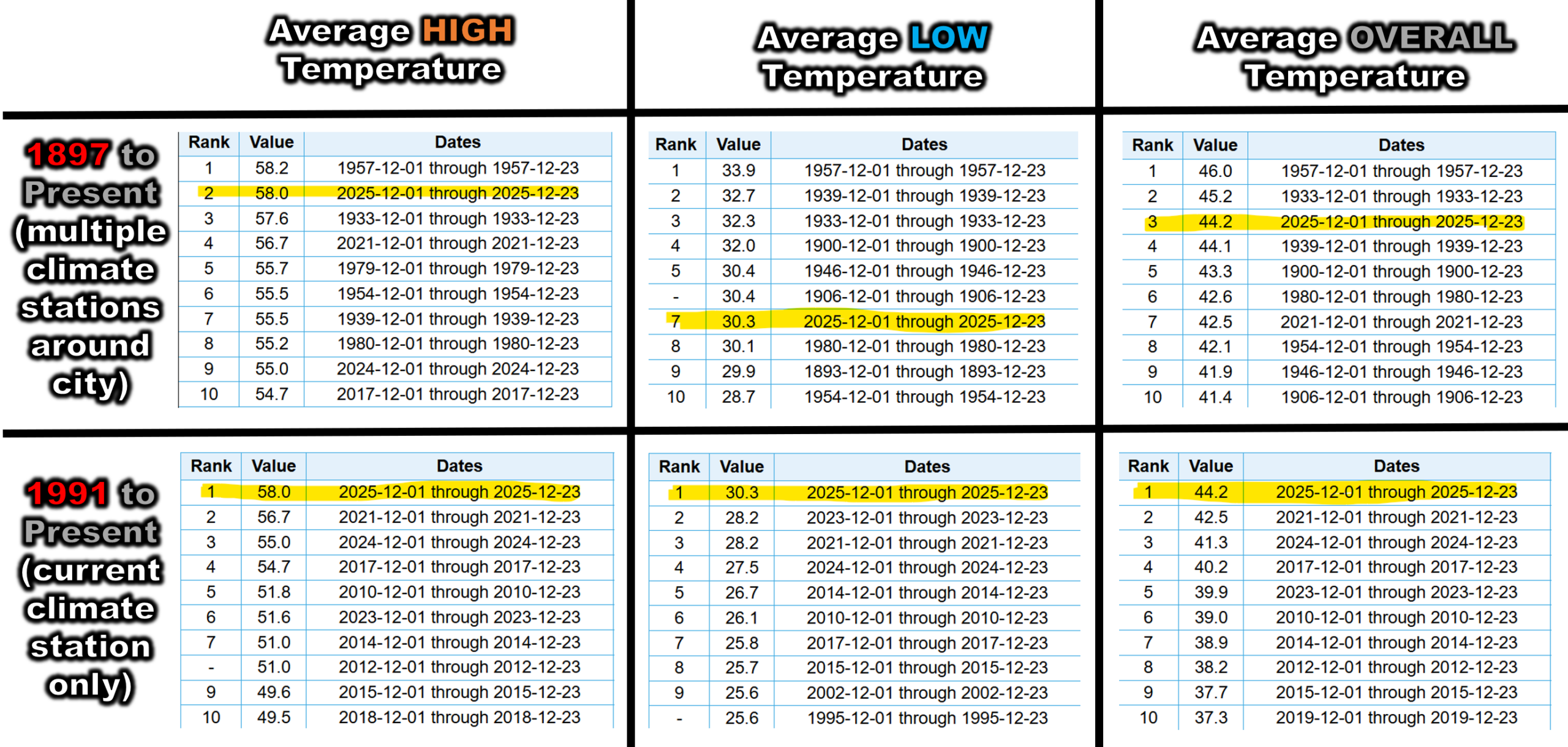
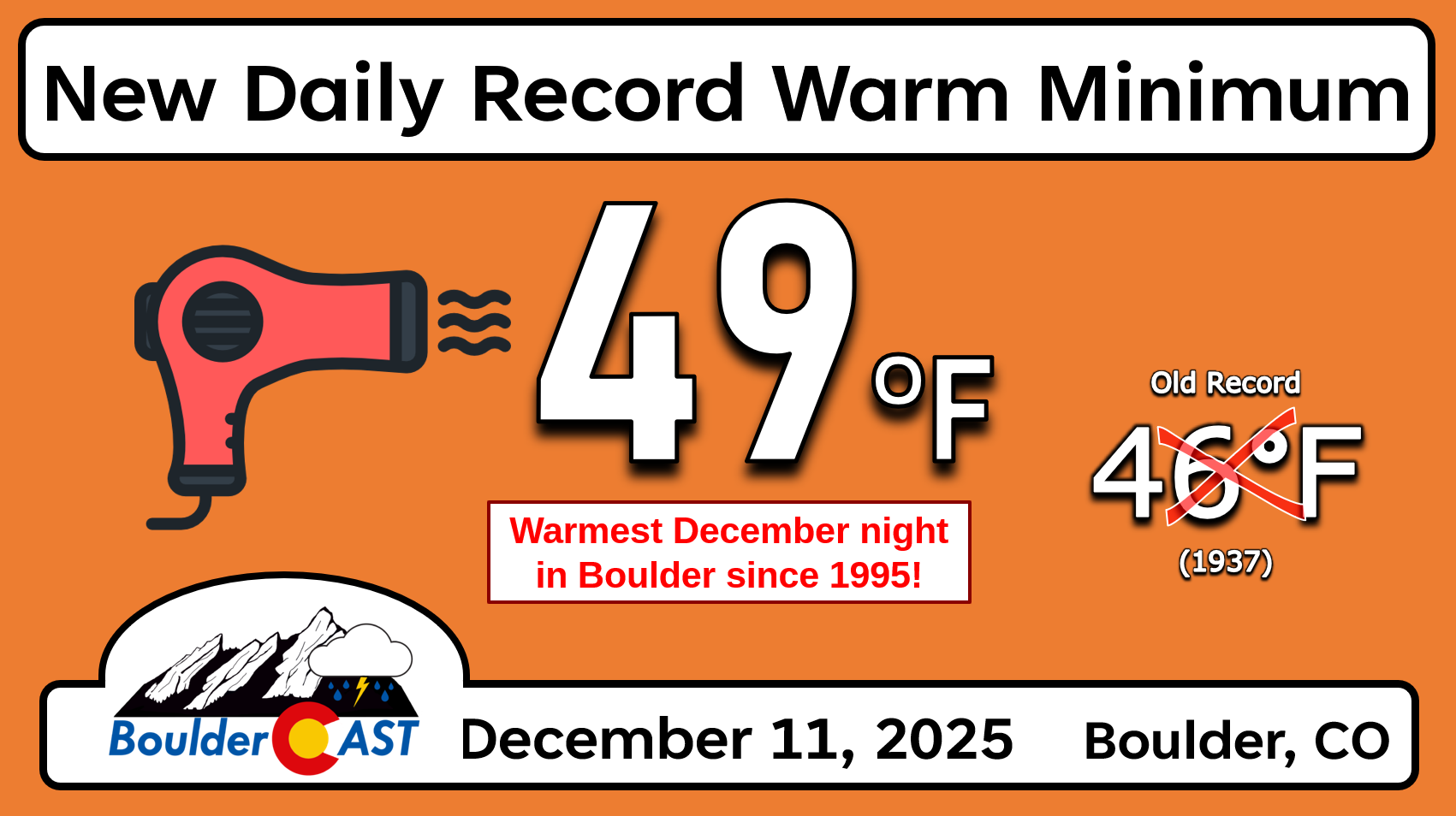
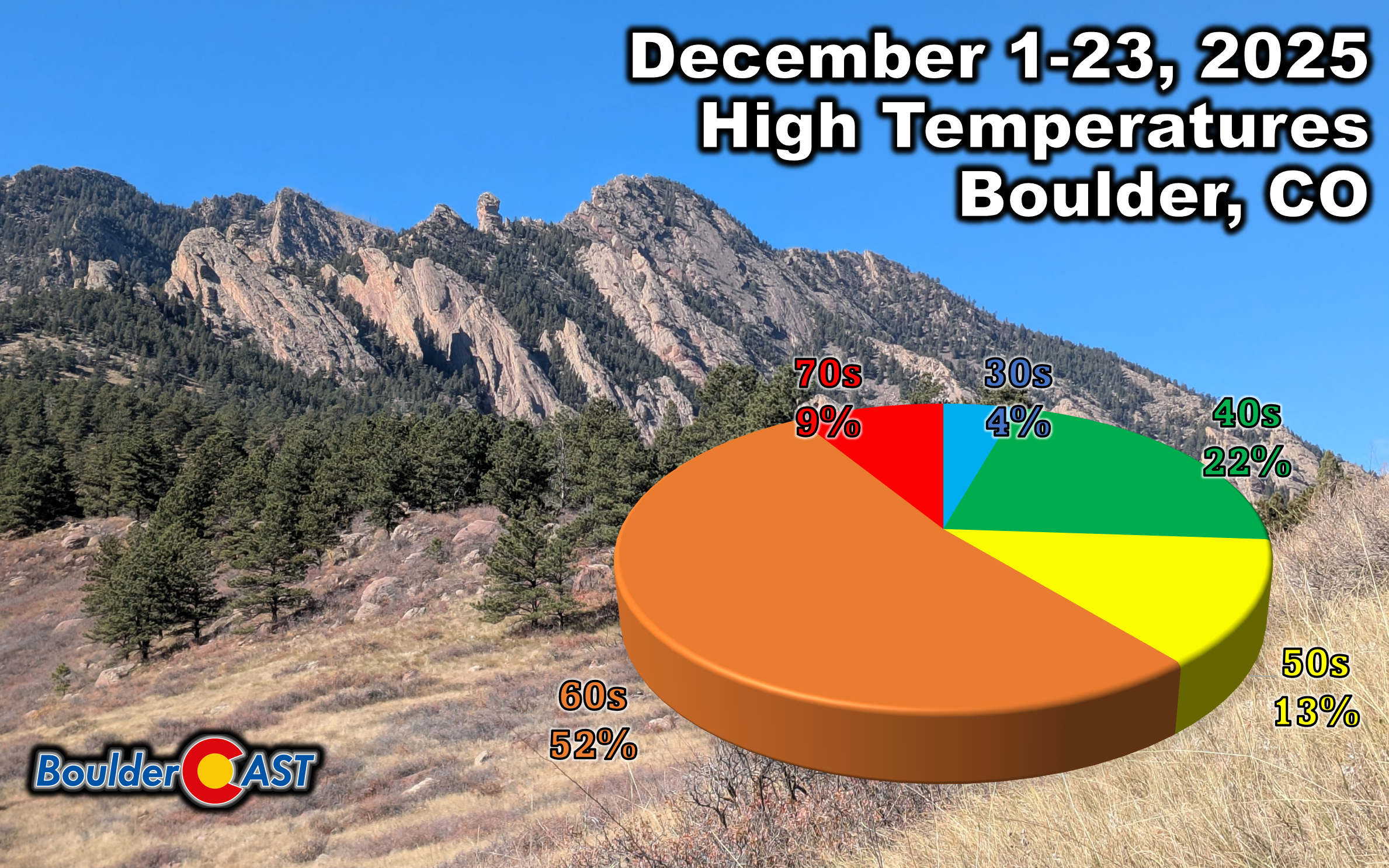
We’ve hit 70° multiple times, broken daily records left and right, and even set a record for warmest overnight low (49° on December 11th). For perspective, that’s warmer than our normal daytime highs this time of year.
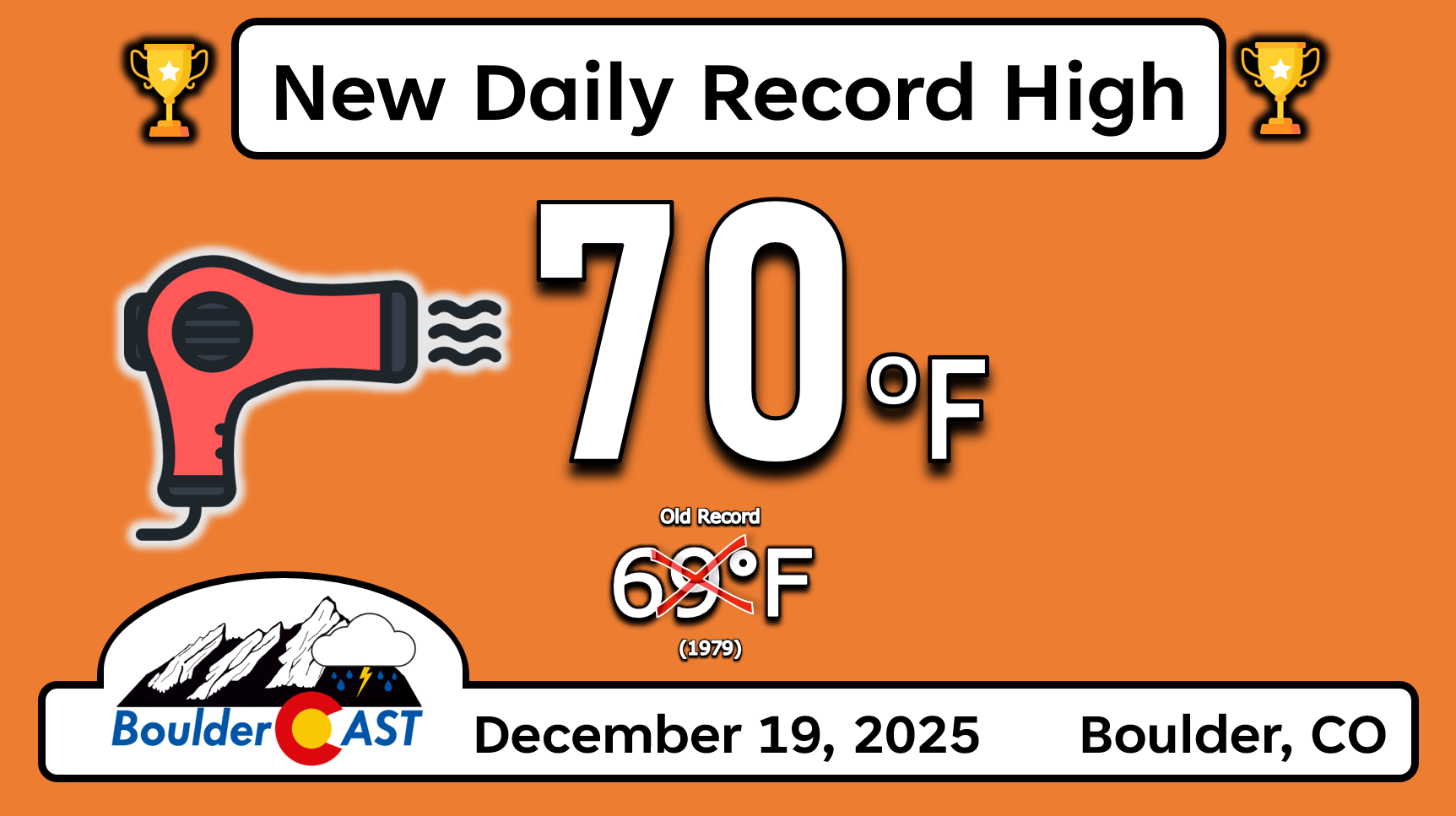
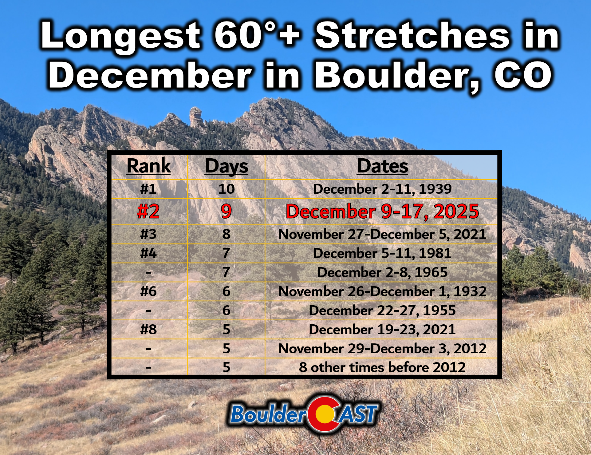
We nearly pulled off an unprecedented streak of 60°+ days in December. Cloud cover on one afternoon kept us “only” at 58°, breaking the run at nine days. Without that hiccup, we’d be sitting at 16 straight days above 60° right now, standing well ahead of any prior streak in Boulder’s historical record.
As it stands, 61% of December days have landed in the 60s or 70s so far. That’s not December—it’s early mid-October in disguise.
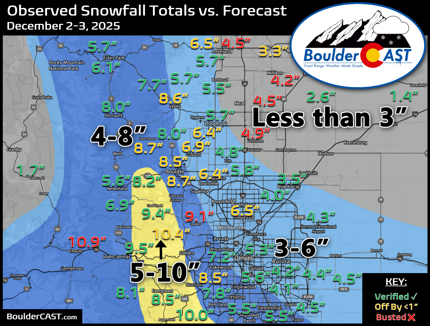
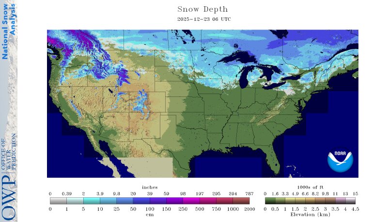
Warmth is only half the story. It’s been bone dry with just a trace of snow in Boulder over the last three weeks. Fortunately we did have a decent 4 to 10 inch snowstorm across the Front Range back in early December, but that snow is long gone, having even melted completely out of the Foothills under this prolonged warm spell.
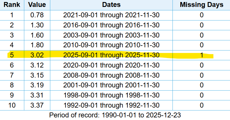
Even before that snow, it had been pretty dry in the months prior. It was the 5th driest meteorological autumn (Sep 1st – Nov 30th) since 1990 in Boulder, though we must note it has not been nearly as dry as Fall 2021 in the lead up to the Marshall Fire.
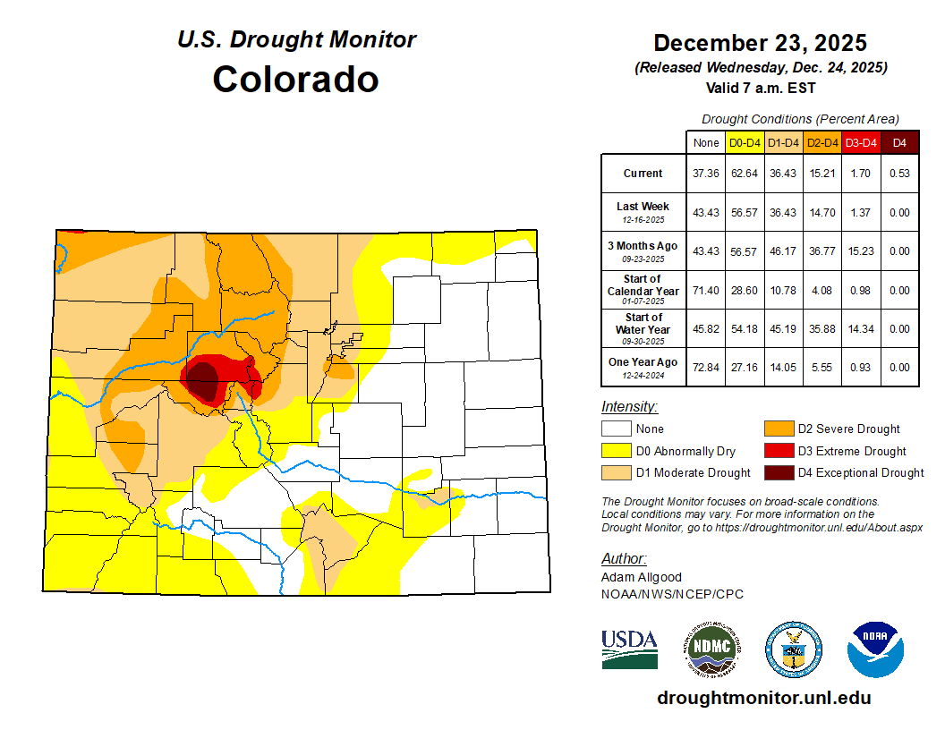
Again, this dryness isn’t something exclusive to Boulder. Much of Colorado has been bone dry over the last three plus months, with some areas receiving less than 25% of their normal precipitation during this timeframe.
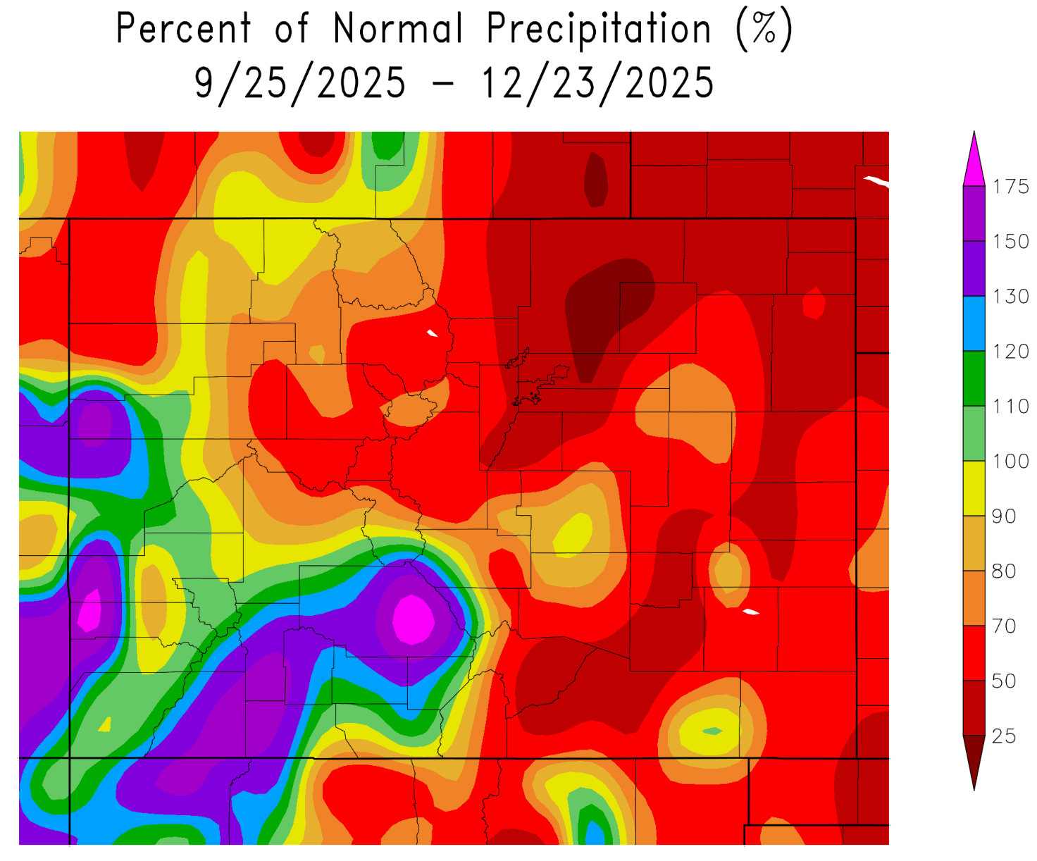
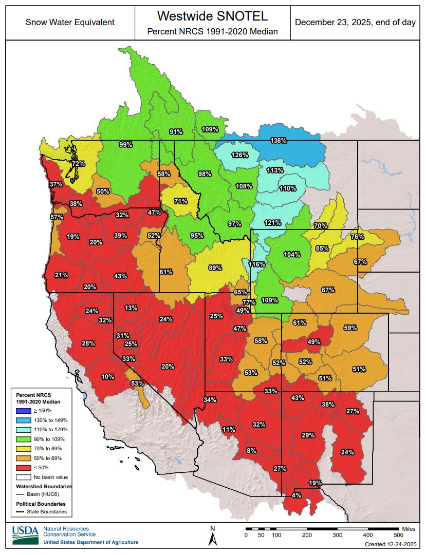
Drought is deepened in our state during this stretch, with Moderate to Severe levels in the Denver Metro area, and worsened conditions in the central and northern Mountains where snowpack is abysmal and near all-time lows.
As a direct result of how dry it has been, we’ve already seen two days with off-the-charts fire danger during last week’s pair of extreme downslope windstorms, including the first ever “Particularly Dangerous Situation” Fire Weather Warning issued in the state of Colorado last Friday, which saw drought, critical humidity and 100 MPH wind gusts overlap for several hours in western Boulder County.

Should We Be Watering Our Trees? Yes, watering trees during exceptionally dry and warm December periods in our climate zone is recommended, but only under the right conditions. Even though trees look dormant, their roots continue slow metabolic activity. Without moisture, roots can desiccate, weakening the tree and making it more vulnerable to pests and disease come spring. Long warm and dry stretches, like we’re enduring right now, can cause root injury that doesn’t show until the following spring or summer. Evergreen trees are especially at risk as they lose water from their needles year-round. Make sure to only water trees when air and soil temperatures are above 40°F and the ground is not frozen. It’s best to water around midday or early afternoon. Water your trees, not the grass, unless it cant be avoided!
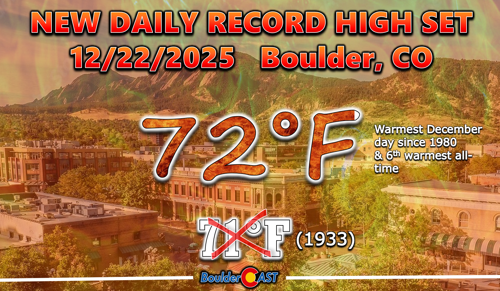
Will it be the warmest Christmas Ever?
Given the recent and prolonged warm and dry spell, this year will be our second brown Christmas in a row, following hot on the heels of last’s year historic “Rainy Christmas”. But this year, for the first time in two decades, it will feel like true beach weather in the Front Range while gifts are opened, Christmas dinners are consumed, and holiday cheer is spread.
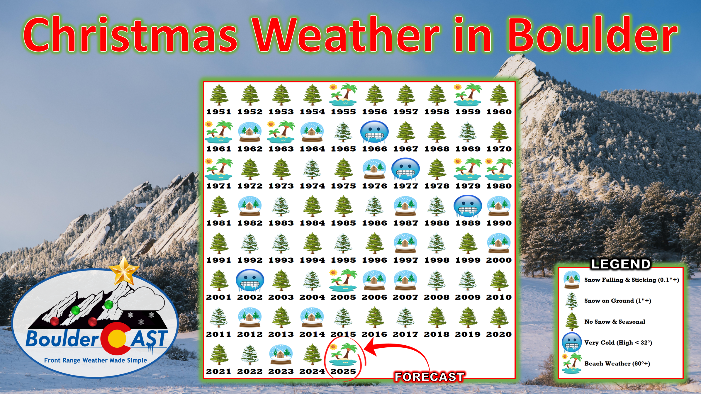
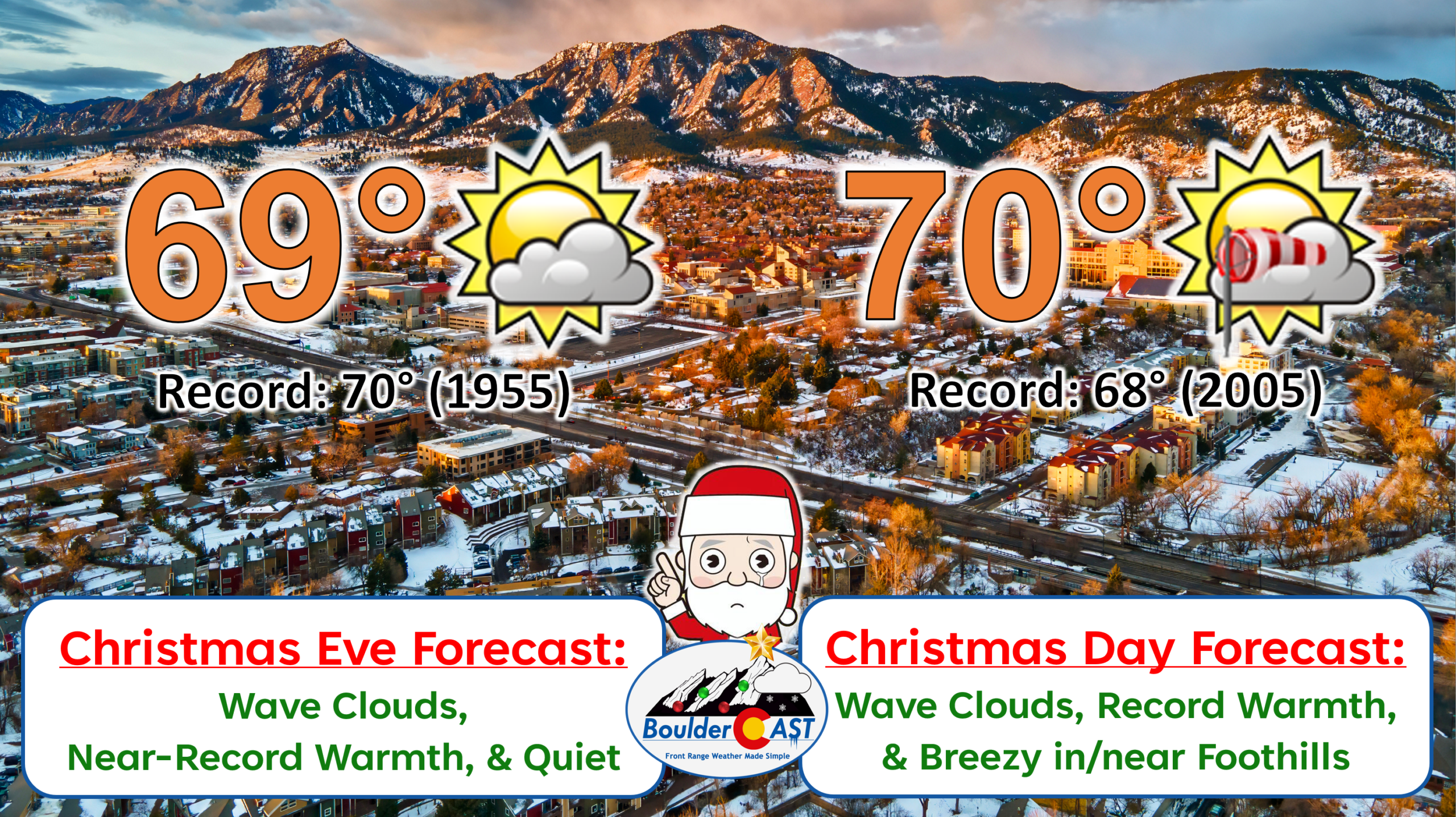
We’re forecasting near‑record highs both Christmas Eve and Christmas Day—upper 60s to lower 70s. Jackets won’t be needed for outdoor festivities.
Where is the snow?
If you want any hope of a white Christmas, you will need to head into the Mountains in order to find appreciable snowfall on the ground, or up towards the Great Lakes where December has brought several rounds of snow and much more continuous cold than here.
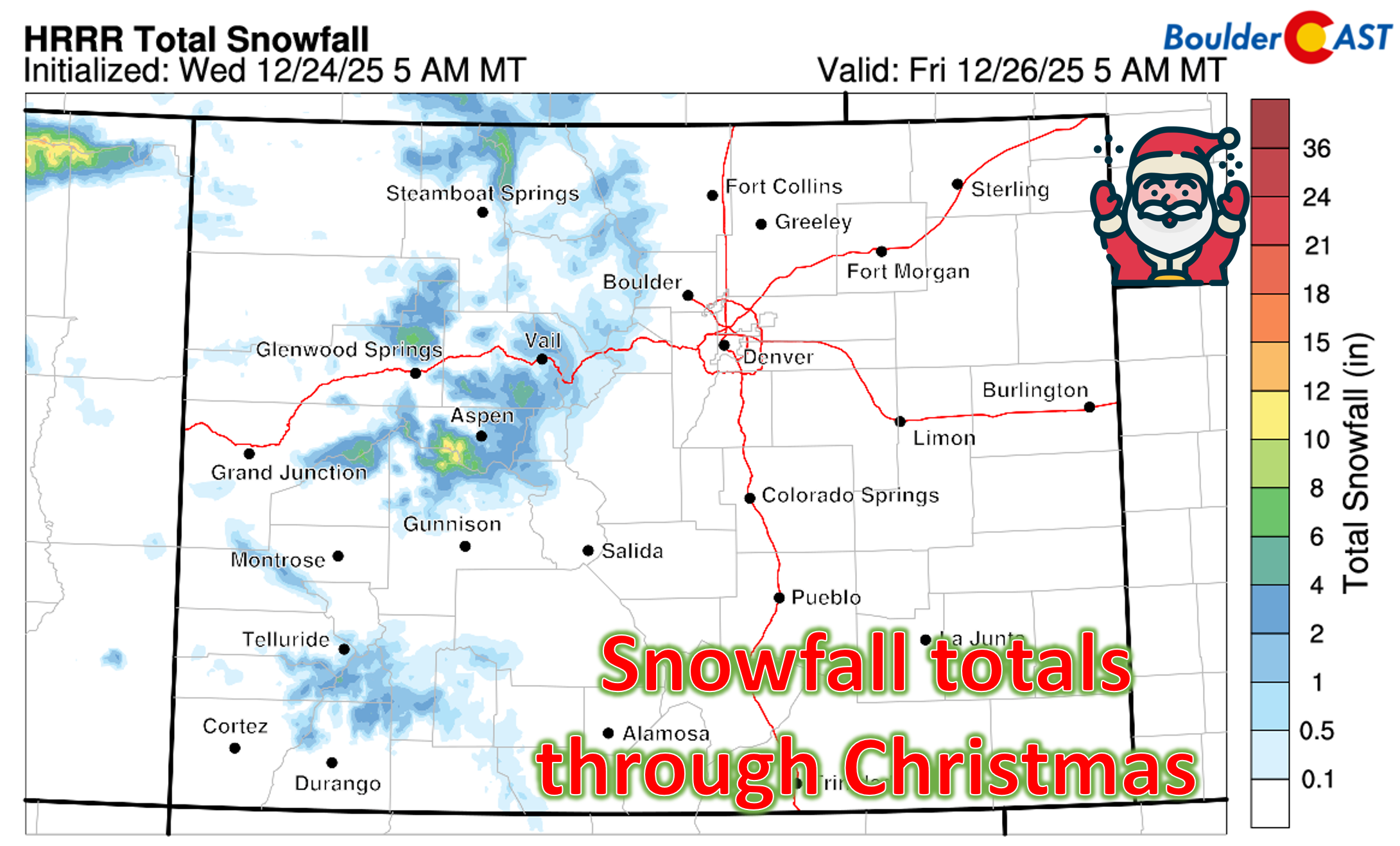
There will be some snow falling tonight and on Christmas Day in the Mountains as moist southwest flow arrives from the Pacific, but it won’t be much. Nearby mountain ranges can expect just a dusting to 2″ of new accumulation for the holiday, mainly on the highest peaks with southwest exposure. Only the most minor travel disruption is anticipated on local travel corridors like Eisenhower Tunnel, Vail Pass, Loveland Pass or Berthoud Pass. A bit more snow is in the works for the mountains near Aspen and Steamboat (3 to 6 inches). Lower elevations of the mountain valleys west of the Divide will be too warm and should prep their umbrellas for sporadic raindrops on Christmas Day.
We do have a glimmer of hope to share for the snow-lovers: cooler pattern is set to arrive heading into the weekend where we will finally see temperatures drop back towards and even below (yes below!) seasonal normals. In fact, we’re tracking a strong cold front Saturday night that could give us a shot of light snow, especially if jet dynamics line up. It doesn’t look like a big event, but a light accumulation of snow is on the table this weekend for the first time in many weeks.
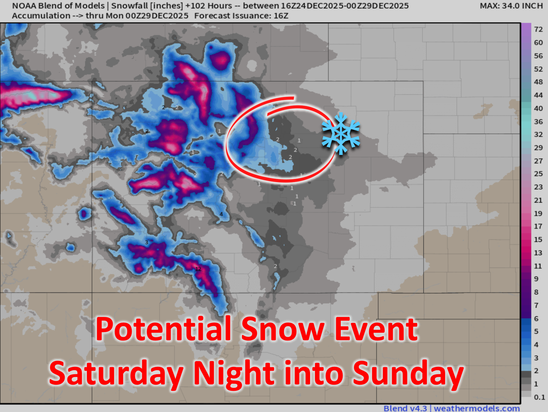
There is growing model support for Sunday’s highs being below freezing for us—just a bit late there Mother Nature!
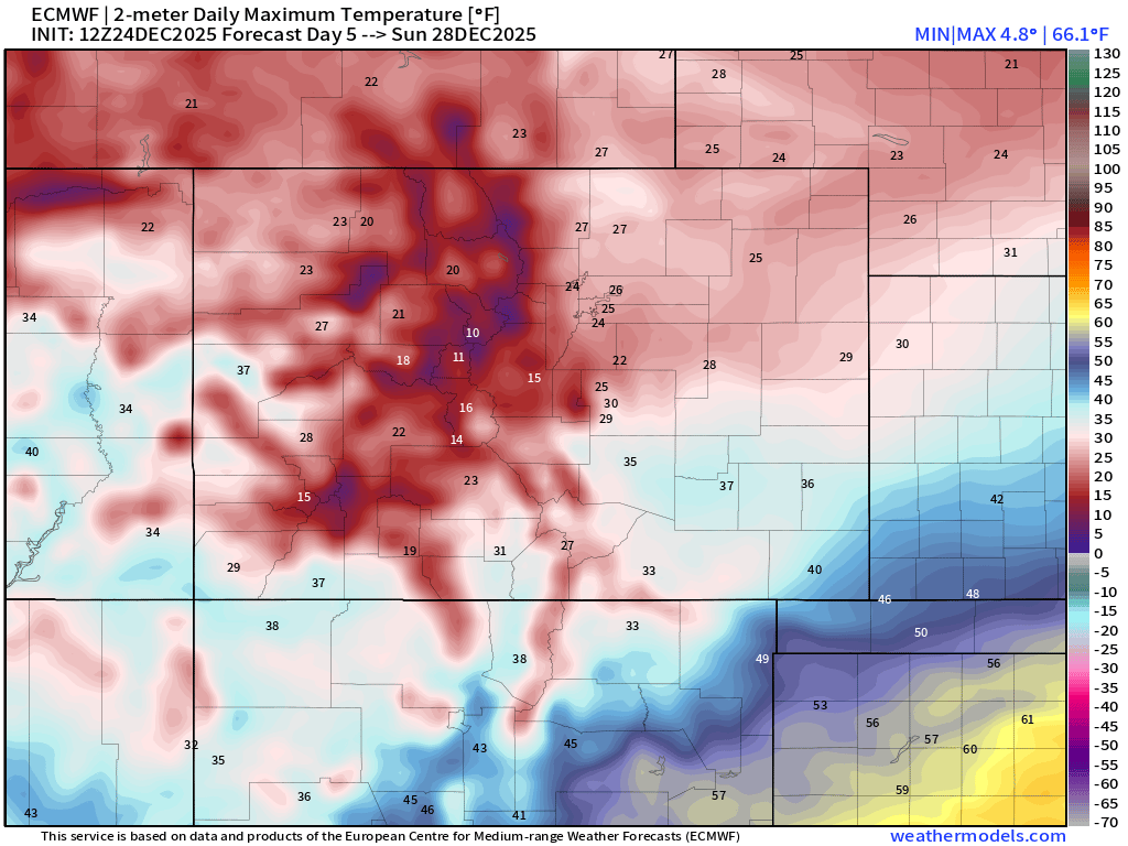
Despite the uncertainties regarding the snow, Friday will kick off a cooling trend that will culminate in downright cold temperatures by Sunday alongside our snow chance. Before then, will have to keep an eye on fire danger for Friday which won’t be extreme but could be elevated to near-critical in the Foothills and Boulder area if humidities fall low enough.
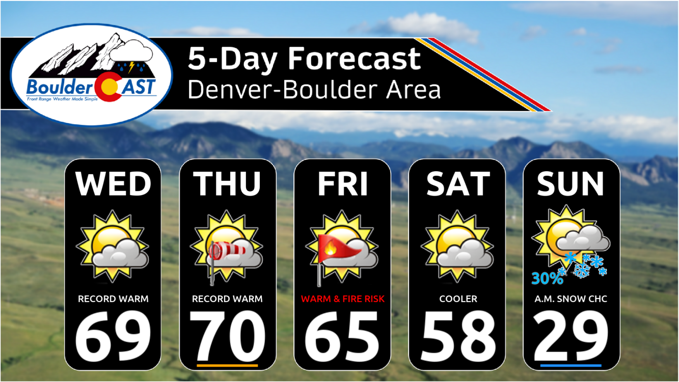
Beyond the brief cold and snow chance on Sunday, quiet weather is expected to resume rapidly early next week with above normal temperatures taking us into the New Year.
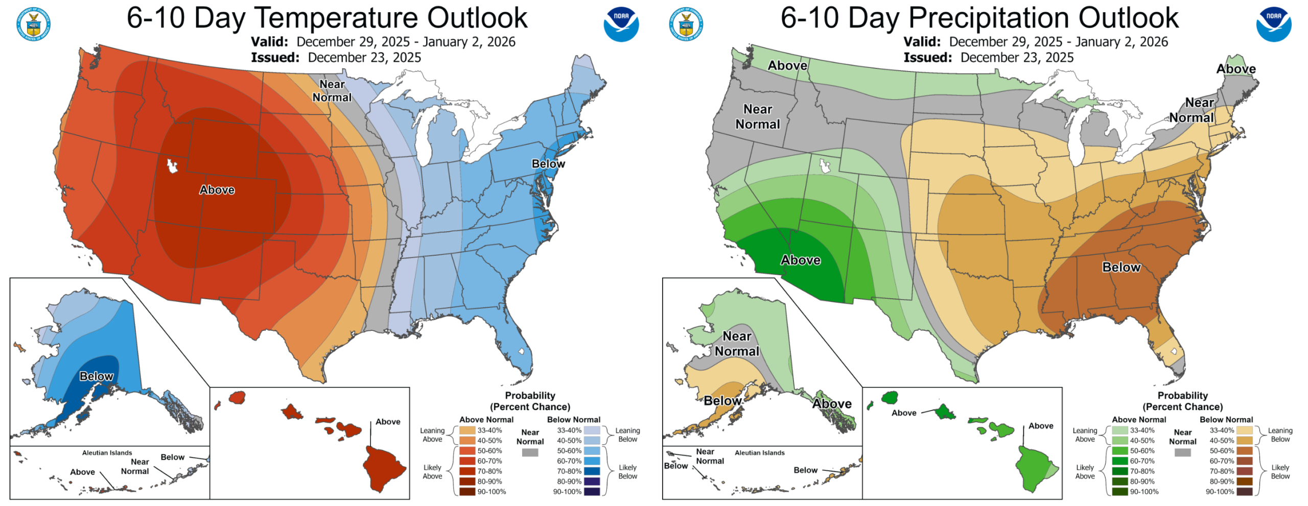
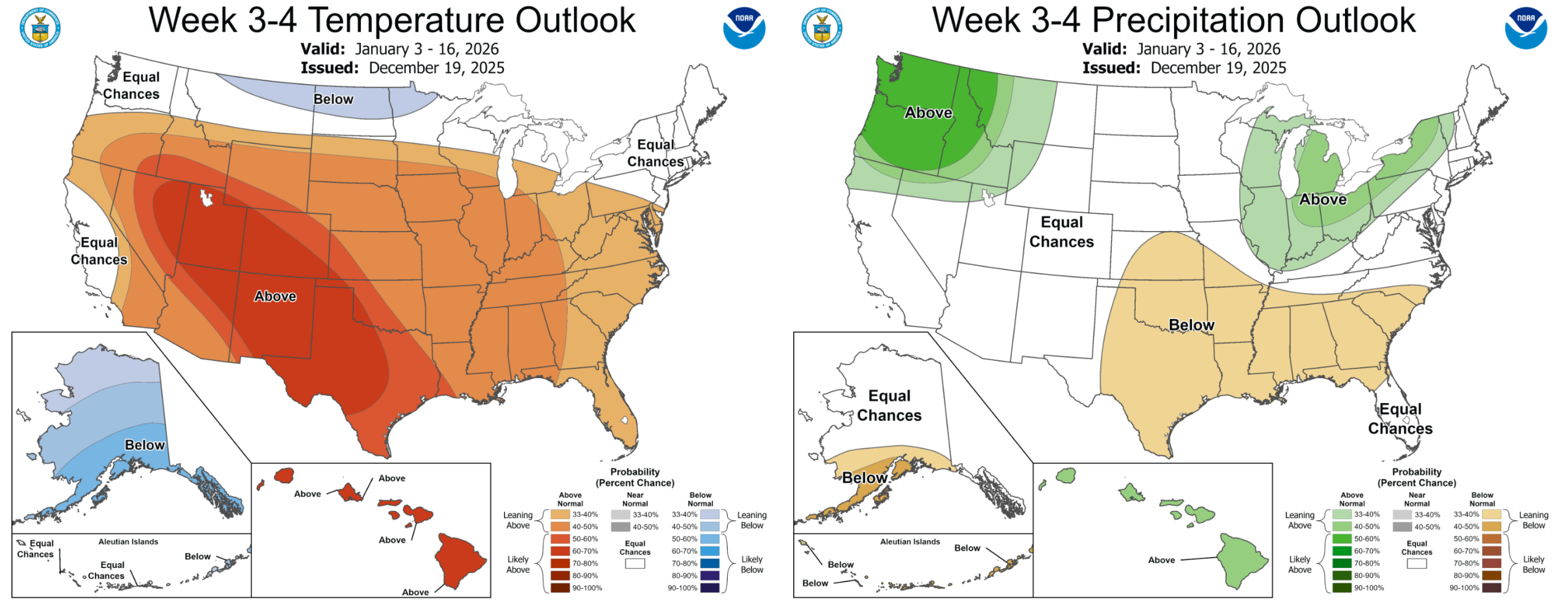
Sadly we’re not seeing much change potential in the extended forecast either. While we won’t rule out a few strong cold fronts with the risk to produce brief winter weather in the coming weeks, any type of substantial pattern shift that would bring prolonged cold and snow will not happen until at least the back half of January. To be clear, there’s not really even any hints for this in the modeling until February but it’s tough to believe even climate models that far out.
December and January are the windiest months of the year in the lee of Colorado’s Rockies, especially during La Niña setups like we have currently, and these are the months we absolutely don’t want to see widespread drought and snow-free conditions present, especially deep up into the Foothills which is the case right now.
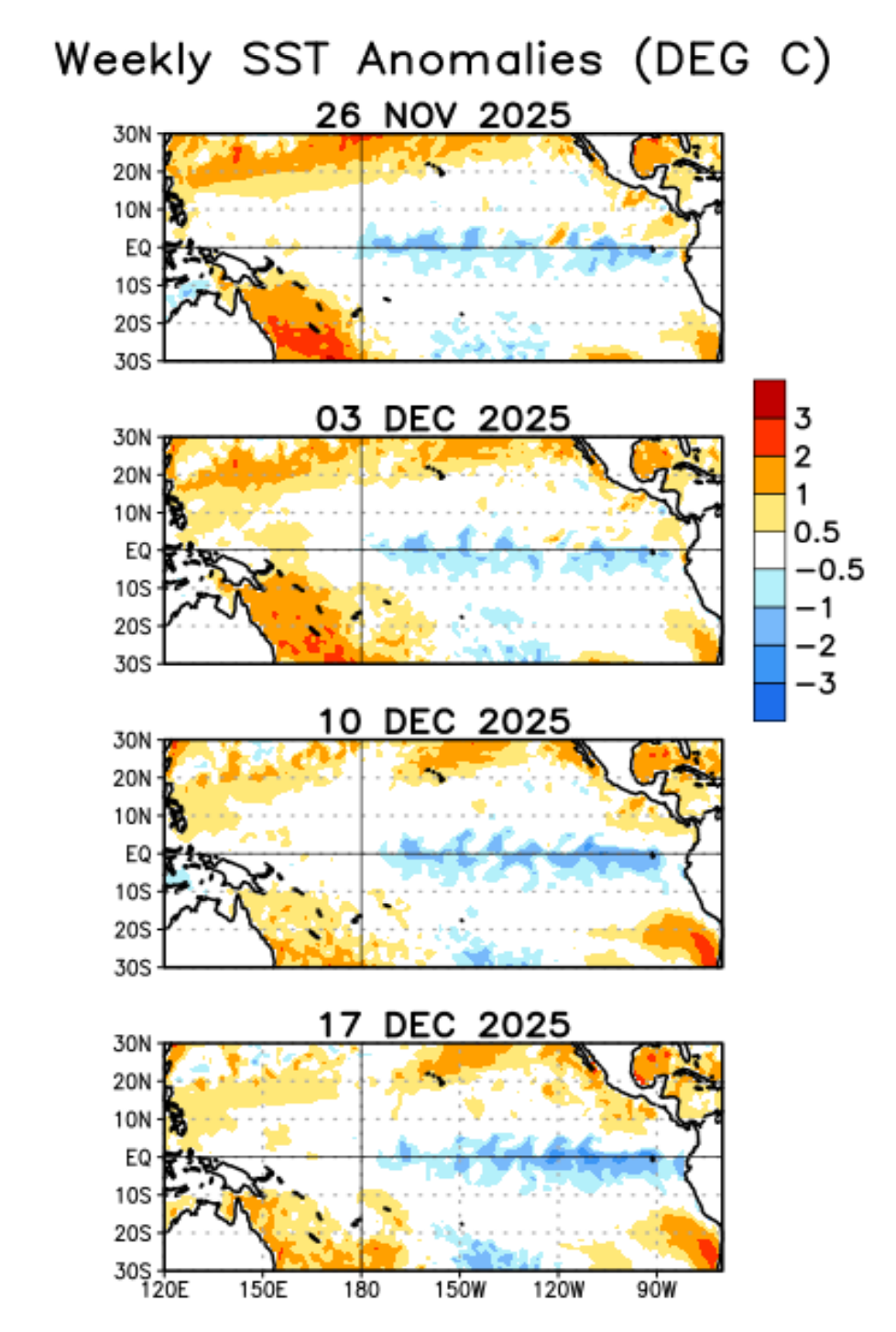
La Niña pattern remains active in the tropics as December closes out
One thing is clear right now, fire danger will continue to be a bigger player than snow in our weather moving forward. Thus, it’s no surprise that a Stage 1 fire ban is now in effect for the lower elevations of Boulder County, just enacted earlier this week.
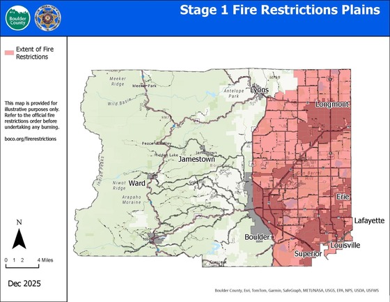
Various spark and flame-related activities are now illegal east of Highway 93, Broadway and US-36.
Long-term: With no major pattern shifts showing up in the modeling—even well into January—any cold snaps or brief snowfalls, like the one shaping up this weekend, look short‑lived and fleeting. In our opinion, anything we do see in the next month or two won’t be enough to turn things around. La Niña is forecast to dissipate in early 2026, which could help us catch up some during late winter and spring. But it’s going to take a bit of luck as well. Fire danger remains the top concern for the Front Range. While conditions aren’t quite as primed as they were before the Marshall Fire four years ago—thanks in part to more limited fuel—that relative margin of safety is shrinking. Each warm, dry week chips away at it, steadily raising the risk.
Short term: It’s shaping up to be a busy holiday weekend in Colorado weather with all the usual players—from record warmth to windy fire danger, to an incoming cooldown and the potential snow over the weekend. Stay tuned for updates!
From all of us at BoulderCAST,
we wish you a Happy Holidays!

Help support our team of Front Range meteorologists by joining BoulderCAST Premium. Get the most accurate Boulder and Denver weather forecasts delivered to your inbox every single day plus much much more…

Share Colorado’s crazy weather! Share this post:


Leave a Reply
You must be logged in to post a comment.