It hasn’t snowed in our area since last year! Well….December 28th to be more precise. However, white stuff is once again in the forecast to begin 2021. A Four Corners low pressure system will spread winter weather back into the Front Range Saturday into Saturday night. Let’s take a look at the timing and potential snowfall amounts in what is sure to be another disappointing snowfall event.
UPDATE (7:00AM Sat 1/9/21): Adjusted snowfall forecast map slightly
At a Glance:
- A low pressure will move through the Four Corners and into Texas Saturday into Sunday bringing a return of winter weather to the Front Range
- Light snow will overtake the area Saturday afternoon and continue into Saturday night
- Snowfall amounts of 1 to 3″
Help support our team of Front Range weather bloggers by joining BoulderCAST Premium. We talk Boulder and Denver weather every single day. Sign up now to get access to our daily forecast discussions each morning, complete six-day skiing and hiking forecasts powered by machine learning, first-class access to all our Colorado-centric high-resolution weather graphics, bonus storm updates and much more! Or not, we just appreciate your readership!

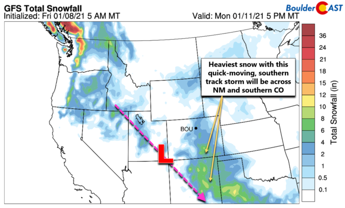
Is the track too far south? Yep.
We dropped you a hint that snow was headed this way in our weekly outlook posted on Monday. That extended forecast is now coming to fruition with a storm system moving toward the state of Colorado. As of Friday afternoon, the center of the approaching low pressure is located in extreme southwestern Idaho. This is seen in the GOES-East water vapor animation below.
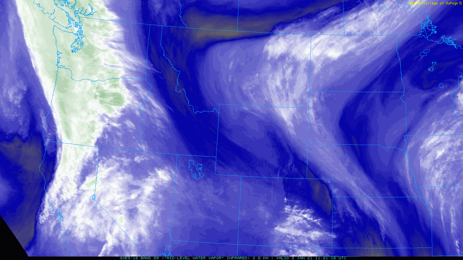
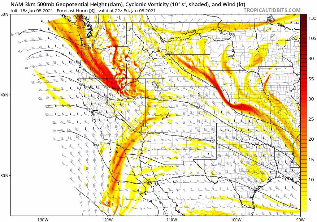
Over the next 24 to 48 hours, this system will drop southeastward and intensify as it moves into the Four Corners region and eventually into Texas. The NAM 500mb vorticity forecast animation below shows the storm’s projected track from Friday afternoon into Sunday morning.
Ordinarily this type of southern track would be fairly rare during an active La Niña pattern, but this year we’ve already seen several storms take this very same route, especially of late. You may gather where we’re going here. This southern track is unfortunately not ideal for Front Range snow….
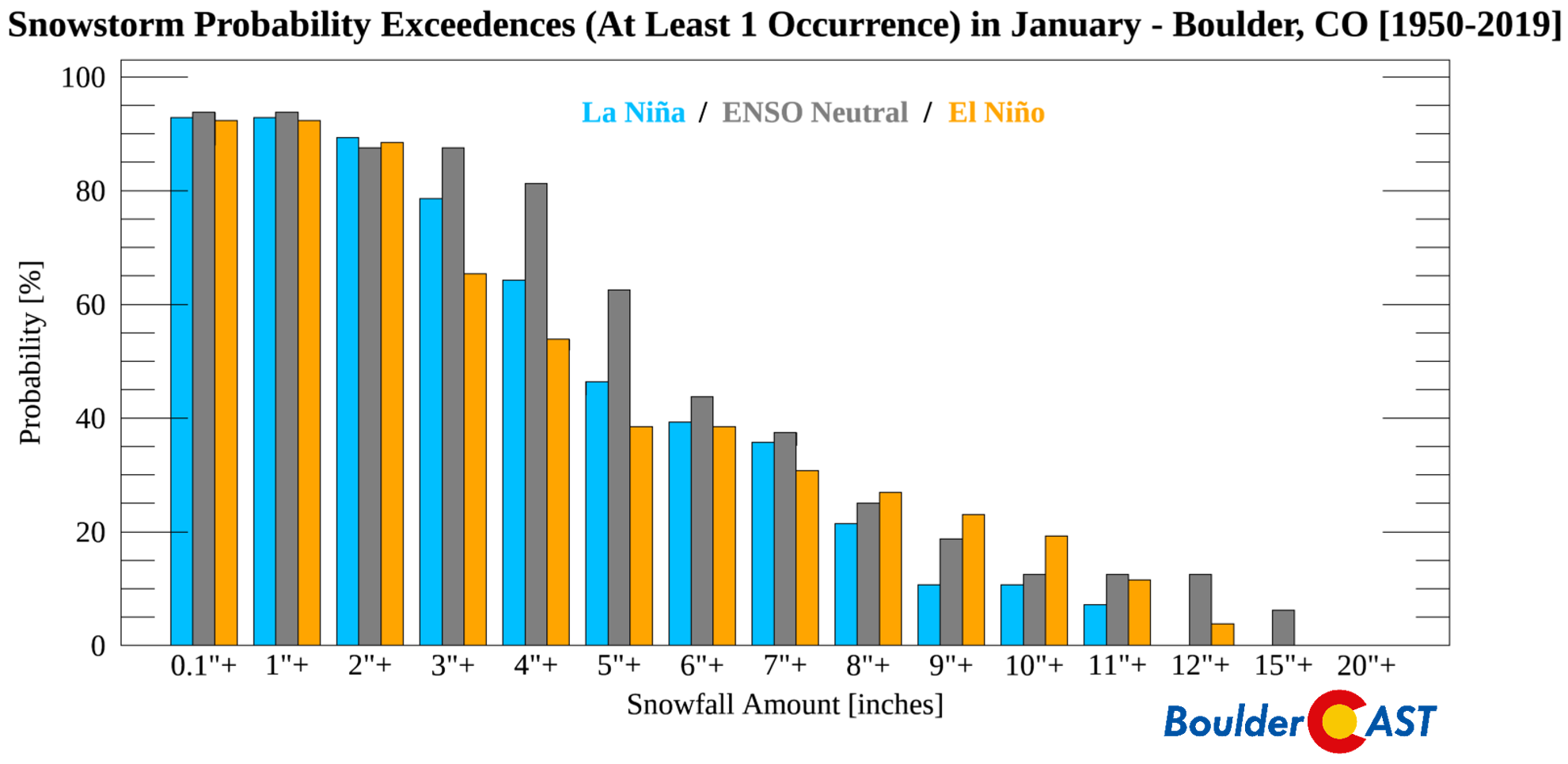
The probability that snowstorms of various sizes will occur at least one time in any given January
The sphere of influence from this system is just barely large enough to produce light snow in our area. Most of the energy and snowfall will be focused across southern Colorado, New Mexico and Texas where upwards of 4 to 10″ could fall by Sunday night.

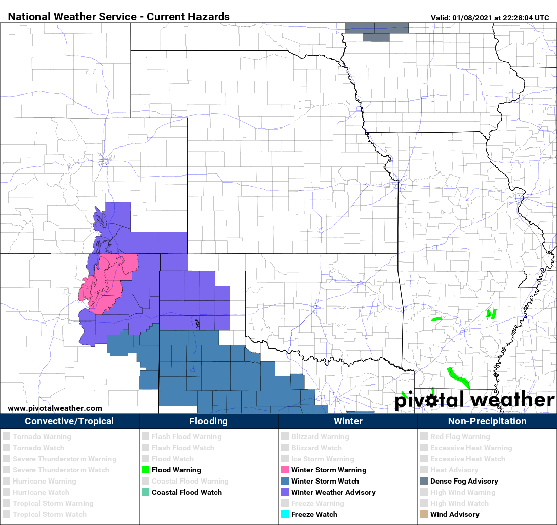
It’s evident just from looking at the current Watches and Warnings from the National Weather Service just how big of a swing and a miss this storm is for the Denver Metro area.
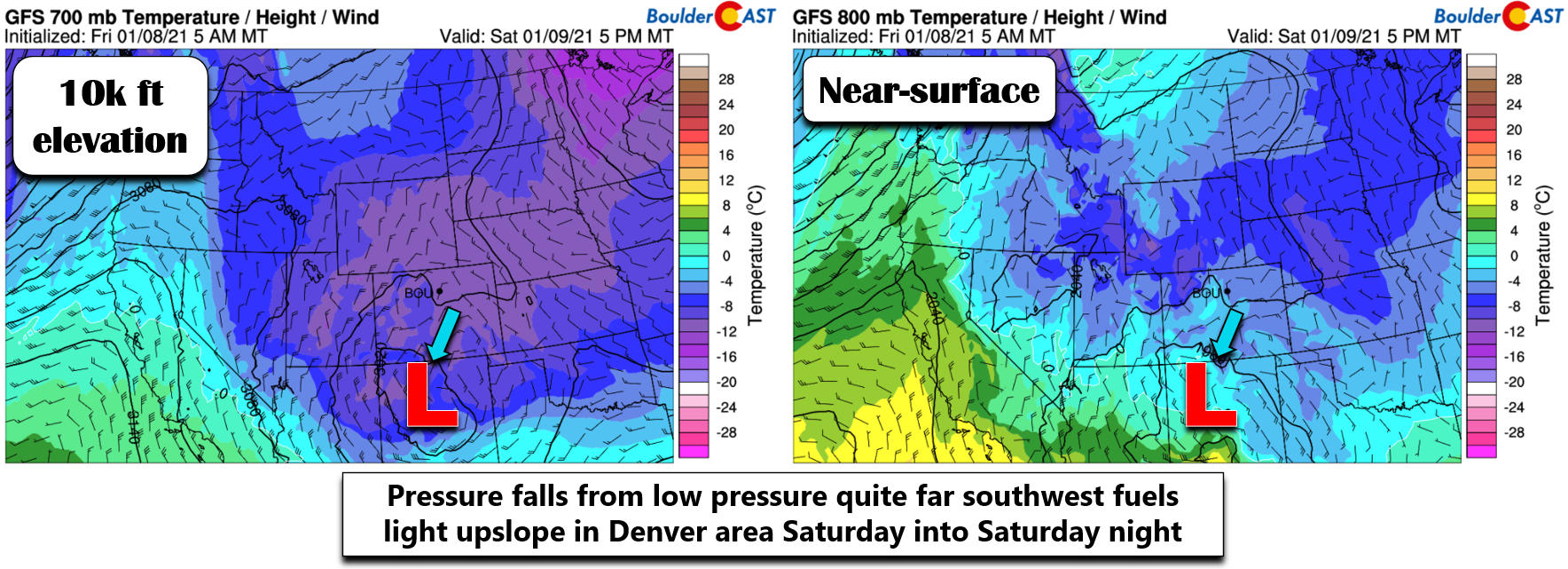
Speaking of, we will be relying on pressure falls from the intensifying but very much distant low pressure system in northern New Mexico to drive our upslope snowfall late in the day Saturday and overnight. The result will be a deep layer of very weak upslope producing a roughly 12-hour period of light snow. Some weak lift from the passing low will also help things along, but not much. Moisture is once again scarce with this storm and its progression is quick.
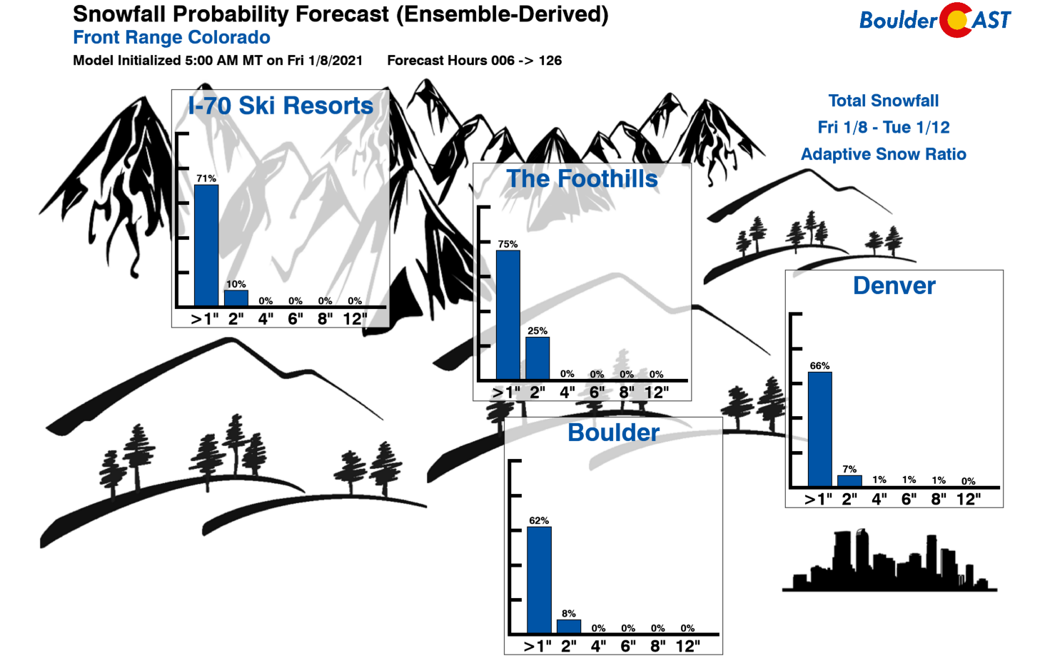
As far as uncertainty, there isn’t a lot here. Models are all in fairly good agreement on where this low will track and none of the solutions produce more than 4 to 5″ of snow in the Denver area. Most produce less than 3″. There is still a little bit of wiggle room but this will be a minor snowfall event for us. Our latest Snowfall Probability Charts indicate a majority chance of 1″ of snow, but little hope for more than 2″ in both Boulder and Denver.
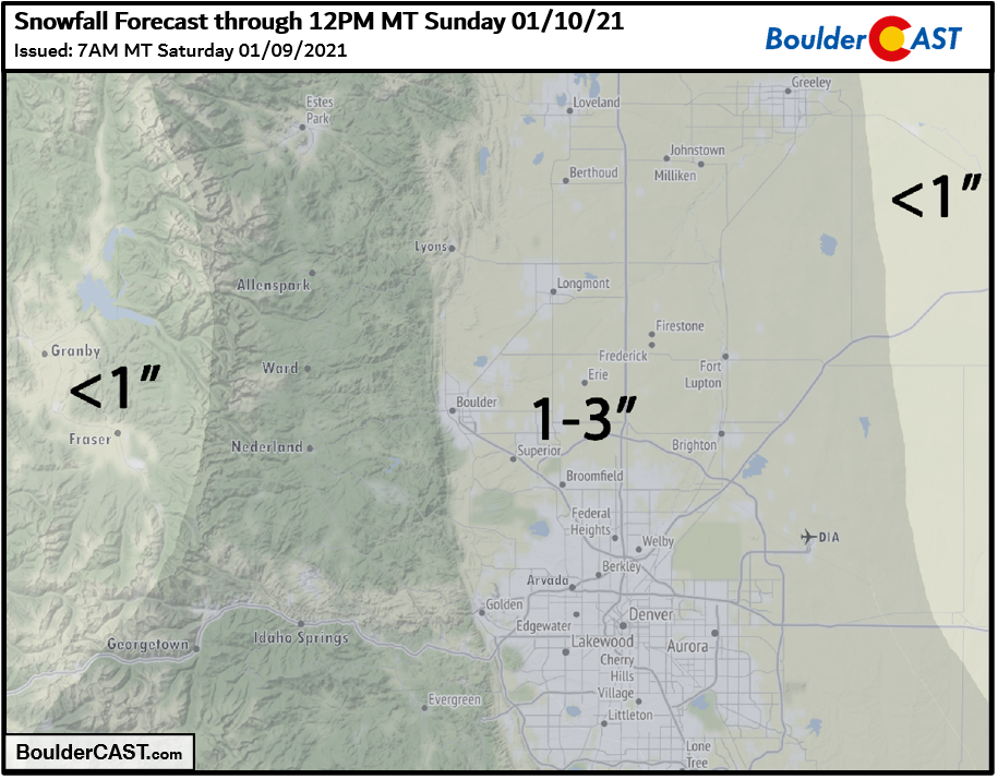
Overall, we’re looking at a 1″ up to 3″ in the Metro area, with the highest totals in that range expected south and west. The Foothills of Jefferson County and possibly the Palmer Divide could see perhaps up to 4″ but that’s about it. Our snowfall forecast map for the event is shown below.
Expect a daytime high temperature just a shade above freezing on Saturday with overcast skies widespread. Light snow should begin to develop during the afternoon on Saturday and continue into the overnight hours. The last of the light snow will be completely gone from the Metro area by sunrise Sunday. Travel impacts will be nearly non-existent, but as always, watch for a few slick spots especially Saturday night.
Have a good week end!
.
Get BoulderCAST weather updates delivered to your inbox!
We respect your privacy. You can unsubscribe at any time.
Help support our team of Front Range weather bloggers by joining BoulderCASTPremium. We talk Boulder and Denver weather every single day. Sign up now to get access to our daily forecast discussions each morning, complete six-day skiing and hiking forecasts powered by machine learning, first-class access to all our Colorado-centric high-resolution weather graphics, bonus storm updates and much more! Or not, we just appreciate your readership!
.
Spread the word, share this BoulderCAST post:
.


You must be logged in to post a comment.