
We hate to be the bearer of bad news, but someone sadly has to assume that role today. What looked like a somewhat good, though uncertain, chance of snow for us earlier in the week has transitioned to a situation where almost every weather model is now struggling to come up with much, if any, snow in the Denver Metro area tonight into Friday. Let’s take a look at what happened and how much snow is currently expected.
At a Glance:
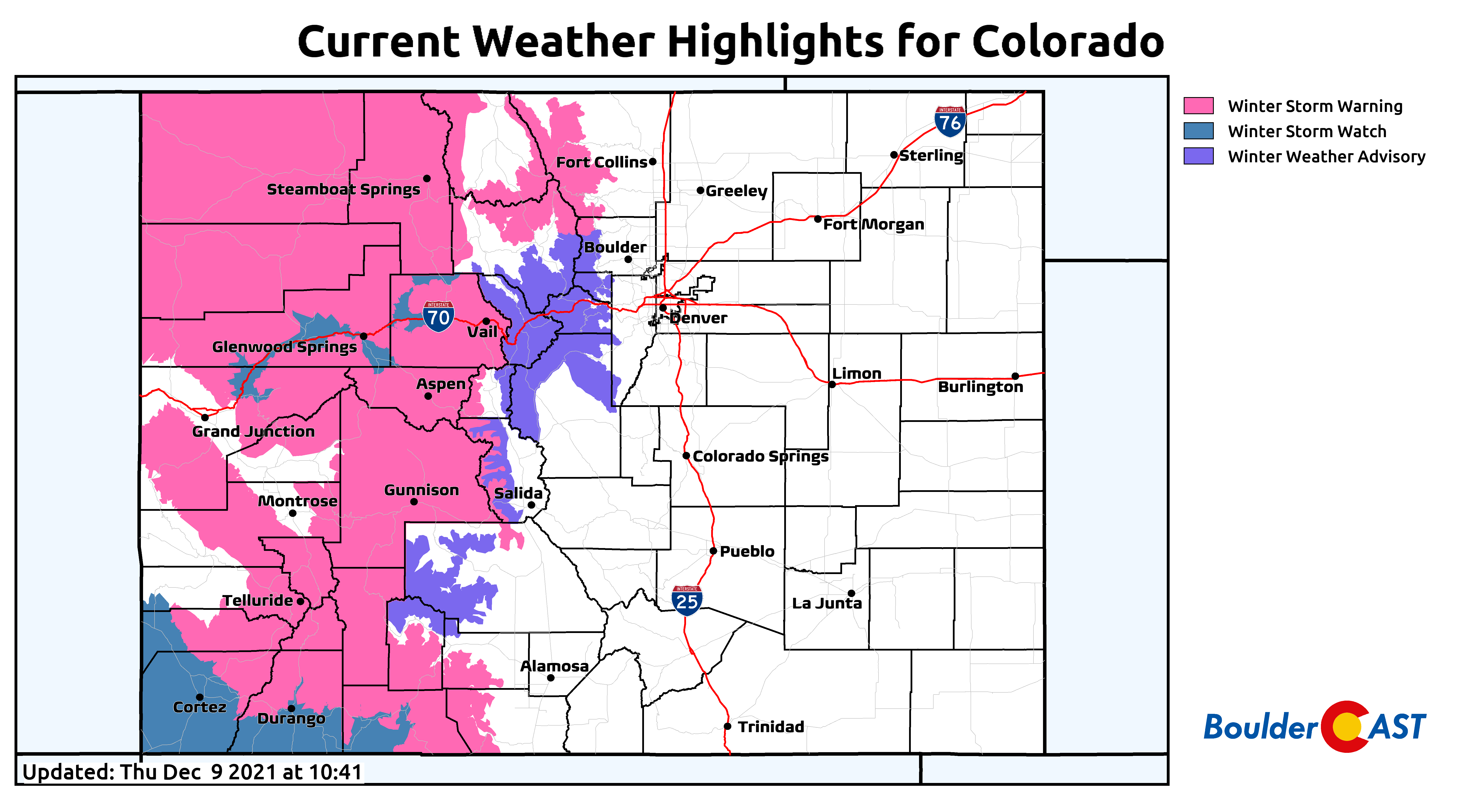
- A strong winter storm is moving across the Rockies to end the week
- Heavy mountain snow will create difficult travel over most mountain passes statewide through Friday afternoon
- Models have unfortunately trended downward in snow amounts east of the Mountains with this system
- Only a brief window for snow Friday morning for the Denver Metro area before downslope kicks in
- After the snow chance, cold and blustery during the day Friday with some sunshine developing
- The outlook for additional snow chances this weekend into next week is bleak
We discuss Boulder and Denver weather every single day on BoulderCAST Premium. Sign up today to get access to our daily forecast discussions every morning, complete six-day skiing and hiking forecasts powered by machine learning, access to all our Front Range specific weather models, additional storm updates and much more!

W
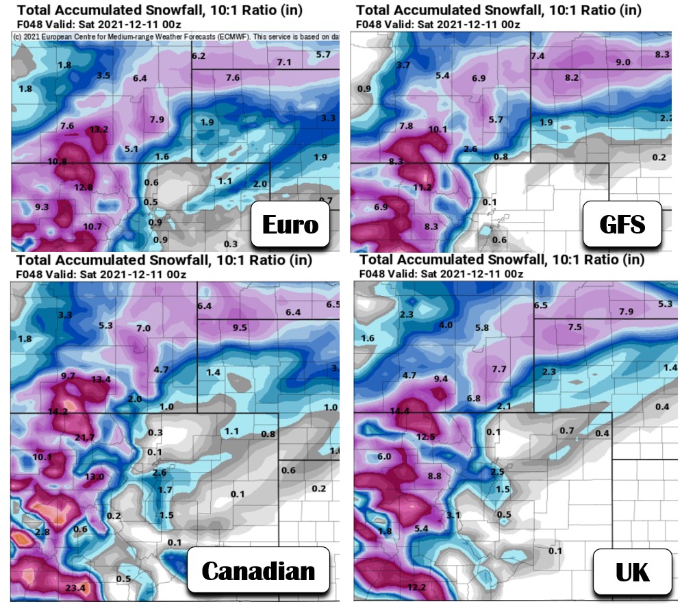
hile we were hopeful for snow in our initial weekly outlook posted on Monday, we did undercut most other weather outlets by including only a 40% chance of snow. In our opinion, anything higher would have been a disservice to you considering the uncertainty (despite how promising things were looking). Here’s what the global models were showing back on Monday. Generally a dusting to 4″ of snow was indicated for the Boulder and Denver area.
Forecasts for this snow event from about 3-4 days ago
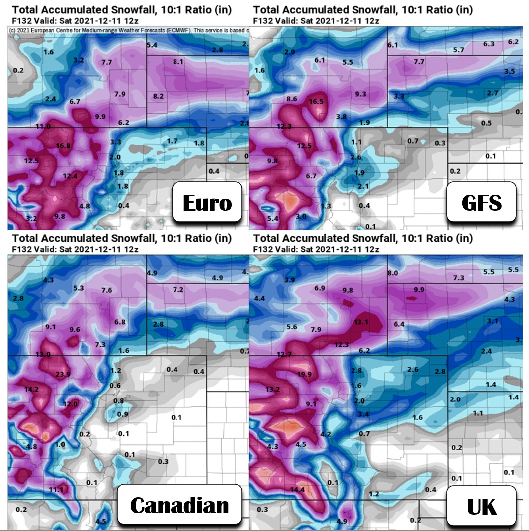
As the week progressed, snowfall amounts have declined and so too has the overall chance of snow, but all hope is not lost for Denver to see its first accumulation of the season. Remember, it only takes 0.1″ to check off that box. Here is what the very same weather models are showing now for snow amounts — generally less than 1″ in most locations.
Latest model snowfall forecasts as of Thursday morning
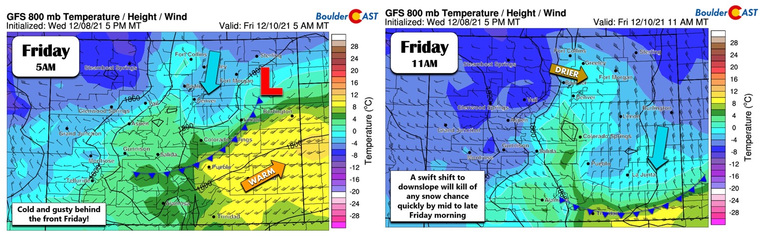
The incoming storm has a lot of winter weather wrapped in, but unfortunately it has an unfavorable track for Front Range snow. This has been the case all along, with the bullseye of heaviest snowfall always expected to be to our north in Wyoming, Nebraska and South Dakota. With the track of the storm so far northward, the Front Range will only experience a brief window where weak lift and moisture can align before strong and dry downslope spill in from the northwest. This overlap of snowfall ingredients will occur roughly from 3:00 AM to 9:00 AM Friday morning after a strong cold front blows through. By mid to late-morning, winds will shift and downslope will spoil our chances of snow entirely.
The jet stream will be sagging through the area early Friday morning as well, with northeast Colorado lining up nicely in the right entrance region. This on paper should allow for a few jet-forced snow bands.
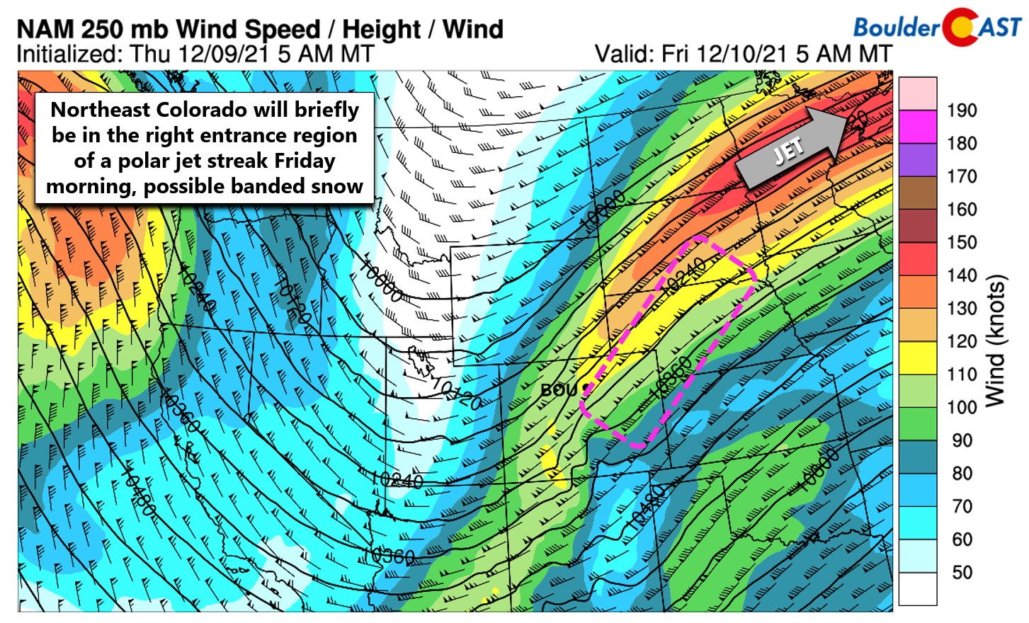
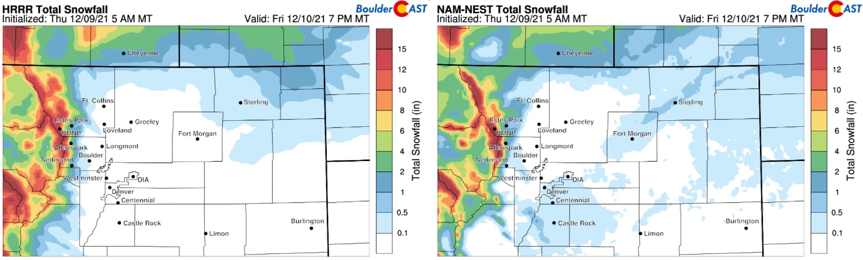
High-resolution models are struggling to form any of these jet bands, but this far out, that isn’t all that surprising. Sometimes they don’t pick up on them until closer to the action. Will that be the case this time? Maybe, but both the HRRR and NAM-NEST models keep accumulations under a dusting for the lowlands with this event. There are only the faintest of hints of banded snow from Fort Morgan to Sterling.
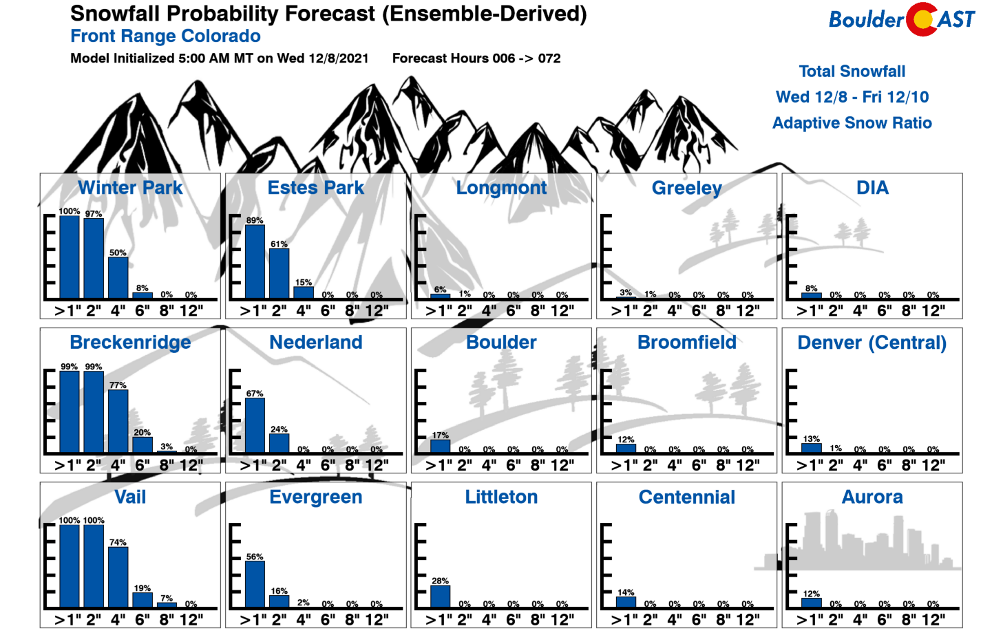
Our snowfall probabilities have also fallen off a figurative cliff through the week…
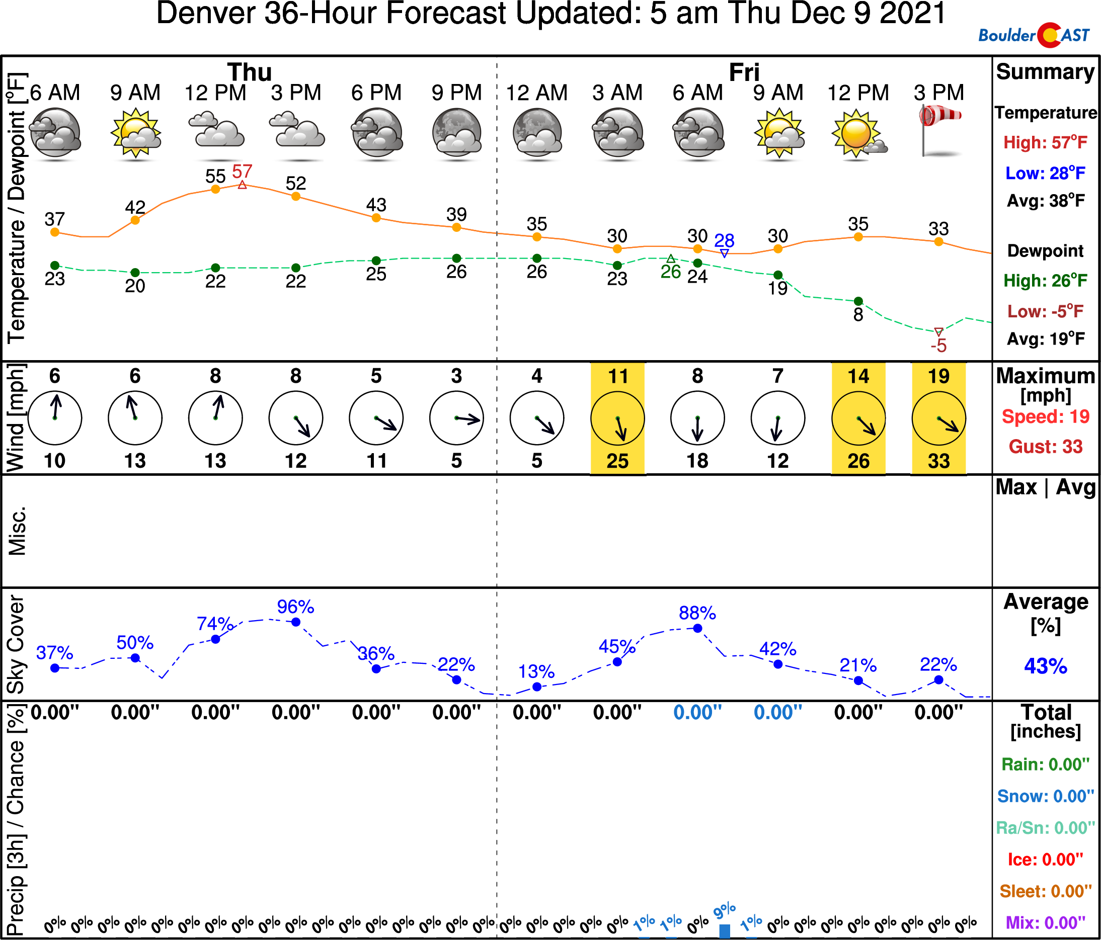
So where does this leave us for snowfall to end the week? Not in a good place. There is a possibility that some or much of our area will see no snowfall accumulation with this system. We still think there is a good chance of a very brief round of snow, especially in southeast Denver which will be further away from any downsloping effects. Denver (DIA) can certainly still pick up its first snow of the season tomorrow — it’s just no longer looking as likely as it once was.
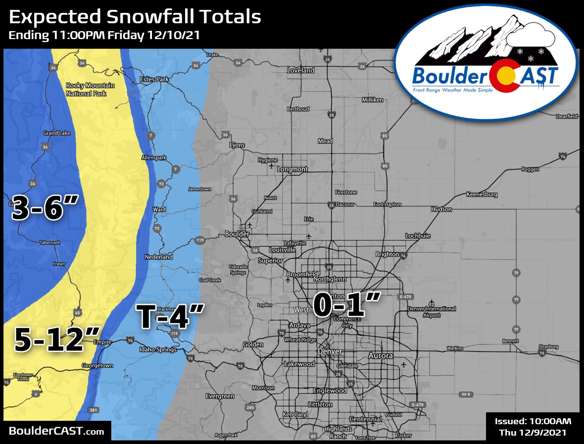
Our snowfall forecast map for the event is shown below. This covers all snow falling through Friday evening.
And of course we can’t forget to mention the dumping of snow already underway in the Mountains, which will receive their most impressive totals of the season as moist west-southwest flow slams into the terrain of western and central Colorado during the day Thursday and well into Friday. 6 to 20″ is possible for much of the state, though this wind direction being a bit south of west doesn’t tend to produce as well in the Front Range Mountains. Definitely plan on winter driving conditions today and tomorrow if you’re heading ANYWHERE along and west of the Continental Divide!
Friday will be cold and blustery with highs only in the 30’s. We will see some sunshine during the day though.
After Friday’s brief shot of snowflakes, the outlook for additional snow is bleak. Saturday begins a warming and drying trend. A ridge of high pressure is expected to develop across the area next week keeping any potential winter storms to our west and north. Will we even see any more snow before the end of 2021? Probably, but the way things have unfolded this autumn, we might not — and frankly, that wouldn’t be all that surprising…
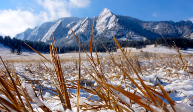
Are you ready for snow?
Help support our team of Front Range weather bloggers by joining BoulderCAST Premium. We talk Boulder and Denver weather every single day. Sign up now to get access to our daily forecast discussions each morning, complete six-day skiing and hiking forecasts powered by machine learning, first-class access to all our Colorado-centric high-resolution weather graphics, bonus storm updates and much more! Or not, we just appreciate your readership!
Enjoy our content? Give it a share!


You must be logged in to post a comment.