Heavy snow fell Friday evening across portions of the Metro area. For potentially the first time ever, Denver International Airport reported the highest snow amount region-wide. We discuss the storm specifics and review the snow totals from across the Front Range.
T
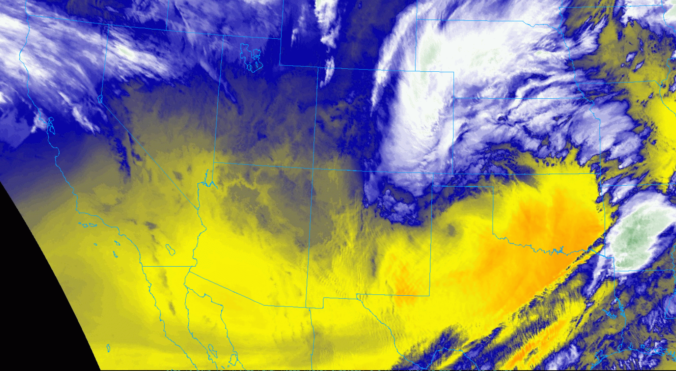
he GOES-East water vapor animation below shows that the center of the main storm system tracked across northern New Mexico last night, with a nice fetch of moisture streaming into Colorado from the south.
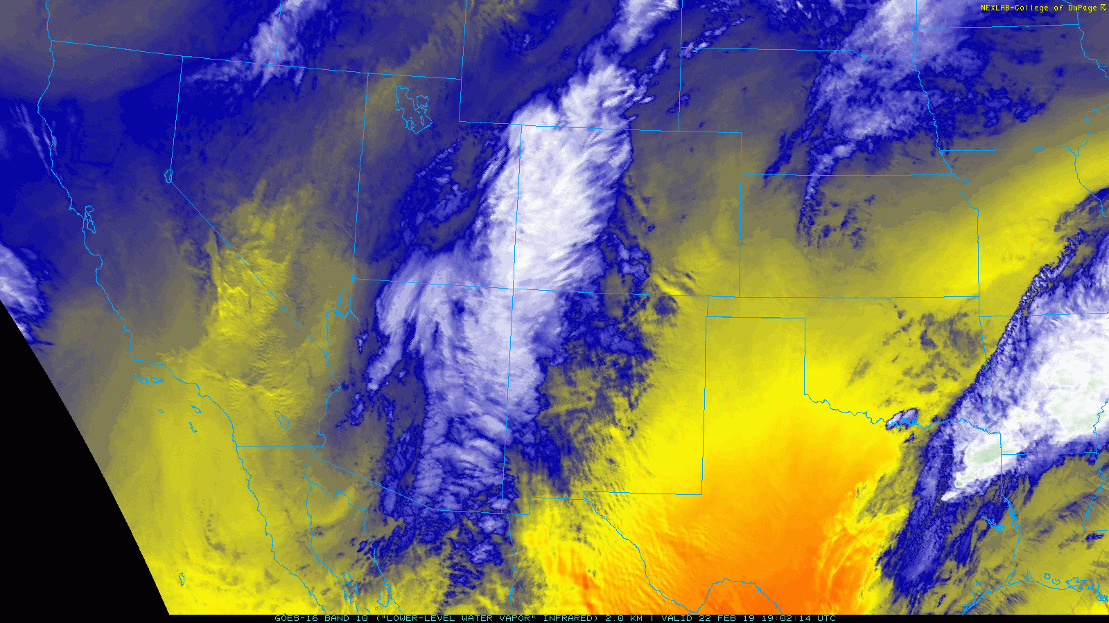
Towards the end of the animation, you can really see the storm beginning to gain strength as it moves into Kansas (the classic “comma” shape). Based on the NAM model’s snowfall forecast for this weekend, you can probably surmise where the storm is headed….
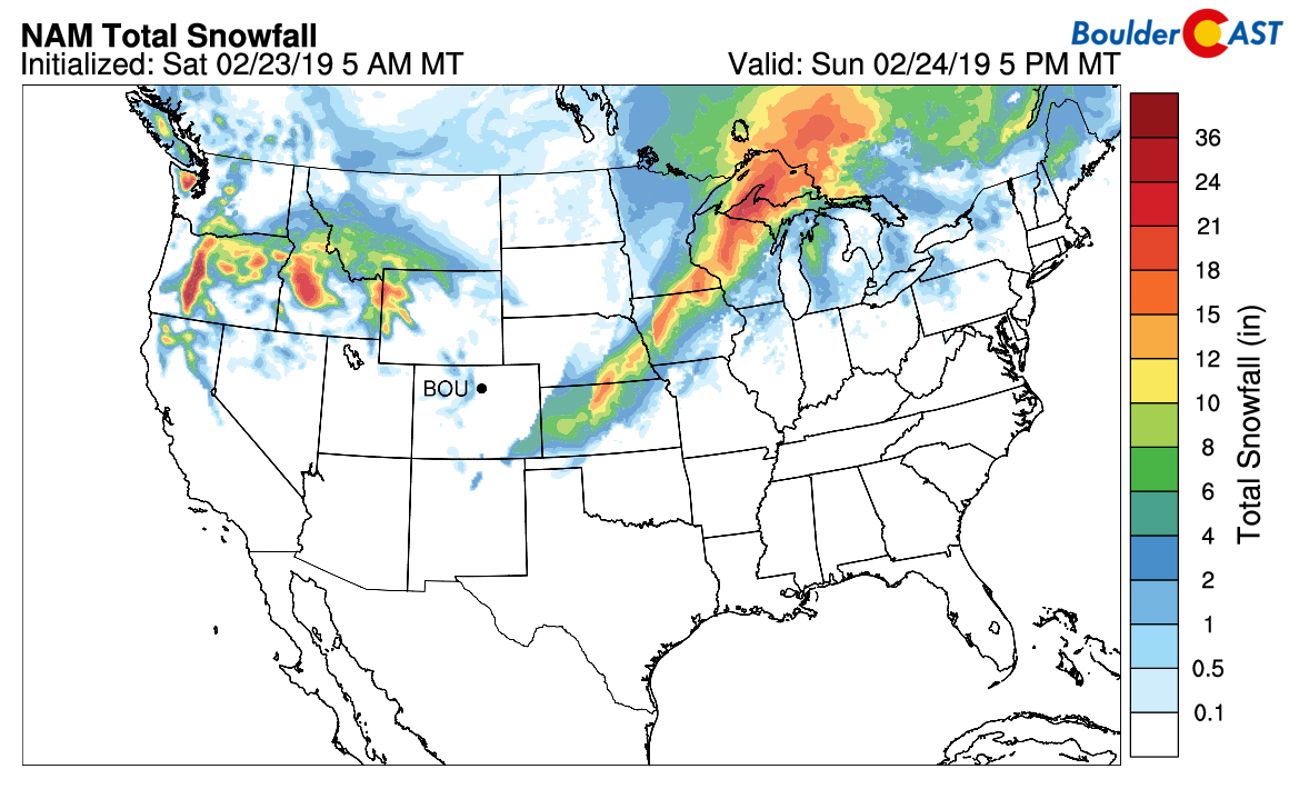
NAM snowfall forecast through Sunday evening
The driving force for Friday night’s snowfall was a line of strong low-level convergence. Northwesterly downslope clashed with moisture-laden southeasterly flow from a strengthening surface low in southeast Colorado. This created a linear region of intense lift that coupled with instability aloft. Once the air got rising, there was nothing to stop it.
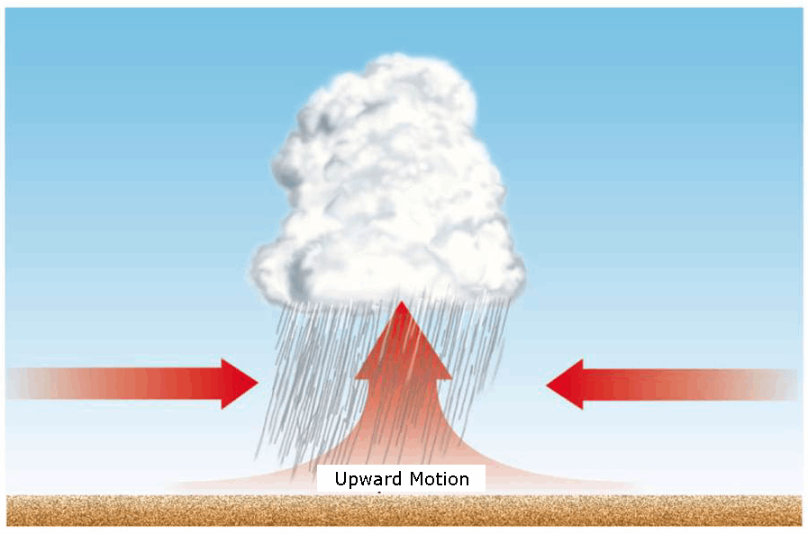
Diagram showing low-level convergence and how it leads to lift. Imagine that rain being snow…in this case.
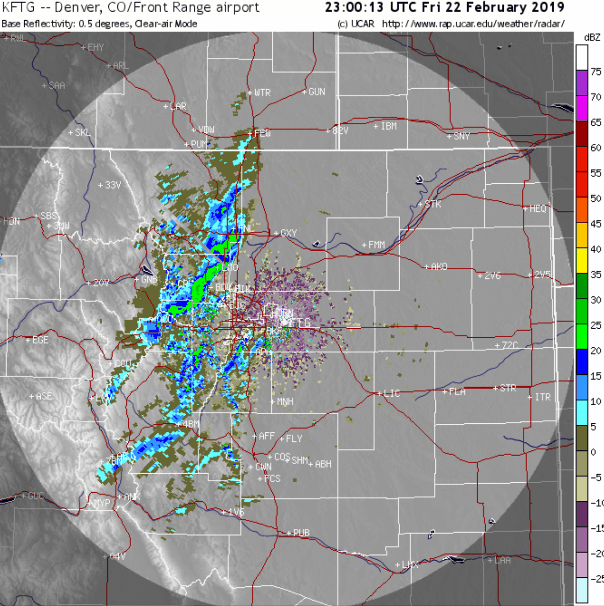
The result was an impressive band of snow with snowfall rates of 2″ per hour. The initial band formed just west of Boulder around 4PM and then slowly crawled eastward across the Denver area Friday evening. It eventually died out as northwesterly winds grew stronger and were too much for the southeasterly winds to counteract. The radar animation for the entire event is shown below.
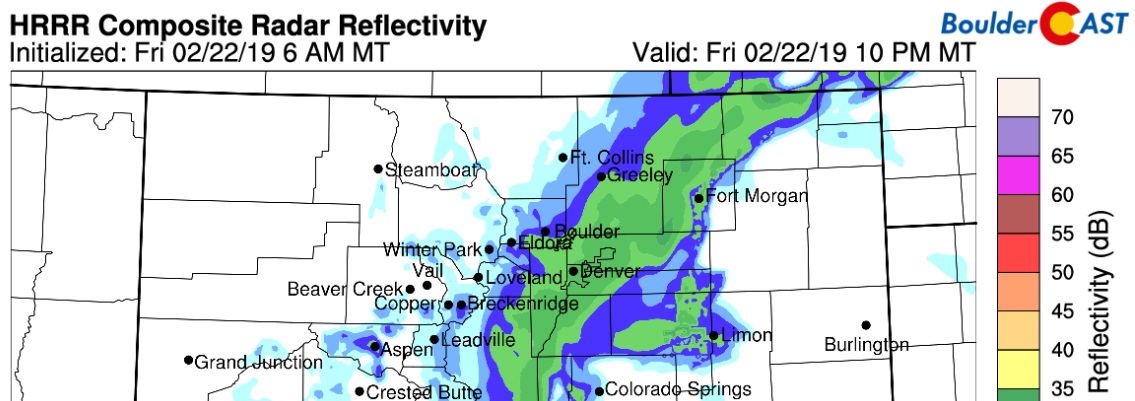
Global weather models like the GFS and ECMWF had there challenges in predicting the heavy snow that transpired across the Metro area Friday evening. The Euro in particular missed the event entirely. We won’t deny it, we underestimated the intensity as well in our preliminary forecast issued Thursday morning. Thankfully, the higher-resolution short-range models, like the HRRR and NAM-3KM, did a fairly good job in predicting not only that the heavy snow band would form, but also getting close on the location, timing and sluggishness of the band’s movement (see below). We hope you weren’t caught too off-guard by how quickly and hard the band hit parts of the Metro area last night. We tried to stress the potential severity and lingering uncertainty in our forecast update!
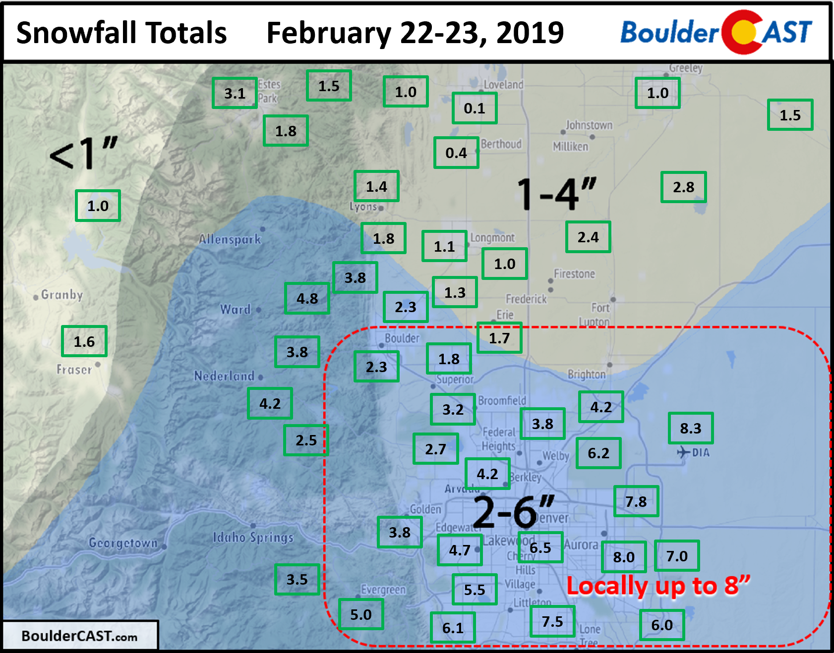
Shown below is our final snowfall forecast map with totals overlaid in boxes. Green boxes indicate that our forecast verified to within one inch of the observed snowfall. Red did not. Our 2 to 6″ forecast did well across the immediate Metro area, including our caveat the localized areas could see up to 8″, as was the case across south and east Denver where the band lingered the longest. Denver International Airport reported 8.3″, the largest total across the entire Front Range. We honestly can’t remember a snow event where this happened before. Feel free to correct us in the comments. Only 2.5″ were reported in Boulder (with some of this falling very early Friday morning).
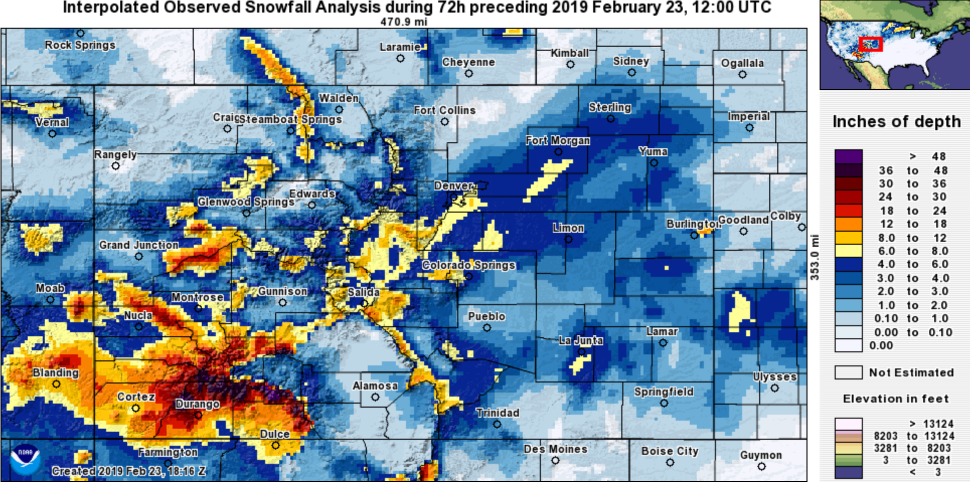
With very few exceptions, this storm produced measurable snowfall for the entire state of Colorado, including more than 3 feet in the San Juans. Wolf Creek and Purgatory ski resorts reported 42 and 48 inches, respectively. That’s a lot of powder!
| Seasonal Snow Totals (Updated Feb 23 2019) |
|---|
| Boulder | Denver |
|---|---|
| 61.3" | 27.8" |
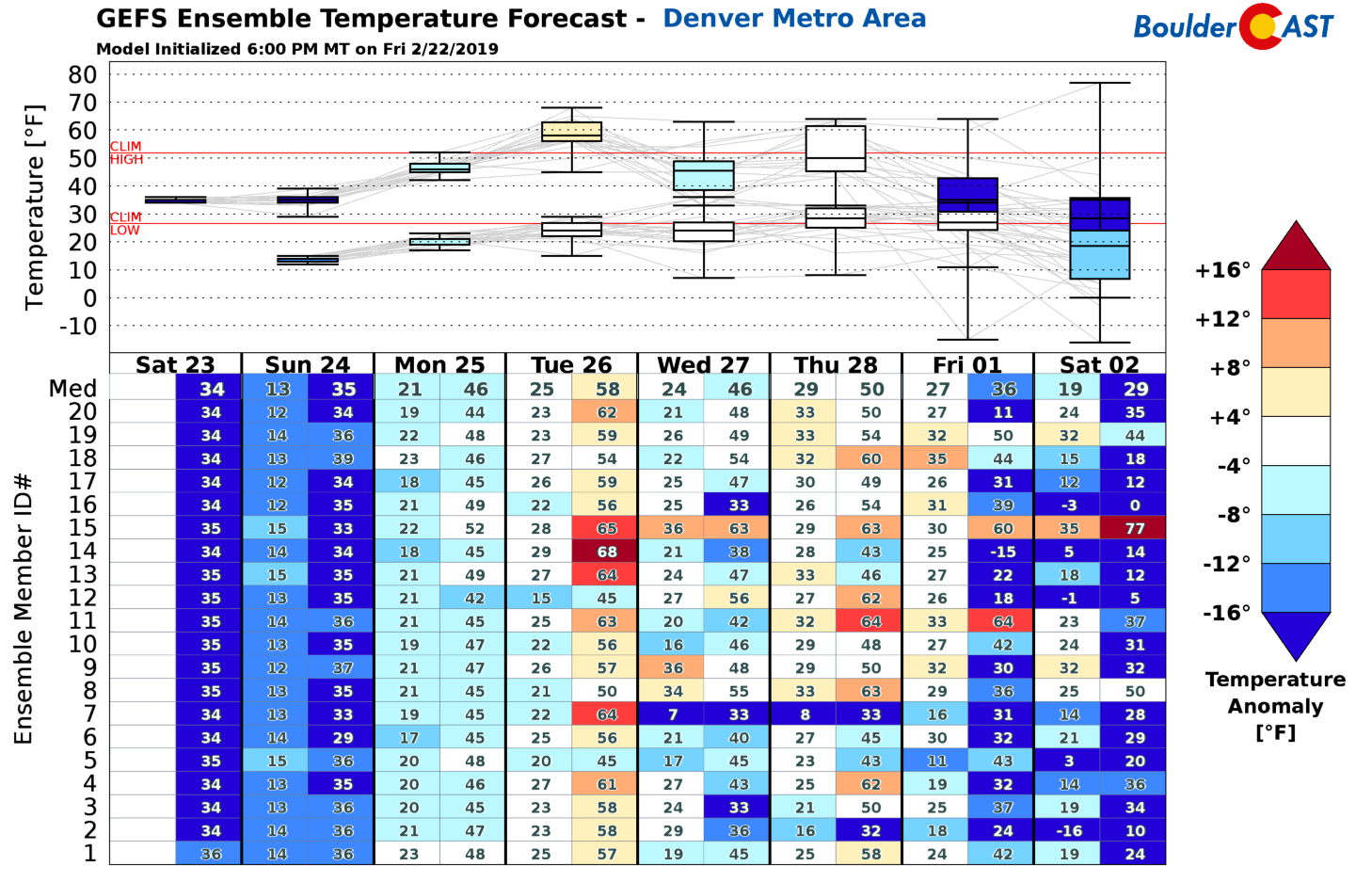
Our weather for the upcoming week will turn quieter as a broad zonal flow pattern aligns across the continental United States. The jet stream will be nearby however, and current model guidance suggests that despite the lack of precipitation, we could see some significant swings in temperatures across northeast Colorado. This and more in our weekly outlook on Monday.
Have a good rest of the weekend as the sun shines and the snow melts!
Share these snow totals:
.


You must be logged in to post a comment.