We provide quick a update on the potential for heavy snow Friday evening across portions of the Metro area. Travel may become difficult with 6″ or more of snow expected in some areas.
The first wave of winter weather went more or less as expected last night. Most of the snowfall was confined to the Foothills and (very) close by Plains. Boulder reported about 1″ of new snow, with 1 to 3″ in the higher elevations from Nederland to Estes Park. Further east, a bulk of the Metro area saw only a few flurries and a glazing of ice from freezing fog and drizzle. Our weather will remain quite dreary through the rest of the day, but we should see the fog lift a little and dry conditions take over through much of the afternoon.
The break in the action will be short-lived, however. The second, stronger wave is already gearing-up to impact the Metro area this evening and tonight as the main storm system and trough axis pass by. As of Friday morning, the center of the upper-low is located near Phoenix, Arizona. Over the next day or so, the system will move east-northeast into the Oklahoma Panhandle and Kansas, passing well south and east of the Front Range.

GFS 500 mb height anomaly forecast for mid-day Friday
The GOES-East water vapor imagery confirms the GFS’s modeled location for the storm in west-central Arizona. It also shows a deep plume of moisture streaming northward ahead of the trough. This plume is an important ingredient that will help supply moisture for snow this evening.
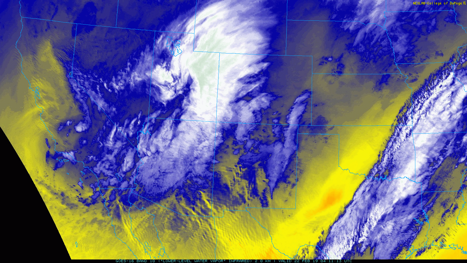
GOES-East water vapor animation for Friday morning
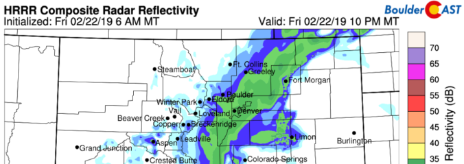
Though most of the energy from the passing storm system will remain south and east of the Metro area tonight, high-resolution models are showing a strong line of low-level convergence (frontogenesis) right across Boulder and Denver this evening (see below).

HRRR model surface wind forecast for this evening showing the convergence.
The EPIC clash between warm/moist southeasterly winds over-running the cold/drier northwesterly winds filtering in is expected to spawn a cluster of moderate to heavy snow bands across the region this evening, aided by moderate instability in the mid-levels of the atmosphere.

HRRR animated radar forecast with precipitation type for this evening
We have very high confidence that these bands will form, but there is notable uncertainty as to where exactly they will develop and linger the longest. The short-range HRRR and RAP models, along with the GFS, have the focus from Boulder southeastward into much of Denver. The NAM has things a little further southeast. The Euro model appears to be missing the banding event entirely. Snowfall rates in the cores of these bands could easily exceed 1 to 2″ per hour, making the forecast of potential snow amounts challenging given the locational uncertainty. Needless to say, it’s going to be an INTERESTING evening….
Timing
Moderate to heavy snow bands will seemingly develop out of no where between 4:00 and 6:00 PM this evening as strong convergence commences. Bands will form first across the Mountains and Foothills, then spreading quickly eastward onto the Plains. Snowfall will be widespread through much of the evening across the Metro area, ending from northwest to southeast after midnight.
Amounts
In general, there should be enough forcing and band coverage for most areas to see between 2 to 5″ of snow. However, localized areas that land under a band for a few hours could see high-end totals push closer to 6 or even 8″. Our thoughts are that the highest probability for this would be closer to Denver than to Boulder given the way things are looking. However, if you’re reading this post now, your area also has a chance! Our updated snowfall forecast map through Saturday morning is below.

Given the timing of the expected on-set and just how hard and fast these bands will hit affected areas, expect widespread travel issues this evening and tonight. If possible, scurry out of work a little early today. We promise you won’t regret it!
Spread the word, share this forecast:
.


You must be logged in to post a comment.