
We concluded the already very snowy and cold month of November with even more snow and cold on Tuesday. A brief period of moderate to heavy snow led to a slick morning commute in many areas, with some of the coldest air of the season filtering in as the snow cleared out. Let’s take a look at the snowfall totals across the area, review November’s weather so far, and discuss the largely pleasant weather that lies ahead.
Light snow began right on schedule late Monday evening across the Front Range, with a swath of moderate to heavy snow following suit shortly thereafter through the wee morning hours on Tuesday. There was a several hour period where snowfall rates of 1″+ per hour were observed in the forecast domain.

Radar animation from the early morning hours on Tuesday 11/29/22
Most of the snow fell before dawn on Tuesday, with lighter snow falling during the morning hours. Despite this, the morning commute was slick across the area.
The roads in Boulder right now #cowx pic.twitter.com/41pExN0Srm
— BoulderCAST Weather (@BoulderCAST) November 29, 2022
Our snowfall forecast map for the event issued early Monday morning is shown below with storm totals overlaid. Green numbers indicate our forecast verified to within 1″. Red did not. As you can see, anywhere from 2 to 8″ of snow fell across the entire area with nearly perfect forecast verification overall.
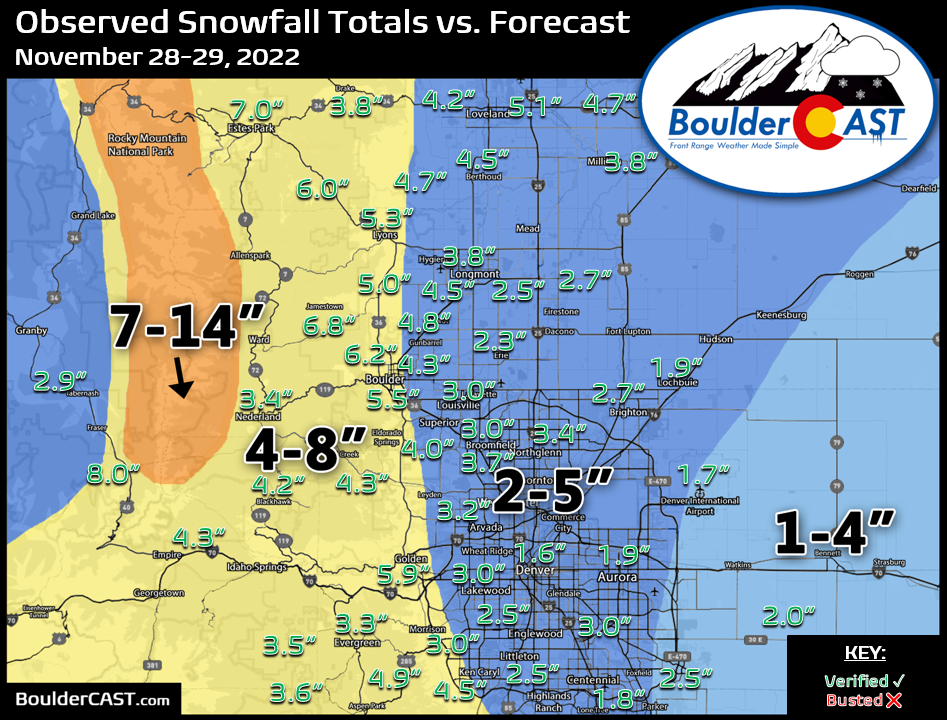
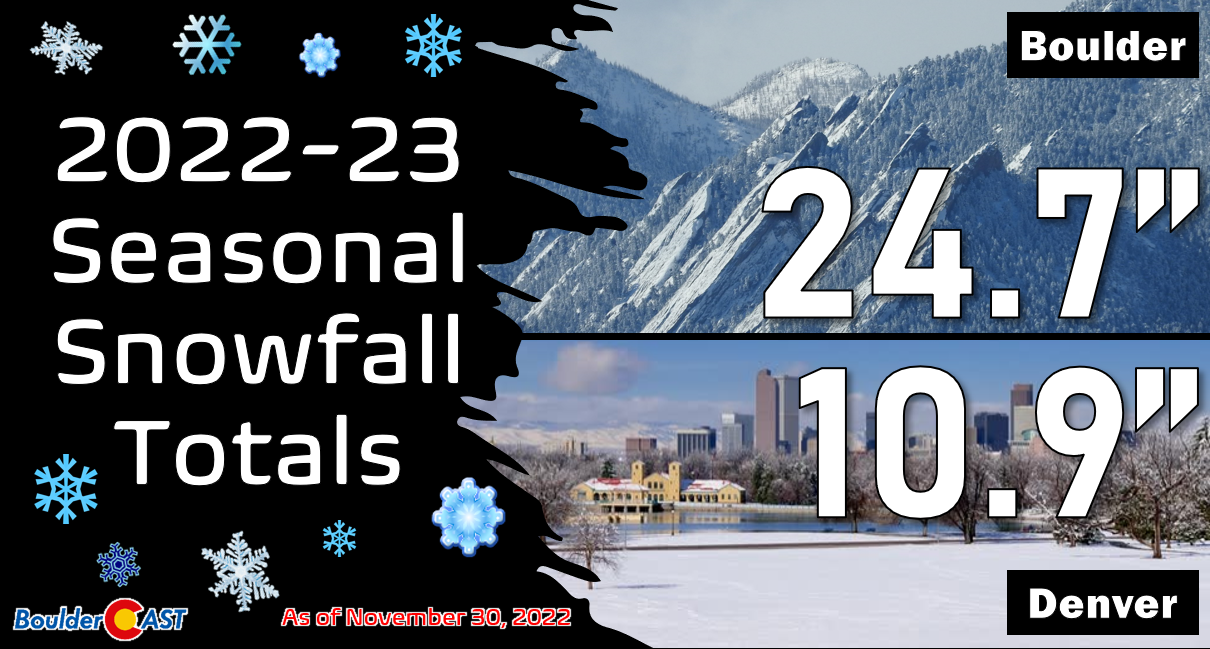
Officially, Boulder reported 5.5″ of snow from the event, while Denver (DIA) received only 1.7″. This brings the seasonal totals to 24.7″ and 10.9″, respectively — above normal in both cities!
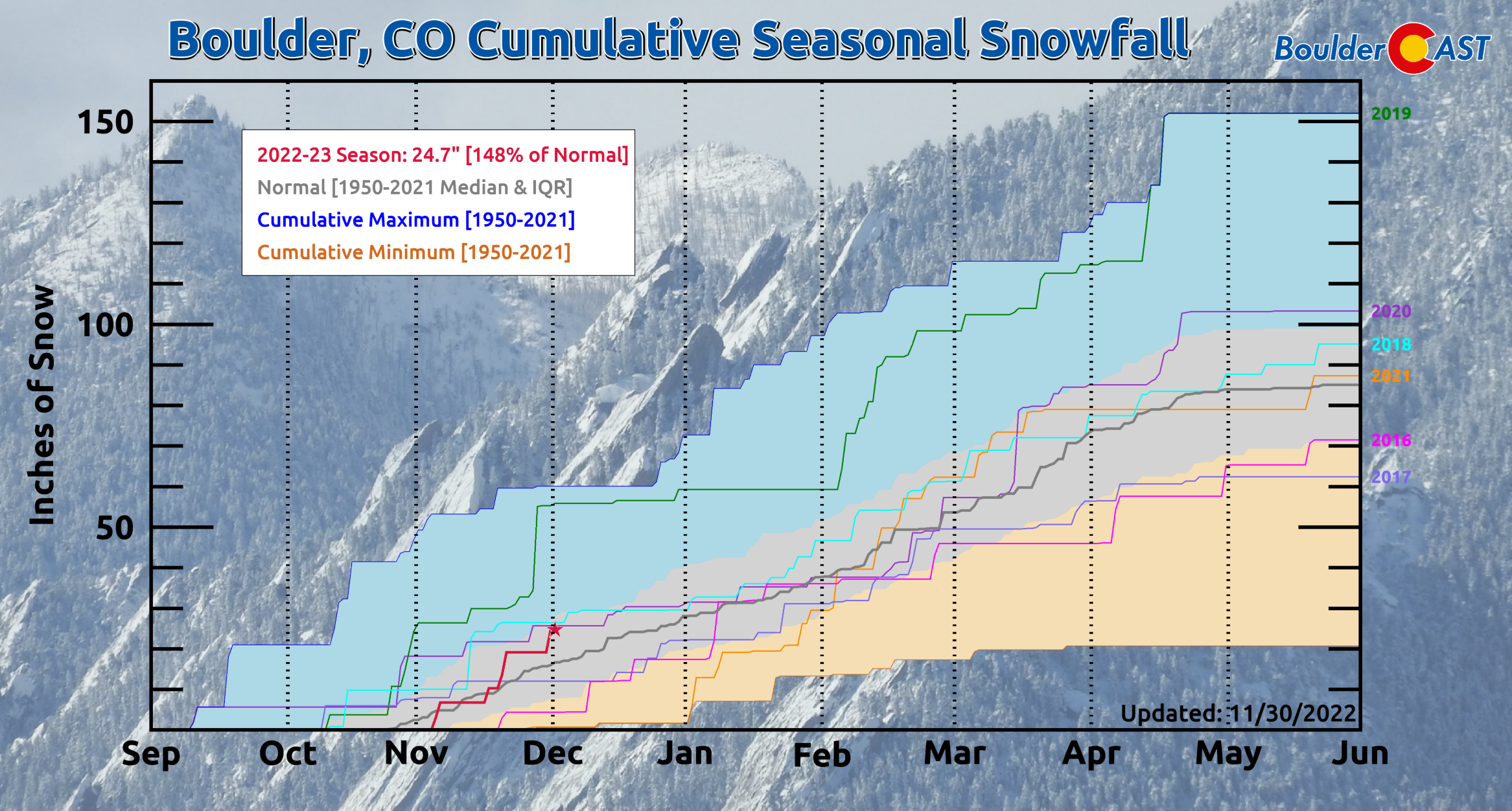
Here’s a look at how snowfall has tracked through the season so far in Boulder. We’re currently sitting about 50% above normal.
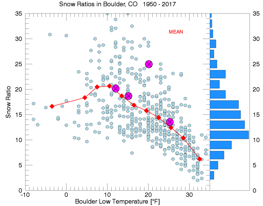
November 2022 has been particularly white in Boulder — just over two feet of snow has fallen this month which is more than double the typical amount. Despite this, our monthly precipitation total — derived the meltwater of all that snow — is 1.42″ which is only 25% above normal. This discrepancy is directly linked to the dry and fluffy nature of the snow this month. Three of the four snow events this November racked up snow ratios of 18:1 or higher!
- November 3-4: 6.7″ snow, 0.51″ meltwater = 13:1 snow ratio
- November 15: 3.5″ snow, 0.14″ meltwater = 25:1 snow ratio
- November 17-18: 8.9″ snow, 0.46″ meltwater = 19:1 snow ratio
- November 28-29: 5.5″ snow, 0.30″ meltwater = 18:1 snow ratio
This month’s snow events are marked in magenta below. Typically snow is not quite this fluffy in November, but the storms have been COLD for this time of year — colder temperatures mean more big dendritic-type snowflakes which pile up faster.
The above normal precipitation this month is something exclusive to the Boulder area. The rest of the Front Range has seen below normal precipitation this month which has slightly exacerbated the ongoing drought.

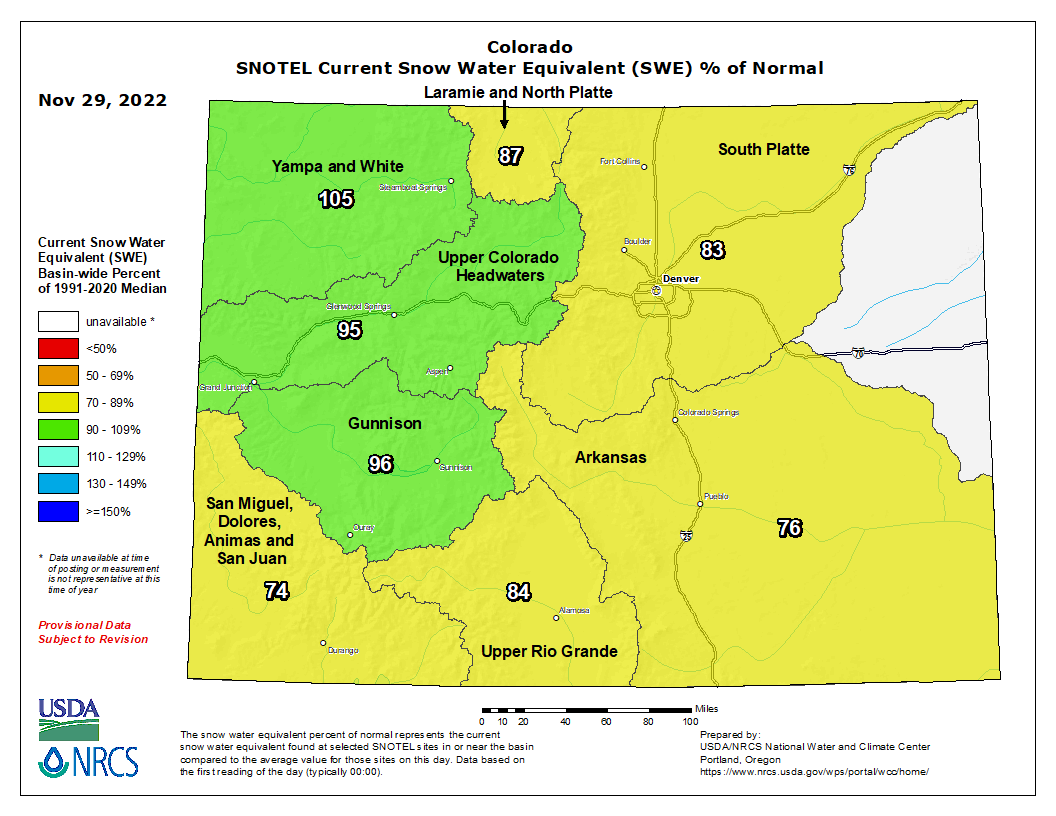
In typical La Niña fashion, northwest Colorado has been rather wet (i.e. snowy) while the eastern and southern Mountains have been drier.
Temperatures have been below normal statewide in November — which has bolstered those snow ratios which we already touched on. Boulder is sitting about 5.0°F below normal for the month while Denver has been 3.3°F below normal. These numbers will worsen slightly considering the unseasonably cold finale to the month today.

Wednesday will stay cold entrenched under Arctic high pressure, but at least it will be mostly sunny out there!
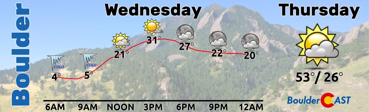
The days ahead will offer a pleasant warming trend — we’ll be back in the 50s in no time — but watch out for those pesky downslope winds on Friday which will be whipping in from the west-southwest! This same system will bring another round of snow to the High Country as well.

Enjoy the rest of your Wednesday!
Get BoulderCAST updates delivered to your inbox:
Enjoy our content? Give it a share!


You must be logged in to post a comment.