
Thanks to multiple rounds of steady rain, a hail-producing thunderstorm, and even a few snowflakes, Boulder has remarkably received about as much precipitation this weekend as we’ve seen in all of 2025 combined beforehand! We review the rain (and snow!) totals across the area and discuss briefly what unfolded over the last 36 hours during what was a rather atypical spring storm.
T
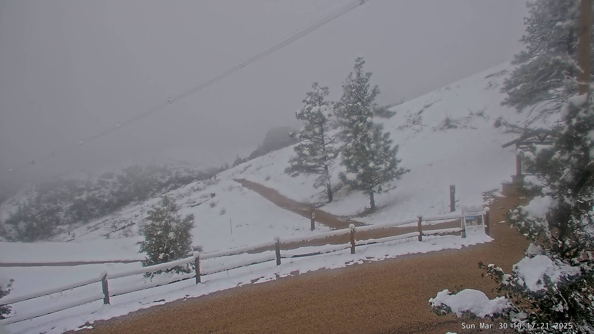
hrough 7:00AM Sunday, Boulder has officially received 2.33″ of precipitation this weekend. Almost all of that fell as a chilly rain, but there was a brief change-over to snow Saturday evening for an hour or so that led to a light dusting of wet flakes on the grass in some parts of the western Denver Metro area. There was significantly more snow, several inches in some cases, just to the west in the Foothills where temperatures were a few degrees colder. This is the view from Walker Ranch Sunday morning, which is located just behind the Flatirons at 7200 feet, where a couple inches of sludgy snow is evident.
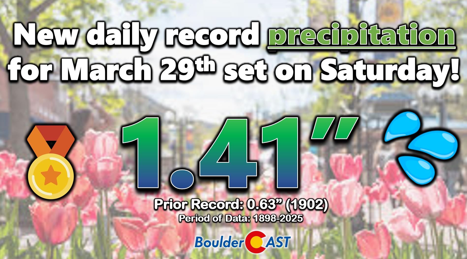
Boulder set a new daily precipitation record for March 29th, obliterating the (admittedly tame) 123-year-old record from the turn of the 20th century:
Here’s a look at precipitation (top) and snowfall (bottom) totals through Sunday morning… what a soaker!
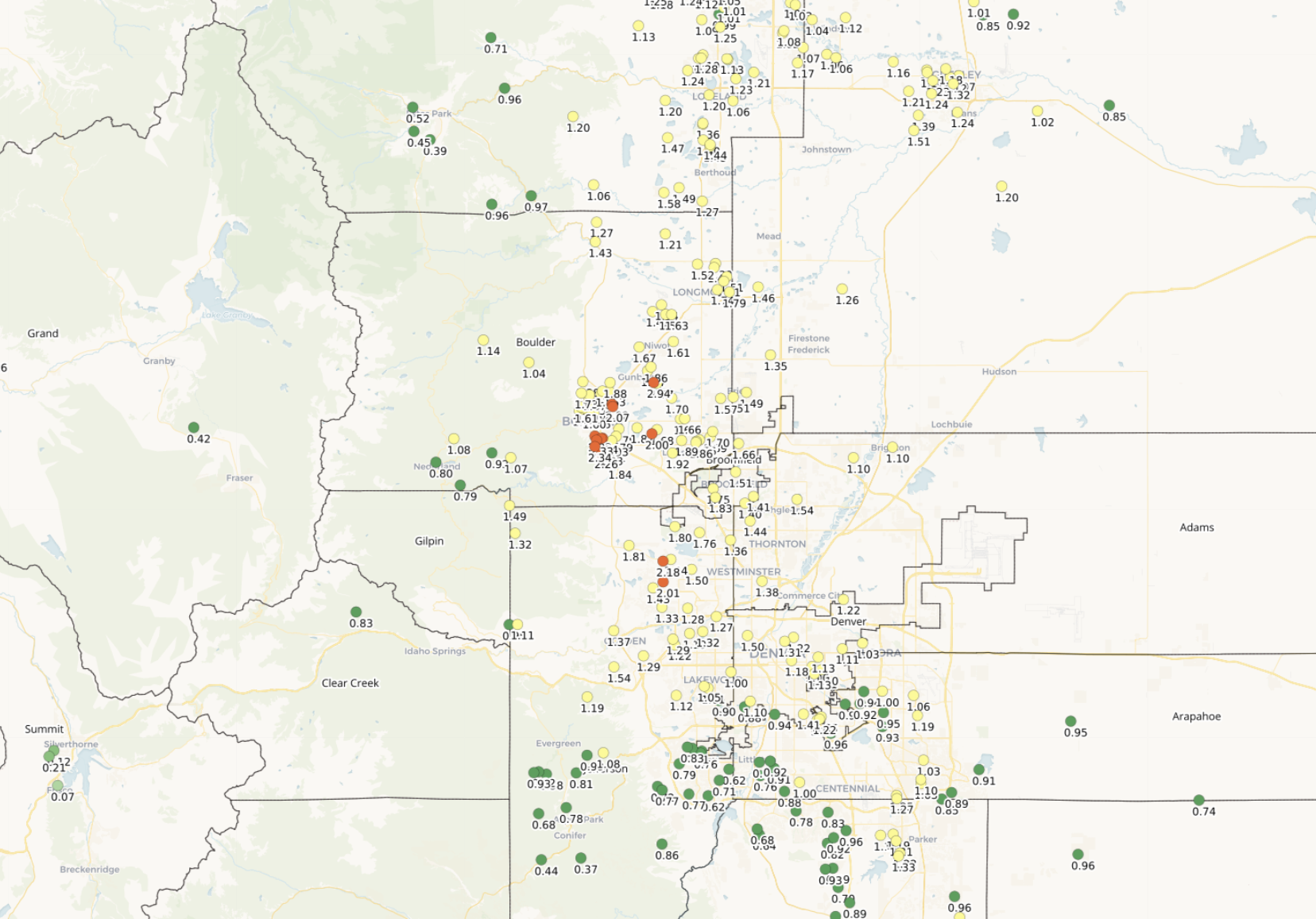
Front Range 48-hour precipitation totals ending ~7AM Sunday March 30, 2025
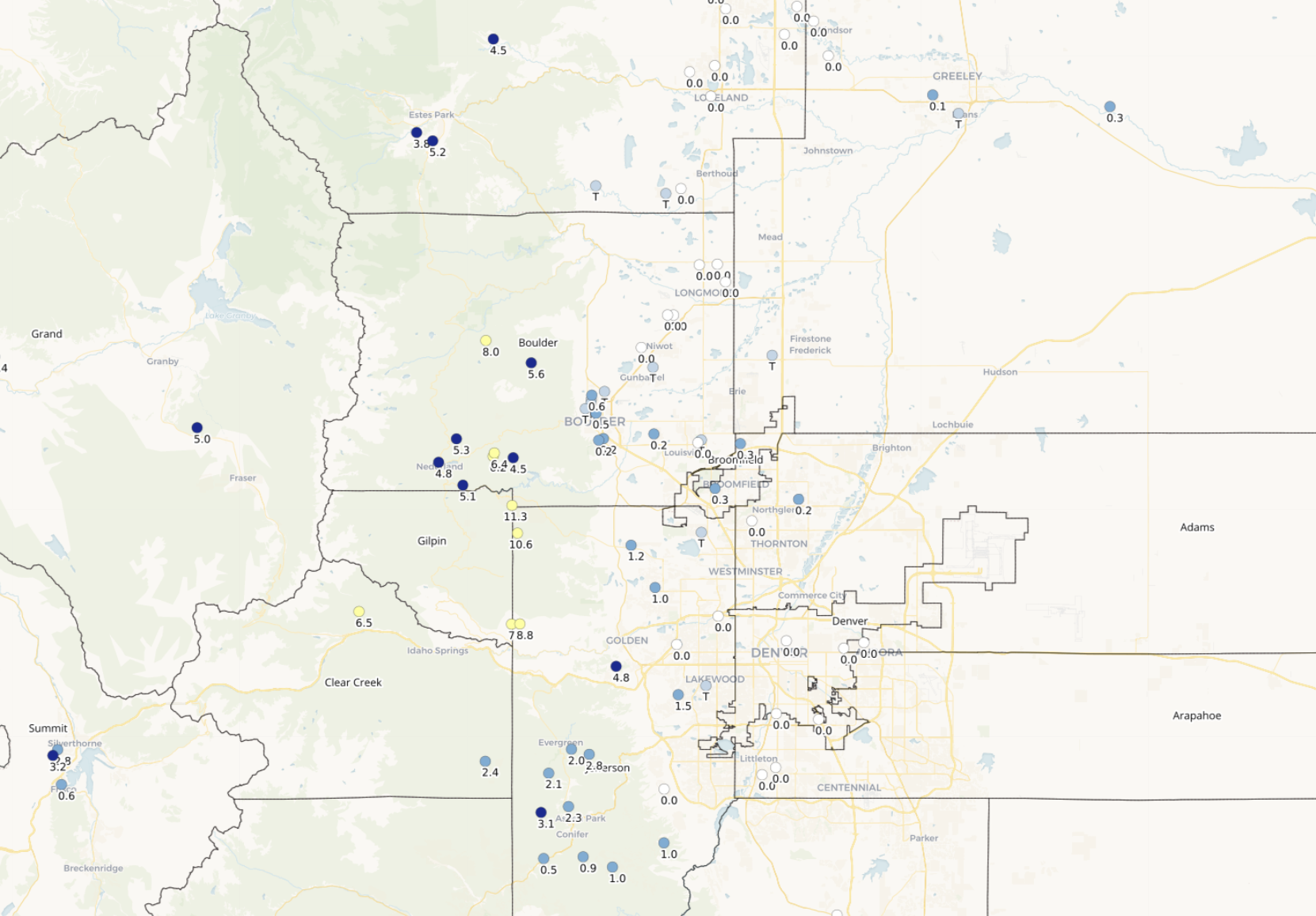
Front Range 48-hour snowfall totals ending ~7AM Sunday March 30, 2025
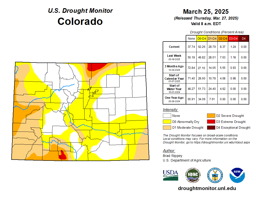
There’s only a small amount of drought in the northeast corner of Boulder County right now, with more intense drought extending northward into Wyoming. We needed this moisture more than you might realize. The last month or two have been exceptionally dry for the entire area — with barely any appreciable rain or snow to be found. The period of February 22 to March 28, 2025 was the fourth driest on record with just 0.29″ of precipitation falling in Boulder during this five-week timeframe.
Can you believe the precipitation that fell over the last 36 hours in Boulder this weekend was nearly as much as had fallen over the prior 90 days? Believe it!

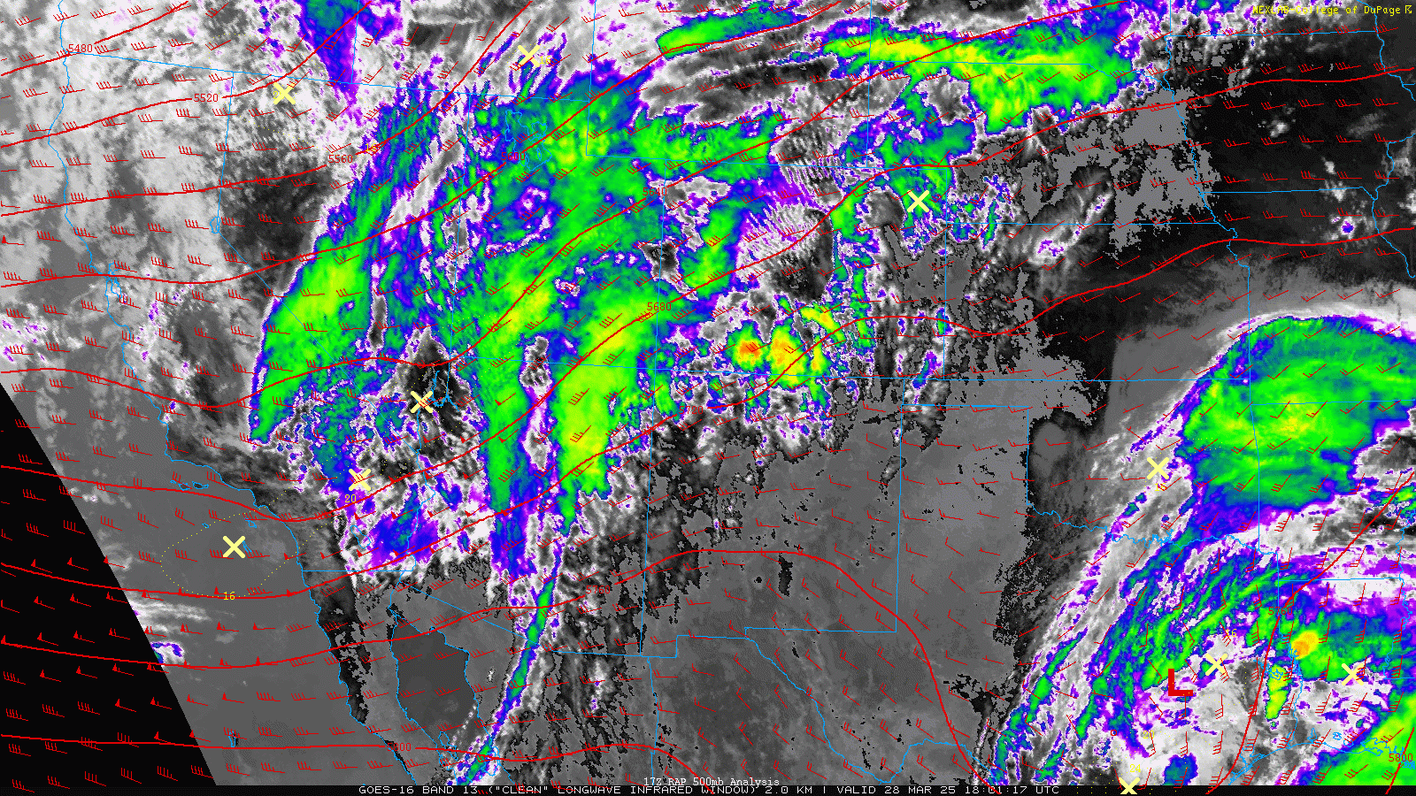
The weekend’s precipitation came via two punches from Mother Nature, each associated with a distinct shortwave disturbance passing across Colorado in the southwest flow. This two-part event led to impressive precipitation totals region wide, but was far from a classic upslope spring storm in the Front Range.
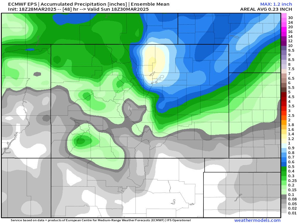
Squeezing this much moisture out of this type of setup is quite remarkable, to be honest. Our weekend forecast called for plenty of rain and gloom, but what unfolded was beyond expectations. There was definitely some model support for this type of event ahead of time, most notably the Euro model nailed it (below), but short-range guidance struggled to pinpoint whether or not the deeper moisture and heavier precipitation would be east of Denver, or squarely over the Front Range. Welp, it was the latter!
Precipitation totals were ultimately bolstered by atmospheric instability that developed late Saturday afternoon when torrential thunderstorms spawned across the area, some of which contained pea-sized hail that lightly accumulated to make the ground briefly white. Saturday actually turned out to be a pretty nice day with lots of sunshine, which ultimately generated the fuel for storms to pummel us later on.
Epic thunderstorm with heavy rain and hail is just what we needed here in #Boulder ! #cowx pic.twitter.com/AENiWCJZq7
— BoulderCAST Weather 🏔️❄️ (@BoulderCAST) March 29, 2025
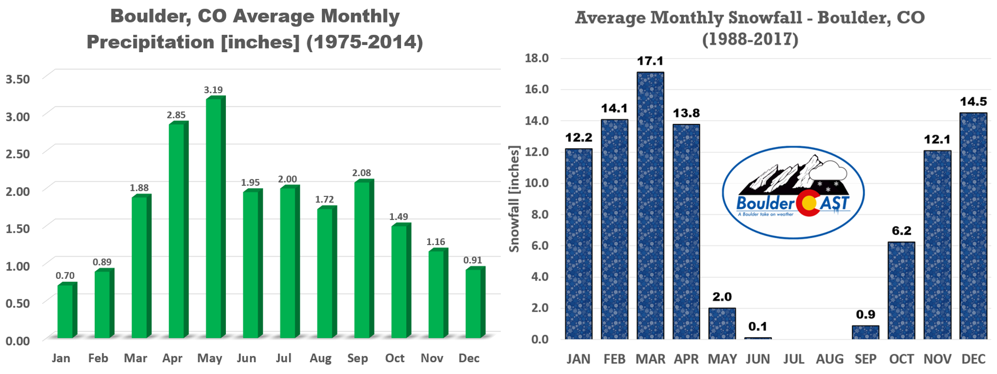
This soggy weekend has put us in much better shape as we transition into April and May, our two wettest months of the year on average.
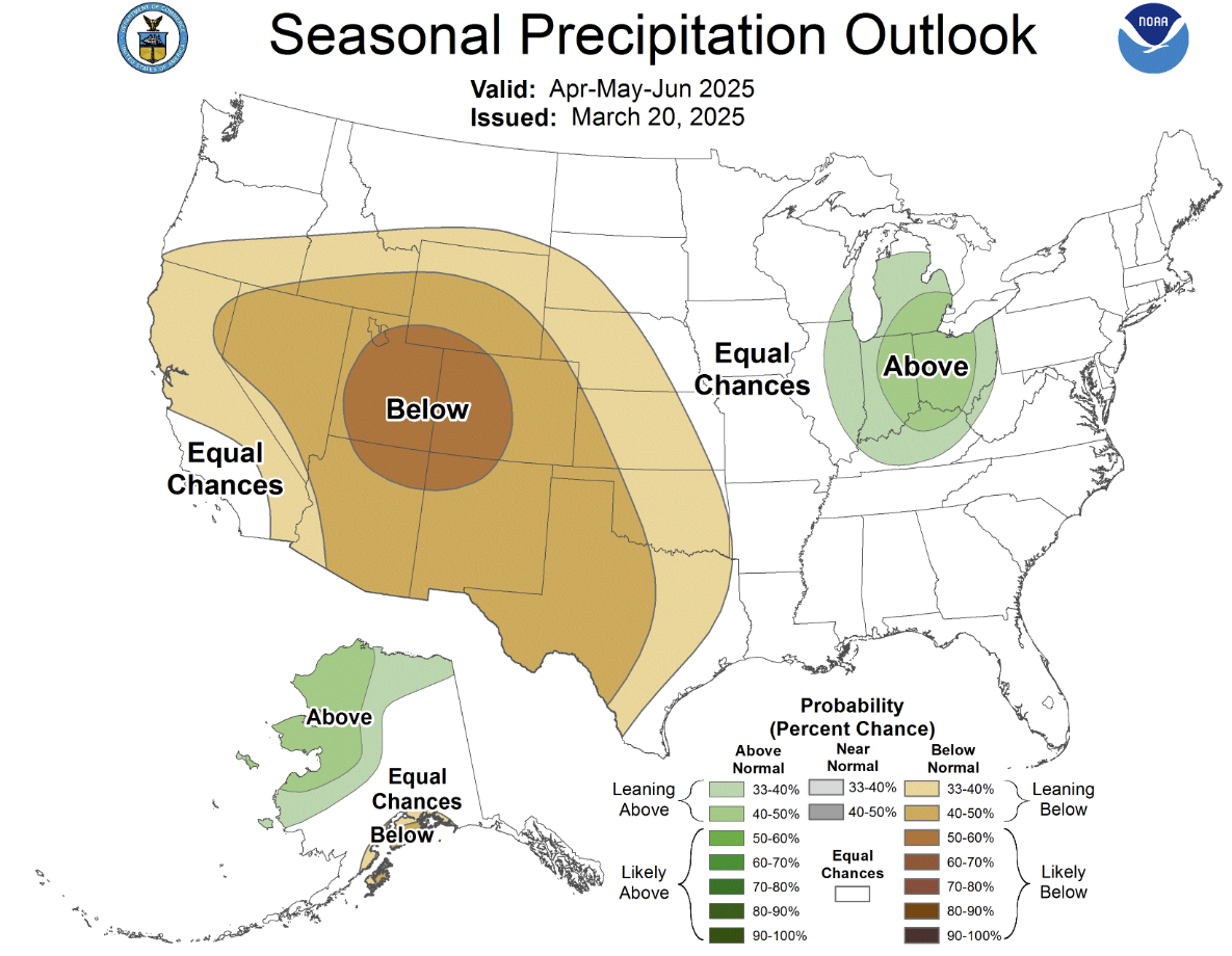
However, the long-range precipitation outlook for the coming months isn’t great with below average precipitation favored across the entire Four Corners area throughout the rest of spring.
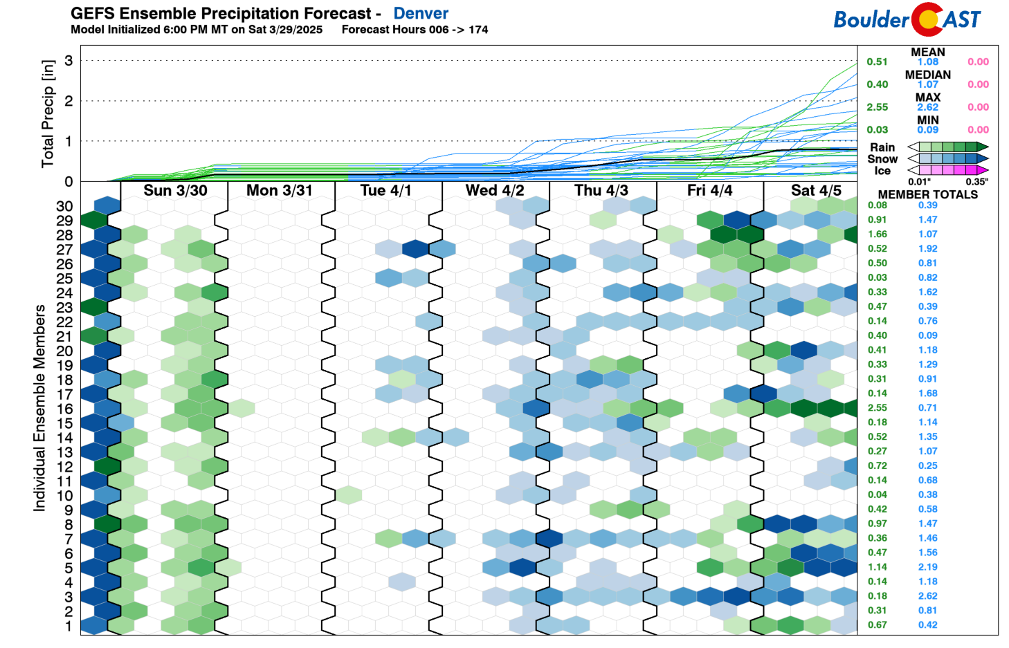
Despite this foreboding outlook, the first week of April will offer several chances for rain and snow in the Front Range. Though there’s still plenty of uncertainty, an ensemble mean precipitation forecast close to 1″ through the week ahead is a good sign. Thanks to the deluge of rain this weekend, and this cool and unsettled extended forecast, our vegetation should be greening up nicely in no time!
That’s all for now. We’ll discuss the upcoming week’s weather in much greater detail in our usual Monday morning outlook tomorrow. Happy gloomy Sunday!
Get BoulderCAST updates delivered to your inbox:
DISCLAIMER: This weekly outlook forecast is created Monday morning and covers the entire upcoming week. Accuracy will decrease as the week progresses as this post is NOT updated. To receive daily updated forecasts from our team, among many other perks, subscribe to BoulderCAST Premium.

Go Premium, get all the perks.
Daily Forecast Updates
Get our daily forecast discussion every morning delivered to your inbox.
All Our Model Data
Access to all our Colorado-centric high-resolution weather model graphics. Seriously — every one!
Ski & Hiking Forecasts
6-day forecasts for all the Colorado ski resorts, plus more than 120 hiking trails, including every 14er.
Smoke Forecasts
Wildfire smoke concentration predictions up to 72 hours into the future.
Exclusive Content
Weekend outlooks every Thursday, bonus storm updates, historical data and much more!
No Advertisements
Enjoy ad-free viewing on the entire site.
Enjoy our content? Help us out and give it a share:


You must be logged in to post a comment.