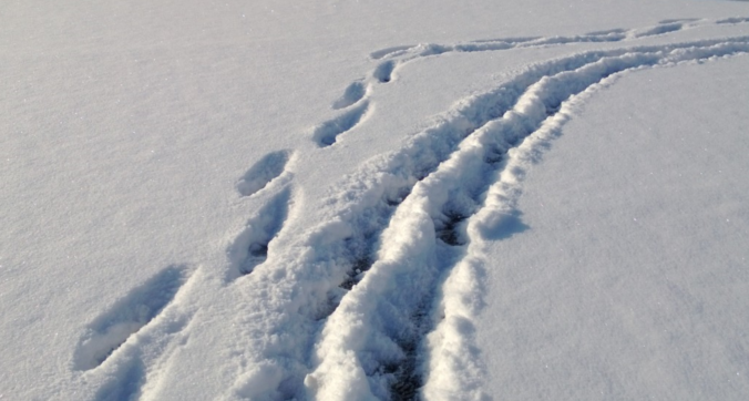
We hope you had a great New Year’s Eve and managed to stay warm! Despite snow falling for more than eightteen hours straight in many locations, it didn’t add up to all that much, or overly impact holiday travel. We review the snow totals from across the Front Range and when the bitter cold will break.
Shown below is our snowfall forecast map with totals overlaid in boxes. Green boxes indicate that our forecast verified to within one inch of the observed snowfall. Red did not. Overall most places landed within the lower bounds of our snowfall forecast. However, the extent of the boosted amounts south and west of Denver did not verify all that well. Boulder’s official total was 3.2″ from this storm, with 2.6″ of that falling in 2018 and 0.6″ in 2019. Denver International Airport reported just 0.5″.
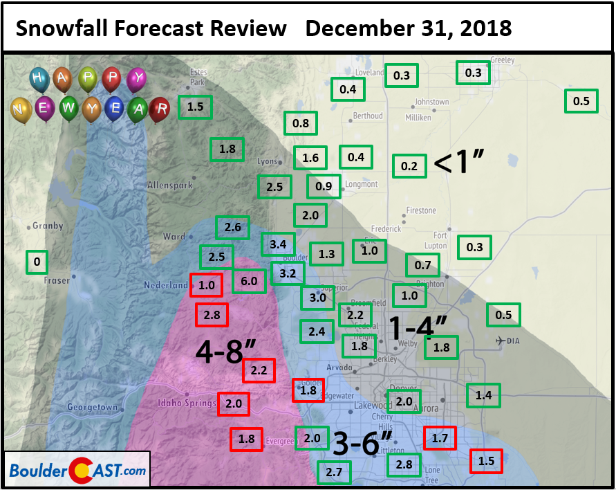
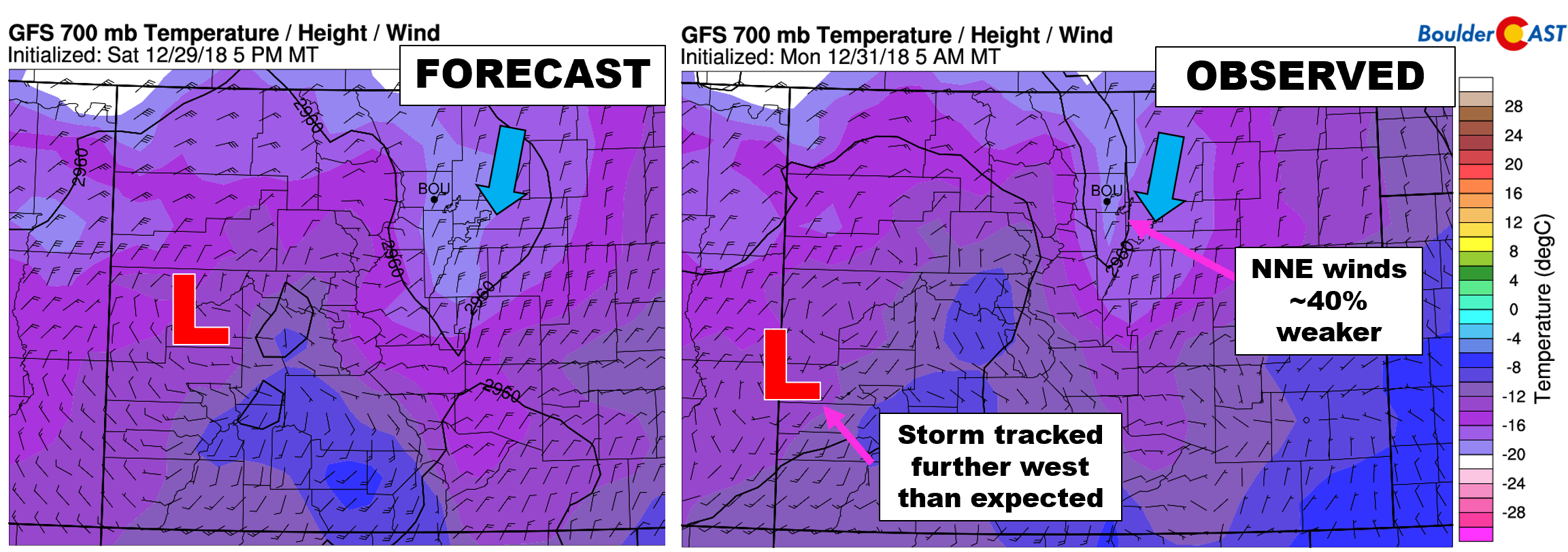
It appears the storm tracked a little further south and west than models were showing on Sunday. We discussed this slight shift in track Monday morning with our Premium subscribers. The shift appears to have reduced upslope intensity by about 40% across the Metro area. For a storm that was ever-so dependent on this upslope component, this is likely the main reason totals came in on the low-end.
| Seasonal Snow Totals (Updated Jan 2 2019) |
|---|
| Boulder | Denver |
|---|---|
| 32.9" | 8.2" |
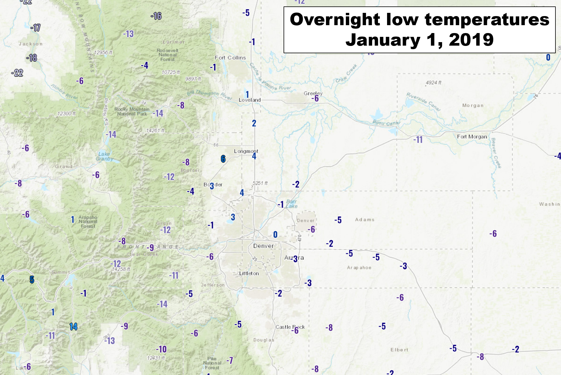
With the storm over and done with and the sun shining, the story now becomes the bitter cold….those that attended the fireworks celebration Downtown Monday know what we’re talking about! Last night was the coldest of the season…with many areas dropping below zero. Enough clouds were socked in across the immediate Metro area that temperatures remained above zero in many locations. We recorded a low of ONLY 3 degrees at BoulderCAST Station.
The upper-level disturbance which aided in producing the snow yesterday has only moved slightly south in the last 24 hours. It is currently located near Four Corners. The storm system is rapidly weakening and its influence is already well south of us. Southwestern Colorado, New Mexico and Arizona are currently receiving the brunt of the dying storm.

GFS 500 mb height anomaly forecast for this morning
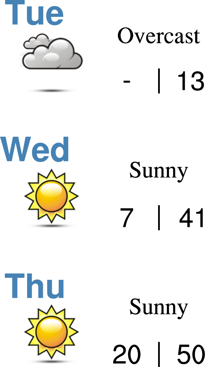
Morning cloud cover today will give way fairly quickly to partly sunny skies. We’re still well embedded in the Arctic airmass and with the fresh snow, temperatures will only warm into the middle teens this afternoon.

GFS 800 mb temperatures for early evening. VERY cold air is evident across Colorado.
Look for a gradual warming trend the rest of the week as high pressure builds in from the west. We’ll have more details on this warm-up and our next chance of snow in our 5- day outlook post tomorrow…
Share this post:
.


You must be logged in to post a comment.