Just when it seemed 2018 would end on a quiet note, snow returns to the forecast for New Year’s Eve in Boulder and Denver. Read on to find out when the snow will begin, how much we will see, and when we expect the first below zero temperatures of 2019.
STORM OVERVIEW:
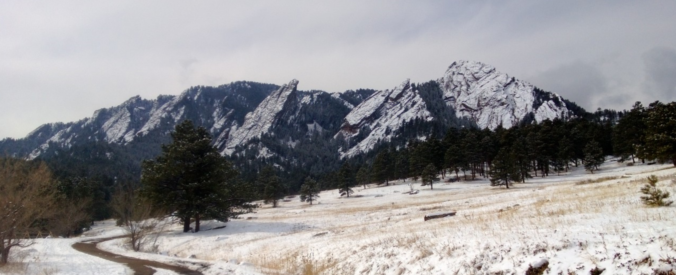
Boulder has only seen 3 inches of snow in the month of December so far, with most of this falling nearly four weeks ago. This is well below the normal of 14 inches for the month. While it is unlikely we’ll see enough snow on Monday to get back to normal, we’re definitely overdue for a little white stuff. Fortunately, that is the topic of today’s weather discussion!
While it has been a decent day so far on this Sunday, changes are looming to our north and west. The approaching storm is easy to spot in the GOES-East water vapor animation below. Do you see the slight rotation in western Montana?
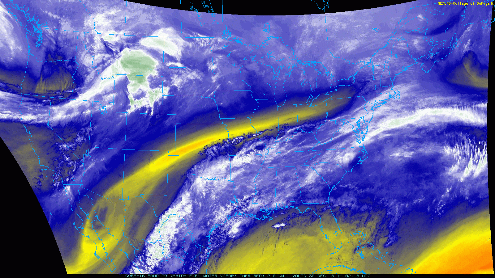
Current GOES-East mid-level water vapor animation (ending Sunday late morning)
This system will move into into western Colorado and Utah by early Monday morning. At that point, it is expected to stall, probably for 24 to 36 hours, as it pivots before moving eastward Tuesday night.

GFS 500 mb map for Sunday at mid-day
This storm isn’t going to be all that organized or strong, and the overall track favors areas of southern Colorado, New Mexico, and Arizona with the best large-scale synoptic lift. This will leave only weak lift for the Front Range.
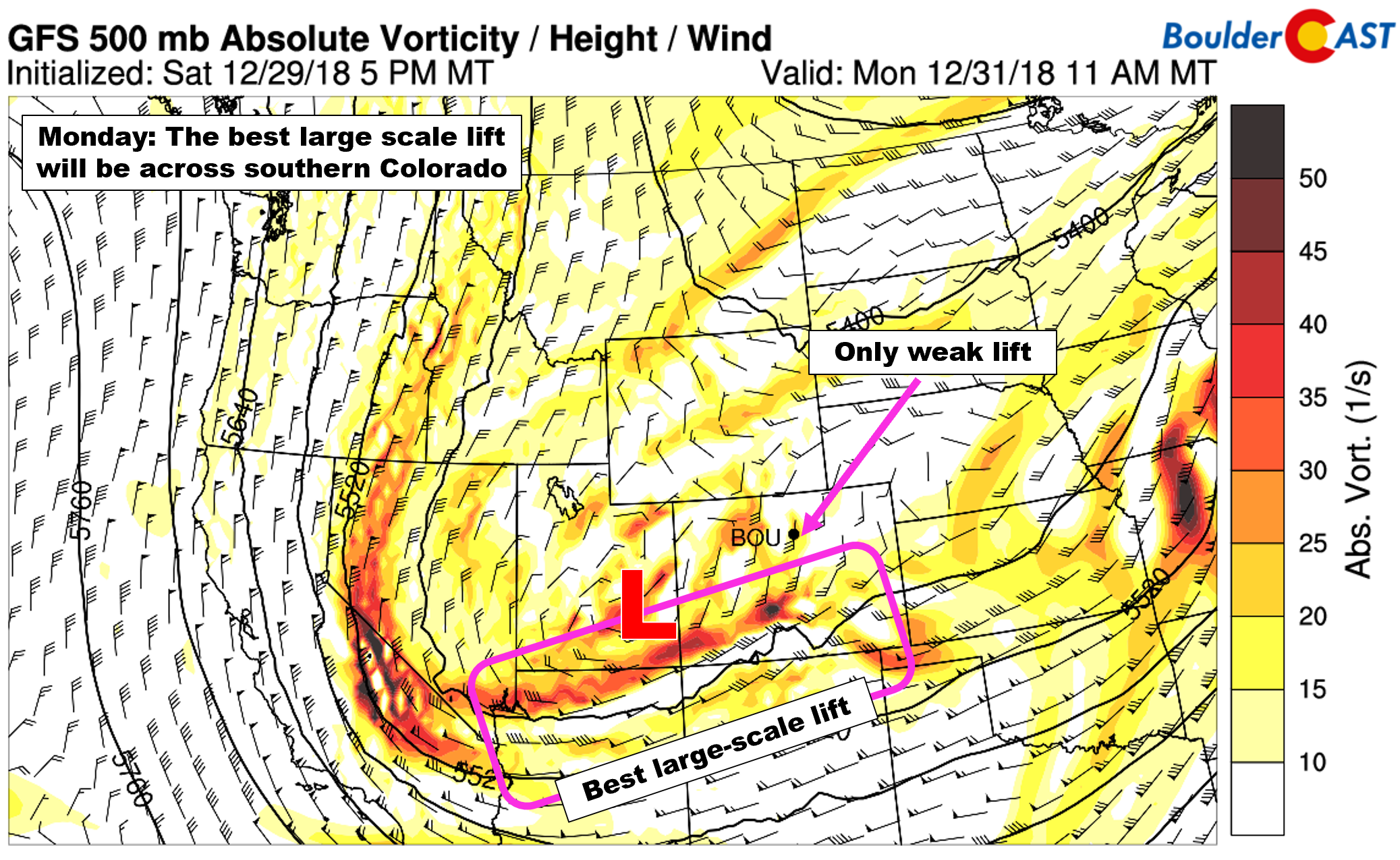
GFS 500 mb vorticity map for Monday at mid-day
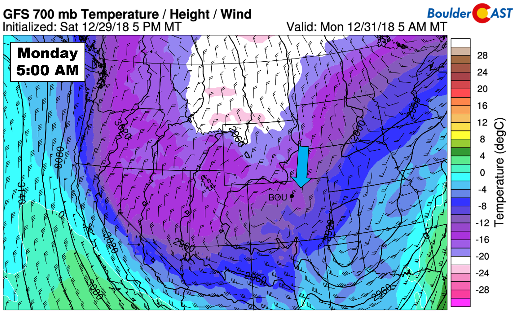
However, this storm does have one thing going for it in our area: an extended period of deep north-northeasterly winds. Here is a look at 700 mb winds and temperatures at 5:00 AM Monday across the West.
GFS 700 mb temperature and wind forecast for Monday morning
Here is a closer look at our region during the same time. Strong 20 to 30 knot winds are present, with a direction that is just a hint east of northerly.
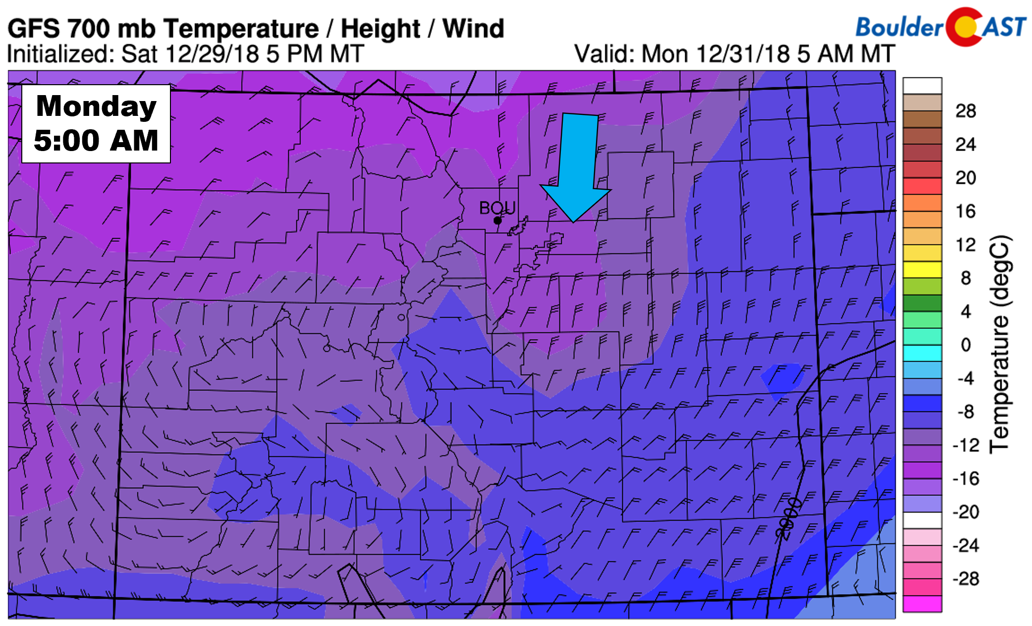
GFS 700 mb temperature and wind forecast for Monday morning
The direction turns just hair more easterly by mid-day Monday:
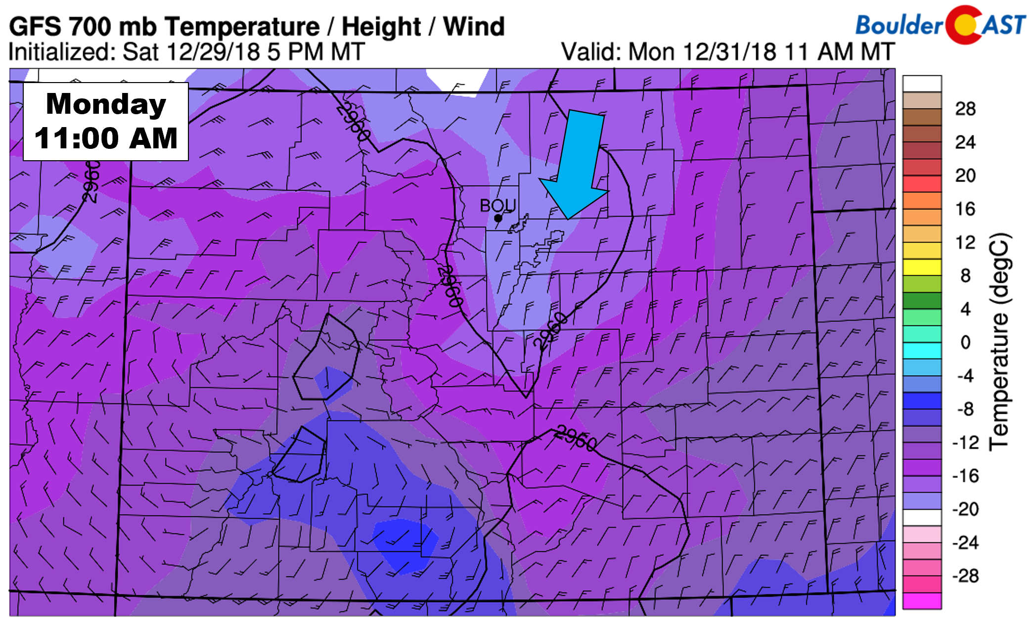
GFS 700 mb temperature and wind forecast for Monday mid-day
By evening, wind directions largely remain unchanged, but speeds start to decrease:
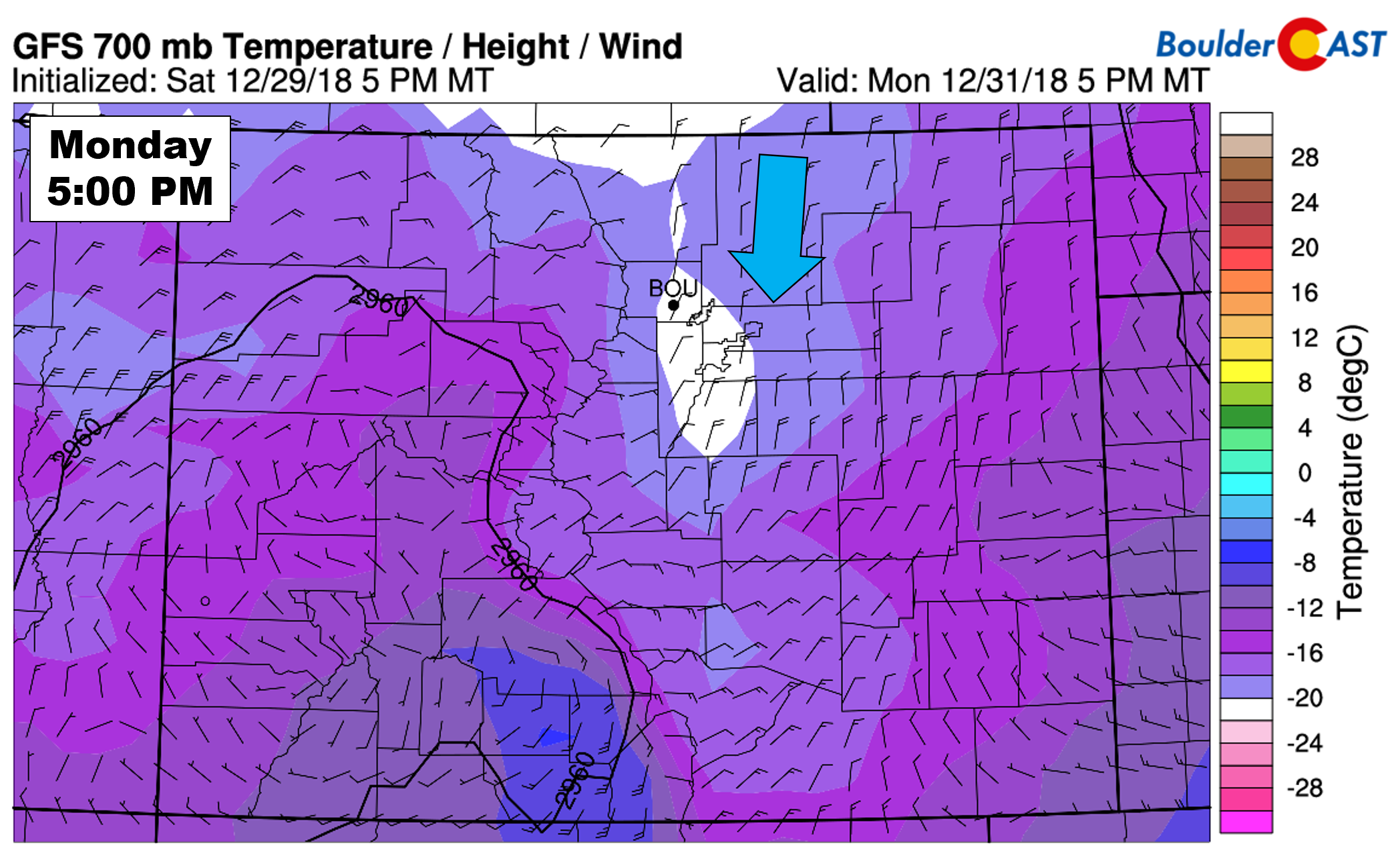
GFS 700 mb temperature and wind forecast for Monday evening
So what are we getting at here? Despite the best forcing from the storm system targeting southern and western Colorado, wind fields are favorable in the Front Range to produce widespread light snow most of the day Monday. The main concern for us is the direction being much more northerly than easterly, which will have two important consequences:
- This is perfect upslope for the Palmer Divide. This is where the biggest snow totals will likely be.
- Limited upslope north of Boulder into Fort Collins…and in fact, even downsloping for this area from the Cheyenne Ridge. Lower snow amounts here.
Okay, we lied. This storm actually has TWO things going for it. In addition to the long duration of upslope (for some areas), it also has very cold air which will contribute to higher snow to liquid ratios. The onset of the storm Monday morning will see fluffy snow ratios around 16:1. As you may have noticed in the 700 mb temperature maps above, colder air will be filtering in throughout the day Monday. With this, snow ratios will increase and approach 20:1 by mid-day into the evening hours.
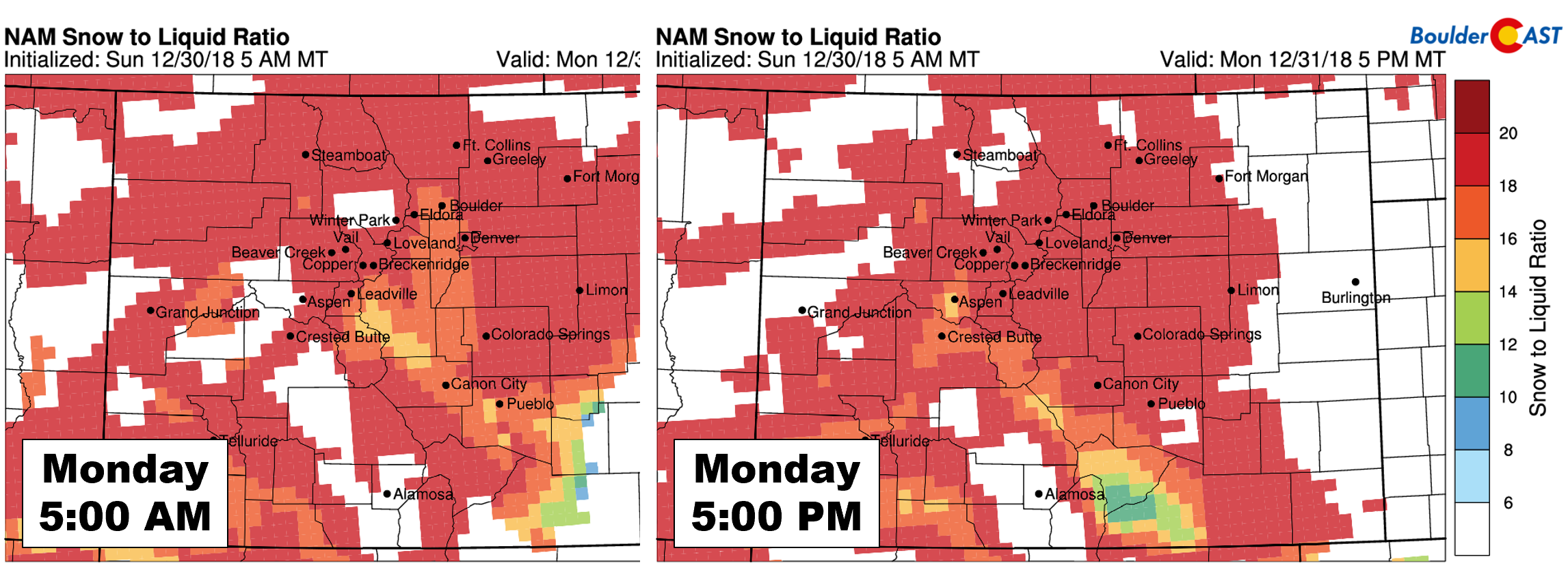
NAM model-derived snow ratios on Monday
Higher ratios mean that snow totals will be boosted overall.
TIMELINE:
Sunday will be mild and pleasant with increasing clouds and temperatures topping out near 50 degrees. The leading edge of the Arctic air is slated to arrive into Boulder and Denver just after midnight Sunday night, with gusty northerly winds taking over afterwards and tumbling temperatures into the upper teens and lower 20’s by sunrise Monday morning.
Snow is expected to develop Monday morning mainly south and west of Denver and continue into Monday evening and possibly overnight towards the commencement of 2019. With little in the way of large-scale lift and no overhead jet stream, upslope will control the snowfall intensity keeping it generally on the light side. This snow will be fluffy variety….good luck architecting a New Year’s snowman…
As upslope weakens snow should wind down later Monday evening, tapering off fully for everyone after midnight Monday night.
AMOUNTS:
With north-northeasterly upslope being the main forcing for this snow event, we expect that the highest totals will be across the southern and western suburbs of Denver. The models currently agree on this quite nicely, though some (NAM) bring higher totals a little further north than others (GFS/Euro).
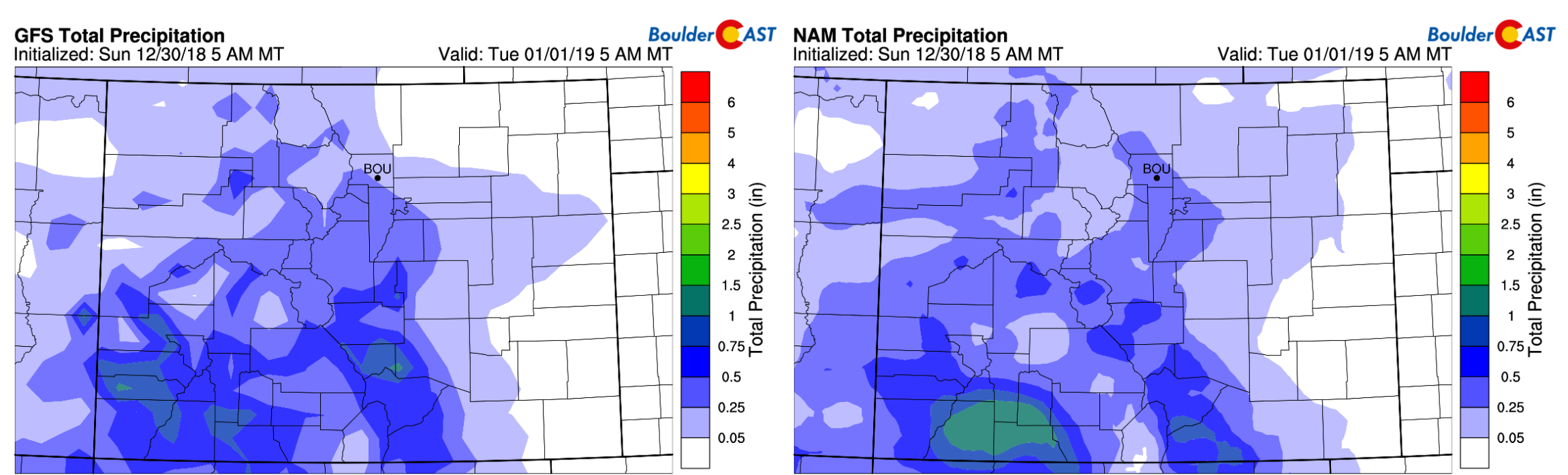
Model precipitation forecast from the GFS (left) and NAM (right)
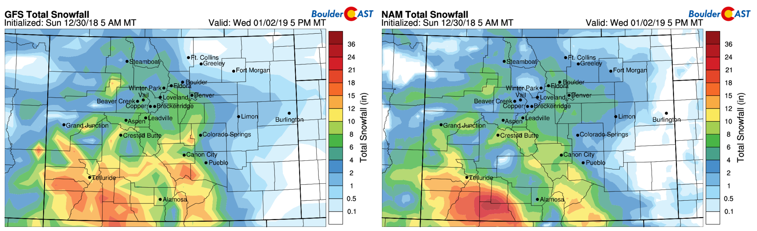
Model snowfall forecast from the GFS (left) and NAM (right)
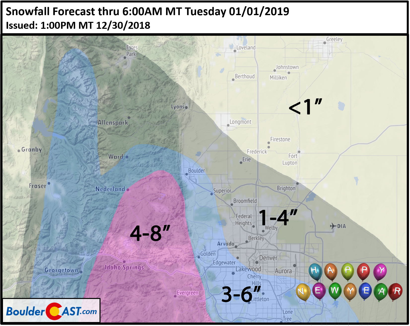
Our snowfall forecast map is shown below. Generally we’re looking at 3 to 6″ in the southern and western parts of the Metro area. This includes Boulder, Golden, Arvada, and Lakewood. In the northern and eastern sections of the Metro area, we’re forecasting 1 to 4″, which includes places such as downtown Denver, Broomfield, DIA, and Erie. Even further north than this, areas such as Longmont, Greeley and Loveland can expect an inch or less. The wind direction won’t be doing much for these locales.
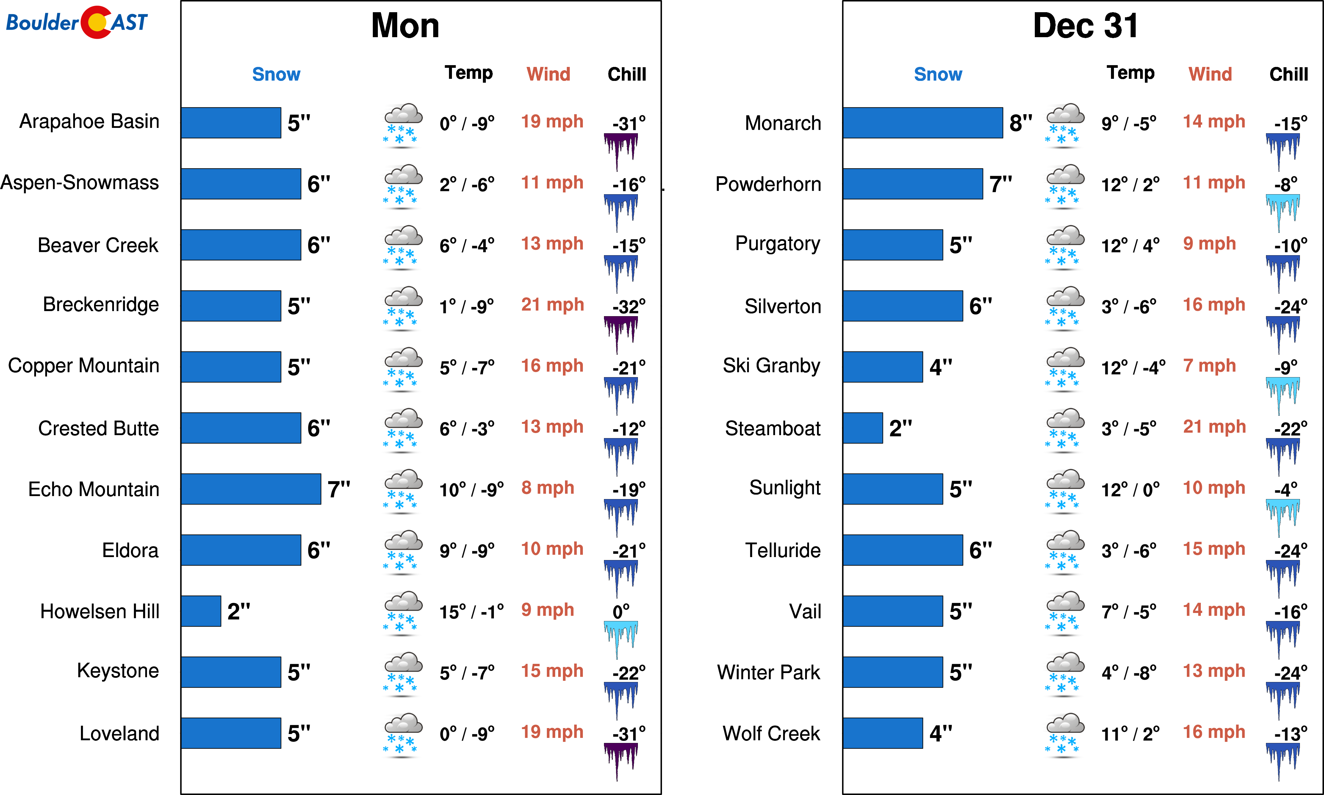
Powder conditions in the Mountains are looking promising with this storm, too. If you can stand the crowds, you may want to consider hitting the slopes on either Monday or Tuesday. The next chance of snow in the Mountains doesn’t look to be until the latter part of the upcoming weekend or early next week.
And finally, just for fun, here’s a look at the probabilities from the ensembles for this event. The take-away: A darn good chance of 4″ of snow in Boulder and Denver, but not much more. Slightly higher amounts are possible in the higher elevations.
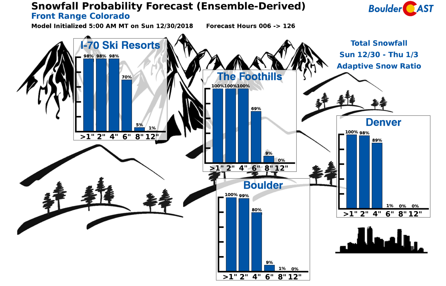
We do want to mention that overall confidence is fairly high for this snowfall event. There isn’t a whole lot that can go wrong with this system. The one area of caution is Boulder County which is right on the cusp of good vs. bad wind direction for snow. Our forecasted snow amounts here play the middle-ground for this area. We could definitely imagine a scenario where Boulder sees a little more than our 3-6″ forecast, or less. This uncertainty also extends to the Foothills of Boulder Country, to locations like Jamestown and Nederland.
SUMMARY:
This isn’t going to be a major snowstorm for the Front Range, but it will cause some elevated travel impacts given the holiday timing. We expect conditions to be worst heading south out of the Denver over the Palmer Divide, and west into the Foothills on I-70. North and east of Denver things likely won’t be bad at all. Even in Boulder, it should be business as usual.
The combination of the cold, breezy winds, and snow will make for a raw day Monday and Monday night. Keep this in mind if you are planning any outdoor activities for New Year’s Eve. Expect wind chills in the single digits below zero and temperatures in the teens. Frostbite is possible at temperatures this cold. Stay warm if you are heading out!
With skies at least partially clearing by Tuesday morning, temperatures will plummet for many areas to near or slightly below zero on New Years Day morning.
From everyone at BoulderCAST, we wish you a safe, joyous and memorable New Year!
Share our forecast for your family & friends:
.


You must be logged in to post a comment.