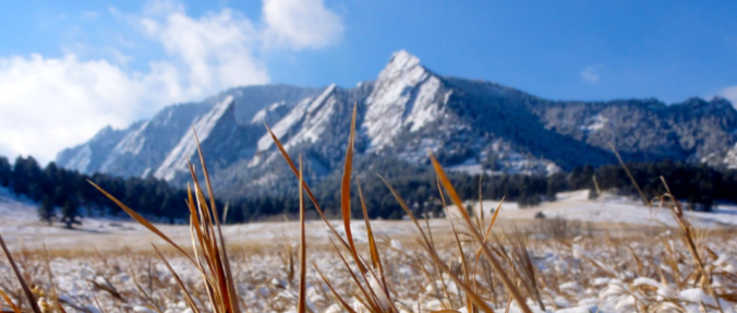
This shortened first work-week of 2019 will feature a return to mild temperatures along with lots of sunshine. You won’t believe how warm it is going to be on Friday and Saturday! Only over the weekend do clouds and the next chance of snow return to Colorado.
Warming trend starts today
First off, Happy 2019! We hope you all had a joyous holiday season and a fun time ringing in the New Year. Below shows the mid-level pattern across the country today. The snow storm has pushed south and will be cutting off from the main jet stream. Over the next few days, it will be moving east into the Midwest. A secondary system with an associated trough axis is over Minnesota, moving into the Great Lakes. An area of building high pressure is off the California coast and will be the player for us the rest of this week. This afternoon, highs warm quite a ways above where they were yesterday into the lower 40’s. Expect lots of sunshine. A majority of the snow will be melting today as a result.
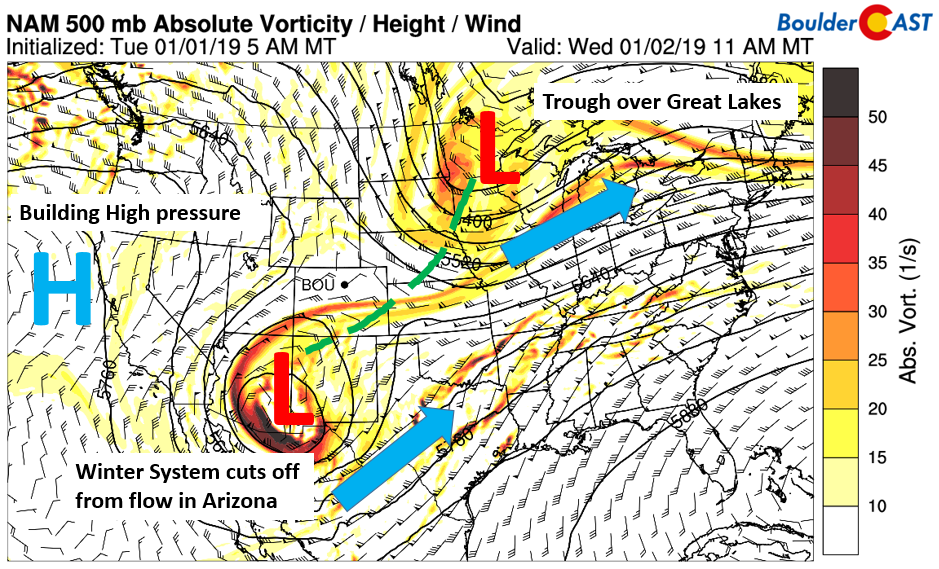
NAM 500 mb absolute vorticity today
Mild and above average temperatures Thursday/Friday
On Thursday and Friday, the pattern will be dominated by the high pressure ridge that will push east into the western U.S. tomorrow and Friday. The upper-level jet stream (below) on Thursday shows that the storm system further pushes east into Texas. More importantly, high pressure starts to situate itself over the West. With that, the polar jet stream remains north of us in Canada, and the subtropical jet east of us over the southern and eastern U.S.
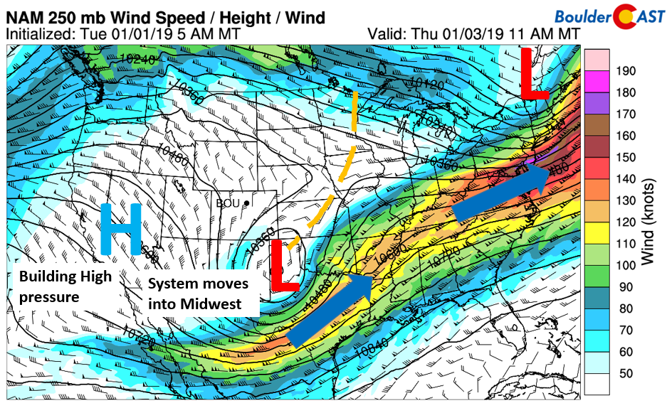
NAM 250 mb jet stream on Thursday
The ridge becomes firmly in place on Friday with well above average temperatures resulting. The height anomaly (below) shows much of the nation will see above average heights on Friday, with the exception of the storm system in Arkansas and Missouri. This is a consequence of the polar jet stream in Canada. A weekend system also reveals itself, moving ashore in the Pacific Northwest.
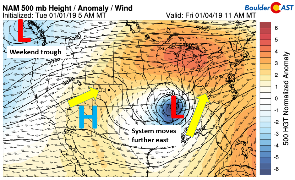
NAM 500 mb height anomaly on Friday
With the ridge in place Thursday and Friday, sunshine will be the main story, with little if any cloud cover – at best some streaming wispy high clouds from time to time from the west and northwest. Downslope flow from the ridge will push highs tomorrow near 50 and close to 60 on Friday (below). The warmth as well continues over the weekend, with a slightly downward trend expected.

NAM 800 mb temperature map forecast for today (top) and Friday (bottom)
Weekend Outlook
As we go into the weekend, the previously mentioned storm system over the Pacific Northwest will favor troughiness across much of the western United States. That will lead to a more southwesterly flow in the mid and upper-levels of the atmosphere over Colorado (below). As a result, mid and high clouds will be on the increase starting Saturday. Highs look to remain well above average but will be hindered slightly with the clouds.
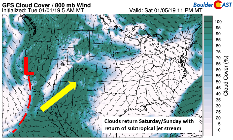
GFS cloud cover outlook on Saturday
On Sunday, the trough moves inland and the threat of precipitation increases dramatically across the inter-mountain West, including snow for western Colorado (below), Utah, Arizona, and New Mexico.
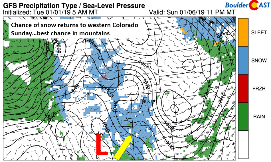
GFS precipitation type on Sunday
As for the Plains, we should stay mostly dry Sunday and early next week. The long-range ensemble prediction still calls for a rather zonally elongated flow, with the exception of the weak trough in the southwestern U.S. (below).
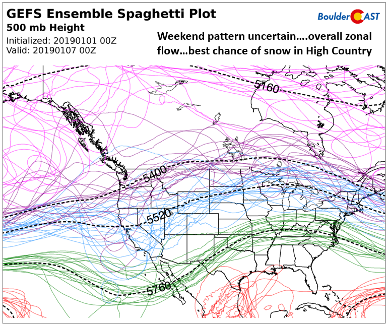
GEFS 500 mb height pattern Sunday and Monday
The precipitation chance is most evident below, showing the precipitation totals through Monday of next week. The only moisture statewide will be in the High Country. California and the Pacific Northwest also look to be very unsettled. High pressure over us is largely responsible for this tranquil pattern.
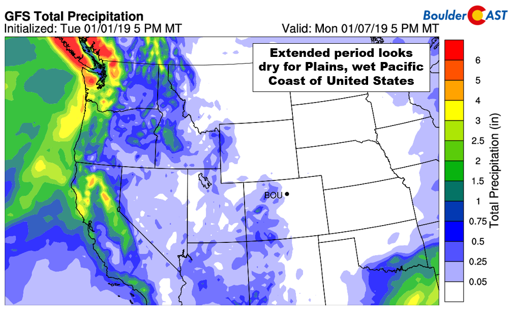
GFS total precipitation forecast through next Monday
Overall, the chance of snow reaching the Metro area increases slightly later next week, but confidence is very low at this point. Enjoy the pleasant stretch of weather on the horizon…
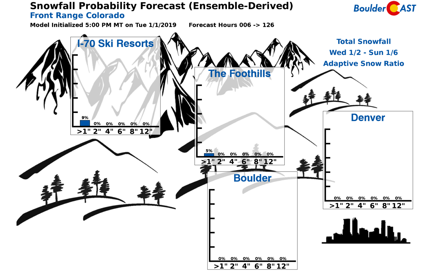
Snowfall probabilities now through the weekend. Very little if any snow is expected in our neck of the woods.
Forecast Specifics:
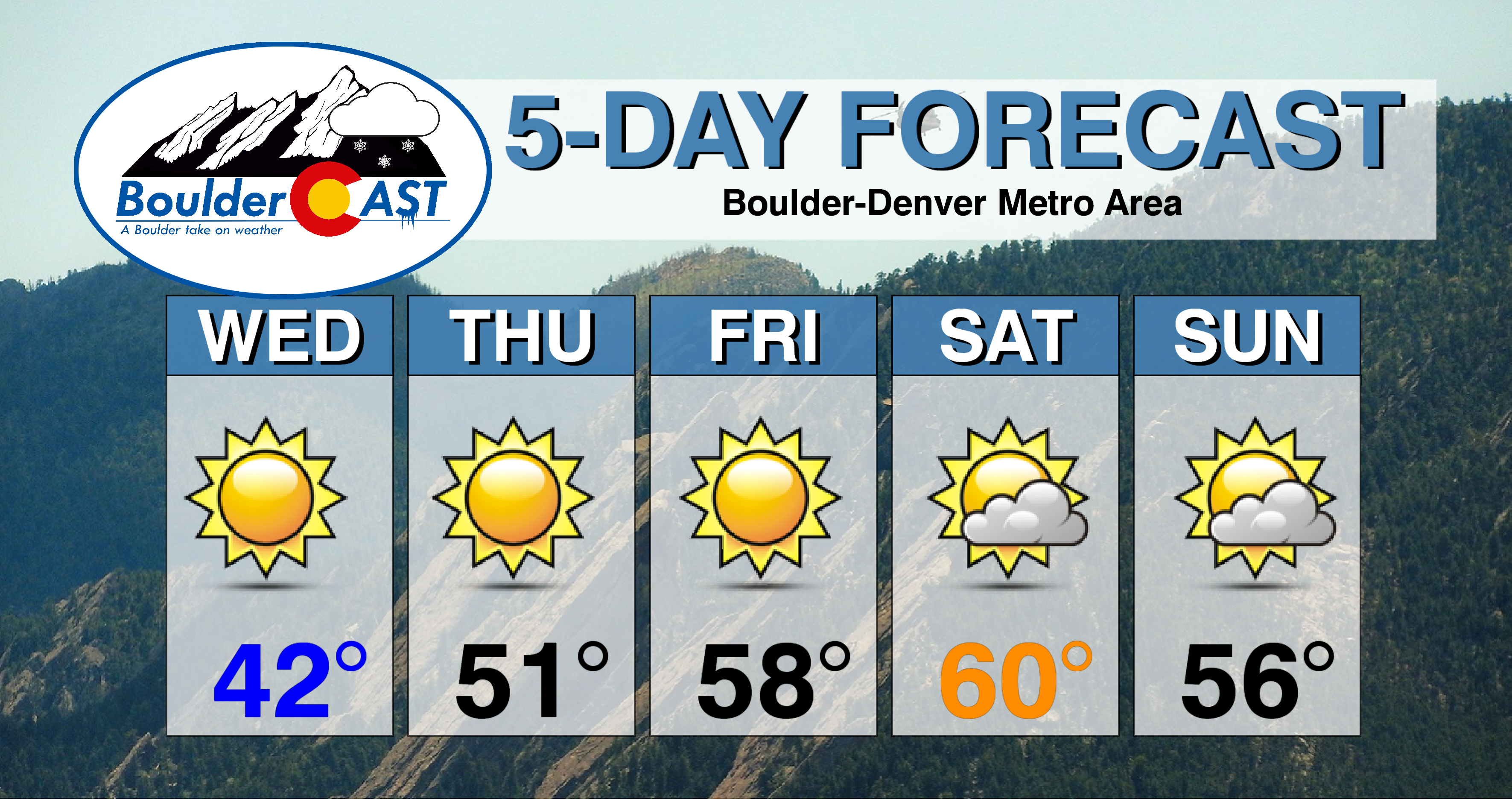
Wednesday: Mostly sunny and warmer. Highs near 40 on the Plains and upper 20’s in the Foothills.
Thursday: Sunny and mild. Highs near the lower 50’s on the Plains and in the low 40’s in the Foothills.
Friday: Overall sunny with a few passing high clouds. Highs in the upper 50’s on the Plains and upper 40’s in the Foothills.
Saturday: Sunny in the morning, but becoming mostly cloudy by evening. Highs in the upper 50’s to near 60 on the Plains and upper 40’s in the Foothills.
Sunday: Partly to mostly cloudy skies with a slight chance of precipitation overnight into Monday. Highs in the middle 50’s on the Plains and lower 40’s in the Foothills.
High Country: Quiet conditions are the main story for the Mountains the rest of this week. The next chance of snow returns Sunday and Monday, with the favored areas at this point looking to be southwestern Colorado. Check PowderCAST for forecasts for all the Colorado ski resorts.
DISCLAIMER: This weekly outlook forecast was created Wednesday morning and covers the entire upcoming week. Accuracy will decrease as the week progresses as this post is NOT updated. To receive daily updated forecasts, subscribe to BoulderCAST Premium.

.
Share our forecast!


You must be logged in to post a comment.