Read our brief discussion of the forecast for Independence Day 2018.
The large scale weather pattern today has high pressure in control across the eastern and south central United States. This includes Colorado. There is also a trough just clipping northern Montana and North Dakota.
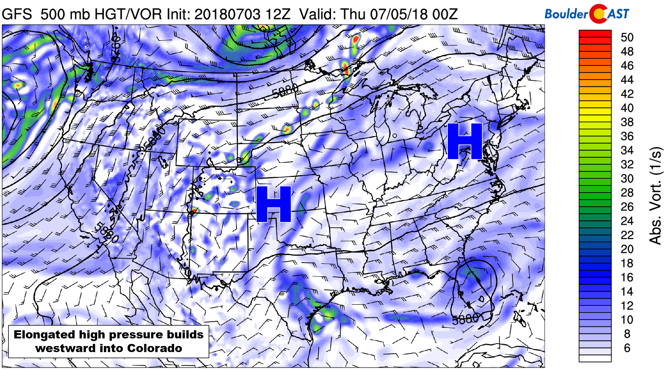
GFS 500 mb vorticity map for today showing a broad ridge of high pressure spanning much of the country today.
This trough has a trailing cold front that is moving into northeast Colorado this morning. As of 10:00 AM, this weak front has already arrived in Boulder and Denver. This will knock a few degrees off our temperatures today compared to the previous. We have highlighted the front in the 800 mb temperature forecast below, valid at noon today.
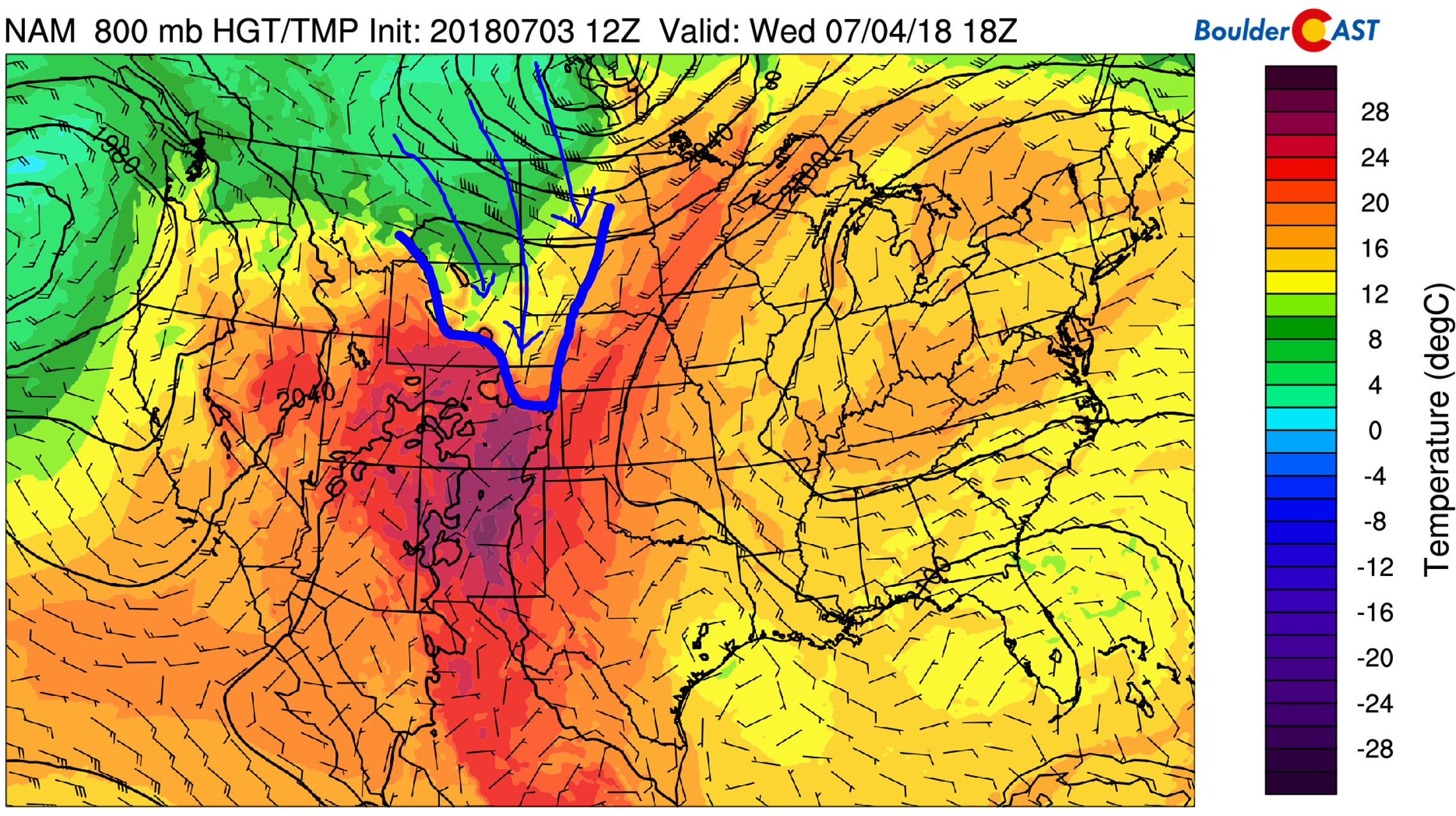
NAM 800 mb temperature and wind forecast for this afternoon showing the cold front.
Despite ominous looking skies the past two days, little if any rainfall actually reached the ground. We did have some sprinkles and gusty winds at BoulderCAST Station on Tuesday afternoon, but nothing measurable, and thankfully, no lightning. This is because moisture was limited overall, but more importantly, the air near ground-level was extremely dry. This changes today as the push of northeasterly winds behind the cold front will usher in more moisture at the surface. Models are indicating a significant bump in dew points later this afternoon and evening, possibly reaching the upper 50’s to lower 60’s near Denver.
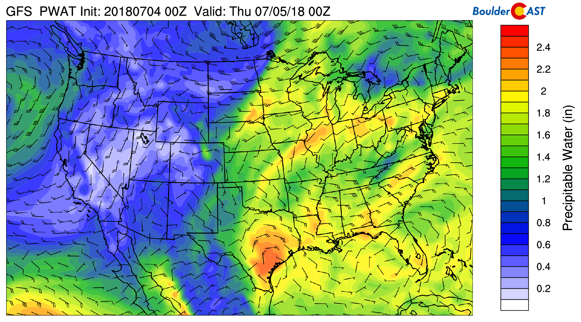
GFS precipitable water forecast for this evening. Moisture pooling near Denver could see values approach 1″.
This moisture will help to destabilize the atmosphere and produce a few isolated storms across the Metro area this afternoon and early evening. The high-resolution HRRR model shows storms moving through this afternoon and evening. The chance of storms will exist between about 1:00 PM and midnight.
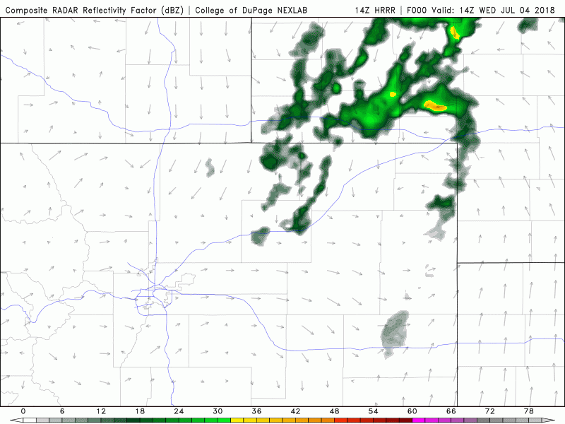
Simulated radar for today from the HRRR model
While the rain has a better chance of reaching the ground today, we’re not expecting anything widespread or too intense. The Storm Prediction Center has both Denver and Boulder at “Marginal Risk” for severe storms today, but we are skeptical that anything will materialize across the Metro area. We believe the best chance of seeing severe storms will be well east and north of our area. Hail up to 1.5″ in diameter and 60 mph wind gusts will be the main concern today…no tornadoes. You can check our Severe Weather Reports page for updates on today and recent days with severe weather.
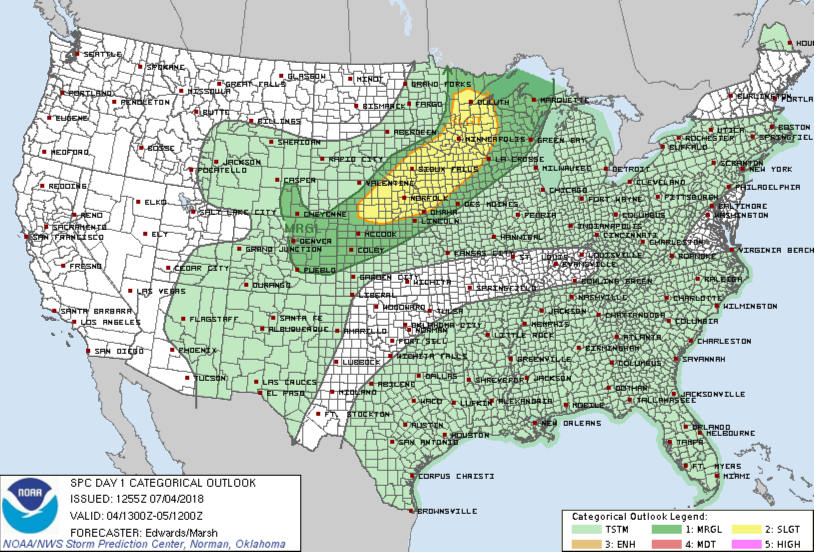
Severe weather outlook for July 4, 2018 from the Storm Prediction Center.
Given all the factors at play today, we don’t see any reason that firework displays should be overly impacted tonight around sunset. Things will be winding down by them, with partly cloudy skies remaining and temperatures in the low to middle 80’s. However, don’t be surprised by a quick passing thunderstorm for any outdoor plans.
Have a safe and happy 4th of July! U! S! A!
.
Share our forecast:


You must be logged in to post a comment.