
Page 6 of 577
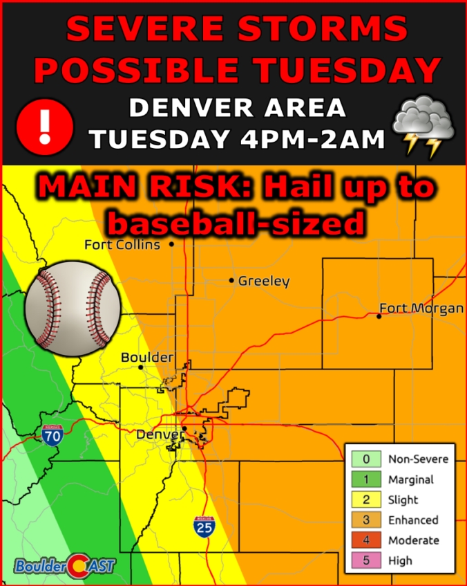
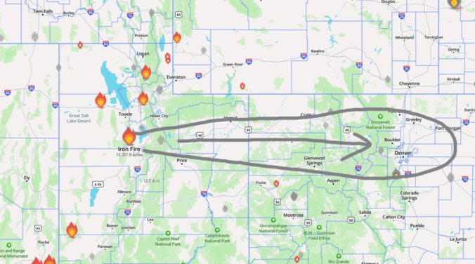
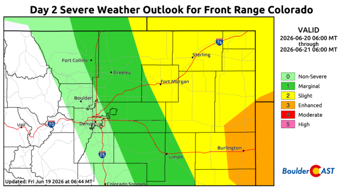
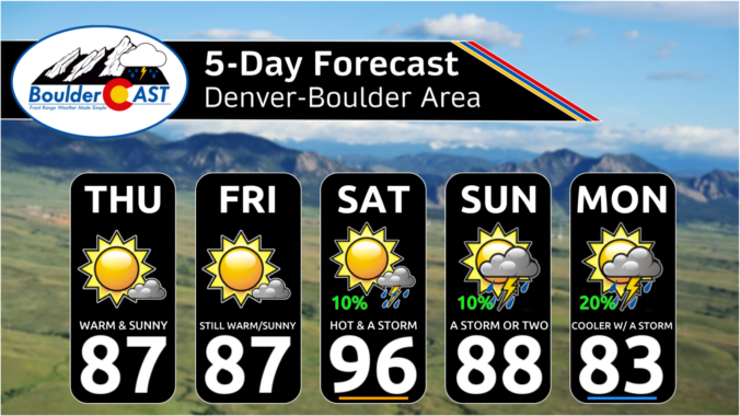
The atmosphere is gearing up for one of those classic late‑June stretches where Colorado tries to run every weather storyline at once. Several days of unusually strong flow aloft, deepening upslope moisture, and a parade of shortwaves are about to collide over the Front Range. The result will be day after day of severe thunderstorms. Add in waves of incoming wildfire smoke and a potentially high‑end fire danger setup by the weekend, and there’s plenty to unpack in this week’s forecast. Let’s take a closer look.
*Premium* This Weekend in Colorado Weather: Limited Weekend Storms With the Monsoon Still Weeks Away

Live View of Boulder

Current Conditions

Live Radar

Latest Smoke Forecast

Recent Premium Posts

BoulderCAST Daily – Wed 07/29/26 | Final Storm‑Filled Afternoon Before an Expanding Desert Southwest Heat Dome Takes Over
🌧️ Lingering Monsoon Moisture — Lingering Tap One last day of beneficial rainfall …
BoulderCAST Daily – Tue 07/28/26 | Front Range Primed for Widespread Thunderstorms as Monsoon Reloads
🌩️ Monsoon moisture surge — Deep moisture availability today, both aloft and at …
BoulderCAST Daily – Sun 07/26/26 | Record Heat Continues…
🔥 Heat Advisory Still in Effect — Near-record temperatures near‑100° this afternoon. 🌩️ …
3-Day Forecast

Trending Content

© 2026 Front Range Weather, LLC