
Page 5 of 576
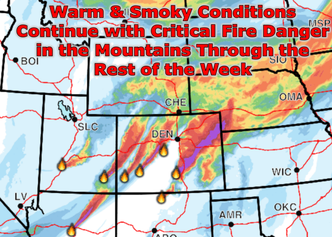
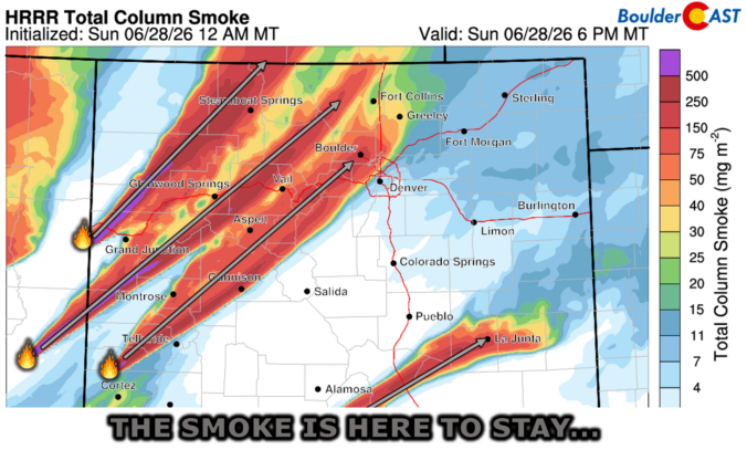
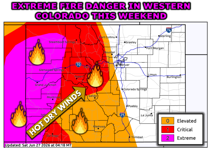
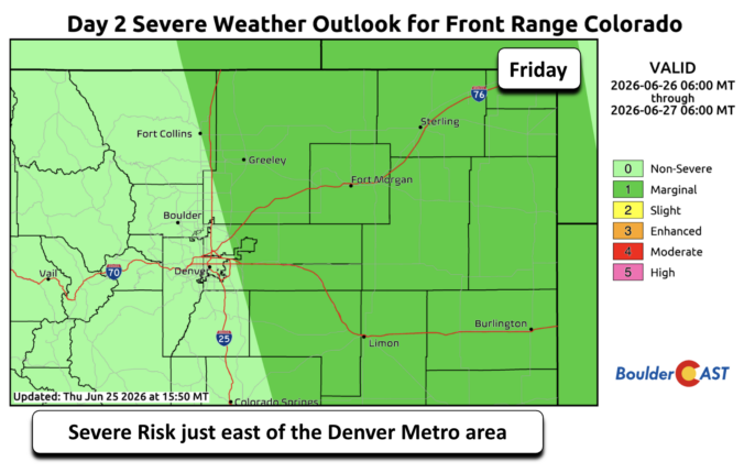
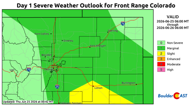
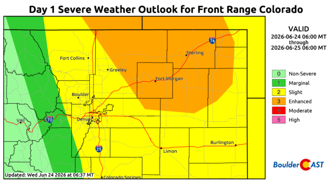
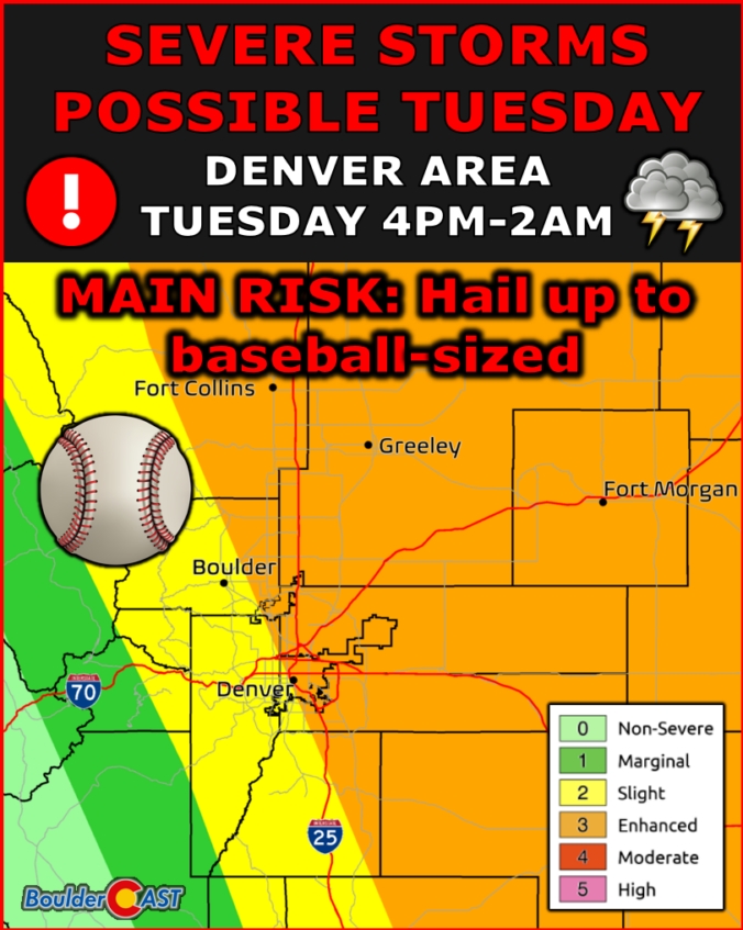
The last weekend of June didn’t just sizzle — it erupted. As a powerful early‑summer trough carved into the Great Basin, the Southwest lit up with new fires and thick smoke thanks to some of the most volatile atmospheric conditions we’ve seen this season. Colorado wasn’t spared, either: several fast‑growing fires ignited across the Western Slope and Mountains, sending plumes straight into the Front Range. And with a stubborn dipole pattern locking in place across the nation, the week ahead promises more wind, more dryness, and more smoke — plus a few twists in the forecast you’ll want to keep an eye on. Let’s break down what’s driving this outbreak, what it means for the Boulder–Denver corridor, and when relief may finally arrive.

Live View of Boulder

Current Conditions

Live Radar

Latest Smoke Forecast

Recent Premium Posts

BoulderCAST Daily – Wed 07/29/26 | Final Storm‑Filled Afternoon Before an Expanding Desert Southwest Heat Dome Takes Over
🌧️ Lingering Monsoon Moisture — Lingering Tap One last day of beneficial rainfall …
BoulderCAST Daily – Tue 07/28/26 | Front Range Primed for Widespread Thunderstorms as Monsoon Reloads
🌩️ Monsoon moisture surge — Deep moisture availability today, both aloft and at …
BoulderCAST Daily – Sun 07/26/26 | Record Heat Continues…
🔥 Heat Advisory Still in Effect — Near-record temperatures near‑100° this afternoon. 🌩️ …
3-Day Forecast

Trending Content

© 2026 Front Range Weather, LLC