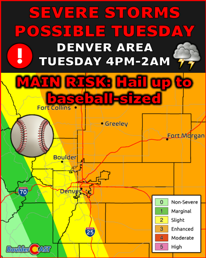
Avery real severe thunderstorm threat exists both today and Wednesday across a large swath of the Front Range. With easterly upslope flow at the surface and westerly 35-45 MPH flow at mid-levels, the atmosphere is well-configured for damaging winds, extremely large hail, and isolated tornadoes. That tornado threat will largely focus along/east of I-25, away from the influence of the …
Born and raised in St. Louis, Andrew obtained a Ph.D. in Atmospheric Science from the University of Colorado in 2015. From 2015 to 2020, he worked remotely in Boulder as an atmospheric scientist with NOAA's Atlantic Oceanographic and Meteorological Laboratory in Miami. Andy is now a full-time meteorologist.
More Posts