



Page 245 of 586


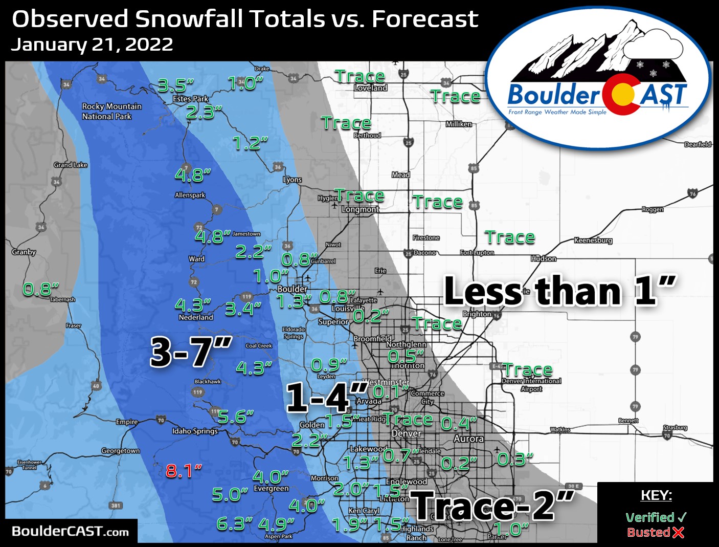

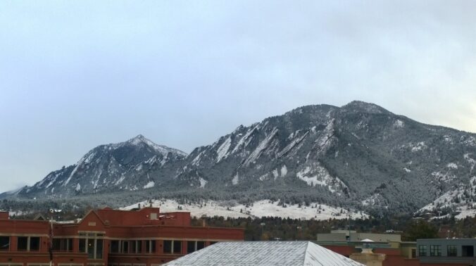
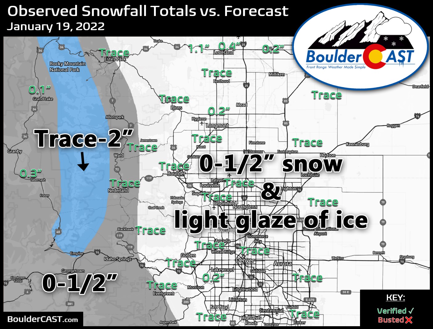
After the recent freezing drizzle event that glazed the entire area in ice, our attention quickly turns to an approaching winter storm that will bring a round of snow to the area on Friday. We discuss the setup, timing and expected snowfall amounts in what will be an all-snow upslope event for mainly the western Denver Metro area.
Premium Storm Update (1/21/22 7:00AM): We do a final check on the latest model runs and discuss the potential for heavier bands of snow now appearing in the short-range models. We give our final thoughts on the storm and discuss the slight changes being made to our snow forecast amounts. READ HERE.


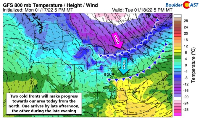
⦁❶⦁ One last mild day in the 50’s before things turn colder for the rest of the week
⦁❷⦁ Two cold fronts will arrive today, the second of which this evening will usher in a shallow Arctic airmass
⦁❸⦁ Freezing fog and drizzle will develop late tonight into Wednesday with a light glaze of ice making for slick travel in spots
⦁❹⦁ There will be another chance of winter weather on Friday (light snow)

Live View of Boulder

Current Conditions

Live Radar

Latest Smoke Forecast

Recent Premium Posts

BoulderCAST Daily – Sat 10/10/26 | Mild Temperatures Continue
🌤️ Continued mild this weekend: Highs remain in the low to mid-80s, still …
BoulderCAST Daily – Fri 10/09/26 | Mild and Quiet Weather Through the Weekend
🔥 Record October heat: Highs may approach record highs today in the middle …
This Weekend in Colorado Weather: 80s Continue With a Big Western Storm Brewing, But Colorado’s Role Next Week Remains Unclear
🌤️ Summer Preview Continues: Warm and dry weather hangs on through the weekend …
3-Day Forecast

Trending Content



© 2026 Front Range Weather, LLC
You must be logged in to post a comment.