



Page 190 of 586
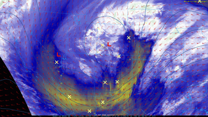
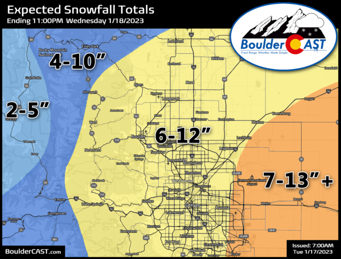
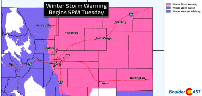
Widespread heavy snow is on the way for the entire Front Range Tuesday evening into Wednesday afternoon. A few subtle changes in the forecast have led to us increasing snowfall amounts a tad across the region. Read on for our latest detailed forecast discussion, newly amended snowfall forecast map, updated storm timeline, and more!
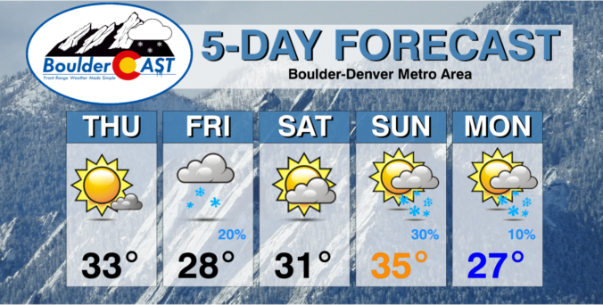
A major winter storm set to impact the Front Range Tuesday night through Wednesday. The heaviest snowfall will likely be focused east of Interstate 25 where up to 10″ could fall, with lesser amounts in Boulder and the Foothills. Another chance of light snow on Friday will round out a rather cold overall week for the Denver Metro area. Read on for our complete outlook of the week ahead, including our preliminary snowfall forecast map for the midweek snowstorm.
December 2022 was a rather fickle month. Things started off somewhat warm and dry, and there was even a sizable wildfire just west of Boulder in the week leading up to Christmas. The weather quickly turned much colder and snowier for the holidays, including the coldest temperature reading in more than 30 years for the city. Here’s a quick and colorful graphical recap of our weather during December and how it relates to climatology.

Live View of Boulder

Current Conditions

Live Radar

Latest Smoke Forecast

Recent Premium Posts

BoulderCAST Daily – Tue 10/06/26 | October Heatwave Keeps Its Grip on the Front Range All Week Long
🔥 Record October heat — Boulder hit 89°F yesterday (just shy of the …
BoulderCAST Daily – Sun 10/04/26 | The Persistent 80s and Continuation of Summer-Like Temperatures
🌡️August-like temperatures: Temperatures hover in the 80s throughout the upcoming week, prolonging the …
BoulderCAST Daily – Sat 10/03/26 | Quiet and Mild in Colorado but Active in the Tropics
☀️ Quiet and dry weather: Highs in the 80s continue through nearly the …
3-Day Forecast

Trending Content



© 2026 Front Range Weather, LLC