



Page 186 of 586

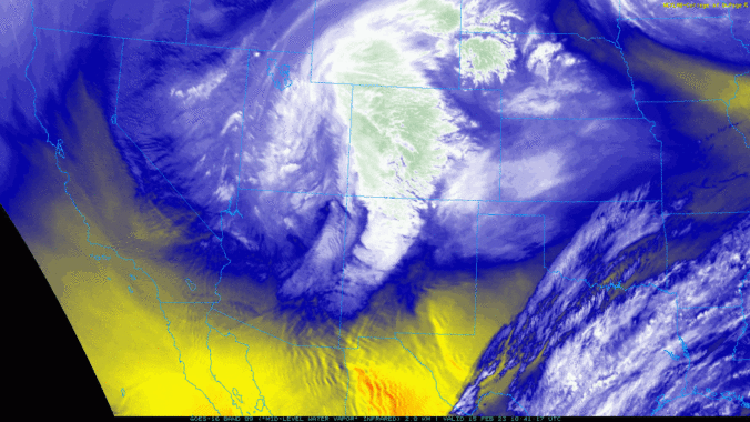
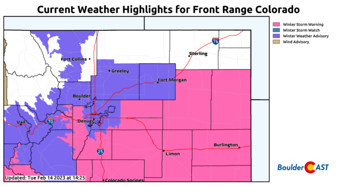
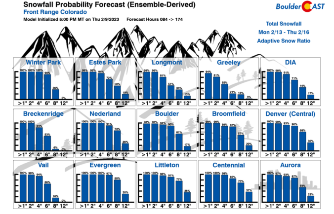
It’s blustery out there this afternoon, but at least there is some sunshine. Our approaching winter storm is gearing up back across Nevada right now and it will be spreading widespread snow into the area tonight. Cold temperatures falling into the teens, gusty winds, and persistent light snow will make for slick travel through Wednesday evening. We run through a final check of the models regarding snow amounts, including a discussion of low and high-end potential for this storm and when it will finally wrap up on Wednesday.
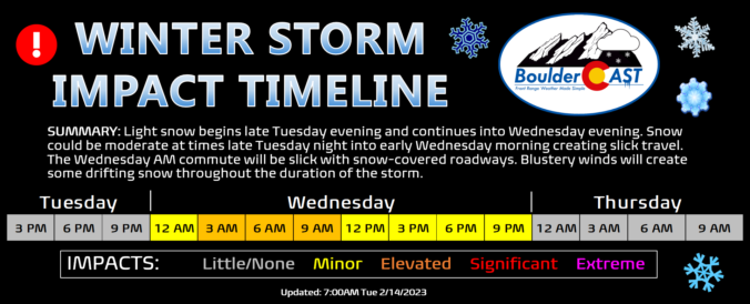
After a nearly two week hiatus in accumulating snowfall, the white stuff returns to the Front Range Tuesday night into Wednesday with a long-duration light snowfall event knocking on the door. Let’s take a look at the latest timing, snowfall amounts, and impacts of the impending winter storm.
Premium Storm Update (2/14/23 3:00PM): Things are coming together nicely with our storm and the snowfall developing late Tuesday evening remains on-track. We run through a final check of the models regarding snow amounts, including a discussion of low and high-end potential for this storm and when it will finally wrap-up on Wednesday! READ HERE
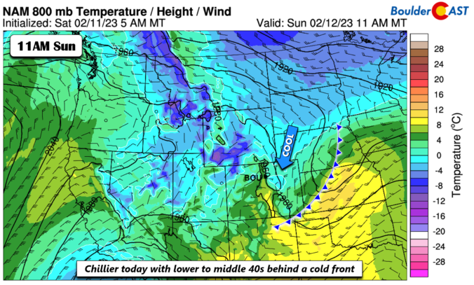
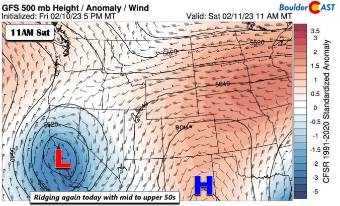
This week will begin and end rather mild, but sandwiched in between will be the return of bitter cold temperatures and widespread snowfall. Though models have trended further south with the midweek snowstorm, everyone should pick up some of the white stuff. Let’s take a look at the roller-coaster of weather set to unfold this week in the Front Range.

Live View of Boulder

Current Conditions

Live Radar

Latest Smoke Forecast

Recent Premium Posts

BoulderCAST Daily – Tue 10/06/26 | October Heatwave Keeps Its Grip on the Front Range All Week Long
🔥 Record October heat — Boulder hit 89°F yesterday (just shy of the …
BoulderCAST Daily – Sun 10/04/26 | The Persistent 80s and Continuation of Summer-Like Temperatures
🌡️August-like temperatures: Temperatures hover in the 80s throughout the upcoming week, prolonging the …
BoulderCAST Daily – Sat 10/03/26 | Quiet and Mild in Colorado but Active in the Tropics
☀️ Quiet and dry weather: Highs in the 80s continue through nearly the …
3-Day Forecast

Trending Content



© 2026 Front Range Weather, LLC