



Page 185 of 586
Premium Storm Update – Tue 2/21/23 7:00PM | Snow will arrives in a hurry pre-dawn Wednesday morning!
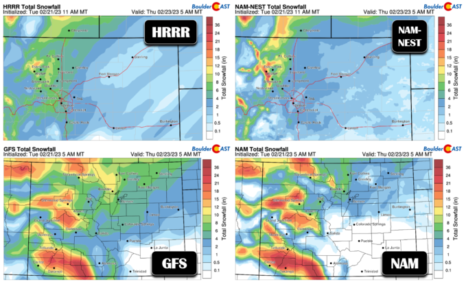
After a beautiful time in the 60s today, things are starting to look more stormy out there as the sun sets behind darkened clouds. It’s hard to believe, but snow will be falling in less than 12 hours in most areas with temperatures dropping into the single digits and teens in a flash! We run through a final check of the models looking at snow amounts, travel impacts and those cold temperatures.
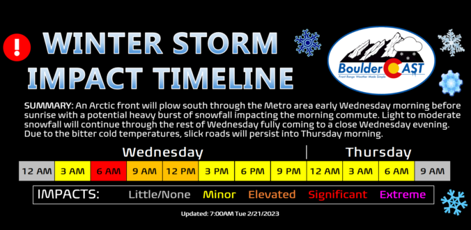
A massive and complex storm is set to slam the entire western United States over the next several days. The Front Range will catch the bitter cold and snowy side of the storm with up to a foot of snowfall possible by Wednesday night alongside record-challenging frigid temperatures. We discuss the latest timing of things, just how cold it will get, the most likely snowfall amounts for the area, and the overall impacts expected from the looming winter storm.
Premium Storm Update (2/21/23 7:00PM): After a beautiful time in the 60s Tuesday, things are starting to look more stormy out there as the sun sets behind darkened clouds. It’s hard to believe, but snow will be falling in less than 12 hours in most areas with temperatures dropping into the single digits and teens in a flash! We run through a final check of the models looking at snow amounts, travel impacts and those cold temperatures. READ HERE
The week starts out mild and at times breezy under a split-flow regime aloft combined with downslope flow at the surface. A deep and highly anomalous trough digs across the western US, Colorado, and Great Plains Wednesday and Thursday, bringing snowfall and record cold for late February. Confidence is increasing for several inches of snow to accompany the cold over portions of the Plains Wednesday, primarily from Boulder northward. The Arctic air slowly retreats by week’s end as a ridge in the southeast US builds westward.




Live View of Boulder

Current Conditions

Live Radar

Latest Smoke Forecast

Recent Premium Posts

BoulderCAST Daily – Tue 10/06/26 | October Heatwave Keeps Its Grip on the Front Range All Week Long
🔥 Record October heat — Boulder hit 89°F yesterday (just shy of the …
BoulderCAST Daily – Sun 10/04/26 | The Persistent 80s and Continuation of Summer-Like Temperatures
🌡️August-like temperatures: Temperatures hover in the 80s throughout the upcoming week, prolonging the …
BoulderCAST Daily – Sat 10/03/26 | Quiet and Mild in Colorado but Active in the Tropics
☀️ Quiet and dry weather: Highs in the 80s continue through nearly the …
3-Day Forecast

Trending Content



© 2026 Front Range Weather, LLC