Light snow and at times freezing drizzle have been falling in Boulder most of the day today, but it hasn’t amounted to much yet in terms of accumulation as snowfall rates have not been enough to counteract the increasingly strong early March sun! The lack of accumulation will change on Sunday as colder air and more substantial upslope arrive. Let’s talk temperatures, timing and those snowfall amounts expected through Monday.
At a Glance:
- Storm #1 underperformed across the area though it has been snowing/drizzling in Boulder most of Saturday
- Widespread light snow will overtake the Front Range on Sunday morning into Sunday night as a colder disturbance passes through
- Snow potential: 3-5″ in Boulder, 3-7″ in the Foothills, and 1-4″ in Denver
- High temperatures only in the low to middle 20’s on Sunday
- The upcoming week will be fairly cold with more snow in the works
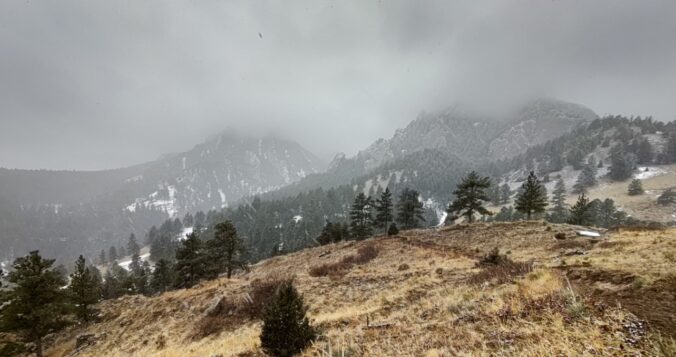
This was the view from Boulder earlier this afternoon as a mix bag of freezing drizzle and snow fell across the city. Though temperatures were below freezing, not many snowflakes were able to stick.
Light snow falling in Boulder this afternoon #cowx pic.twitter.com/cprXnmPII4
— BoulderCAST Weather (@BoulderCAST) March 5, 2022
Storm #1 was a bit underwhelming across the area as the potential heavier bands of snow never really materialized for the area early Saturday morning. This was always an uncertain aspect of the forecast and was hopefully conveyed via our snowfall forecast range of a Trace to 3″ covering much of the Metro area.
The best window for snow this weekend was always to be Sunday and that remains the case as another wintry system approaches Colorado by way of California. Unfortunately, the incoming low pressure will wobble and weaken substantially before reaching the Front Range on Sunday:
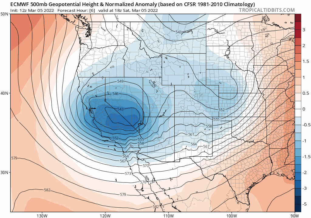
Euro model 500mb height anomaly forecast animation for Saturday into Sunday night
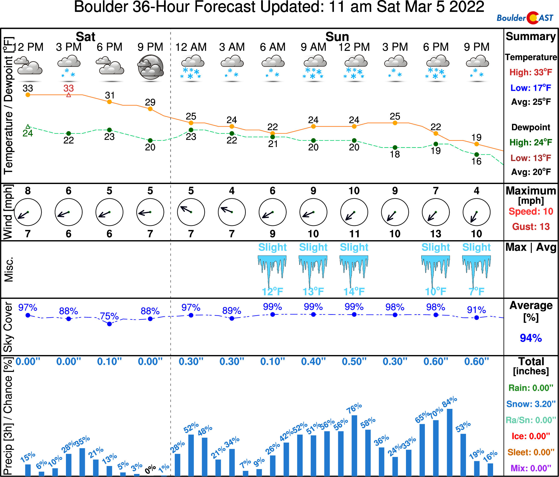
Despite this, upslope and weak lift from the passing storm will be enough to squeeze out a little snow for our area over the next 36 hours. Everyone that missed out so far will soon see the white stuff return. After a few spotty snow showers tonight, light snow will increase in coverage across the entire Denver Metro area Sunday morning with snow continuing through most of the day and evening. Snowfall rates will be on the light side again, so daytime accumulation will be hindered by the March sun with roadways remaining just wet in most cases. The early morning and evening hours could turn a little slick in spots, though. Most of the snow should be over and done with by midnight Sunday night, though some models want to keep the upslope snow machine going into some of Monday. That remains to be seen.
The second half of the weekend will be snowy and cold indeed! High temperatures on Sunday will be in the middle 20’s at best as colder air continues to filter in all day long and into Monday.
Our snowfall forecast map covering all snow through Monday afternoon is shown below. We’re generally expecting 3-7″ in the far western suburbs and Foothills, with 1 to 5″ in the rest of the Denver Metro area.
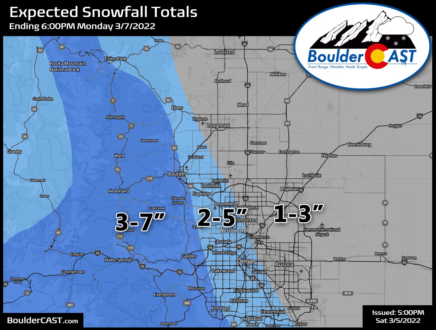
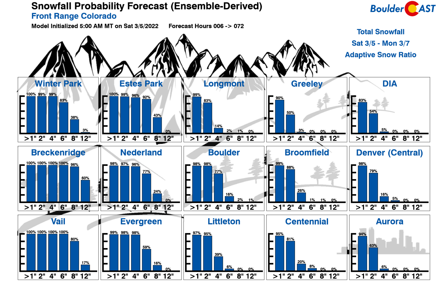
Our latest snowfall probabilities cover the gamut of outcomes. Note the 77% chance of Boulder seeing at least 4″ of snow, but only a 16% chance for downtown Denver to exceed 4″.
After the snow tapers off late Sunday night, winter weather sticks around for much of the upcoming week. Check back for more in our usual weekly outlook posted every Monday morning.
Get BoulderCAST updates delivered to your inbox:
Help support our team of Front Range weather bloggers by joining BoulderCAST Premium. We talk Boulder and Denver weather every single day. Sign up now to get access to our daily forecast discussions each morning, complete six-day skiing and hiking forecasts powered by machine learning, first-class access to all our Colorado-centric high-resolution weather graphics, bonus storm updates and much more! Or not, we just appreciate your readership!

Enjoy our content? Give it a share!


You must be logged in to post a comment.