


A stubborn late‑summer pattern refuses to budge across the West, and Colorado is once again caught in the middle — but this holiday weekend comes with a tropical twist. As Hurricane Marie drifts offshore of Baja California, pulses of subtropical moisture will begin sneaking into the state, boosting storm chances in the High Country and adding some intrigue to an otherwise familiar stretch of warm, southwest flow. If you’re heading outdoors for Labor Day weekend, especially in the Mountains, you’ll want to keep an eye on the sky — the atmosphere has a few surprises lined up.
What You Need to Know
- 🌡️ Persistent Western stagnation — A locked‑in synoptic pattern has fueled widespread heat records across Colorado and the West. Something similar will persist this weekend, though nothing record-breaking.
- 2️⃣ Two dominant players — A Gulf Coast ridge expands northwest while a closed Pacific Northwest low stays parked, keeping Colorado in steady southwest flow.
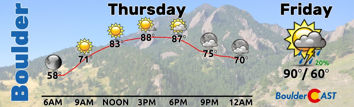
- ☀️ Dry start — Thursday features moisture‑starved southwest flow: mostly sunny, mostly dry, highs near 90°F.
- 🌀 Marie enters the chat — Hurricane Marie will churn offshore of Baja, sending mid/high‑level tropical moisture toward the Four Corners by Sunday–Monday.
- ⛰️ Mountain storm surge — Tropical moisture dramatically boosts storm chances in the High Country with heavy rain and lightning late each day.
- 📉 Uncertain next week — Ensemble guidance splits Marie’s track; offshore is favored, but a closer approach would enhance monsoon potential across the Southwest much of next week.
- 🌦️ Front Range / Denver outlook — Increasing storm chances Friday–Monday, but low‑level dry air and a lack of forcing may limit meaningful rainfall east of the Continental Divide.
- 🌥️ Temps ease slightly — Lower 90s hold for several days, dipping into the 80s by Sunday or Monday as clouds and deeper moisture arrive.

Go Premium, get all the perks.
Daily Forecast Updates
Get our daily forecast discussion every morning delivered to your inbox.
All Our Model Data
Access to all our Colorado-centric high-resolution weather model graphics. Seriously — every one!
Ski & Hiking Forecasts
6-day forecasts for all the Colorado ski resorts, plus more than 120 hiking trails, including every 14er.
Smoke Forecasts
Wildfire smoke concentration predictions up to 72 hours into the future.
Exclusive Content
Weekend outlooks every Thursday, bonus storm updates, historical data and much more!
No Advertisements
Enjoy ad-free viewing on the entire site.
T
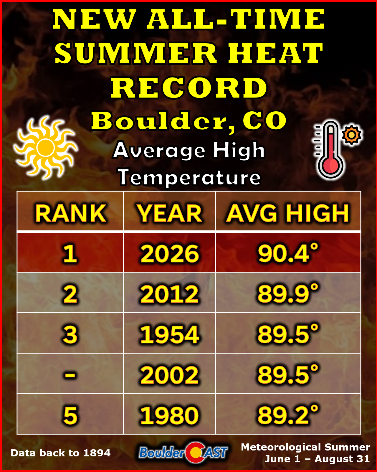
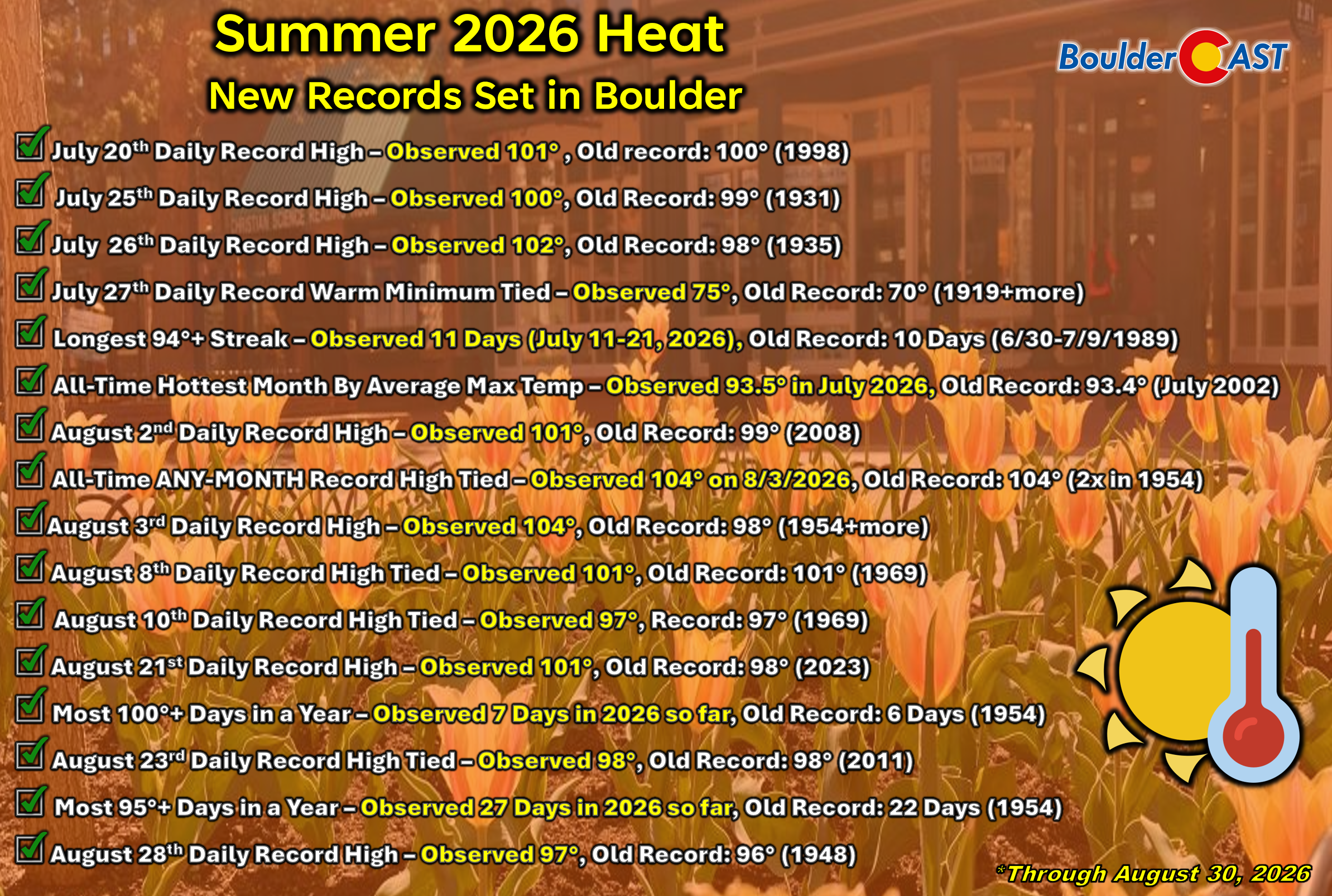
he large‑scale pattern across the West has been stuck in an almost comically stagnant mode this summer — one of the key reasons that an enormous amount of heat records have toppled across Colorado and much of the interior West. The atmosphere simply hasn’t been able to meaningfully reshuffle itself, and that theme will continue straight through the extended period.
Over the next five to seven days, the dominant weather players barely move. A sprawling Gulf Coast ridge will gradually expand northwest toward the Texas Panhandle this weekend, while a deep, closed Pacific Northwest low remains anchored in place through at least Monday. Colorado is set to sit squarely between these two features, locked under various flavors of southwest flow from now through the holiday weekend and into the middle of next week.
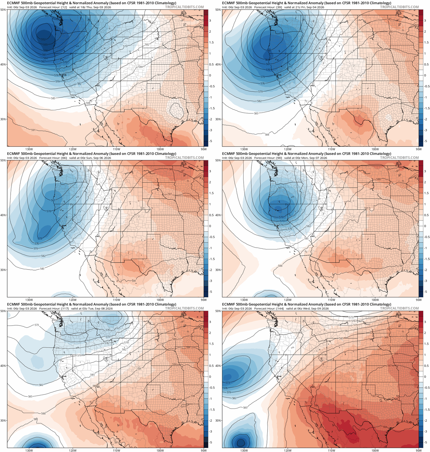
Early on, that southwest flow will be moisture‑starved and lacking any meaningful lift. Thursday delivers mostly sunny skies, very limited to no storm coverage, and highs near 90°F.
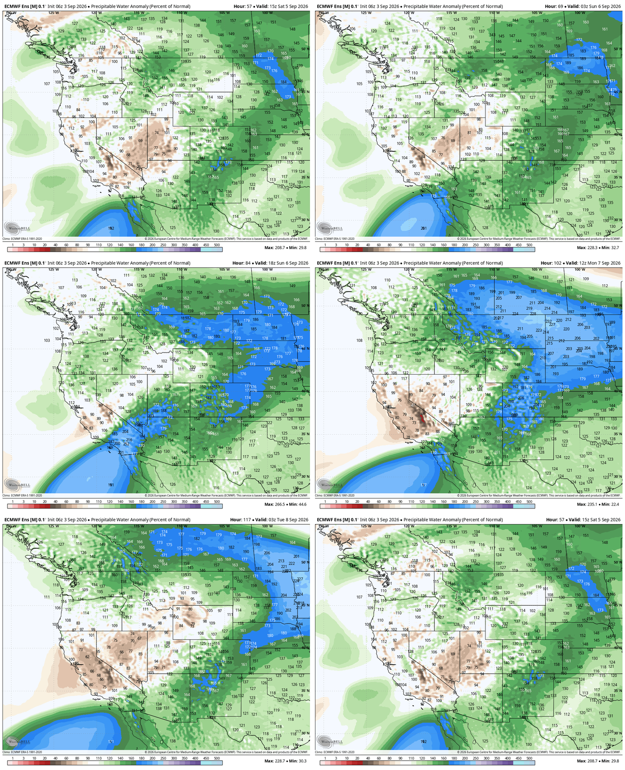
But this weekend marks a shift. Hurricane Marie will move into position well offshore of Baja California, directly upstream from the Four Corners. As Marie strengthens and begins lofting deep tropical moisture northward, an elevated plume of mid‑ and high‑level humidity will surge toward Colorado Sunday into Monday.
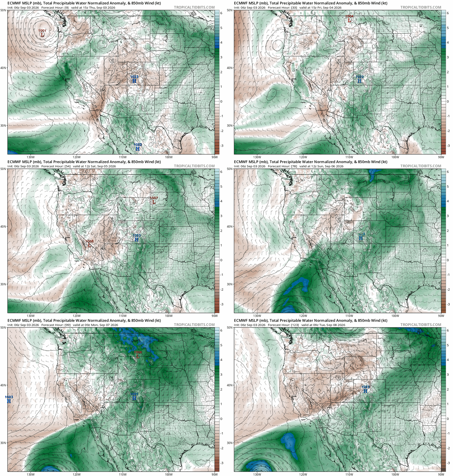
This is the type of setup that dramatically increases storm chances in the Mountains. If you’re camping, hiking, or boating along or west of the Divide, stay weather aware — tropical moisture is no joke. Expect pockets of heavy rain, prolific lightning and plenty of late‑day storms, especially Sunday and Monday when the first major moisture pulse arrives.
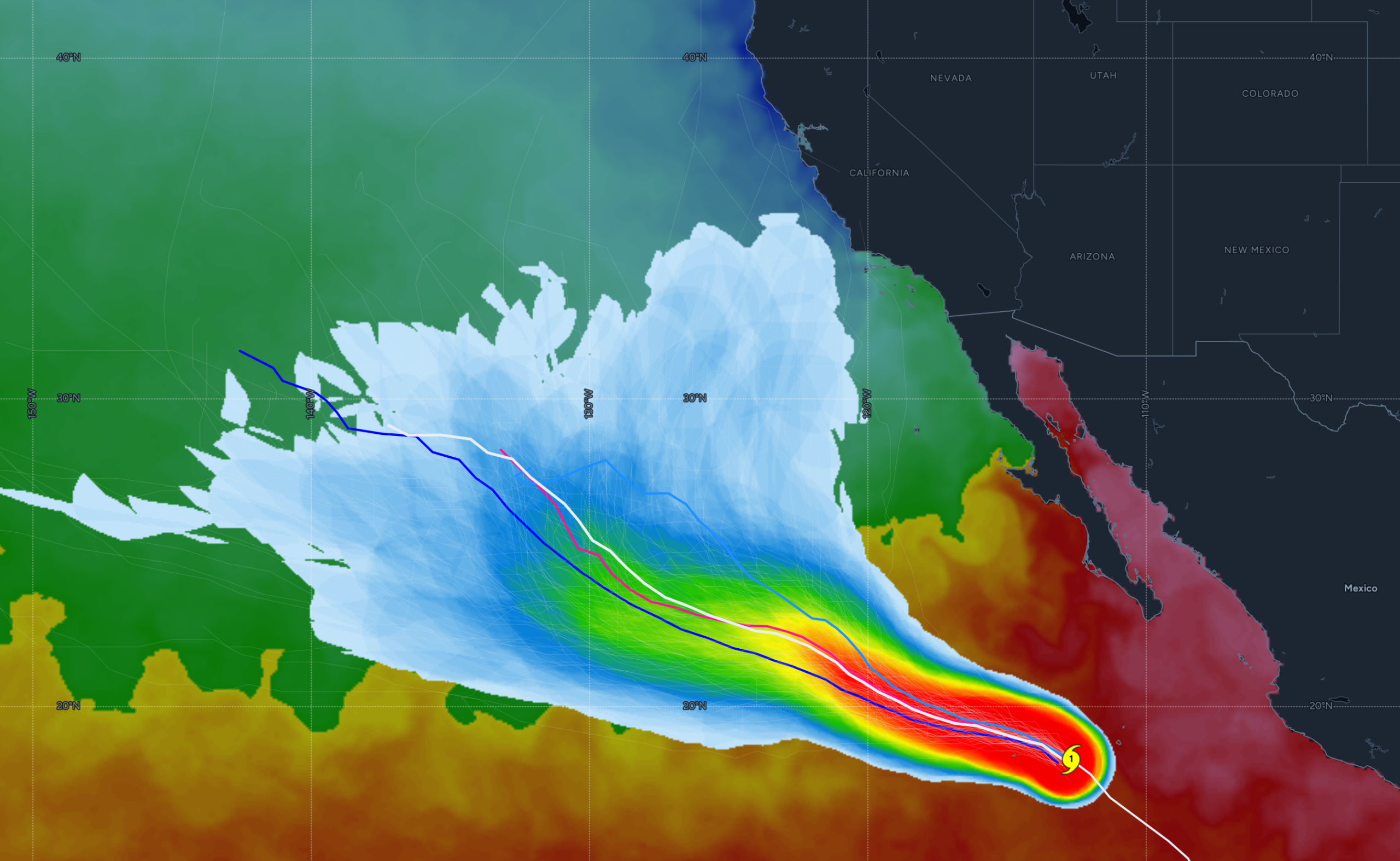
Next week becomes more uncertain — and Marie is the reason. Ensemble guidance is split into two camps: one cluster keeps Marie well offshore, drifting northwest; another curves the system closer to the California coastline. The offshore solution is definitely favored, but the closer‑to‑shore track would be far more beneficial as a wingman for the monsoon across the Southwest.
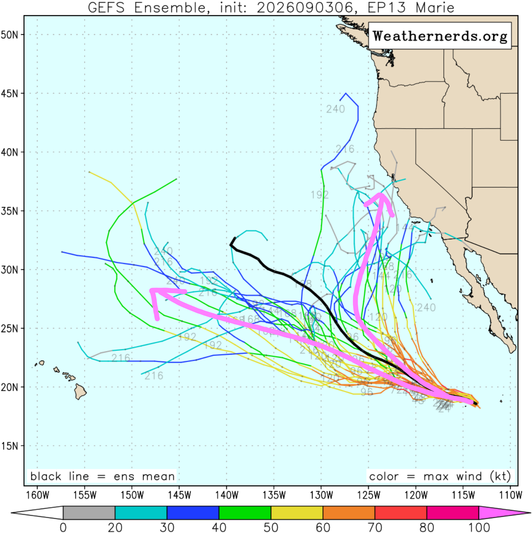
Marie’s short‑term evolution is fairly straightforward: strengthening into a Category 2–3 hurricane as it tracks northwest, then weakening over cooler waters this weekend. The real uncertainty lies beyond Monday.
Regardless what happens with Marie in the long-term, the Front Range forecast through the holiday weekend is essentially locked in.
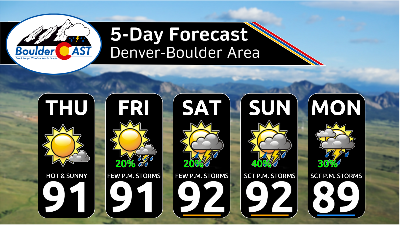
- Thursday: Mostly sunny, dry, only a tiny chance of an evening thundershower southeast of Denver.
- Friday: Slight uptick in moisture; isolated to widely scattered storms return areawide.
- Saturday: Moisture increases further late in the day; storm chances ramp up slightly.
- Sunday–Monday: Highest storm coverage as Marie’s first tropical moisture pulse arrives.
For the Plains, this pattern is historically not ideal for widespread rainfall. Yes, exceptional mid‑ and high‑level moisture will stream overhead, but low‑level dry air will be undercutting it, limiting how much precipitation actually reaches the ground and how intense low elevation storms can become. Without a cold front or some additional forcing mechanism to tap into Marie’s moisture, we may end up with plenty of cloud cover and boosted storm chances — but unimpressive rainfall totals. That’s been the theme this summer, why would Mother Nature stop now?
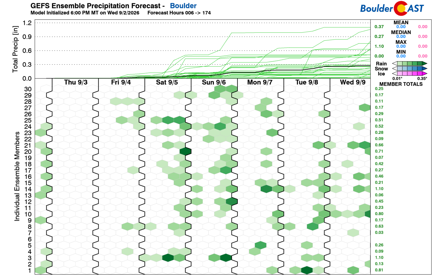
Temperatures are forecast to remain in the lower 90s through the extended, with a modest cool‑down into the 80s by Sunday or Monday as deeper moisture, thicker cloud cover, and better odds for late‑day storms move in.
Bottom Line
A stubborn, late‑summer pattern will keep Colorado locked in southwest flow through the holiday weekend, with increasing moisture and storm chances — especially in the Mountains — as Hurricane Marie sends a pulse of tropically-infused moisture our way. The Plains will see more clouds and higher storm chances, but meaningful rainfall remains uncertain without additional forcing. Temperatures hold in the lower 90s before easing into the 80s as deeper moisture arrives Sunday or Monday.
Please do have a safe and enjoyable Labor Day Weekend — stay weather‑aware if you’re headed into the High Country, where the influx of tropical moisture could turn afternoon plans stormy in a hurry.
Spread the word, share our crazy Colorado weather:
Go Premium, get all the perks.
Daily Forecast Updates
Get our daily forecast discussion every morning delivered to your inbox.
All Our Model Data
Access to all our Colorado-centric high-resolution weather model graphics. Seriously — every one!
Ski & Hiking Forecasts
6-day forecasts for all the Colorado ski resorts, plus more than 120 hiking trails, including every 14er.
Smoke Forecasts
Wildfire smoke concentration predictions up to 72 hours into the future.
Exclusive Content
Weekend outlooks every Thursday, bonus storm updates, historical data and much more!
No Advertisements
Enjoy ad-free viewing on the entire site.












You must be logged in to post a comment.