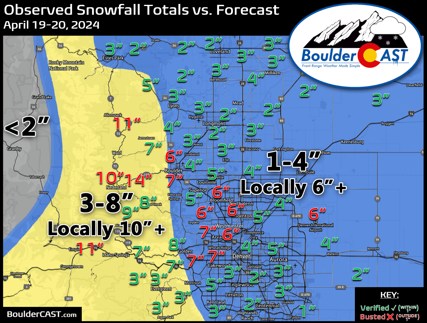
Shown below is our snowfall forecast map issued Friday afternoon with actual storm totals overlaid. Green values indicate that our forecast verified to within one inch of the observed snowfall total. Red numbers did not. Bands of snow last about 18 hours and produced variable snow totals across the Front Range. The forecast played out about as expected with generally 1-5″ across the Metro area but locally up to 7″. Several locations in the Foothills did see double digit snowfall totals, mainly in Boulder County. Officially (yet still unofficially as we await the final totals), Boulder received 7.4″ of new snow while Denver (DIA) recorded 6.3″. These totals may increase an inch or so by the time the snowflakes fully stop.
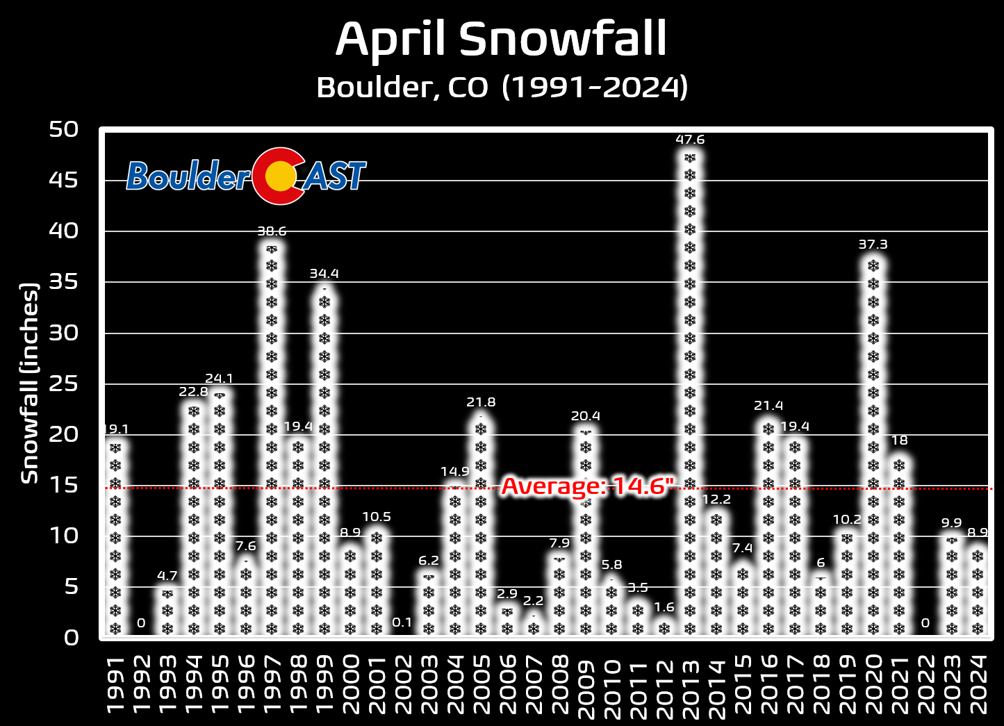
This brings April’s snowfall up to 8.9″ in Boulder with ten days to go. This is just slightly below the normal month-to-date.
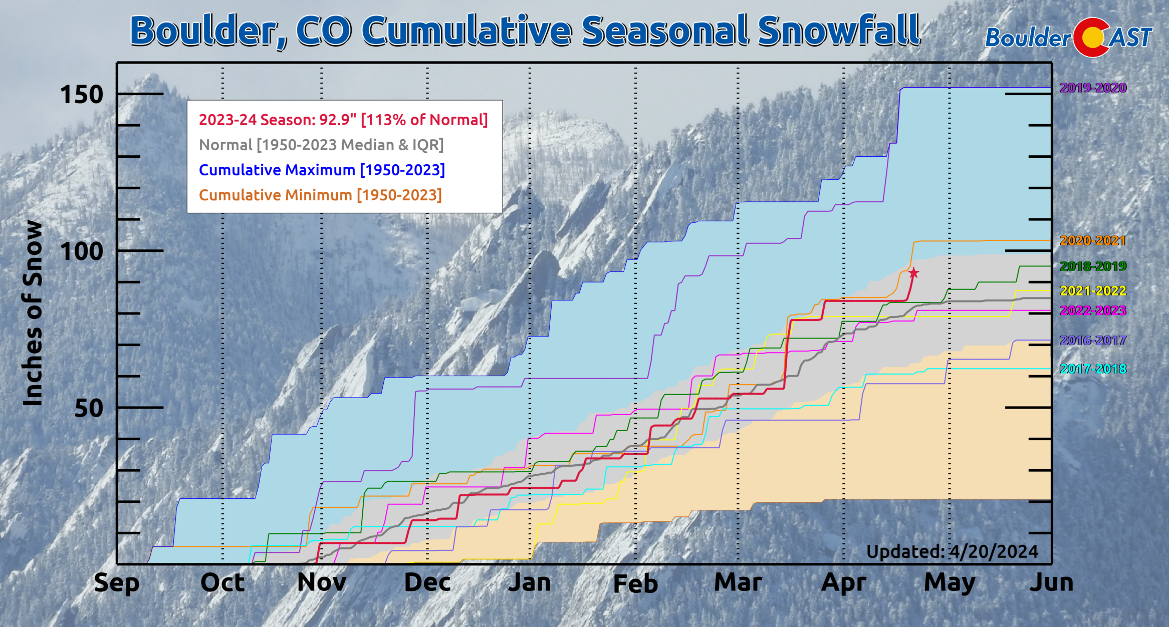
Boulder now has 92.9″ of snow for the season, securing our first above average snow season since 2020-2021!


You must be logged in to post a comment.