After our first real taste of summer the last few days, the weather will revert to more seasonal conditions Sunday into Monday. For Front Range Colorado in early May, that means severe weather, soaking rainfall and snow in the higher terrain. Let’s take a look at the latest on the stormy, soggy and snowy weather about to unfold!
We discuss Boulder and Denver weather every single day on BoulderCAST Premium. Sign up today to get access to our daily forecast discussions every morning, complete six-day skiing and hiking forecasts powered by machine learning, access to all our Front Range specific weather models, additional storm updates and much more!

At a Glance:
- Another somewhat slow-moving and wet storm system will impact the Front Range Sunday into Monday
- Scattered strong thunderstorms are expected Sunday afternoon, turning to a widespread soaking rain/snow event thereafter
- More than a foot of snow possible in the highest peaks, up to 6″ in the Foothills
- Rainfall totals of 1-2″ are expected in Boulder and Denver
- Cold temperatures and on-and-off rain will linger through the day Monday
M
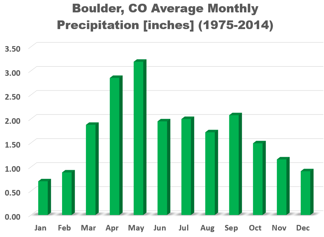
ay is typically our wettest month of the year and this one seems to be no exception with another major spring storm headed for northeast Colorado to kick off the month!
The responsible Pacific trough is located back across Nevada and Idaho as of Sunday morning. It will move into western Colorado late Sunday night and through our area Monday afternoon. Up until this passage, conditions will be primed for spring-time precipitation up and down the Front Range.
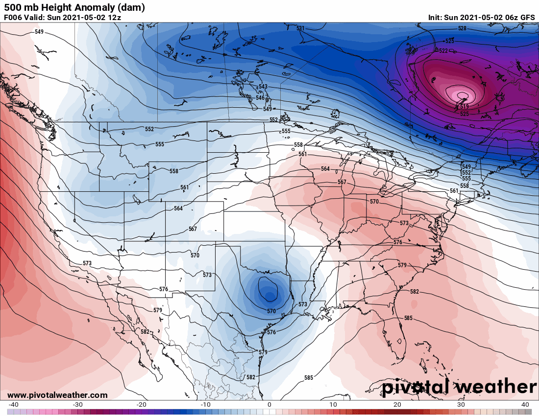
Similar to our last storm, the concern initially will be for thunderstorms Sunday afternoon before the cold front blows through later on Sunday. Plenty of low-level moisture, early day sunshine, and ample shear will support the development of strong to even severe storms Sunday afternoon.
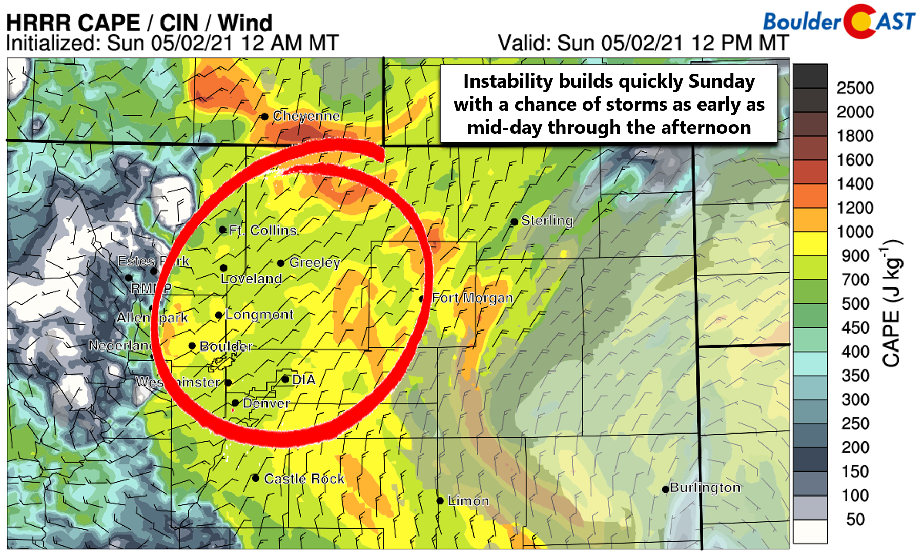
Some of the high-resolution models are showing convective initiation as early as mid-day Sunday around Boulder with a line of strong storms pushing eastward through the Metro area during the afternoon. Additional storms could redevelop over the region through early evening after which the instability fades and chilly upslope will take-over as the primary forcer for precipitation.
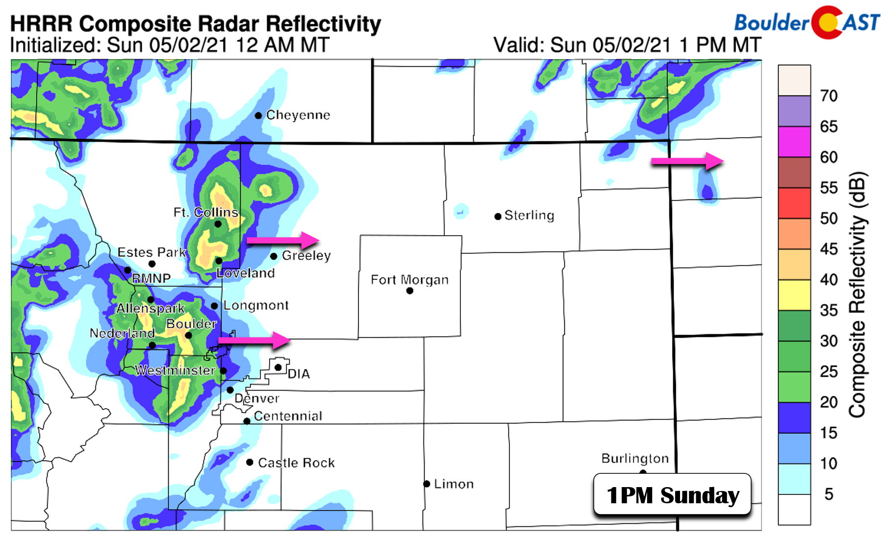
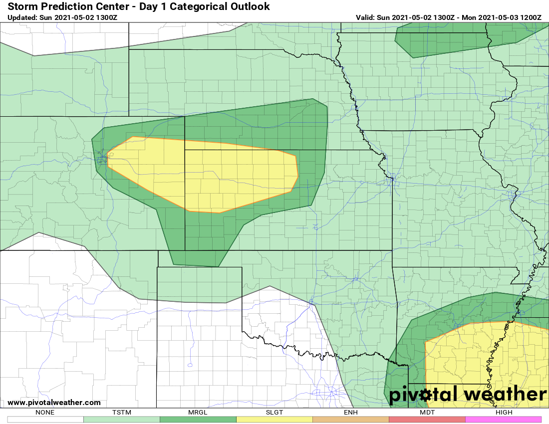
The Storm Prediction Center includes both Boulder and Denver at “Marginal Risk” for severe weather this afternoon into early evening with 1″ hail and 65 MPH wind gusts the main things to watch out for. The threat is higher east of Interstate 25 to the Kansas border where a “Slight Risk” is indicated.
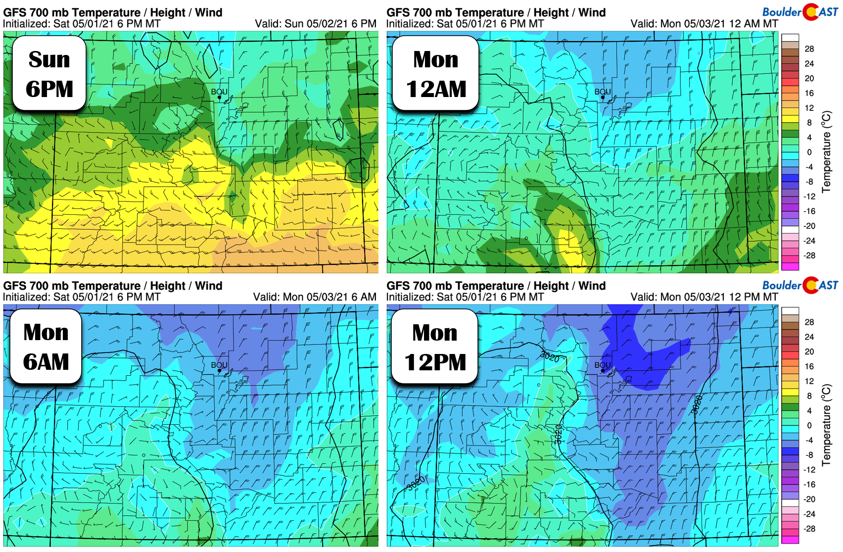
Sunday evening and night colder air will begin to push in from the north and northeast (an upslope direction). The coldest airmass aloft doesn’t really arrive until Monday morning and afternoon, as shown below. This daytime timing should help mitigate some of the impacts from snow falling in the Foothills. Nonetheless, the higher elevations will be dealing with snow once again.
Most if not all of the snow will remain above 6000 or 6500 feet with this system. However, we could see a few flakes mix in down to around 5500 feet Monday morning with no accumulation expected. More than a foot of snow is possible in the Mountains above 9500 feet where it will start snowing late this afternoon, with a dusting to several inches of snow likely in the Foothills between 6000 and 9500 feet. Our snowfall forecast map for this event is shown below. This covers snow falling through Monday evening.

Across the lower elevations, the story with this system will be a widespread, soaking and chilly rainfall. Model consensus points to around 1″ of liquid for most of the Front Range by Monday night, with slightly higher amounts in and near the Foothills (including Boulder) and lesser amounts east of Interstate 25. Remember, after the brief thunderstorm threat Sunday afternoon, this will largely be an upslope event, so this precipitation pattern makes sense.
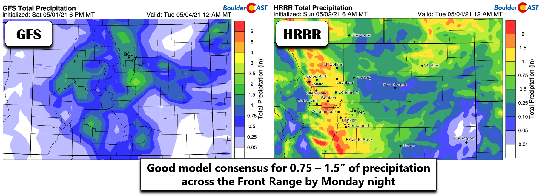
A look at the GFS ensembles gives us more confidence in the expected precipitation totals. Roughly 85% of members are predicting that Boulder will see between 1 and 2″ of rainfall from this event, with the other members predicting just over 2″ or just under 1″. The median value is around 1.45″. Overall, this storm should be about on par with what transpired last week.
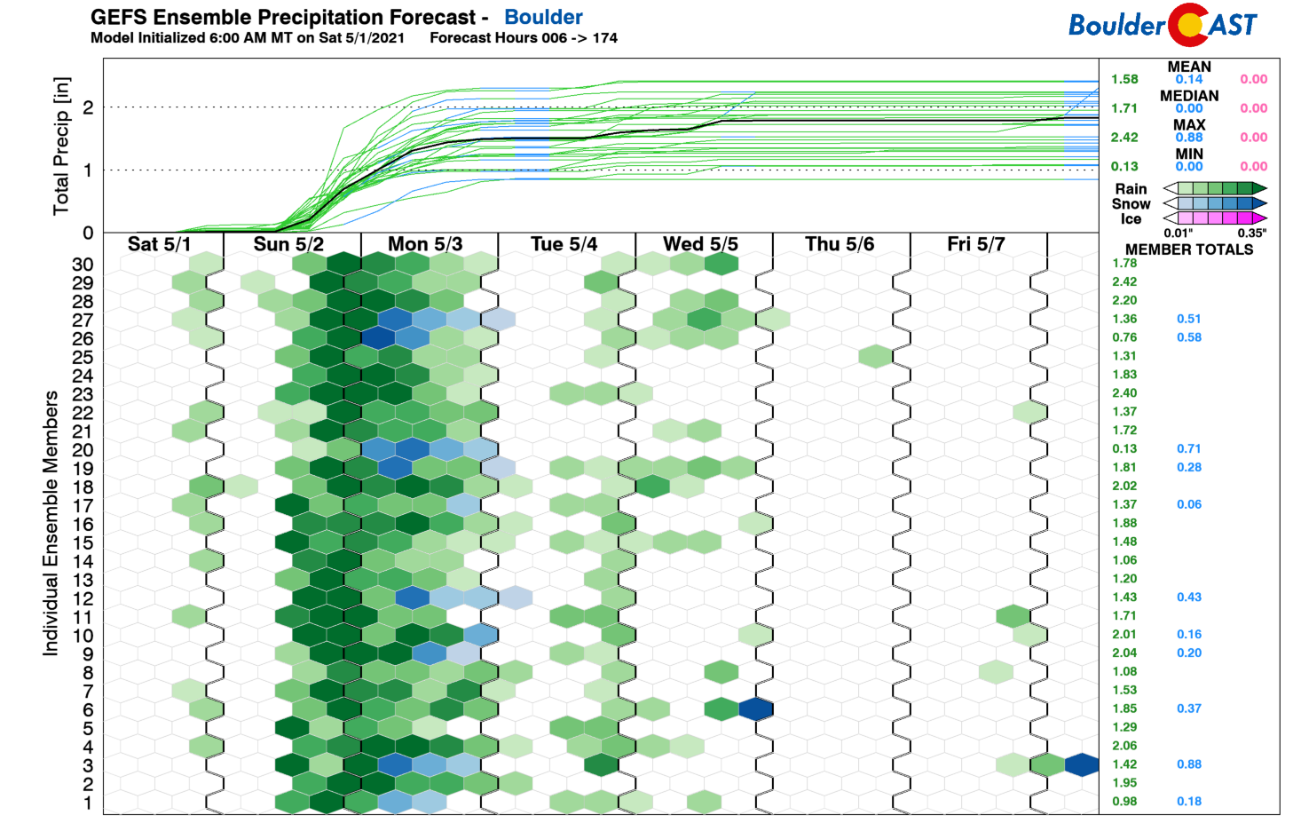
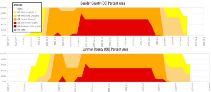
This should be enough precipitation to wipe of what’s left of the drought in Boulder County (7%) and possibly Larimer County (28%) as well. This storm combined with last week’s system will continue to help improve the drought conditions…an improvement that actually began with the historic snowstorm back in mid-March.

Clouds, cold temperatures and on-and-off rainfall will linger through the day Monday with highs only in the 40’s. Rain/snow will continue in the Foothills as well with limited additional accumulation. The melt rate will likely exceed the accumulation rate of any falling snow during the day, keeping snow totals for the higher terrain in-check.
The weather pattern rest of the week ahead will remain active but not quite as active as Sunday or Monday. Check back tomorrow morning for our complete outlook of the upcoming week. Enjoy the weather on this gorgeous Sunday morning. Dark skies, showers, and storms are already filling the skies just to the west and will be here within a few hours!
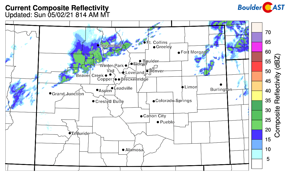
Current radar animation as of 9AM Sunday
We discuss Boulder and Denver weather every single day on BoulderCAST Premium. Sign up today to get access to our daily forecast discussions every morning, complete six-day skiing and hiking forecasts powered by machine learning, access to all our Front Range specific weather models, additional storm updates and much more!
.
Spread the word, share Colorado’s crazy weather:


You must be logged in to post a comment.