Get ready, Colorado! The first snowflakes and a hard freeze of the season are on their way as this dramatic shift in weather across the state continues. Better late than never, right? We discuss when the snow will begin, how much could stick on the grassy surfaces, and when to expect the end to the 2024 growing season as temperatures are sure to plummet below freezing. We’re also tracking another potential snow event early next week. Here’s the latest.
At A Glance:
- One-Two-Punch: We are expecting the first snow and hard freeze of the season in the coming days across the entire Denver Metro area.
- Snow Potential: Upslope and cold air aloft will combine to produce spotty rain/snow showers on Wednesday across the area, with up to 1″ of wet snow accumulation (more in the Foothills)
- Goodbye Growing Season: As skies clear Wednesday night, temperatures will drop well into the 20s leading to the first hard freeze of the season and the end of the growing season. Subsequent nights may also drop below freezing.
- Cold Precautions: Residents are advised to disconnect outdoor hoses and drain above-ground pipes to prevent damage from freezing temperatures. In-ground pipes will be fine for now.
- More Snow Next Week? This cold snap may be followed by another stronger one early next week with snow in tow as well.
Daily Forecast Updates
Get our daily forecast discussion every morning delivered to your inbox.
All Our Model Data
Access to all our Colorado-centric high-resolution weather model graphics. Seriously — every one!
Ski & Hiking Forecasts
6-day forecasts for all the Colorado ski resorts, plus more than 120 hiking trails, including every 14er.
Smoke Forecasts
Wildfire smoke concentration predictions up to 72 hours into the future.
Exclusive Content
Weekend outlooks every Thursday, bonus storm updates, historical data and much more!
No Advertisements
Enjoy ad-free viewing on the entire site.
First snowflakes and hard freeze of the season are on the way!
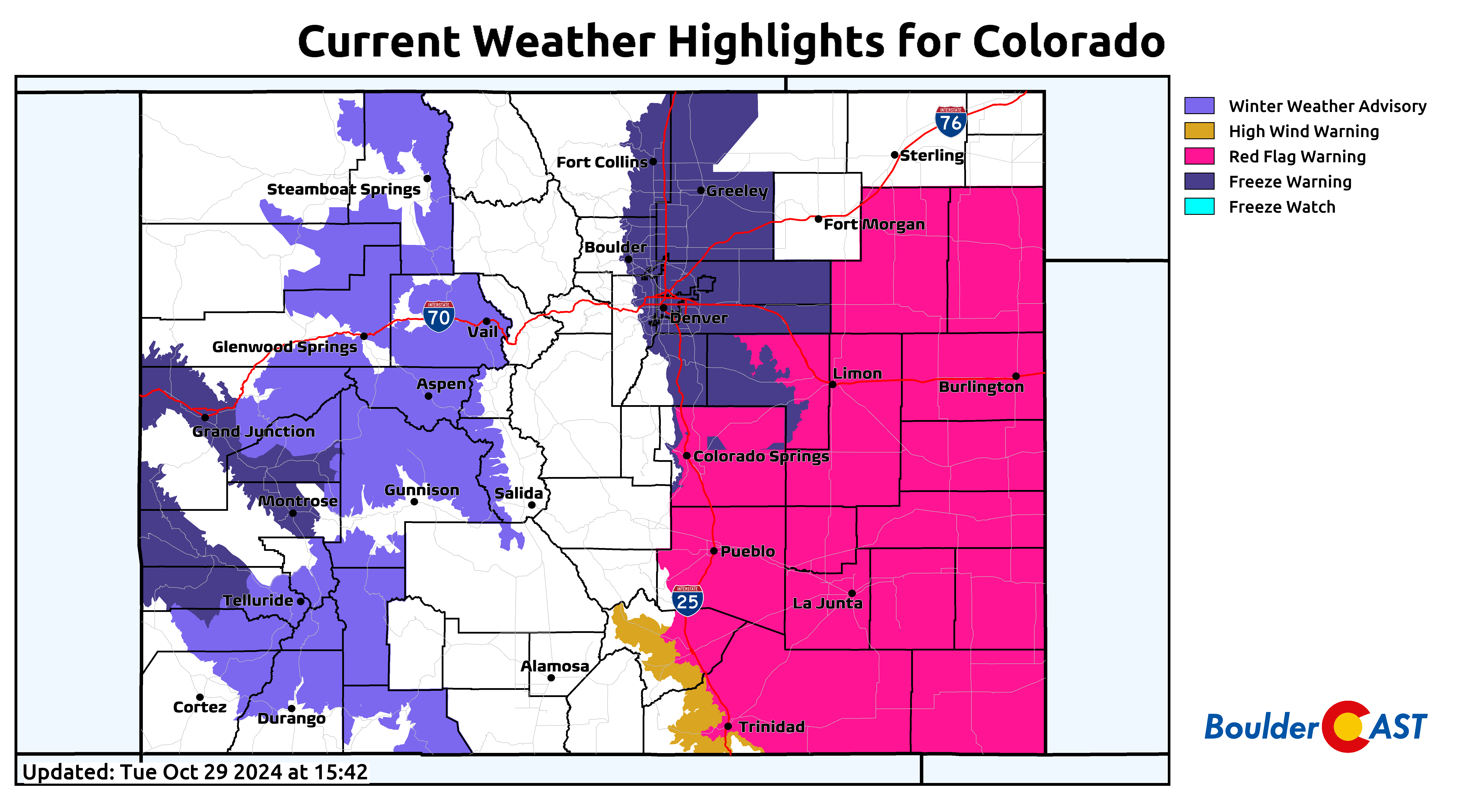
Nothing is more “Colorado” than a weather highlight map lit up like a Christmas tree, with damaging winds, fire danger, snow, severe storms, ice and freezing temperatures spread across our beautiful state. This is exactly what’s going on right now across the region:
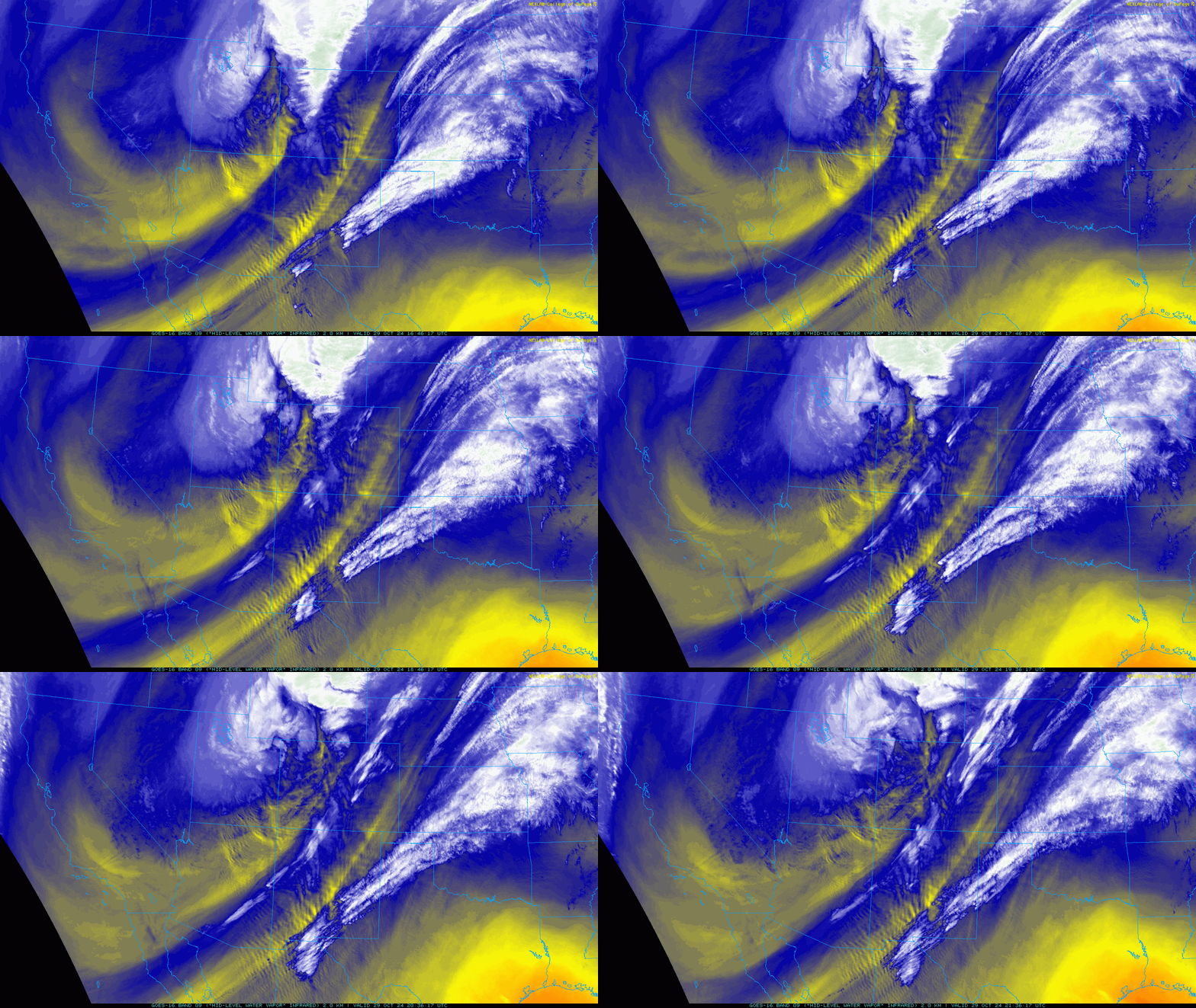
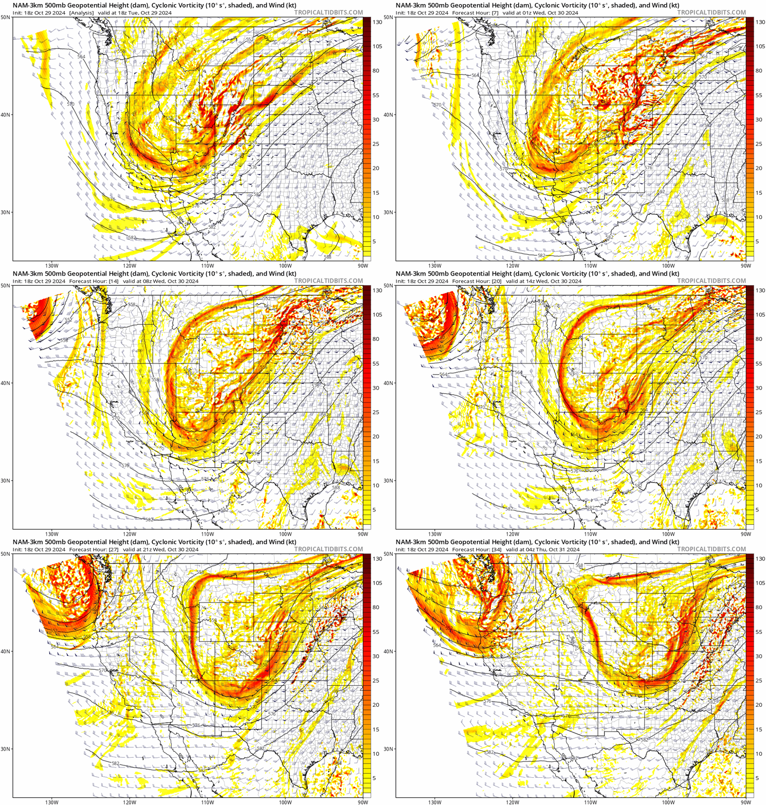
In case you live under a rock, the well-forecasted pattern shift predicted for this week, perhaps the true arrival of autumn, is already underway throughout the Front Range as an impressive mid-level trough continues its slow approach from the west. The center of the primary upper-low is located near the triple point of Colorado, Utah and Wyoming as of Tuesday early evening.
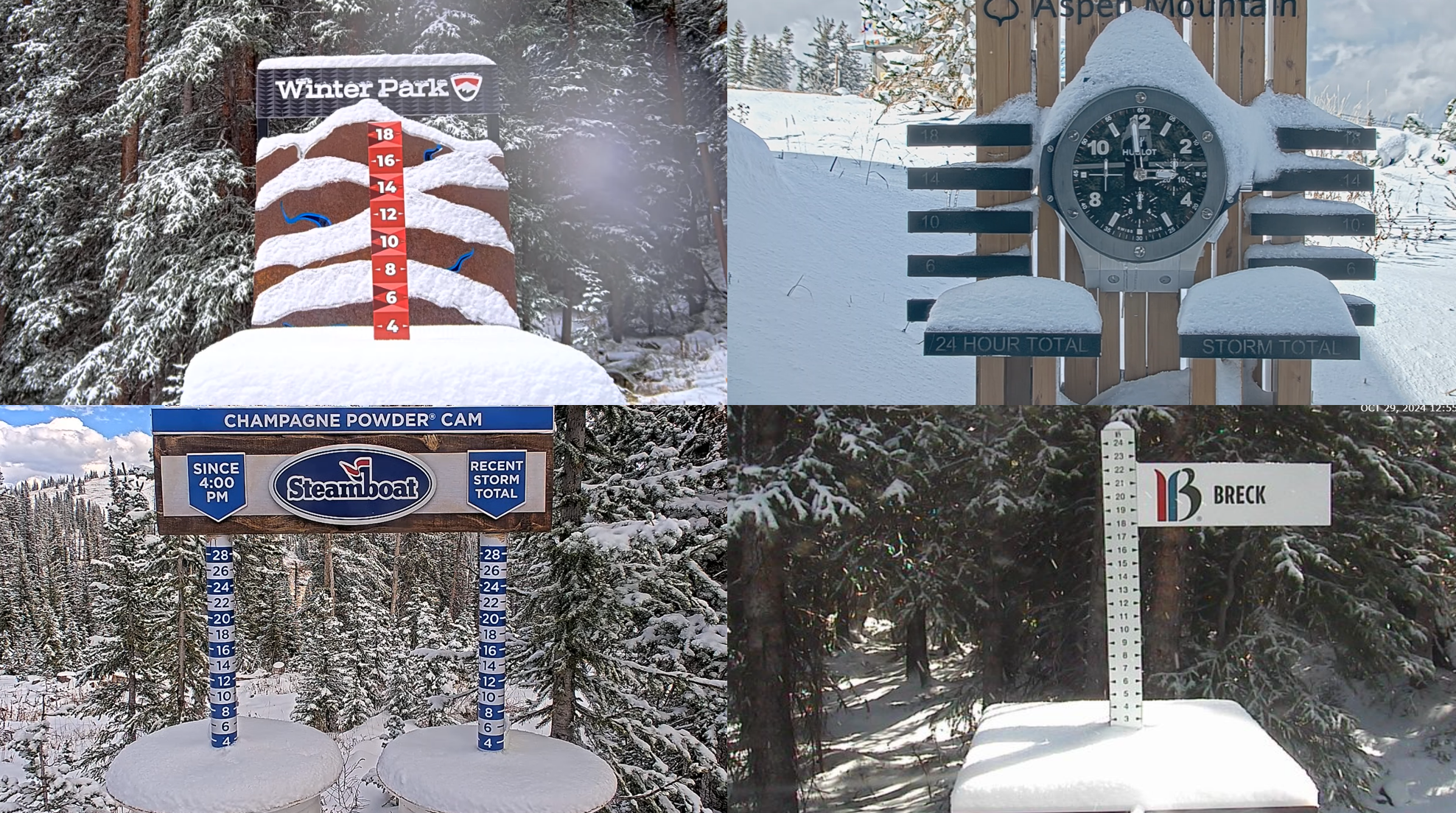
In our weekly outlook posted Monday morning, we discussed how this approaching trough would unfold as a “one-two punch” for Colorado. The first haymaker is basically over and done with already, impacting mainly central and western Colorado with widespread rain and mountain snow. Most of the ski resorts picked up a quick few inches of white stuff earlier today, but now the sun is out as a dry slot has invaded the region:
East of the Mountains, we had just a few rain showers clip parts of the Metro area Tuesday afternoon, mainly from Boulder to Fort Collins. The northward track of this initial wave was always expected to mostly bypass the Front Range, with a focus on western Colorado, Wyoming and the Dakotas. The more interesting facet of this trough was the secondary jab queuing up for our Wednesday. This remains on-track for an arrival into the Denver area Wednesday morning lasting into the evening hours. This subsequent and final wave of the trough is currently located near Las Vegas. It will swoop across the Four Corners tonight before reaching our area Wednesday morning.
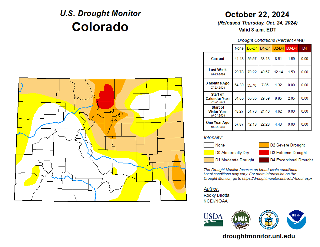
We’re not going to dive too deeply into the meteorology behind this particular storm. Frankly, if it hadn’t been bone-dry for the last several months and this wasn’t our first real shot of snowflakes for the season, this one wouldn’t be getting nearly as much attention. However, we’re in the midst of extreme drought and this system does stand a good chance to produce our first snow of the season — so here we are!
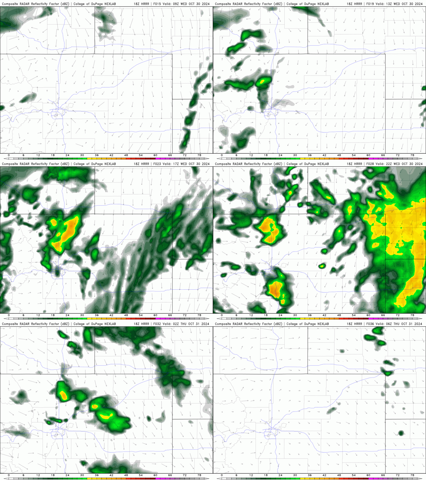
Long story short: there is some discrepancy in the models regarding what unfolds on Wednesday. All guidance agrees it will be a very cold day with high temperatures probably not making out of the 30s on the flatlands and the upper 20s in the Foothills. That’s the easy part. Upslope flow will be in-place during the morning hours on Wednesday behind a shallow cold front. This may produce areas of fog and mist. With temperatures in the low to middle 30s, this could be freezing fog and freezing mist, depending on the exact temperature in your given location. The approaching storm will also include plenty of cold air aloft — setting the stage for convective snow showers to mix in with the cold upslope, producing pockets of moderate to even heavy snowfall Wednesday morning into the afternoon. Short-range models, like the HRRR shown below, have been indicating a northward bias with the convection, impacting areas mainly around Boulder northward to Wyoming. This isn’t a definite forecast, though. These convective snow showers could form anywhere from the Wyoming Border down to the Palmer Divide — but Boulder to Estes Park does appear to be the sweet spot…
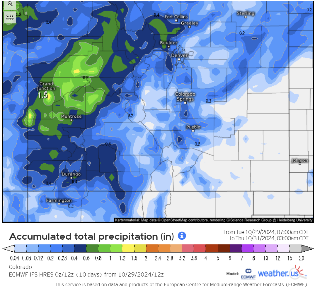
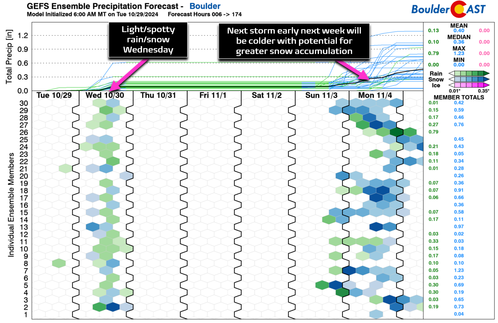
For moisture, we’re generally looking at less than 0.25″ of rain/melted snow equivalent for the entire Metro area — this is far from a major precipitation event for us. Some models, like the Euro shown below, incate 0.5″+ of moisture may be possible in the Foothills west of Boulder, but this is an outlier model. In general, we’re looking at a broad brush of 0.25″ or less of moisture for most. A few lucky spots that land under convective showers for longer could possibly eclipse the elusive 0.5″ mark!
Precipitation could begin as early as 6AM Wednesday (rain/snow/mist), with decent chances lingering at least into the afternoon hours. With temperatures in the low to middle 30s Wednesday morning across the lower elevations, any showers that form should be falling as rain/snow mix or all snow, with slushy accumulations possible on the grassy surfaces in the heavier bursts.
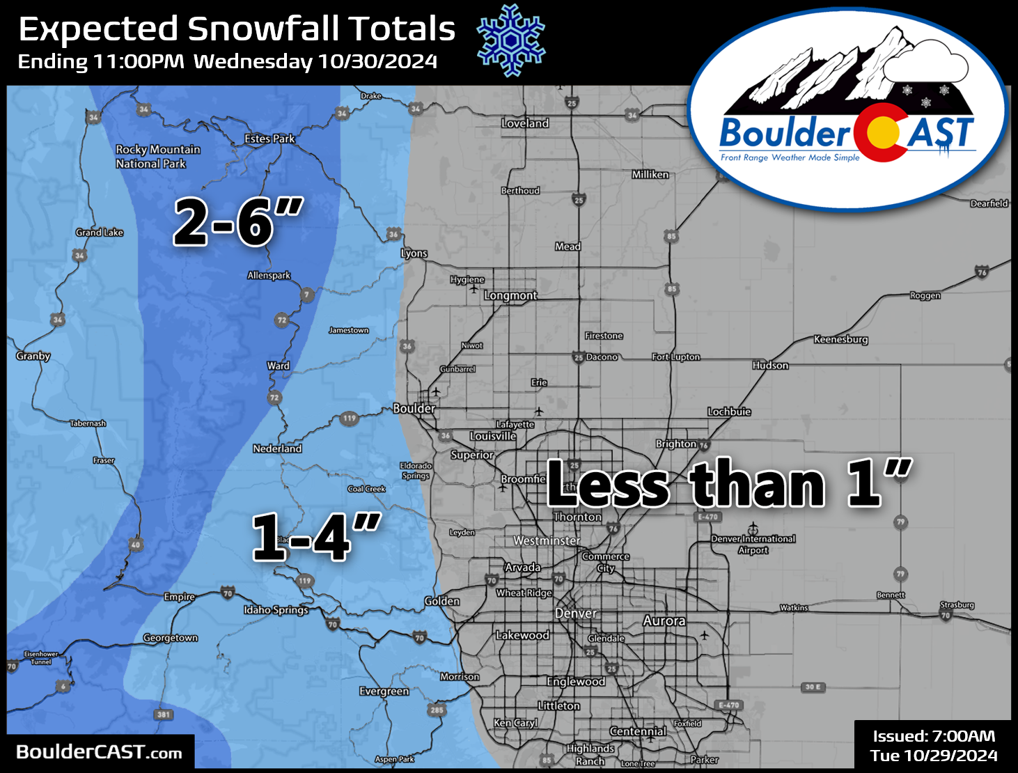
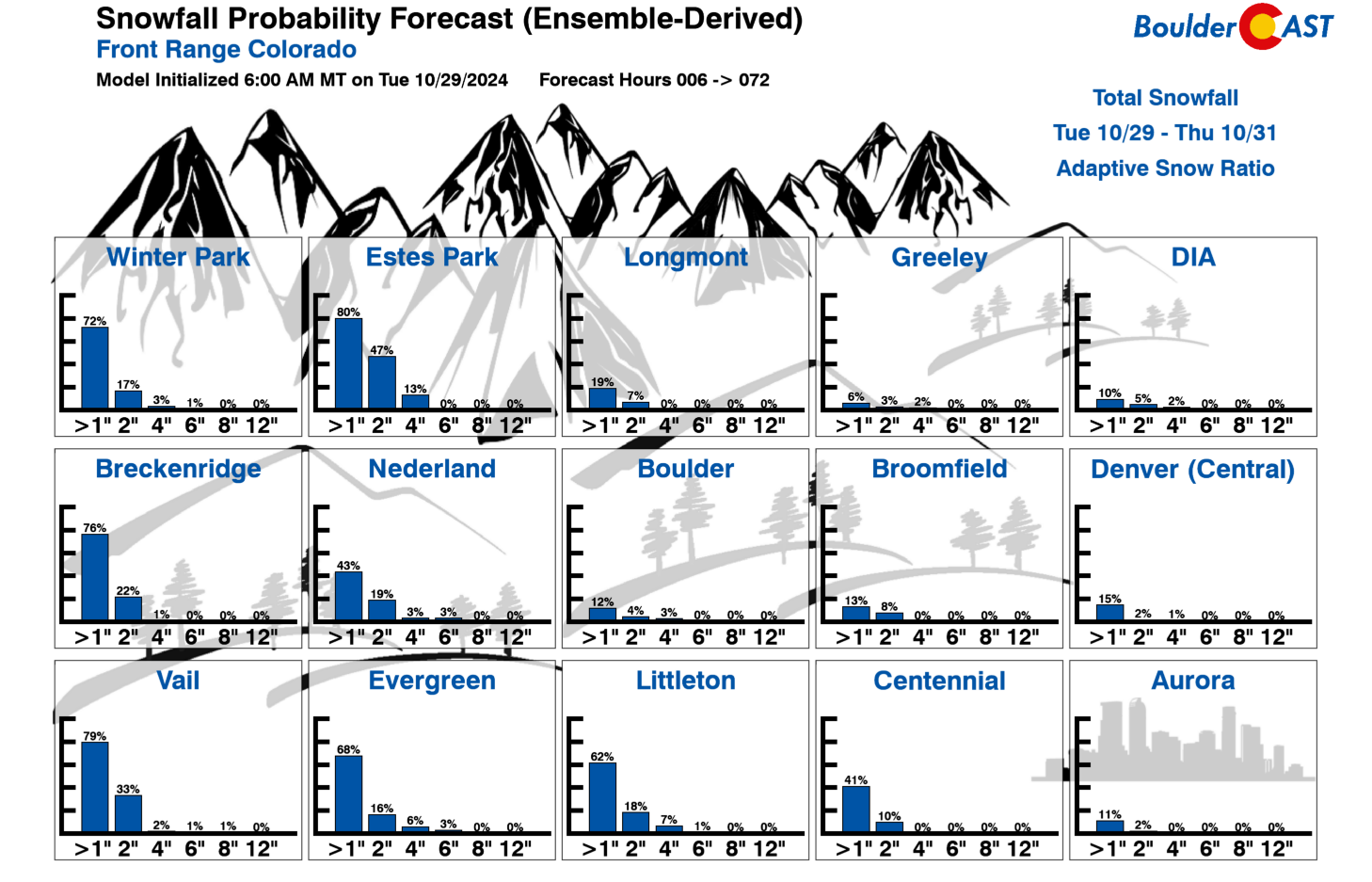
After careful consideration, we’re not making any adjustments to our official snowfall forecast map shown below. The lower elevations will see a few flakes up to 1″ of slushy accumulation. Yes, just about everyone should see frozen water falling from the sky at some point Wednesday (80%+ odds), with about a coin flip’s chance to see a dusting of wet accumulation in any given area. If a convective shower lingers for an hour or two, which these potentially could, then you could see perhaps 1-2″ of wet snow briefly pile up. This should be rare, but is possible. In the Foothills it will be colder and snow totals of 1-6″ are expected, highest above 8000 feet elevation in Boulder and Larimer Counties.
For the gamblers out there — well, you’re better off sitting this one out…
Any lingering snow or rain/snow showers should wrap-up by late Wednesday evening followed by skies clearing out Wednesday night. This brings about the secondary concern with this system — the first hard freeze of the year. It’s all but guaranteed at this point that our entire area will drop below freezing Wednesday night into Thursday morning — the official end of the 2024 growing season! Overnight low temperatures will range between 24 and 30°F for the Metro area Wednesday night, with even colder temperatures (some teens) possible in outlying areas. If you haven’t done so already, you absolutely should disconnect outdoor hoses and drain any above ground pipes (e.g. backflow preventers on your irrigation system). Below ground irrigation lines will be fine for now as the relatively warm ground will insulate those fully. Take action now — you have been warned! Personally, our household is not going to spend any time trying to preserve outdoor plants. Spoiler: there’s another, colder storm system targeting Colorado towards early next week with even colder temperatures and a better chance of accumulating snow. Why delay the inevitable?
FINAL THOUGHTS:
- There is a strong likelihood that everyone in the Metro area will see snowflakes falling from the sky at some point on Wednesday (80%+ chance)
- There is a decent chance that your area will see at least a small amount of snow stick on the grassy surfaces (50%+ chance).
- There is a near-certainty of a hard freeze Wednesday night into Thursday morning (95%+ chance), followed by potential frost and/or lighter freezes Thursday and Friday nights as well
- Keep an eye out around the Monday timeframe for our next autumn storm with more snow in the works
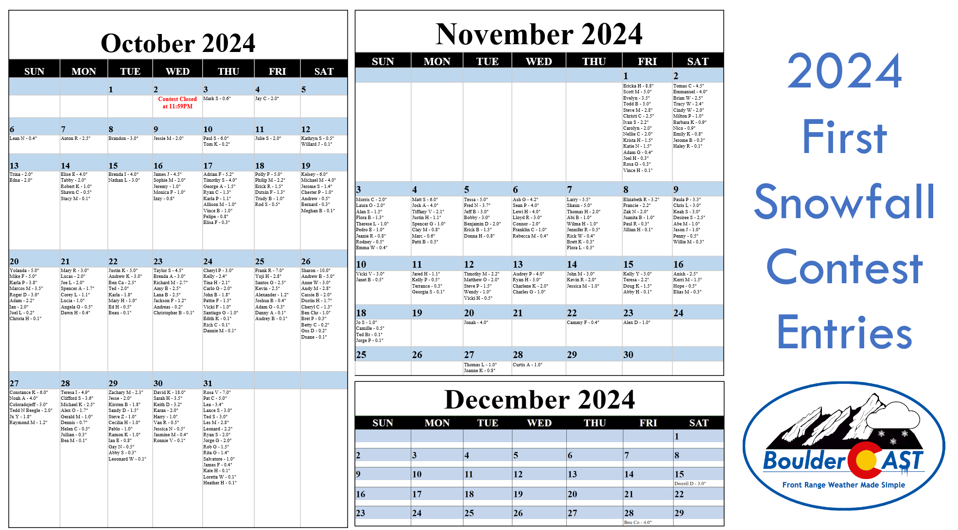
Though more than 50% of contestants have already been eliminated, read on into the section below for a reminder of all the entries to our 10th Annual First Snowfall Contest. The winner may very well be decided tomorrow. Think snow!
A reminder of the 2024 First Snowfall Contest entries
In the announcement post for this contest, we offered a little insight by providing a few of Boulder’s “first snow” statistics. More than 270 of you came up with “educated” guesses for the timing and amount of Boulder’s first snow of the 2024-25 winter season. All of the entries are contained in the calendar view below. Click to enlarge or head over to the official Google Sheet for a clearer look at things.
A few notes about the predictions:
- Dates range from October 3rd to December 28th, the latter being nearly six weeks later than the existing latest first snow on record for Boulder! Our readers are really pessimistic aren’t they?
- Amounts range from 0.1 to 18.0 inches. Keep in mind there’s only been one first snow in the last 75 years that was greater than a foot!
- The median date of the guesses is October 29th. This is nine days later than climatology, perhaps a sign of public sentiment being marred by the recent prolonged warm pattern
- The most popular date chosen was October 31st with sixteen picks — no doubt influenced by the long-standing Denver area urban legend that our first snow is always on Halloween!
- 90% of entries predict a first snow of 4.0 inches or less. Bravo, climatology strongly agrees with these folks!
- As of October 29th, more than 50% of contestants are already eliminated due to the warm month of October weather so far. Better luck next year!
SUMMARY OF SCORING:
Those who come closest to the actual date of Boulder’s first MEASURABLE SNOW (defined as snowfall at or above 0.1″) win! For verification, we’ll go off the official Boulder climate station located at the NIST building in south Boulder. Only the first calendar date of snow will be used (i.e. if the first snow event spans two days, only the amount of the first day will count). In the event that multiple participants select the same date, the tie-breaker of snowfall amount will be used.
SUMMARY OF PRIZES:
The prizes for the contest are as follows:
- 1st place: 12-month Premium subscription + $35 Amazon Gift Card
- 2nd place: 6-month Premium subscription + $15 Amazon Gift Card
- Anyone who guesses within 1 day OR 0.1″ correct: 2-month Premium subscription
- All other entries: Virtual “pat on the back”
Get BoulderCAST updates delivered to your inbox:
Daily Forecast Updates
Get our daily forecast discussion every morning delivered to your inbox.
All Our Model Data
Access to all our Colorado-centric high-resolution weather model graphics. Seriously — every one!
Ski & Hiking Forecasts
6-day forecasts for all the Colorado ski resorts, plus more than 120 hiking trails, including every 14er.
Smoke Forecasts
Wildfire smoke concentration predictions up to 72 hours into the future.
Exclusive Content
Weekend outlooks every Thursday, bonus storm updates, historical data and much more!
No Advertisements
Enjoy ad-free viewing on the entire site.
Enjoy our content? Help us out and give it a share:





You must be logged in to post a comment.