Category: Winter Weather (Page 34 of 134)
These posts contain some discussion of the white stuff, whether it be mountain snow pack or a Front Range snowstorm.
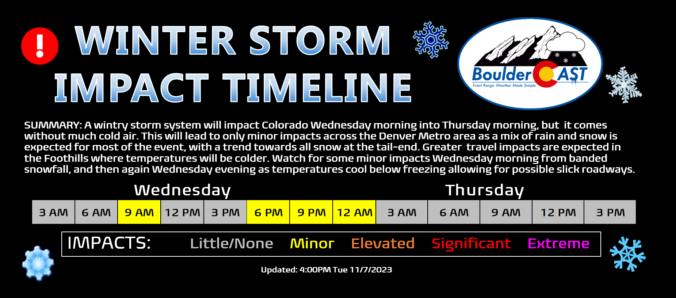
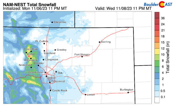
A wintry storm system will impact Colorado Wednesday morning into Thursday morning, but it’s not bringing much cold air to the party! This will lead to only minor impacts across the Denver Metro area as a mix of rain and snow is expected for most of the event, with a trend towards all snow at the tail-end as precipitation will be wrapping up. Greater travel impacts are expected in the Foothills where temperatures will be colder and up to 8 inches of snow may accumulate. We discuss the timing of the rain and snow, the expected snowfall totals for everyone and when travel may be most impacted.
What a wonderful weekend it was across the Front Range culminating with sunshine and record high temperatures on Sunday! The warmth will continue for just a couple more days here before a midweek weather system will usher in much colder temperatures alongside the threat of rain and snow, including potential heavy snow in the Foothills. Uncertainty remains elevated for this storm overall, but change is definitely headed this way. Read on for the latest details.
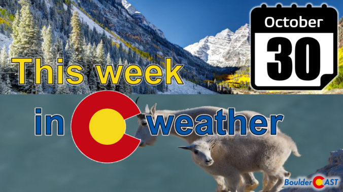
October 2023 was an overall warm and very dry month in Boulder, but the days leading up to Halloween turned markedly colder with our first snowfall of the season arriving just a tad later than usual, and it was a sizable one for many! Despite the dry last few months, officially drought has not yet returned to the Front Range. Here’s a quick and colorful graphical recap of our weather during October and how it relates to climatology.
Our first snowfall of the season is now behind us, but the bitter cold temperatures that accompanied it are still sticking around. It will take several more days before we have anything resembling normal temperatures across the Front Range. Overall the week ahead will be quiet and mostly sunny with little to be concerned about weather-wise. The upcoming weekend looks rather nice as well. Read on for all the details.
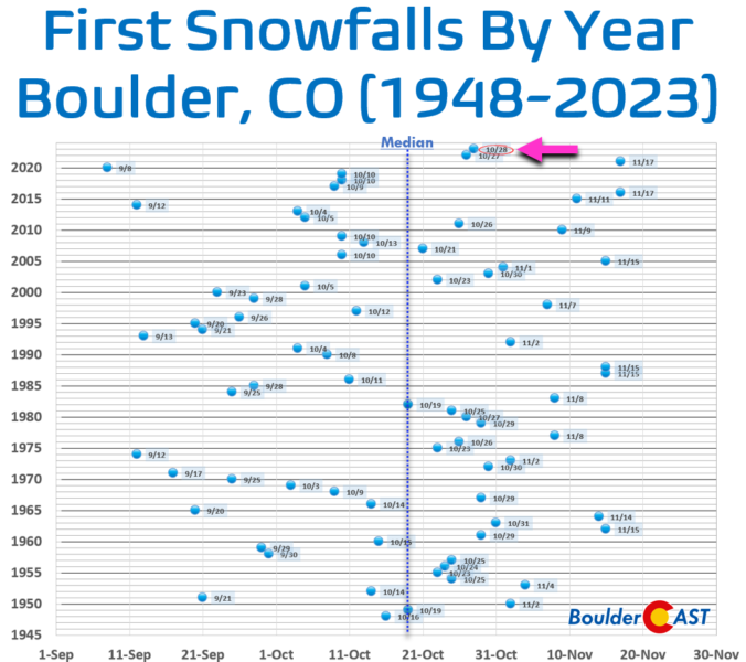
The highly anticipated first snowfall of the season is now out of the way for everyone in the Front Range with a widespread blanket of snow having dumped on the area Saturday evening and overnight. Light snow continues to fall Sunday morning, but most of the accumulation is over and done with. Though things didn’t go perfectly as planned, snowfall amounts came in about as expected across the Boulder-Denver Metro area with a range of 3 to 12″. Let’s take a look at the totals and near-term forecast. We also announce the (many) winners of our 2023 First Snowfall Contest.
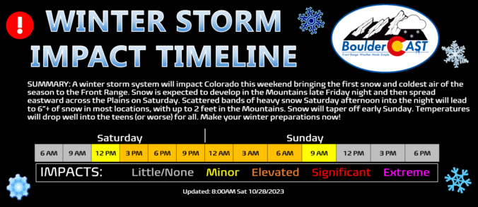
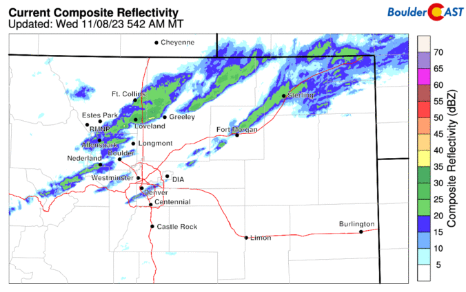
The potent winter storm is moving into Colorado as we speak. We’ve got just a quick update for you this morning as models remain shockingly consistent placing the bullseye of heavy snow directly on the Denver Metro area. We discuss the latest timing on the heaviest snow bands, expected travel impacts, and provide our final prediction on snowfall amounts. Spoiler alert: they have gone up a tad!

Live View of Boulder

Current Conditions

Live Radar

Recent Premium Posts

BoulderCAST Daily – Thu 01/15/26 | Fire Danger Today Before a Cold Front Tonight
🔥 Fire danger rising — Warm and windy today ahead of a strong …
BoulderCAST Daily – Wed 01/14/26 | A gorgeous Wednesday ahead of increasing fire danger & a stronger cold front tomorrow
🌬️ Weak front overnight — A weak cold front slipped through around 9:30 …
BoulderCAST Daily – Tue 01/13/26 | A thick blanket of high clouds won’t stop us from reaching the 60s again
☁️ Thick cloud deck overhead — Moisture streaming in aloft brings widespread mid‑ …
3-Day Forecast

Trending Content

© 2026 Front Range Weather, LLC