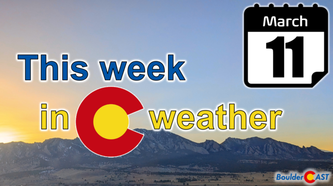
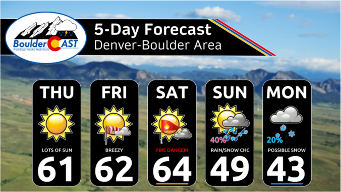
It will be business as usual the first two days of the week with 60-degree temperatures and dry conditions continuing. However, a major storm system will drop south into the Desert Southwest this week, with impacts expected in the Front Range Wednesday through Friday. All signs point to a significant dumping of upslope precipitation in our area from this storm, most of which will fall as heavy wet snow. There’s still a lot of uncertainty in this week’s forecast, but let’s discuss the latest developments in what could be a historic March winter storm for the Denver Metro area.
Category: Winter Weather (Page 25 of 134)
These posts contain some discussion of the white stuff, whether it be mountain snow pack or a Front Range snowstorm.
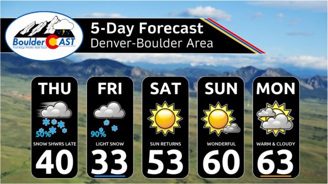
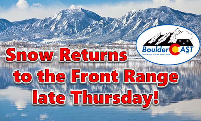
After a long, quiet stretch following last week’s snow squall, winter weather will return to the Front Range as a slow-moving but ultimately weak storm system impacts the area to end the work week. We discuss the long-duration of weak upslope about to unfold, the potential snowfall amounts across the area, and when travel will become slick.
Update (Thursday 3/7/24 7:00AM): We’ve now concerned that heavy snow the far eastern areas of Colorado on Thursday will reduce the amount of upslope/moisture that make it back westward into the Front Range. We’ve seen models trend downward in snow amounts slightly for our entire area, especially east of I-25. Thus, we’ve scaled back snow amounts slightly for the region. Please check our updated snowfall map, model forecast graphics, and storm impact timeline throughout this post. We talk about this last-minute shift and much more in Thursday morning’s Premium discussion HERE.

Mother Nature will mostly offer up seasonal temperatures and dry conditions to the Denver Metro area through midweek. There will be a few disturbances Tuesday and Wednesday embedded in the southwest flow aloft, but these will mainly impact the higher terrain. However, we are watching a late-week cold front which will usher in colder temperatures, upslope flow and likely produce widespread accumulating snow for most of the Front Range. Let’s take a look!
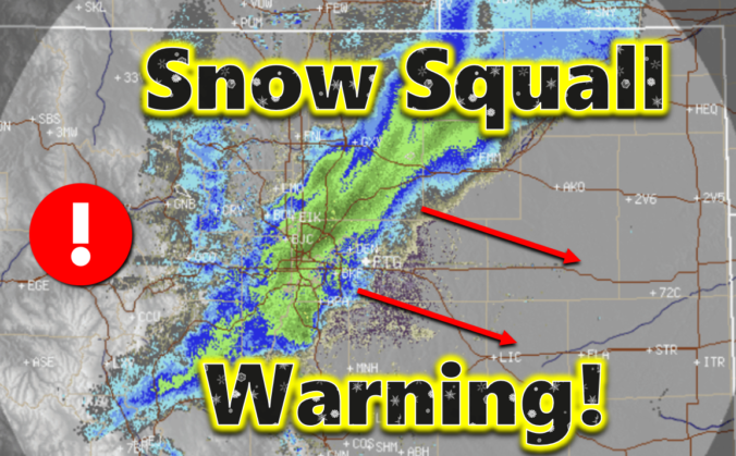
In dramatic fashion, an intense snow squall blew up over Boulder Tuesday morning and spread across the entire Denver Metro area leading to brief whiteout conditions just after the morning commute window. The heavy snowfall ended as quickly as it began, leaving behind rather unimpressive snowfall totals in the Front Range. However, as they say, it’s not about where you end up — it’s about how you got there! We discuss the crazy weather that unfolded on Tuesday and take a look at the snowfall totals.

Live View of Boulder

Current Conditions

Live Radar

Recent Premium Posts

BoulderCAST Daily – Thu 01/15/26 | Fire Danger Today Before a Cold Front Tonight
🔥 Fire danger rising — Warm and windy today ahead of a strong …
BoulderCAST Daily – Wed 01/14/26 | A gorgeous Wednesday ahead of increasing fire danger & a stronger cold front tomorrow
🌬️ Weak front overnight — A weak cold front slipped through around 9:30 …
BoulderCAST Daily – Tue 01/13/26 | A thick blanket of high clouds won’t stop us from reaching the 60s again
☁️ Thick cloud deck overhead — Moisture streaming in aloft brings widespread mid‑ …
3-Day Forecast

Trending Content

© 2026 Front Range Weather, LLC