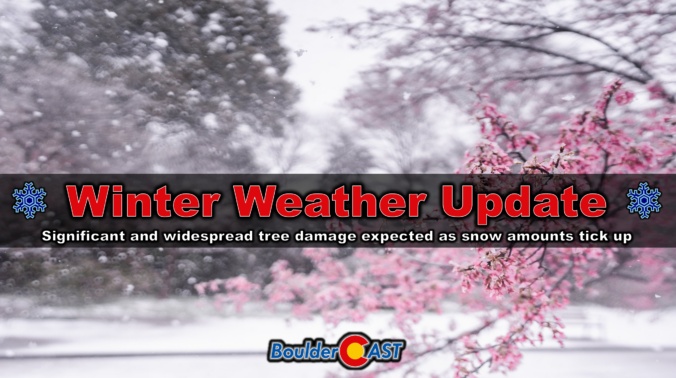
The spring storm rolling across the Front Range has already pulled off quite a transformation, shifting from rumbles of thunder to flakes of heavy, wet snow in just 12 hours. What comes next is shaping up to be even more impressive. Two separate storm systems are preparing to merge over Colorado and the result will be a long stretch of heavy wet snowfall that will have significant impacts for our fully leafed-out trees and power lines. We break down why snowfall amounts have ticked up a tad since yesterday, when and where power outages are most likely to occur, and the broader impacts this wet storm will have across Boulder, Denver and the Front Range.
Category: Winter Weather (Page 2 of 139)
These posts contain some discussion of the white stuff, whether it be mountain snow pack or a Front Range snowstorm.
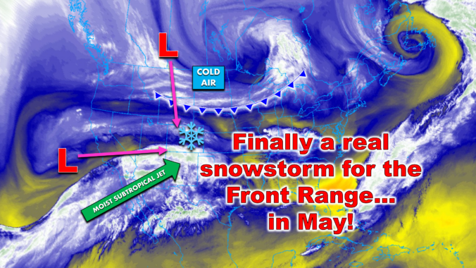
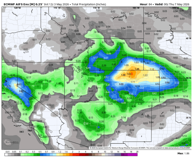
After another warm, spring weekend across the Front Range, big wintry changes are brewing for the days ahead! A surprisingly potent May storm is lining up for Colorado, and this one has all the ingredients to deliver a late-season deluge of precipitation. From deep moisture to prolonged upslope and a well‑timed blast of cold air, the setup is primed to be a high‑impact event — and yes, that includes heavy, wet late-season snow for all of us. We discuss the intriguing dynamics of the storm, the most likely snowfall amounts, potential impacts to our trees and power lines, and just how far we will drop below freezing.
A potent spring storm is lining up for the Front Range, and early signals point to a colder, wetter setup with the potential for impactful heavy, wet snow for everyone. We’ll dig into the details more deeply on Monday morning, but confidence is growing that this one could deliver both much‑needed moisture and heavy wet snow. Here’s a quick update on where things stand right now.
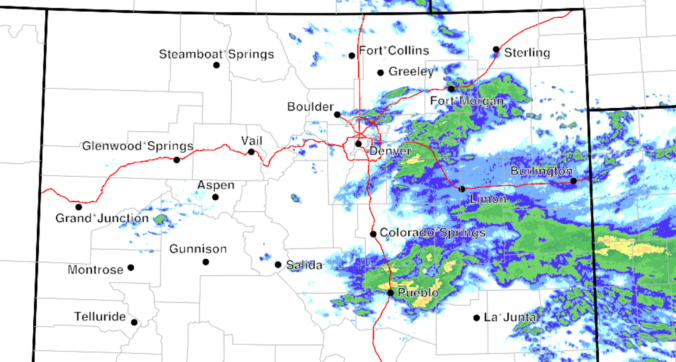
Rain is spreading across eastern Colorado this morning, with a broad, soggy setup still on track to bring rain and high‑elevation snow through the day to the Front Range. However, a continued southward shift in the storm track means precipitation totals around Denver and Boulder will likely fall short of earlier expectations. Nonetheless, a cool, gloomy day with plenty of showers still lies ahead, along with accumulating snow in the Foothills. Here’s the latest.
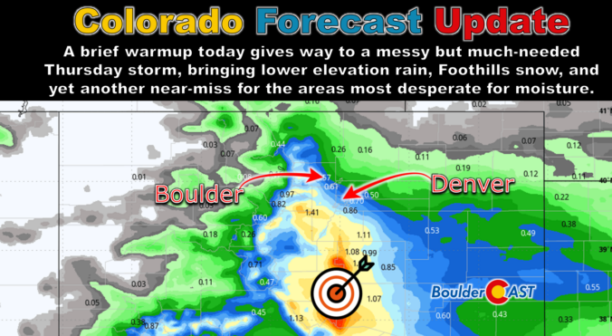
This brief lull in the action Wednesday morning won’t last long as the pattern is set to turn unsettled again in a hurry. A pair of poorly aligned disturbances is gearing up to bring the Front Range a long‑overdue dose of moisture — along with snow in the higher terrain. While the bullseye of heaviest precipitation is frustratingly expected to be south of our area again, a slew of marginal ingredients are coming together for what should be our most meaningful storm in months. We break down what to expect as we head into a soggy, colder, and in some cases, snowier end to the week.
As April winds down, several moisture‑rich systems are lining up along the Front Range, each bringing a mix of clouds, cooler temperatures, rain, and Mountain snow. Most days the forecast is straightforward, but one late‑week setup has quite variable outcomes. If you want to know when the dreariest stretches will be, how much moisture we can realistically expect, and when warmer weather will return, read on for all the details.

Colorado headlines have been buzzing about a looming “Super El Niño,” but the story behind the hype is far more layered than the headlines let on. Before leaning into the dramatic graphics and sweeping claims, it’s worth unpacking where this narrative actually came from and why one overzealous model run has taken on a life of its own. More importantly, we must consider what this all really means for our state as we limp into summer with record‑low snowpack, deepening drought, and a fire season that has already been sharpening its teeth. The truth is far more nuanced than the current online discourse suggests.
The atmosphere is gearing up for a dramatic mid‑week pivot, and the Front Range is about to feel every bit of it. We start the week under a warm, bone‑dry ridge that will send temperatures soaring and fire danger spiking—especially by Wednesday, when downslope winds and exceptional dryness are set to collide. But just as quickly, the pattern will flip. A pair of incoming troughs will drag us into a cooler, unsettled stretch of weather heading into the weekend, with several chances for much‑needed moisture and even the prospect of a few snowflakes mixing in at times. It’s a true tale of two patterns this week! Read on for all the details.

Live View of Boulder

Current Conditions

Live Radar

Latest Smoke Forecast

Recent Premium Posts

BoulderCAST Daily – Sat 07/11/26 | Here comes the heat!
🥵 Heat start today: Upper 90s start today and continue well into next …
BoulderCAST Daily – Fri 07/10/26 | The heat builds into the weekend
⛈️ Storms around today: A weak impulse of energy favors some isolated storms …
BoulderCAST Daily – Wed 07/08/26 | The Front Range Has Broken Out of the Haze — Storms Fire After Noon
🌬️ Smoke has (mostly) cleared out: Westerly flow pushed the thick plume south/east, …
3-Day Forecast

Trending Content

© 2026 Front Range Weather, LLC