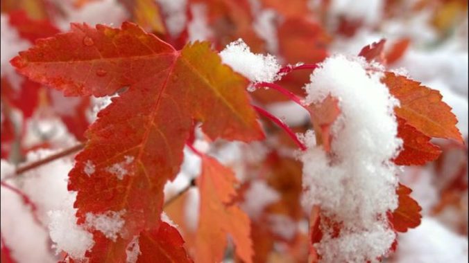
More snow is incoming as the active weather pattern for Colorado continues. We recap this week’s Columbus Day storm and discuss the snow potential today and over the upcoming weekend.
Category: Verification (Page 36 of 53)
These posts take a look back at recent weather events, like snow storms or severe weather outbreaks, and evaluate how the forecast played out. We evaluate how well the models predicted what actually occurred, and offer insight into what can be learned and applied moving forward.
Winter is in full swing, but don’t worry, BoulderCAST has you covered. We have several important announcements related to the ongoing snowy season.
Though there is officially still about one week left in summer, meteorological summer ended last weekend. We take a look back at what ended up being a warm, monsoon-deprived summer in which severe thunderstorms lessened wildfire and drought concerns. We also congratulate the 25 winners of our 2018 Summer Heat Contest!
We explain how SummitCAST is “trained” via machine learning to produce the most accurate mountain weather forecasts possible. We also show you where you can find hourly updated forecast verification for SummitCAST…helpful if you want to gauge the uncertainty in our forecasts when heading to the Colorado’s mountains.
It’s been a busy weather-week to say the least….There is usually only one or two days per year where a significant severe weather outbreak impacts the immediate Metro area. It just so happens this year those two days of severe weather occurred back-to-back! We review the damaging hailstorms that transpired earlier in the week and also look ahead to Friday’s forecast which may have large hail returning to the Boulder/Denver area.

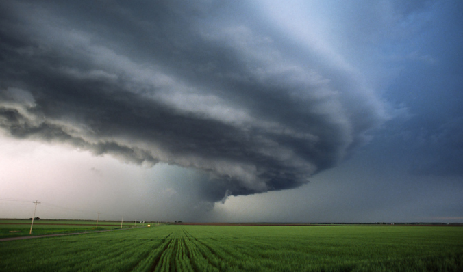
A recap of yesterday’s hailstorms, a discussion of today’s forecast which contains more hail, and a look at the eye of Category 4 Hurricane Bud from GOES-16.
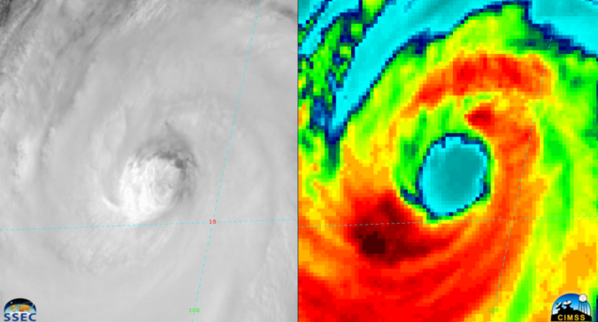
A favorable atmospheric set-up will help to funnel the remnants of Hurricane Bud, currently churning off the coast of western Mexico, into Colorado over the upcoming weekend. We discuss the impacts this will have for the Front Range and the rest of the state.
Are you tired of the heat yet? We discuss the weather pattern responsible for the recent heat wave and explain why it’s going to be difficult to unseat this hot airmass heading forward. Continue reading

Live View of Boulder

Current Conditions

Live Radar

Recent Premium Posts

BoulderCAST Daily – Tue 06/02/26 | Storms Reload This Afternoon, But With Noticeably Less Bite
❄️ Monday delivered lots of hail to northeast Colorado, with one supercell tracking …
BoulderCAST Daily – Sun 05/31/26 | Dry and warm today but rain chances increase this week
🌦️ Overall dry and warm Sunday, though cannot rule out a very widely …
BoulderCAST Daily – Sat 05/30/26 | A stray shower today as most activity resides well east of Denver
🌦️ Spotty showers today, mainly well east of the Denver Metro area, where …
3-Day Forecast

Trending Content

© 2026 Front Range Weather, LLC