More snow is incoming as the active weather pattern for Colorado continues. We recap this week’s Columbus Day storm and discuss the snow potential today and over the upcoming weekend.
Columbus Day storm recap
We had been tracking the winter weather that transpired on Columbus Day more than five days in advance for you, believing that it would be a coin-flip as to whether the Plains would see any snowfall. When we issued our final forecast the night before, we were cautiously optimistic that some areas indeed would see a little snowfall mixed in with all the rain. However, as the front moved through Sunday night, it became clear things were not coming together entirely as we hoped. The biggest issue for us was the warm air aloft. It ended up not being nudged out as aggressively by the approaching trough located to our west. This left an elevated inversion intact at about 10,000 feet elevation over the Denver Metro area (orange layers in the profiles below). Warm air above cold air stabilized the atmosphere, leading to a shallow, saturated layer near ground-level capable only of producing drizzle and mist.
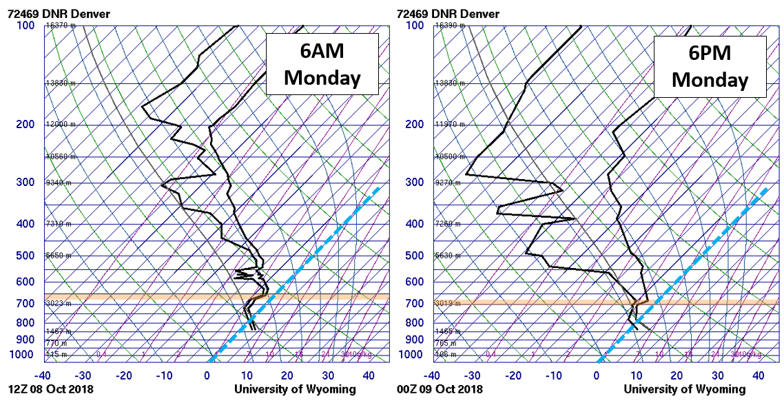
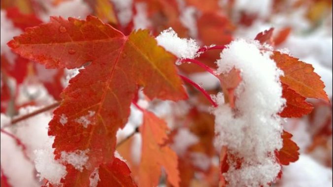
You’ll notice that these profiles look just like the one we described and showed in our lengthy explanation of how freezing drizzle so often occurs in the Front Range. We’re actually fairly lucky…had temperatures been a few degrees colder at ground-level, Columbus Day 2018 could have been remembered for accumulating ice. Instead, it was just plain old boring (non-freezing) drizzle for the lower elevations mostly. There were a few reports of snow mixing in on the western fringes of the Metro area, but nothing close to sticking on the ground. Elevations above 7,000 feet received between 1 and 4″ of snowfall, the first “significant” snow so far for the Foothills this season.
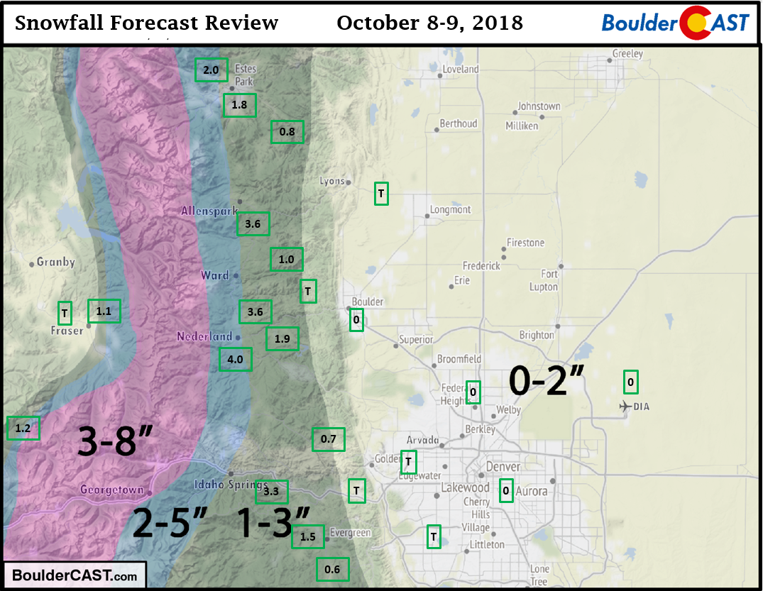
Shown below is our original snowfall forecast map issued Sunday evening. Overlaid in boxes are actual snowfall reports. Green boxes indicate that the report was within 1″ of our forecast range. Red boxes indicate that the report was outside of our forecast by more than 1″.
While disappointing that we didn’t see our first snow of the season yet in Boulder on Monday, it’s definitely not far off. An active pattern will take us right through the upcoming weekend and into early next week. More on that below…
Chance of light snow Wednesday
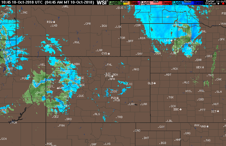
We’re getting right back on the horse. There is a chance of accumulating snow across the Denver Metro area today actually. The jet overhead, lift from a small but vigorous trough, and solar heating across the Mountains will produce scattered snow showers through the day. We’re already seeing widespread rain/snow across western Colorado, along with light freezing drizzle and fog in Boulder this morning.
CAPE values could reach 100-200 J/kg this afternoon, enough to potentially spawn a few thundersnow showers in the High Country. The Mountains can expect totals of 3 to 7″ given this threat of thundersnow.
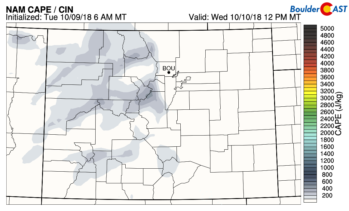
NAM CAPE forecast for Wednesday afternoon
Some of these heavier snow showers are expected to move eastward onto the Plains producing brief bursts of snow during the daylight hours today. Snow levels are right around Plains level (5000 to 5500 feet), so it will mainly be snow for everyone. A dusting to 2″ is possible on the Plains. Also, notice the warmer air present west of the Continental Divide with snow levels higher at 8000 feet. This means valleys will be seeing rain, or at least a rain/snow mix today.
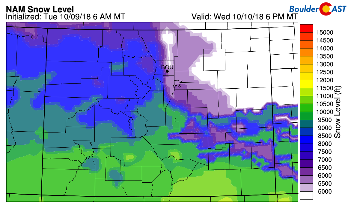
NAM snow-level forecast for Wednesday afternoon.
As the shortwave energy moves eastward, snow activity should diminish before midnight for most of Colorado.
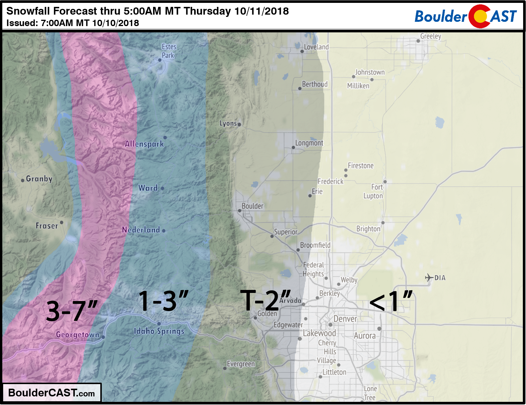
Our snowfall forecast map below covers only Wednesday’s snow chances. Given the warm air and ground temperatures out there, expect no travel impacts and roadways to remain just wet through the day. Any accumulation will be in the grass or on elevated surfaces.
A better chance of heavier snow Saturday into Sunday?
The wave-train coming into the northern Rockies is poised to remain active the rest of this week and into the weekend. In the 500 mb map below we have highlighted four systems. The one we are interested in for Saturday evening/night is located WAY out over the northern Pacific right now. It will be taking the scenic route across Alaska and Canada, then sliding southward into Colorado on Saturday.
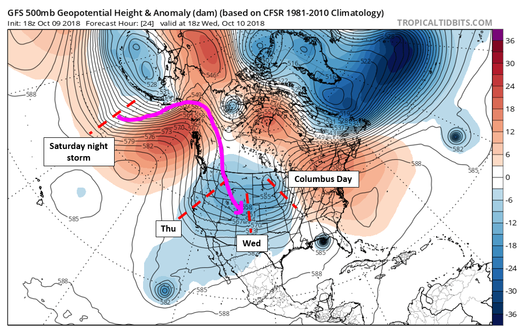
While it may seem impossible to predict a storm accurately in three days that is currently so far away, the model consensus thus far has been coming together quite well. Models push strong cold front and favorable upslope into the Front Range Saturday night, with snow continuing into early Sunday. It’s too early to speculate on exact snowfall amounts, but potentially significant impacts are possible from this storm. At this rate, the ski resorts will be open in no time!
Stay tuned…
Don’t forget, Thursday (October 11th) is the last day to take advantage of our pre-winter promotion. Save 30% on BoulderCAST Premium with promo code SNOW. Click here.

.
Share our forecast!


You must be logged in to post a comment.