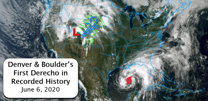
Were you caught off-guard by the historic wind storm that swept across Colorado on Saturday? This type of widespread, damaging wind event is known as a derecho. What transpired on Saturday was the first in recorded history to impact Boulder and Denver. We take a look at the low pressure that caused the event, the astonishing wind reports from across the area, and discuss why this may have been the first and last derecho we ever experience.
Category: Verification (Page 25 of 51)
These posts take a look back at recent weather events, like snow storms or severe weather outbreaks, and evaluate how the forecast played out. We evaluate how well the models predicted what actually occurred, and offer insight into what can be learned and applied moving forward.
The week ahead is one typical for the last week of May. We have some warmer days, some cooler ones and chances for rain throughout the forecast. Let’s take a look!
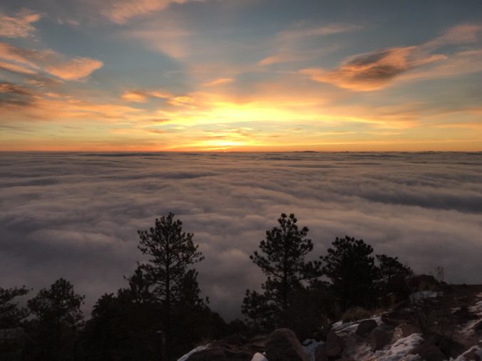
Not surprisingly, many of you are outdoor-oriented and we get asked this question a lot. If you look out the window and see low clouds or fog blanketing your area, there is a decent chance that some or all of the peaks just west of town are soaking in the sun, but not always. We walk you through the process of how to determine the elevation of the top of the cloud deck and how it relates to the hiking options near Boulder and Denver.
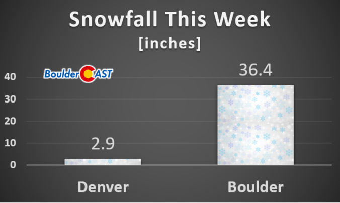
The polar jet stream took a major dive this week rolling out the red carpet for a series of storm systems that brought record-setting cold as well as significant late-season snow to the Front Range. We take a look at the snowfall totals, new cold and snow records, and look ahead to a stretch of warmer temperatures.
As if we haven’t had our fill of winter already this week, another potent storm system will bring more accumulating snow to the Boulder and Denver area Wednesday night and into Thursday. This approaching storm isn’t as cold as the one earlier this week, but does have more moisture to work with and a very efficient mechanism to produce moderate to heavy snow. As a result, many locations will likely see more snow in the next 36 hours than what fell on Easter Sunday and Monday combined! Read on for a discussion of the incoming winter wonderland and a look at our snowfall forecast map.
PREMIUM STORM UPDATE (7:00 AM Thu 04/16/20): Heavy snow has fallen as expected overnight from Boulder to Fort Collins. We take a look at the latest model runs and discuss for the forecast for the second half of the snowstorm that will linger into Thursday evening. Click HERE to read.
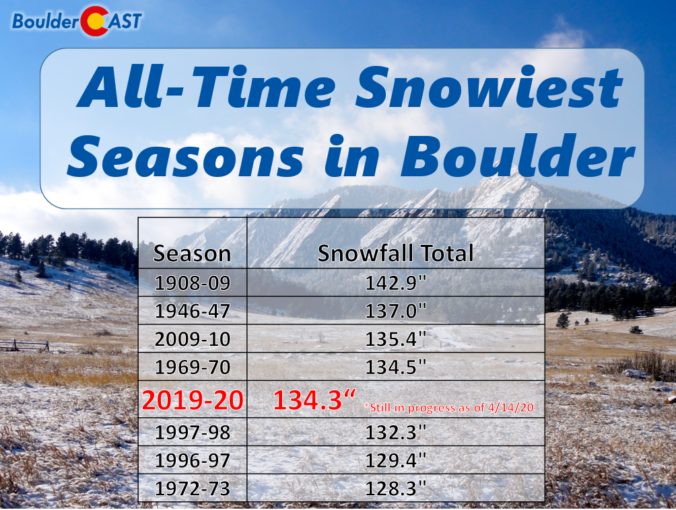
Boulder picked up nearly 19″ of snow from the cluster of storms earlier this week and now has a very good chance of breaking its century-old seasonal snowfall record. We discuss why Boulder has seen so much more than Denver this snow season, and also comment on our next winter storm knocking on the door Wednesday night into Thursday.

Around a foot and a half of fluffy snow fell in Boulder for Easter, while many areas saw much less. We take a look at snow totals from around the region. We also discuss our next wave of snow coming Monday afternoon into the evening, as well as the outlook for the rest of the week (spoiler: there will be more snow). Let’s get to it!
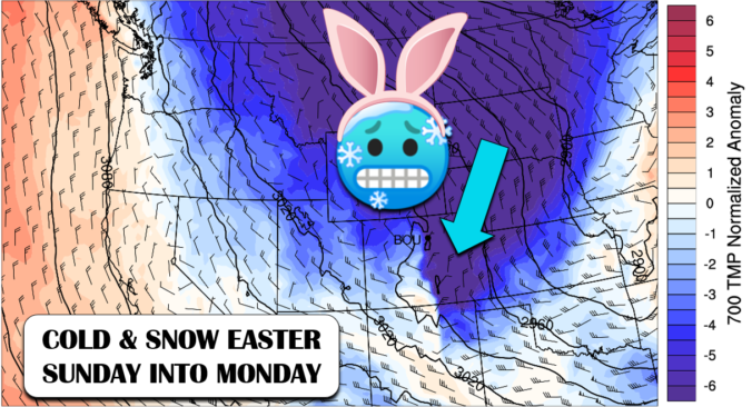
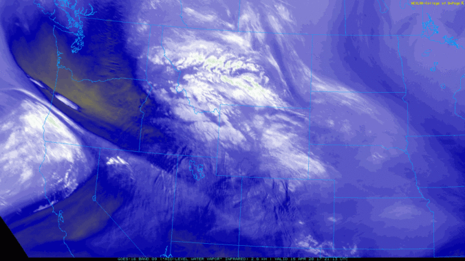
A winter storm is coming to Front Range Colorado just in time for Easter Sunday with temperatures expected to fall nearly 50°F in the next 18 hours. Accompanying the fierce drop in temperatures will be an extended period of snowfall from Sunday morning into Monday. Let’s take a look at forecast snowfall amounts and just how cold temperatures will get in the coming days.

Live View of Boulder

Current Conditions

Live Radar

Recent Premium Posts

BoulderCAST Daily – Sun 12/14/25 | A warmup after the chilly yesterday afternoon
🌡️ Warmth Returns with no sight of snow: Highs return close to 60 …
BoulderCAST Daily – Sat 12/13/25 | Highs in the 60s this weekend!
🌡️ October Warmth in December: Highs typical for late October will be in …
This Weekend in Colorado Weather: The December that has felt like October continues with bone dry warmth persisting into next week
🌬️ Two more breezy days ahead with gusts 15–25 MPH before the jet …
3-Day Forecast

Trending Content

© 2025 Front Range Weather, LLC