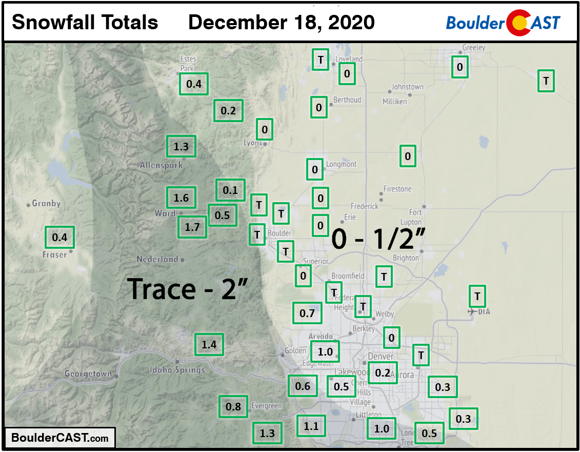
Shown below is our snowfall forecast map with actual storm totals overlaid in boxes. Green boxes indicate that our forecast verified to within one inch of the observed snowfall. Red did not (there are no red).
These posts take a look back at recent weather events, like snow storms or severe weather outbreaks, and evaluate how the forecast played out. We evaluate how well the models predicted what actually occurred, and offer insight into what can be learned and applied moving forward.
Shown below is our snowfall forecast map with actual storm totals overlaid in boxes. Green boxes indicate that our forecast verified to within one inch of the observed snowfall. Red did not (there are no red).
We take a look at regional snow totals from the past few days as the dry pattern finally came to an end for Front Range Colorado.
Winter has resettled into the area following a weak storm system yesterday when light snow accumulations were reported across the entire Denver Metro area. Yet another period of widespread light snow will move into the Front Range Saturday evening. We’re predicting slightly larger totals from this next storm. Read on to find out how much snow to expect and also more about the next chance of winter weather which we are already tracking for late Monday.
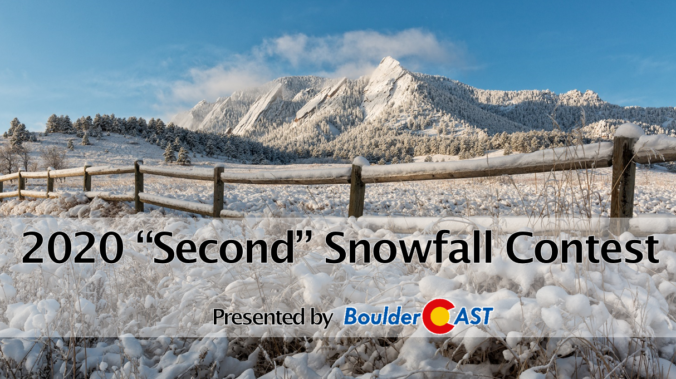
If you recall, Mother Nature threw a greasy wrench into our usual “First Snow” contest this year, delivering the earliest ever snowfall in Boulder’s history before we even announced the annual contest! But the show must go on, and this year predictions surrounded the date and amount of Boulder’s second snowfall of the season. With that having now come and gone this week, it’s time to announce the winners of the contest!
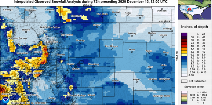
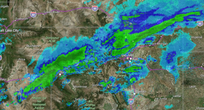
As the two largest wildfires in state history were burning across north-central Colorado this weekend, Mother Nature delivered big changes via an Arctic airmass and widespread snowfall. We take a look back at what was a mostly jet-driven snowfall event across the Front Range, go over the snowfall totals, the potential impact on the fire zones, and look ahead to warmer times.
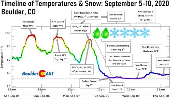
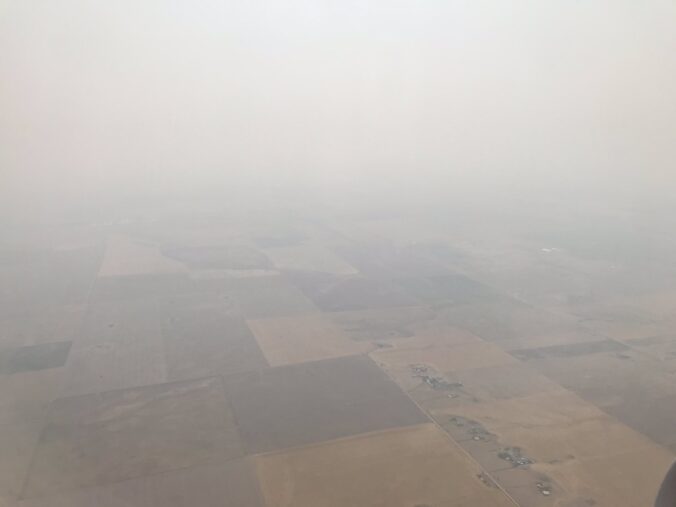
What an absolutely incredible week of weather we experienced across the Front Range. From sizzling record heat, to explosive wildfire growth with towering pyrocumulus clouds blocking out the sun and ash raining from the sky, to unprecedented early season snowfall, to eventual record cold. This week had it ALL! Let’s step through this crazy week in weather and look at just how many long-standing records we broke over the last several days.
August 2020 in Colorado was headlined by brutal heat, expanding drought, new massive wildfires, thick smoke, and poor air quality. Here’s a quick and colorful recap of our weather during August and how it relates to climatology.
Hooray! Monsoon season has just begun and the beneficial rains are already on the way to Colorado! We take a look at the current monsoonal pattern, the cool and wet forecast for the next five days, and why we think the rainy pattern won’t last long.


© 2025 Front Range Weather, LLC

You must be logged in to post a comment.