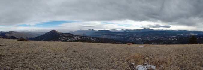
Here’s a quick and colorful rundown of our weather during January 2021 and how it relates to climatology.
Category: Verification (Page 25 of 53)
These posts take a look back at recent weather events, like snow storms or severe weather outbreaks, and evaluate how the forecast played out. We evaluate how well the models predicted what actually occurred, and offer insight into what can be learned and applied moving forward.

A strong jet streak moved across Colorado on the evening of February 3rd with a heavy band of jet-forced snow clipping only the far south and eastern portions of the Denver Metro area. Let’s take a look at the totals.
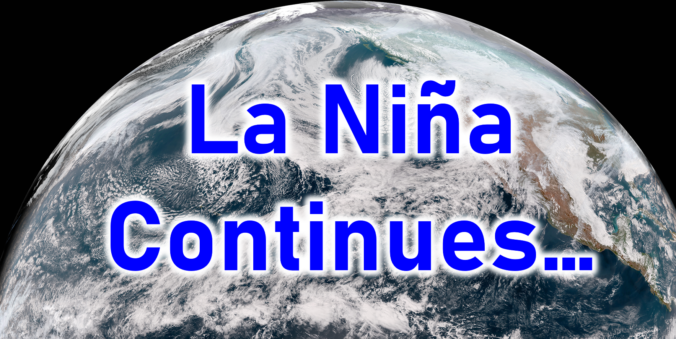
This week’s snow event, while certainly welcomed, is not nearly enough not help the ongoing extreme drought across the entire state of Colorado. With a dry stretch shaping up through the weekend ahead, Boulder will most likely polish off January with its 7th consecutive month of below normal precipitation. We recap the recent “snowstorm”, discuss the current state of the drought, update you on the evolving La Niña, and provide our prediction for what lies ahead the rest of winter.
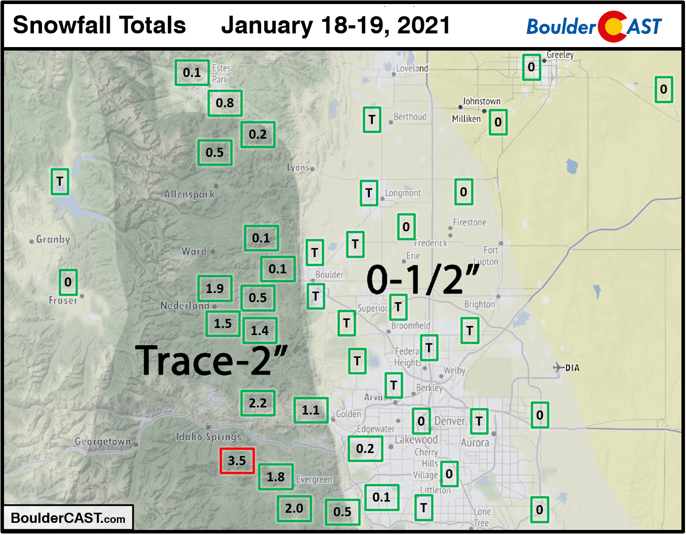
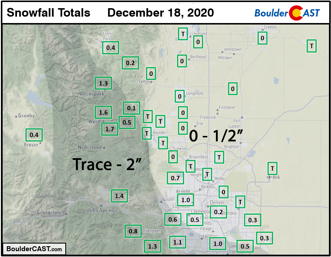
A few light snow showers impacted the Denver Metro area on Martin Luther King Jr Day afternoon and into the overnight. Only the very far southwestern suburbs had any snow stick. Boulder and Denver both reported just a trace of snow. A few inches were observed in the Foothills of Boulder and Jefferson Counties.
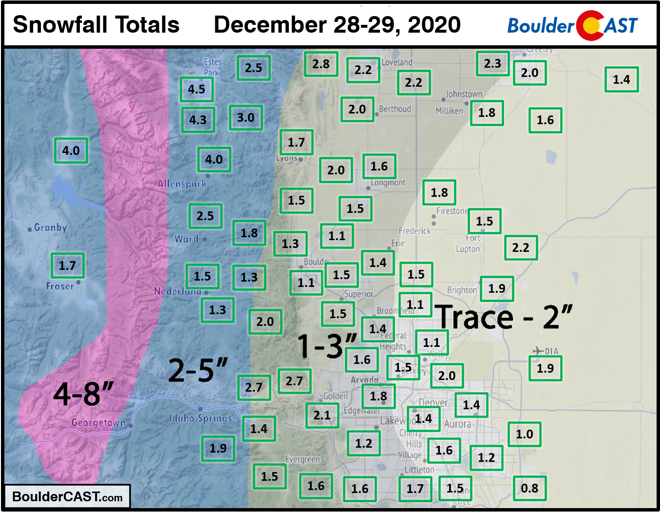
Shown below is our snowfall forecast map with actual storm totals overlaid in boxes. Green boxes indicate that our forecast verified to within one inch of the observed snowfall. Red did not.
Shown below is our snowfall forecast map with actual storm totals overlaid in boxes. Green boxes indicate that our forecast verified to within one inch of the observed snowfall. Red did not (there are no red).
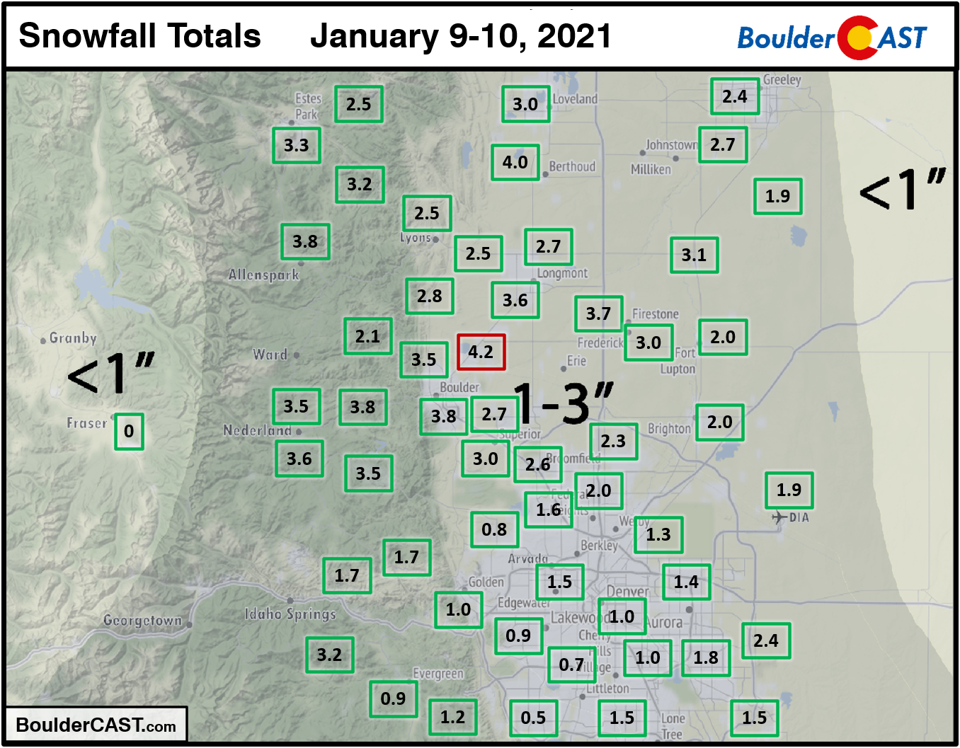
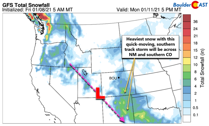
It hasn’t snowed in our area since last year! Well….December 28th to be more precise. However, white stuff is once again in the forecast to begin 2021. A Four Corners low pressure system will spread winter weather back into the Front Range Saturday into Saturday night. Let’s take a look at the timing and potential snowfall amounts in what is sure to be another disappointing snowfall event.
UPDATE (7:00AM Sat 1/9/21): Adjusted snowfall forecast map slightly
Shown below is our snowfall forecast map with actual storm totals overlaid in boxes. Green boxes indicate that our forecast verified to within one inch of the observed snowfall. Red did not (there are no red).
Shown below is our snowfall forecast map with actual storm totals overlaid in boxes. Green boxes indicate that our forecast verified to within one inch of the observed snowfall. Red did not (there are no red).

Live View of Boulder

Current Conditions

Live Radar

Recent Premium Posts

BoulderCAST Daily – Tue 06/02/26 | Storms Reload This Afternoon, But With Noticeably Less Bite
❄️ Monday delivered lots of hail to northeast Colorado, with one supercell tracking …
BoulderCAST Daily – Sun 05/31/26 | Dry and warm today but rain chances increase this week
🌦️ Overall dry and warm Sunday, though cannot rule out a very widely …
BoulderCAST Daily – Sat 05/30/26 | A stray shower today as most activity resides well east of Denver
🌦️ Spotty showers today, mainly well east of the Denver Metro area, where …
3-Day Forecast

Trending Content

© 2026 Front Range Weather, LLC
You must be logged in to post a comment.