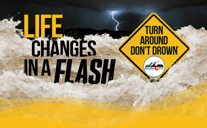
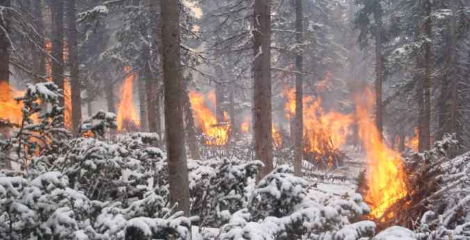
After more than two consecutive weeks of hot weather, the pattern is set to shift following the passage of a welcomed cold front Friday evening! While not directly tied to the monsoon, storm chances will ramp up considerably in the near-term. Unfortunately, at the same time weak winds aloft under high pressure will introduce a real risk of flash flooding over the next few days with recent wildfire burn scars at the highest risk (Calwood, Cameron Peak, etc.). We discuss some historical context for July’s weather so far, when the cold front will arrive, how chilly it will be the next few days, and expected rainfall totals by the end of the weekend across the Front Range.
Category: Tropical Weather (Page 10 of 19)
This week will feature a continuation of the dangerous, unprecedented heatwave in the Pacific Northwest, but cool and rainy weather in the Front Range. Go figure! Our temperatures will remain below normal through the week with daily chances for showers and thunderstorms, helping to alleviate but not remove wildfire concerns across the state. We also discuss the status of monsoon season, the active tropical eastern Pacific, and what may lie ahead for the Fourth of July weekend.
Front Range weather during the month of May was certainly busy! We got our first taste of summertime thunderstorms, including accumulating hail in spots. There were numerous upslope storms; a few even turned cold enough for snow in Boulder and Denver. La Niña dissipated and the drought showed continued signs of improvement. Here’s a quick and colorful rundown of our weather during May 2021, the notable atmospheric highlights and how it all relates to climatology.
Following the long, cold and gloomy holiday weekend, our weather improves considerably in the coming days. Temperatures will warm back above average and may even approach 90 degrees for the first time in 2021. After a few dry days, subtropical moisture is expected to surge into Colorado during the upcoming weekend bringing the return of wet weather to the region.

There’s no doubt about it. The La Niña pattern that developed late last summer is now dead. There’s no need to mourn this loss as this is actually good for Colorado and bodes well for a more active monsoon season this summer…or does it? Let’s take a look at the current state of ENSO and the weather outlook for the coming months.
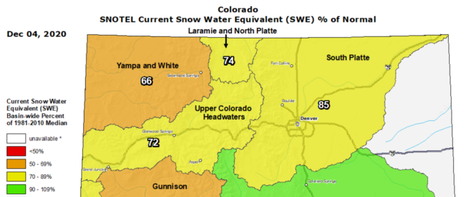
November 2020 ended up quite a bit different than November 2019 which was one of the coldest for our area. The month began with a record warm stretch but eventually had a few snow events. Overall, though, it was a very warm and fairly dry month which is just what we predicted. Here’s a quick and colorful rundown of our weather during November and how it relates to climatology.
After a very gusty weekend, you’ll be happy to know that warmer and calmer weather is on the way for much of the week ahead. High temperatures rise sharply back into the 60’s and even 70’s this week with lots of sunshine. However, winter weather could be right around the corner. Read on for our complete outlook of the week ahead.
What is the status of the historic wildfires across Colorado? What is the latest on La Niña and its forecast through the rest of winter? How many Greek letters are left in the alphabet for Atlantic hurricanes this year? Listen to find out!

Live View of Boulder

Current Conditions

Live Radar

Recent Premium Posts

BoulderCAST Daily – Sun 01/11/26 | A mild Sunday with readings reaching the 50s
🌤️ Mild & Melty Sunday: Light winds and patchy clouds, with lingering snowpack …
BoulderCAST Daily – Sat 01/10/26| Widespread sunshine and moderating temperatures this weekend as our recent snow melts off
🌤️ Calm Saturday: Winter storm systems have departed the state, leaving behind a …
BoulderCAST Daily – Fri 01/09/26| Snow ends quickly this morning with a quieter weekend in store
❄️ Overnight snow bands: A second push of upslope after midnight sparked narrow …
3-Day Forecast

Trending Content

© 2026 Front Range Weather, LLC