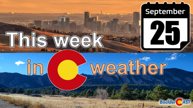
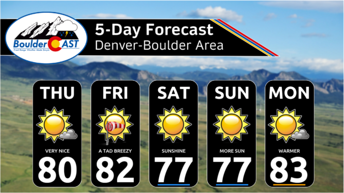
Another boring week of weather is set to unfold across the Front Range as Colorado remains trapped in a dry and stagnant weather pattern. Sunshine and unseasonable warmth will be the story this week across the area as a result. While there was some potential for things to change this upcoming weekend, that no longer appears to be the case. There’s no rain (or snow) anywhere in pipeline — heck there’s barely any clouds! Let’s take a look…
Category: Severe Weather (Page 9 of 21)
The posts contain discussion of severe weather in our region, including forecasts, outlooks, and recaps of events involving large hail, damaging winds, and tornadoes.
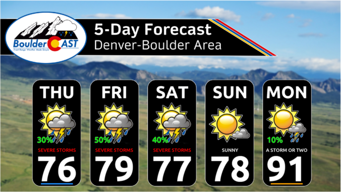
The week ahead will remain somewhat cooler and drier than normal as a weak trough stays entrenched and monsoon moisture continues to be difficult to come by. However, a favorable setup for severe thunderstorms will exist across northeast Colorado early in the week with hail the main risk. Overall temperatures will stay mostly below normal in the days ahead but they will trend back towards 90 degrees by week’s end.
Temperatures and precipitation ended up about as close to normal as possible for July in Boulder. The month began active with numerous severe weather outbreaks, some of which produced landspout tornadoes in parts of Denver. The last few weeks turned up the heat with a total of fifteen 90-degree days during the month. Here’s a quick and colorful graphical recap of our weather during July and how it relates to climatology.
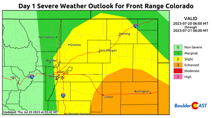
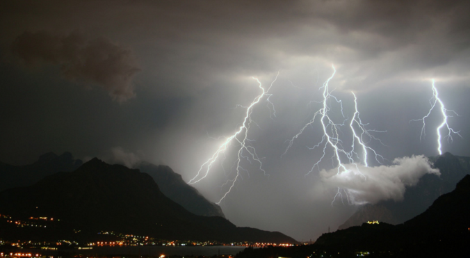
The weather this week in the Front Range will have two contrasting primary themes. A heat dome cooking beneath a large ridge of high pressure off to our southwest will push temperatures towards record highs Monday and Tuesday. However, the rest of the week will exhibit a cooling trend with increasing chances for late-day thunderstorms as several backdoor cold fronts team up with increasing monsoonal moisture. Yes, the famed monsoon season is about to commence! In typical fashion though, there will also be a risk of some severe weather mixed in. Let’s take a look at what should be yet another interesting weather week…
The Front Range has managed to ink out a cool and wet summer so far, but that wasn’t at all due to the monsoon. We discuss what has been causing the cool/wet weather of late and look ahead to when monsoon season may actually commence in Colorado. Spoiler alert: it’s sooner than you might think, but there’s a bit of a catch!

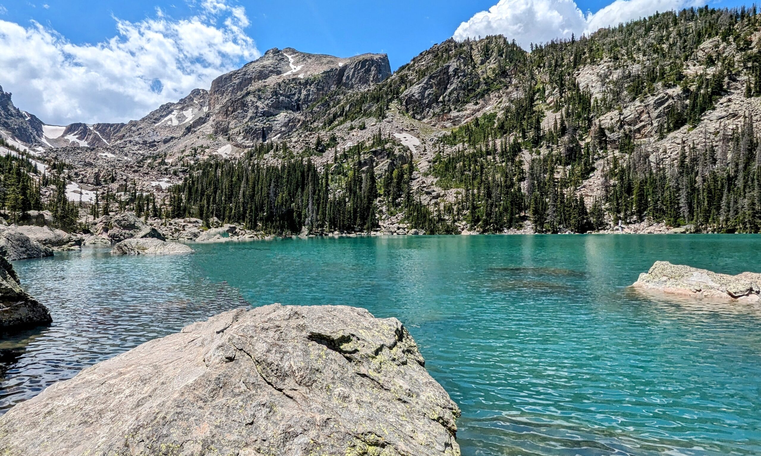
Live View of Boulder

Current Conditions

Live Radar

Recent Premium Posts

BoulderCAST Daily – Sun 01/11/26 | A mild Sunday with readings reaching the 50s
🌤️ Mild & Melty Sunday: Light winds and patchy clouds, with lingering snowpack …
BoulderCAST Daily – Sat 01/10/26| Widespread sunshine and moderating temperatures this weekend as our recent snow melts off
🌤️ Calm Saturday: Winter storm systems have departed the state, leaving behind a …
BoulderCAST Daily – Fri 01/09/26| Snow ends quickly this morning with a quieter weekend in store
❄️ Overnight snow bands: A second push of upslope after midnight sparked narrow …
3-Day Forecast

Trending Content

© 2026 Front Range Weather, LLC