June 2021 began as one of the hottest and driest on record for the area, but ended on a cool and rainy note! Other weather highlights during the month included a slew of new wildfires across the Western Slope, a highly photogenic landspout tornado, multiple heatwaves, and poor air quality from near and distant wildfires. Here’s a quick and colorful recap of our weather during June and how it relates to climatology.
Help support our team of Front Range weather bloggers by joining BoulderCAST Premium. We talk Boulder and Denver weather every single day. Sign up now to get access to our daily forecast discussions each morning, complete six-day skiing and hiking forecasts powered by machine learning, first-class access to all our Colorado-centric high-resolution weather graphics, bonus storm updates and much more! Or not, we just appreciate your readership!

Top Weather Highlights of June 2021:
WET SPRING = DEEP SNOWPACK: A wet spring across the Front Range, especially in April and May, led to deep late season snowpack in some areas. While the rest of the state had fairly dismal snowpack in early June, the South Platte River Basin was well above normal.
We trekked above 13,000 feet yesterday & all we can say is that there is a lot of deep snow in western Boulder County!
South Platte River Basin snowpack is melting out about one week behind schedule due to the snowy spring and the chillier month of May #COwx #Snowpack #Boulder pic.twitter.com/ywWccw828L
— BoulderCAST Weather (@BoulderCAST) June 6, 2021
TRANSPLANT SMOKE: With several large wildfires burning out of state mainly in Arizona, when the large-scale pattern shifted to southwest flow across Colorado this month all that smoke invaded the Front Range. Most of the smoke during the early to middle part of the month was elevated and only caused minor drops in visibility.
Most of the wildfires contributing elevated smoke over the Denver area are in Arizona and Mexico. There are also a few smaller fires in New Mexico and Utah playing a small role as well. #COwx #NMwx #AZwx #Smoke #Wildfire #Drought pic.twitter.com/kbCRQOAfKg
— BoulderCAST Weather (@BoulderCAST) June 10, 2021
THE MOST VIEWED TORNADO EVER? On June 7th, severe weather was not expected at all across the Front Range, but Mother Nature had other ideas spawning a landspout tornado. Colliding outflow boundaries from weak thunderstorms aligned just right to create a tornado east of Longmont in Weld County which moved northward. This tornado was rated EF1 by the National Weather Service and was on the ground for at least 7 miles causing minor structural damage and killing some livestock.
It might have started as a simple landspout, but it definitely ended up a real tornado. https://t.co/7BEG7UoLH5
— BoulderCAST Weather (@BoulderCAST) June 8, 2021
Not only was this tornado unique for the conditions that created it, it was also extremely photogenic! It was potentially visible to nearly 50% of the population of the Denver Metro area due to the isolated nature of the storms that day and the extremely high cloud base of the tornadic thunderstorm.
Not exactly what most people want to see on approach to DIA #9wx https://t.co/zKw1hUb2Re
— Cory Reppenhagen (@CReppWx) June 8, 2021
A LONG-DURATION HEATWAVE: Two separate heatwave patterns blended together to produce a 15-day long period of above normal temperatures across eastern Colorado (June 4th to June 19th).

While hot, this particular heatwave was stronger in the Desert Southwest than it was in Colorado. Because of this, we predicted that Boulder would not reach the relatively rare 100-degree mark during this stretch. Boulder peaked at 99°F on two separate days (June 16th & 17th), while Denver made it to the triple digits on three consecutive days (June 15th – 17th).
Who else is pumped for the cold front Thursday night? https://t.co/iICqZokEKI #COwx #Heatwave pic.twitter.com/ytlqEIMN8Z
— BoulderCAST Weather (@BoulderCAST) June 14, 2021
In case you are wondering, 100-degree days are relatively rare in Boulder, happening only 45 times in the last 125 years (about once every 3 years).
With Boulder failing to hit 100 degrees this week, the city's historical count of triple digit days remains at 45. Records date back to 1897, an average of ~1 occurrence per 3 years: https://t.co/4eML3DYV3a #Cowx #Boulderwx #HeatWave #Not100Degrees @bouldercolorado pic.twitter.com/7GPzMyB369
— BoulderCAST Weather (@BoulderCAST) June 18, 2021
With the prolonged hot weather to start the month, June 2021 was actually on pace for a Top 10 finish for hottest Junes through the 20th in Boulder.
The first 20 days of June 2021 have collectively been the 7th warmest since 1900 in Boulder: https://t.co/PWZtUMDkwL #COwx #Boulderwx
1952 – 75.3°F
1956 – 74.1°F
2006 – 73.1°F
1979 – 72.5°F
1910 – 72.5°F
2012 – 71.4°F
>>2021 – 71.0°F<<
1977 – 70.8°F
1933 – 70.7°F
1959 – 70.6°F pic.twitter.com/tA0YNVU4g1— BoulderCAST Weather (@BoulderCAST) June 21, 2021
COLORADO NATIVE SMOKE: Towards the end of the heatwave (which one?), several wildfires ignited across western Colorado and began contributing just as much smoke, if not more, than the larger out-of-state fires. The result was an extended period of thicker and lower-level smoke across the Denver Metro area.
Here comes the #SMOKE! Several new fires in western CO are now contributing just as much as those burning out of state towards increasing smoke in the Front Range the rest of the week #COwx #OilSpringsFire #SylvanFire
Check the latest smoke forecast: https://t.co/gcXXztS7nK pic.twitter.com/1WhZWmNqRC
— BoulderCAST Weather (@BoulderCAST) June 22, 2021
Several days in a row had poor air quality due to secondary ozone concentration spikes from the smoke.

Visible satellite image from June 21, 2021 orf at least 6 wildfires burning in western Colorado
MAJOR COOLDOWN TO END THE MONTH: June wrapped up with a big pattern shift that brought cooler temperatures to most of Colorado while an historic, deadly heatwave raged across the Pacific Northwest and parts of southwestern Canada. Boulder concluded the month with seven straight days of below normal temperatures. This weeklong cool and rainy stretch knocked June 2021 out of contention for the hottest and driest Junes on record in Boulder. With half of 2021 complete, Boulder has a nearly 4″ surplus in precipitation for the year.
This stretch will be enough to knock June 2021 out of top ten contention for the hottest & driest Junes in the historical record.With flow out of Canada in the extended, the smoke situation will improve dramatically after about midday Friday! More: https://t.co/AnjrrpH1fH #Cowx pic.twitter.com/NFu14S9TAb
— BoulderCAST Weather (@BoulderCAST) June 24, 2021
June 2021 Recap Graphics:


Spread the word, share Colorado weather:
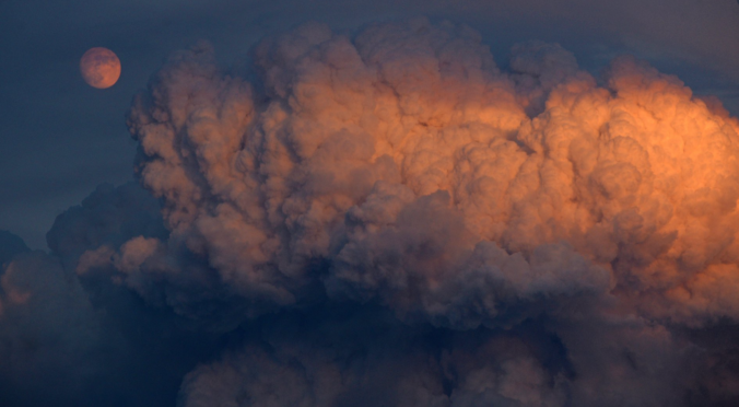
Thanks to Larry Pierce for the featured image of smoke and moon.
We discuss Boulder and Denver weather every single day on BoulderCAST Premium. Sign up today to get access to our daily forecast discussions every morning, complete six-day skiing and hiking forecasts powered by machine learning, access to all our Front Range specific weather models, additional storm updates and much more!


You must be logged in to post a comment.