

After enduring extreme late summer heat of late, we thankfully start off this week with closer to average temperatures and a threat of thunderstorms, some being severe into Tuesday evening. Drier and warmer conditions take over Wednesday through Friday, although the upcoming weekend could see a resurgence of moisture and unsettled weather.
This week’s highlights include:
- A series of mid-level disturbances through Tuesday will interact with a front and instability to produce isolated to scattered showers and thunderstorms
- Storms could be severe with the main impacts of large hail and damaging winds, though an isolated tornado cannot be ruled out east of Denver
- More seasonal start to the week, with above average temperatures towards the latter part
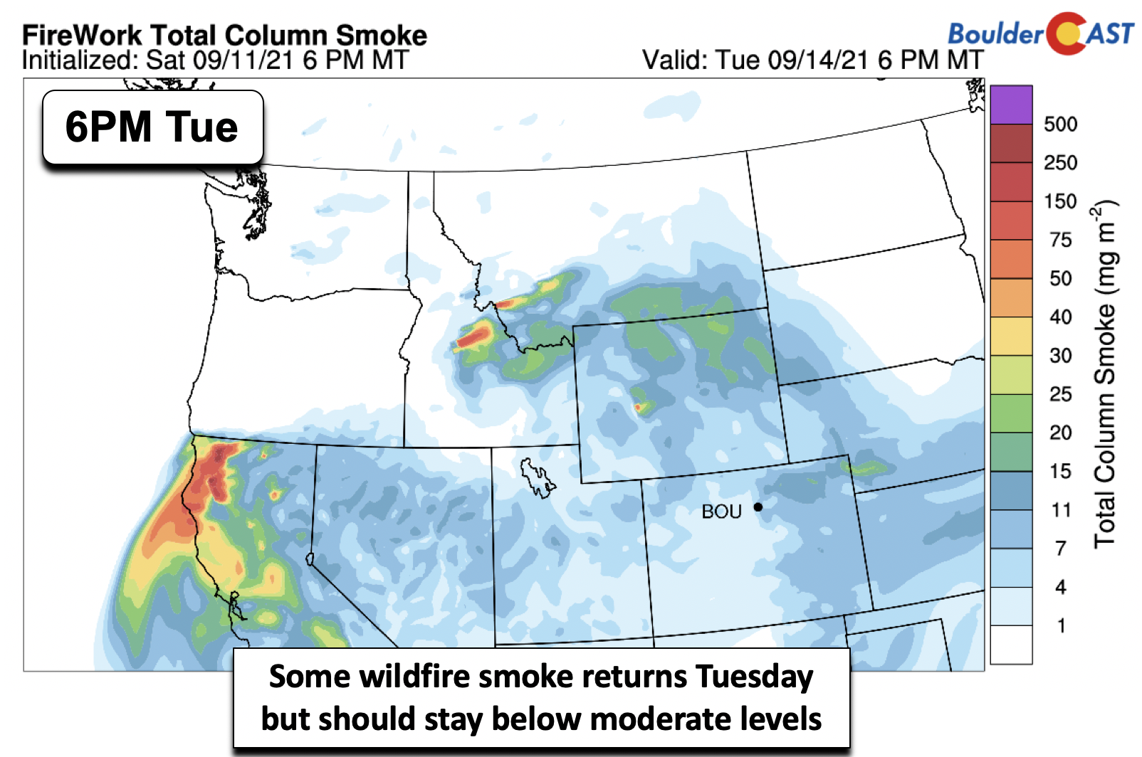
- Wildfire smoke returns briefly Tuesday but visibilities should improve by late-week
- A resurgence of tropical moisture over the weekend??
DISCLAIMER: This weekly outlook forecast is created Monday morning and covers the entire upcoming week. Accuracy will decrease as the week progresses as this post is NOT updated. To receive daily updated forecasts from our team, subscribe to BoulderCAST Premium.

Seasonal & stormy to start…severe weather possible!
Busy weather across the nation starts the work week. There are several features of note on the mid-level pattern below. A largely zonal flow is present from Oregon into the Great Lakes. The only caveat is that a series of many shortwaves are embedded in the flow. We count about 5 shortwave troughs, but there are likely more! Today and tomorrow, a series of these shortwaves will traverse from west to east from Wyoming into the Great Plains, enhancing lift over the Front Range for isolated to scattered storms. Elsewhere, another tropical storm has formed in the Atlantic, this time over the Gulf of Mexico, Tropical Storm Nicholas. It is poised to move into eastern Texas in the next day or two. Quiet and seasonal weather is present in the southeastern U.S. under high pressure.
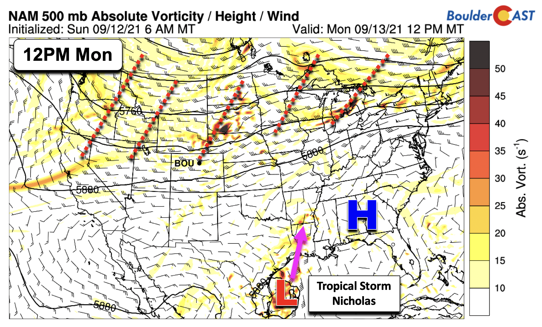
As the shortwave troughs track from west to east just to our north over Wyoming, a slew of cold fronts today and tomorrow will sag south into the Denver Metro area. The first front will drift south this afternoon (below left) and be draped along the Foothills tomorrow (below right). As a result, the east-northeasterly flow at the surface, along with considerable clouds, temperatures will be closer to normal the next few days. Expect highs in the lower 80’s today and upper 70’s Tuesday.

Along with the shortwave energy, moisture will be on the increase today and Tuesday with precipitable water values approaching 1″ come Tuesday (below). The moisture is concentrated along and east of the Foothills, with little if any deep moisture noted over the Western Slope and Utah/Nevada. That drier air will filter in Wednesday through Friday, however.

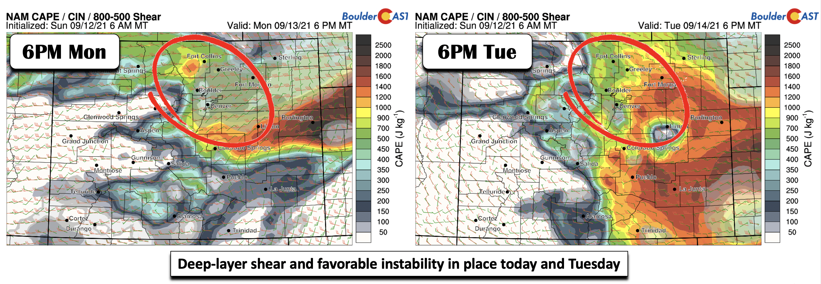
Although somewhat subtle, close inspection of the atmospheric pattern Monday and Tuesday (below) indicate the threat of severe thunderstorms. The pattern is almost identical both days, with deep-layer shear in place exceeding 45 mph from the west-northwest, along with instability ranging from 800 to 1300 J/kg across the Plains.
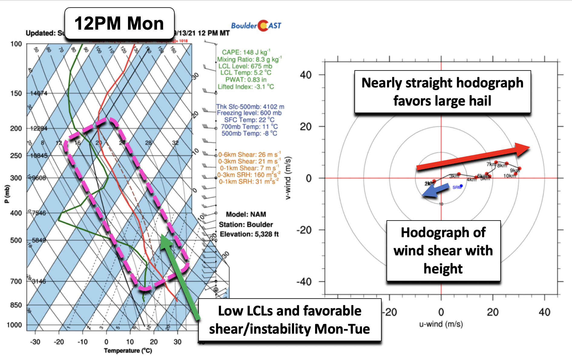
Going from a map display to a point location over Boulder using a Skew-T (temperature and dewpoint as a function of height) and hodograph diagram (wind shear with height), it is evident that there will be low cloud bases and favorable shear/instability. A hodograph (below right) gives a sense of the overall wind pattern with height. The blue arrow denotes the mean flow in the low levels, while the red arrow depicts the mean flow in the mid to upper-levels. The nearly straight hodograph shape in the mid and upper-levels favors large hail as it supports both right and left-moving supercells. Left-moving supercells are prolific hail producers. We cannot rule out a stray tornado along/east of Denver these next few days given strong low-level shear too, though confidence is low at the moment. Damaging winds are also favored given dry-air in the mid-levels for strong downdrafts.
While the pattern is nearly identical both days, storms appear to be more isolated on Monday relative to Tuesday (below). The NAM-NEST model indicates more scattered activity tomorrow behind the cold front. Confidence on storm location and overall coverage both days is medium at best given the tendency to favor isolated supercells. But keep an eye on the weather these next few days. The main threats will be damaging winds and large hail, but a tornado or two cannot be ruled out east of Boulder!

The Storm Prediction Center currently has much of the Front Range at Marginal Risk for severe storms both Monday and Tuesday, with the focus shifting from northeast Colorado Monday to east-central Colorado on Tuesday.

Somewhat lost in the weeds given the severe threat is our smoke forecast. The extended smoke outlook shows that low visibilities may return Tuesday from the passage of the cold front. We think that smoke levels, however, should remain on the low side, despite the uptick. Plus, any storms that do form will help to remove some smoke particulates from the air.

Trending drier & warmer starting Wednesday
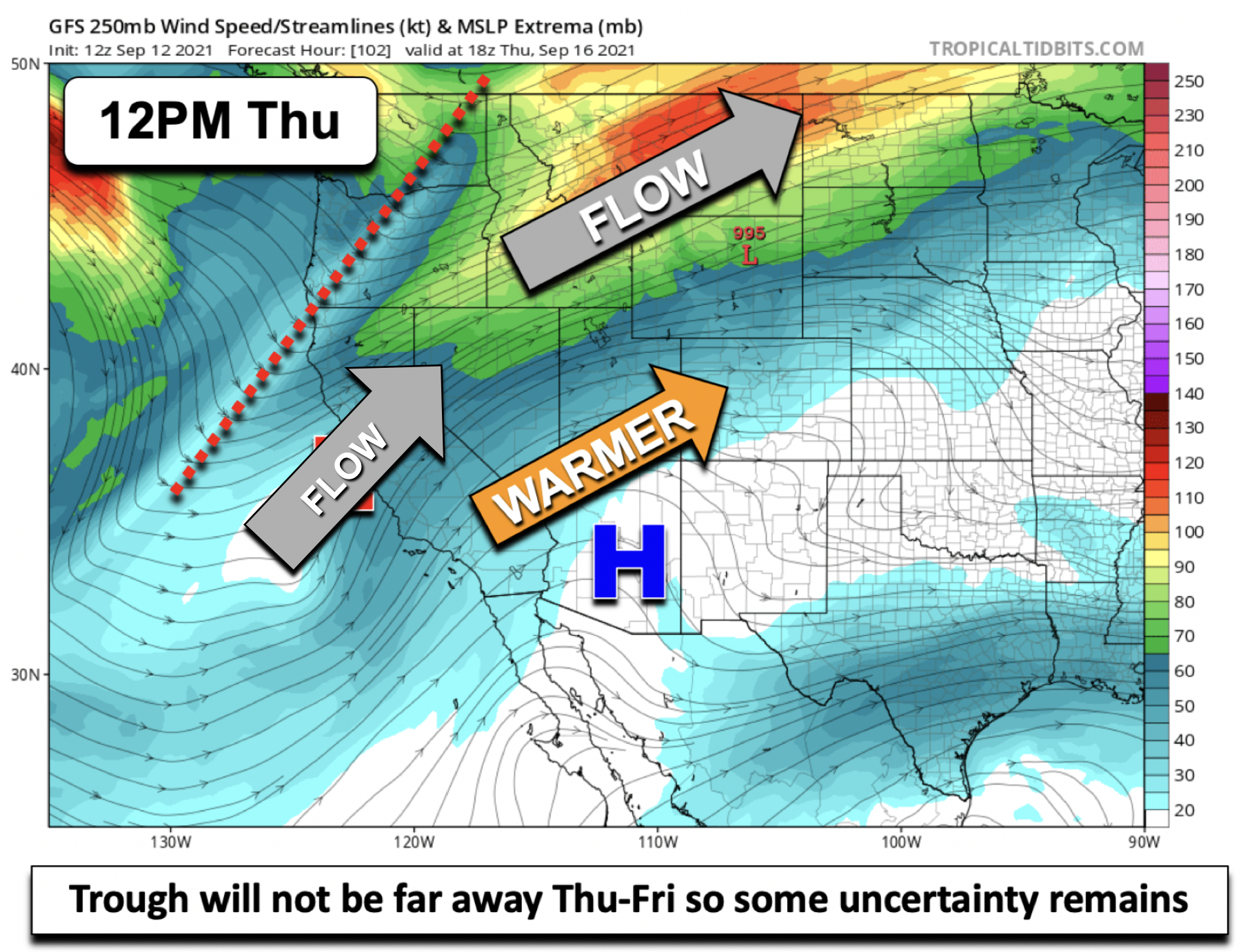
The unsettled weather early in the week will give way to mid-level ridging Wednesday through most of Friday. A deep trough is forecast to be present across the Pacific Northwest into Montana and southwest Canada by Wednesday and Thursday (below; GEFS ensemble spaghetti plot). The location of this trough and a ridge to our southeast will favor warm southwest flow that should take over and dry out the atmosphere for the end of the week in Colorado.

Unfortunately, that means highs will rise above normal through the end of the week, likely reaching the lower 90’s by week’s end. Conveniently, the record highs for Boulder Wednesday, Thursday and Friday are all 93°F each day. There could be some records broken again this week similar to last week, but right now it seems like a longshot.

It is worth noting the uncertainty, though. The trough to our northwest will not be far away, especially in the Thursday/Friday timeframe. We have seen in the past many times where the trough digs further south than originally anticipated. If that happens, Friday in particularly could feature slight storm chances and increased clouds. For now, the forecast will favor a drier and warmer motif, but do keep an eye on things as we get closer to week’s end.
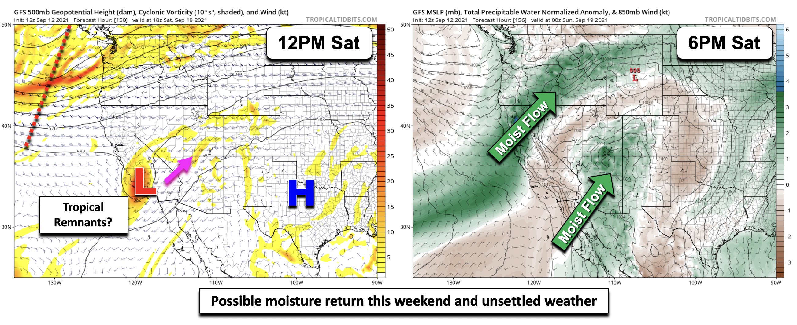
The upcoming weekend in the global deterministic models shows a possible resurgence of moisture, maybe even tropical in nature, late Saturday into Sunday (below). It is difficult to discern in the GFS, but it is possible some tropical remnants from the eastern Pacific could advect higher moisture into Colorado late in the weekend. Confidence in this solution though is low at best, given the GEFS ensemble keeping the overall pattern dry through most of the weekend. For now, this is just something to keep in the back of our minds. Be sure to stay tuned!
Finally, though we don’t see any snow in the pipeline, don’t forget to get your guesses in for our 7th Annual First Snowfall Contest which closes to entries next Monday (September 20th). Have a good week!
Stay up to date with Colorado weather and get notified of our latest forecasts and storm updates:
We respect your privacy. You can unsubscribe at any time.
Forecast Specifics:
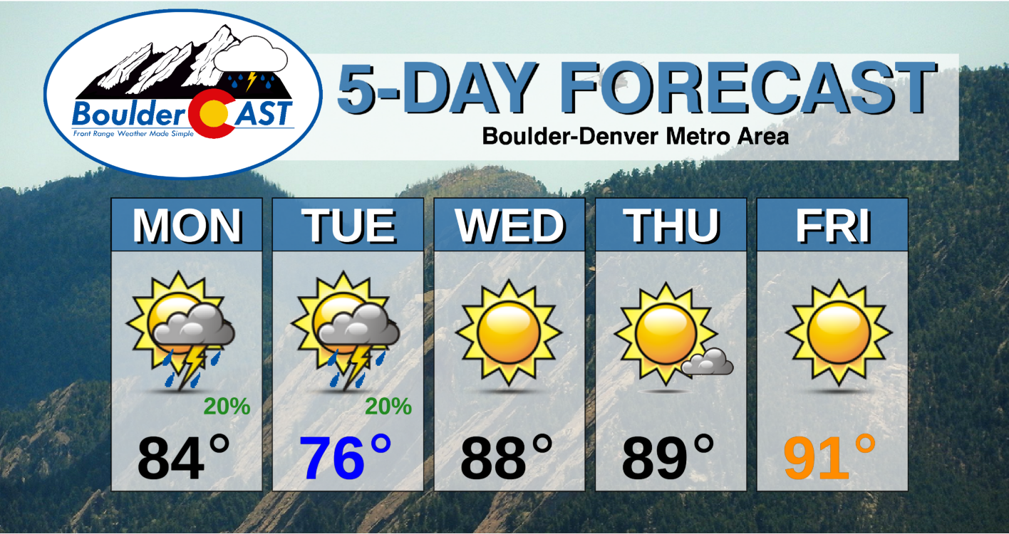
Monday: Partly mostly cloudy with widely scattered thunderstorms, some possibly turning severe. Highs in the lower 80’s on the Plains and lower 70’s in the Foothills.
Tuesday: Partly cloudy with scattered severe thunderstorms in the afternoon/evening. Highs in the middle 70’s in the Denver Metro and middle 60’s in the Foothills.
Wednesday: Warmer, drier, and sunny with highs in the middle to upper 80’s on the Plains and middle 70’s in the Foothills.
Thursday: Mostly sunny and warm with highs near 90 degrees on the Plains and upper 70’s in the Foothills.
Friday: Sunny and hot with highs in the lower 90’s on the Plains and lower 80’s in the Foothills.
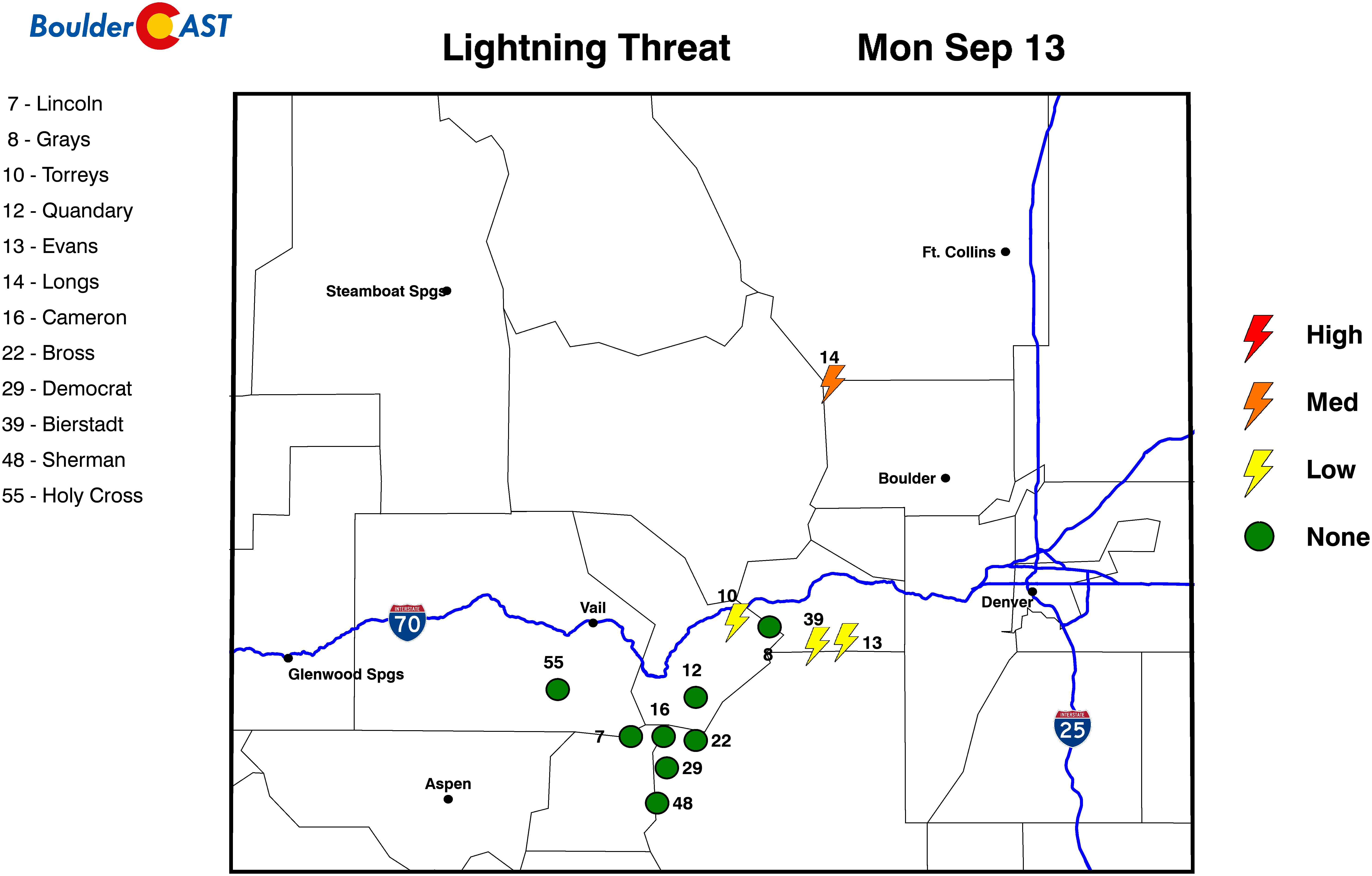
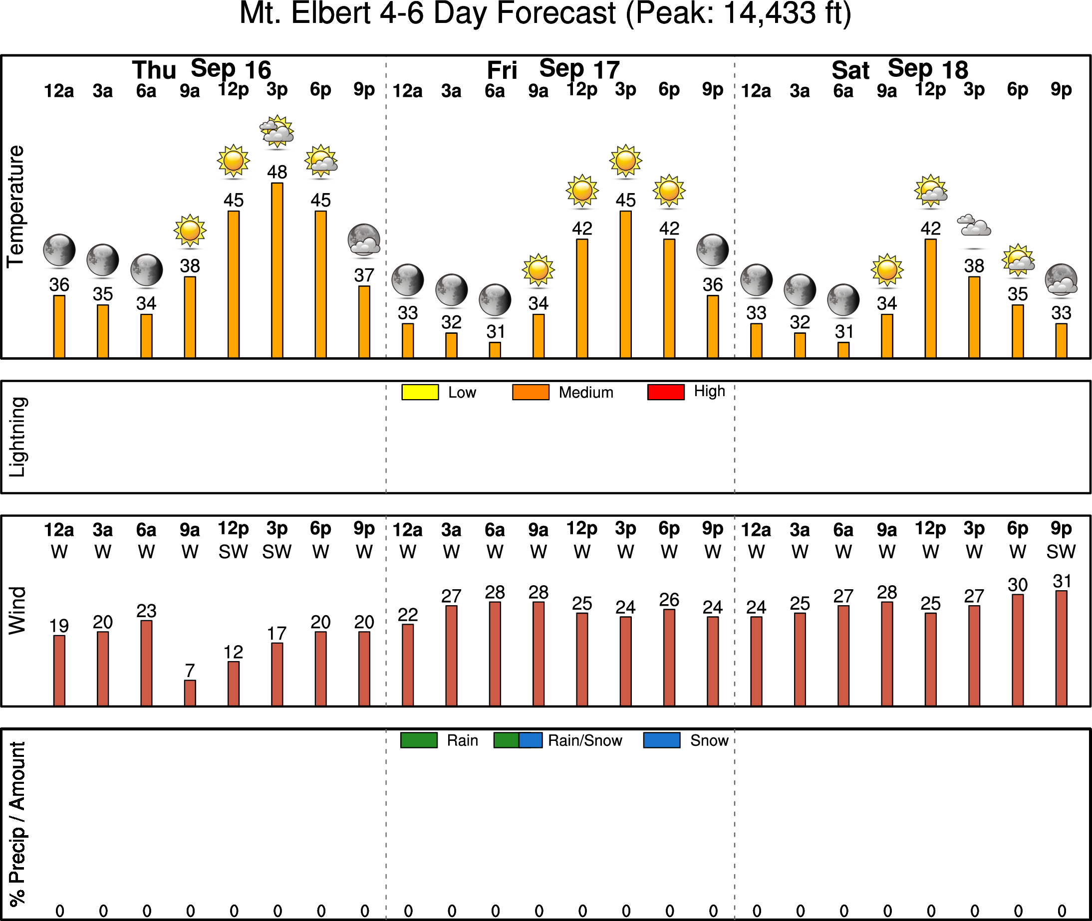
Mountains: Isolated to scattered storms will be possible over the higher terrain today and Tuesday, along with gusty winds and chilly temperatures. Drier and sunny skies will take over Wednesday through Friday, although gusty winds will occasionally be present. Check our SummitCAST page for up-to-date forecasts for more than 120 mountain destinations across Colorado, including all the 14ers.
Help support our team of Front Range weather bloggers by joining BoulderCAST Premium. We talk Boulder and Denver weather every single day. Sign up now to get access to our daily forecast discussions each morning, complete six-day skiing and hiking forecasts powered by machine learning, first-class access to all our Colorado-centric high-resolution weather graphics, bonus storm updates and much more! Or not, we just appreciate your readership!
.
Spread the word, share the BoulderCAST forecast!
.


You must be logged in to post a comment.