Category: Severe Weather (Page 8 of 21)
The posts contain discussion of severe weather in our region, including forecasts, outlooks, and recaps of events involving large hail, damaging winds, and tornadoes.
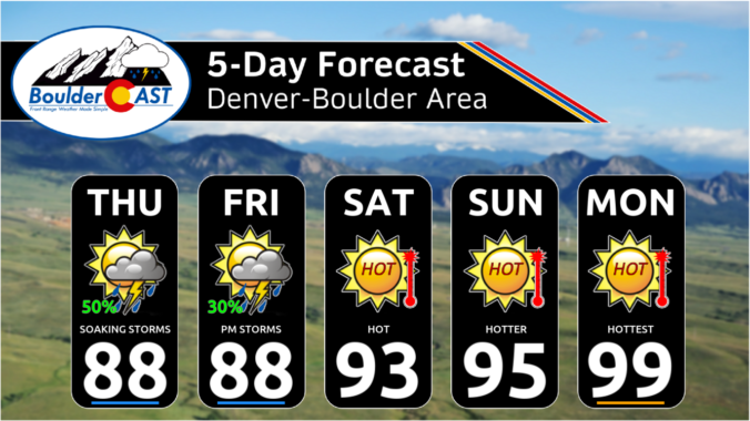
As the Front Range races towards near-record high temperatures on Thursday, the weather pattern is evolving to offer a short-lived reprieve on Friday with a chance of severe thunderstorms and cooler temperatures accompanied by well-mixed smoke blowing in from Mexico. While the blistering heat will ramp back up again over the weekend, we are tracking a potential dip towards more comfortable temperatures next week. Here’s the latest!
This week in the Front Range will feature two scorchingly hot days sandwiched between chances for thunderstorms. For the most part, the severe risk looks to be low throughout the extended, but we will need to monitor things late in the week as a surge of subtropical moisture may support more numerous storms and torrential rainfall rates. Read on for all the details.

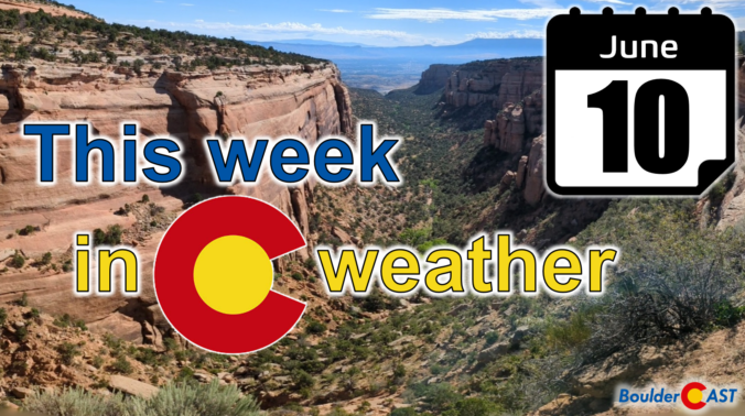
After a mostly quiet and warm weekend, things will more-or-less remain unchanged for the first full week of June. Temperatures will stay warm to hot with only a small chance of rainfall this week. We’ve managed to dodge the nineties so far in 2024, but that bout of good fortune will run out later this week with multiple days soaring above 90 degrees. Read on for all the details.
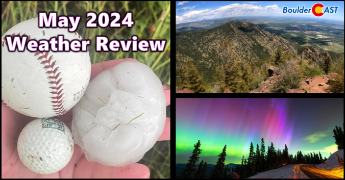
2024 began very soggy across the Front Range, but the month of May did a complete one-eighty concluding as Boulder’s driest in 50 years and 2nd driest since record-keeping began in the late 1800s. Other notable weather events during the month include the once-in-a-lifetime northern lights display visible across almost the entire United States and also what is likely to be yet another “billion-dollar hailstorm” which slammed parts of the Denver Metro area on May 30th. Here’s a quick and colorful graphical recap of our weather during May and how it relates to climatology.
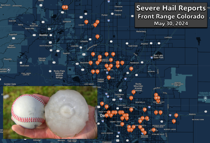
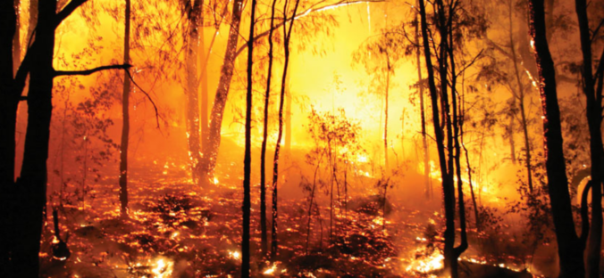
A pair of severe, supercell thunderstorms exploded across the northern Front Range late Thursday evening with very little advanced notice for residents. Hail larger than baseballs caused significant property damage on the northern and northeastern Metro area — roofing, siding, car windows and gardens stood no chance against the onslaught. The hail repair and insurance scammers are probably already knocking on doors this morning or making cold calls! We take a look at where the largest hail fell and why the forecast was so poor.


Live View of Boulder

Current Conditions

Live Radar

Recent Premium Posts

BoulderCAST Daily – Sun 05/31/26 | Dry and warm today but rain chances increase this week
🌦️ Overall dry and warm Sunday, though cannot rule out a very widely …
BoulderCAST Daily – Sat 05/30/26 | A stray shower today as most activity resides well east of Denver
🌦️ Spotty showers today, mainly well east of the Denver Metro area, where …
BoulderCAST Daily – Fri 05/29/26 | A Marginal Risk of Severe Isolated Storms
🌦️ Spotty showers this afternoon, mainly noon and 4 PM, with highs in …
3-Day Forecast

Trending Content

© 2026 Front Range Weather, LLC