Category: Severe Weather (Page 7 of 21)
The posts contain discussion of severe weather in our region, including forecasts, outlooks, and recaps of events involving large hail, damaging winds, and tornadoes.
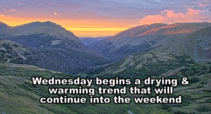
Our scorching hot, two-week-long heatwave will finally come to an end later this week, but not before we endure a few more days. A cold front is slated to arrive into the Denver area late Wednesday finally knocking us out of the 90s. This front will also come with an enhanced chance of rainfall, though monsoon moisture is still largely lacking. Despite daily chances for rain this week, our existing fires will continue to smolder and the risk of new fire ignitions remains uncomfortably high.
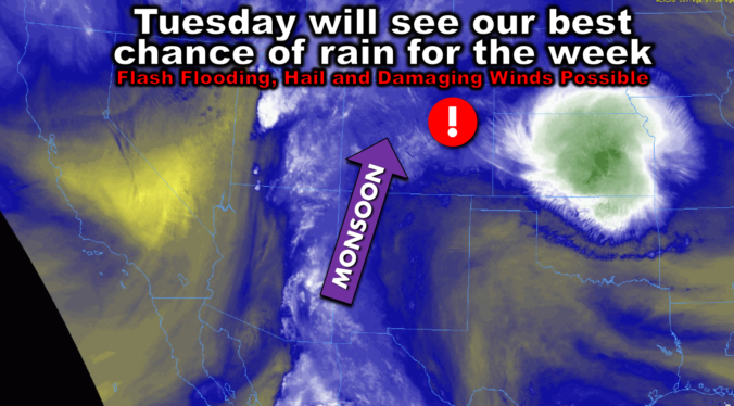
After days of scorching heat, this week will fortunately trend cooler and wetter with the return of monsoon moisture to Colorado — perfect timing considering severe drought has now returned to the area and fire danger continues to explode. Following one more toasty outing on Monday, temperatures will tumble below normal by midweek with daily chances for monsoon thunderstorms, some of which could be severe. We review the ongoing heatwave, the recent Dinosaur Fire in Boulder, why the pattern is now shifting and look ahead to which days will offer the best chance of rain this week.
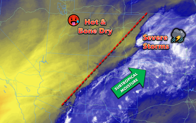
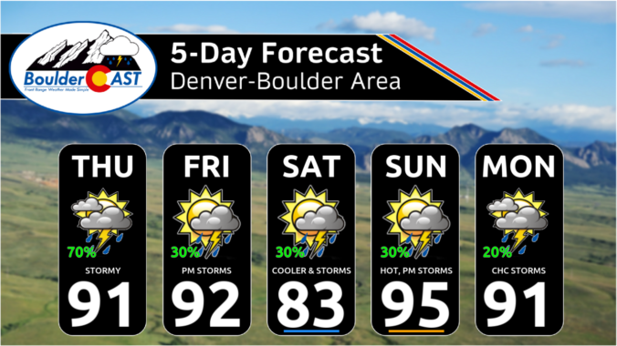
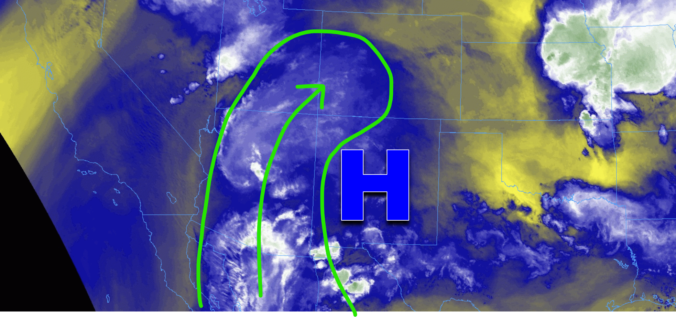
This week’s weather in Colorado will be dominated by a potent ridge of high pressure setting up shop across New Mexico. Although chances of storms will exist for Monday and Tuesday, model guidance shows better agreement for more numerous thunderstorm activity during the latter part of the week as a few weak fronts move into the region and moisture levels increase across the Front Range. High temperatures will be close to record values early in the week, but trend downward slowly by week’s end. Read on for more details.

Live View of Boulder

Current Conditions

Live Radar

Recent Premium Posts

BoulderCAST Daily – Sun 05/31/26 | Dry and warm today but rain chances increase this week
🌦️ Overall dry and warm Sunday, though cannot rule out a very widely …
BoulderCAST Daily – Sat 05/30/26 | A stray shower today as most activity resides well east of Denver
🌦️ Spotty showers today, mainly well east of the Denver Metro area, where …
BoulderCAST Daily – Fri 05/29/26 | A Marginal Risk of Severe Isolated Storms
🌦️ Spotty showers this afternoon, mainly noon and 4 PM, with highs in …
3-Day Forecast

Trending Content

© 2026 Front Range Weather, LLC